Stokeld Green

Downs, Moorland in Northumberland

England

Stokeld Green

Fields descending towards Lintley Halt An embankment of the South Tynedale Railway can be seen entering the image at the lower left side of the image; the small building at Lintley Halt shows as a pale object just below trees.
The valley of the Barhaugh Burn extends into the distance beyond that of the River South Tyne.
Fields descending towards Lintley Halt Credit: Trevor Littlewood

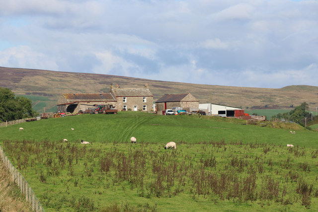
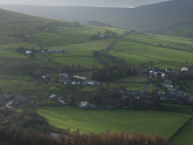
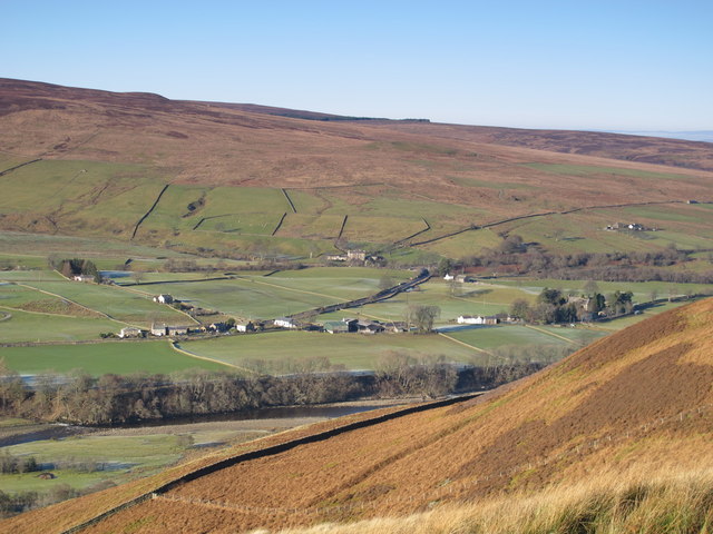
Stokeld Green is a picturesque village nestled in the heart of Northumberland, England. Surrounded by rolling hills, lush green meadows, and breathtaking moorland, this idyllic location offers a tranquil retreat for nature lovers and outdoor enthusiasts alike.

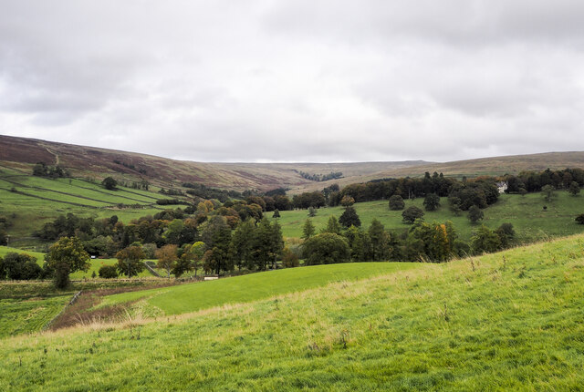
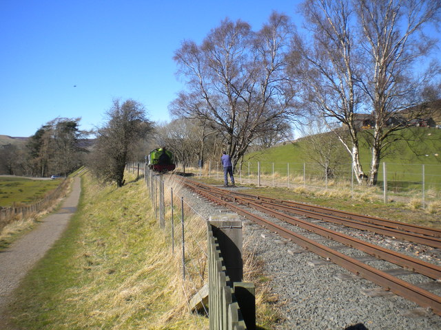
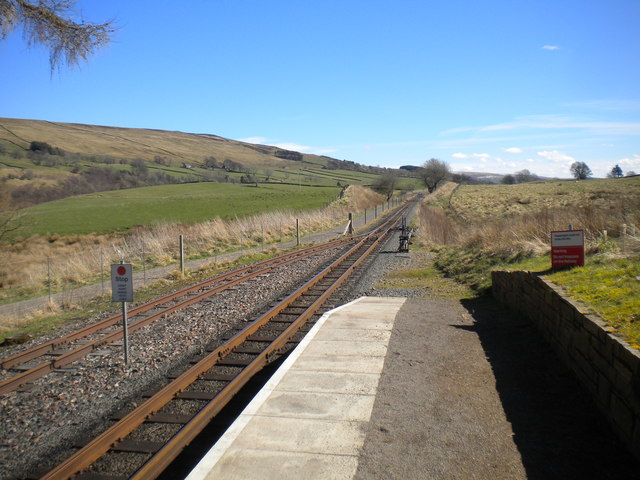
The village is predominantly known for its stunning downs and moorland, which provide a haven for wildlife and an array of outdoor activities. The downs, with their gentle slopes and panoramic views, are perfect for leisurely walks and picnics, allowing visitors to soak up the beauty of the surrounding countryside. In contrast, the moorland offers a more rugged terrain, attracting hikers and birdwatchers who come to explore its vast expanse and spot rare species such as curlews and red grouse.

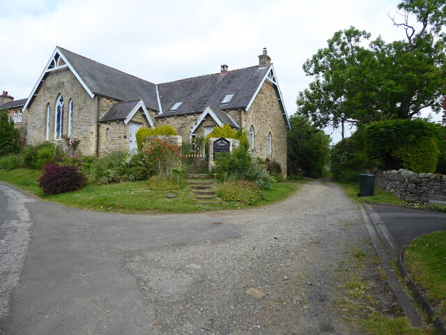
Stokeld Green itself is a small, close-knit community with a rich history dating back centuries. The village is adorned with charming cottages, many of which are constructed from locally sourced stone, giving it a timeless and authentic feel. The local pub, The Green Inn, is a popular gathering spot for both locals and visitors, offering a warm and friendly atmosphere along with traditional pub fare.

Despite its rural location, Stokeld Green is conveniently located near several larger towns, providing residents with access to amenities such as shops, schools, and healthcare facilities. The village also benefits from excellent transport links, with regular bus services connecting it to nearby towns and cities.

In summary, Stokeld Green is a hidden gem in Northumberland, offering a stunning natural landscape, a warm community spirit, and easy access to modern amenities. Whether you seek tranquility amidst the downs or adventure on the moorland, this village has something to offer for everyone.

If you have any feedback on the listing, please let us know in the comments section below.

Stokeld Green Images

Images are sourced within 2km of 54.867777/-2.474787 or Grid Reference NY6952. Thanks to Geograph Open Source API. All images are credited.

Fields descending towards Lintley Halt An embankment of the South Tynedale Railway can be seen entering the image at the lower left side of the image; the small building at Lintley Halt shows as a pale object just below trees.
The valley of the Barhaugh Burn extends into the distance beyond that of the River South Tyne.
Fields descending towards Lintley Halt
An embankment of the South Tynedale Railway can be seen entering the image at the lower left side of the image; the small building at Lintley Halt shows as a pale object just below trees. The valley of the Barhaugh Burn extends into the distance beyond that of the River South Tyne.
The approach to Lintley Halt Station on the South Tynedale Railway The path alongside is the South Tyne Trail to Haltwhistle.
The approach to Lintley Halt Station on the South Tynedale Railway
The path alongside is the South Tyne Trail to Haltwhistle.
South Tynedale Railway just south of Lintley Halt Station
The South Tynedale Railway bridge over Thornhope burn The path alongside the railway is the South Tyne Trail to Haltwhistle.
The South Tynedale Railway bridge over Thornhope burn
The path alongside the railway is the South Tyne Trail to Haltwhistle.
The South Tynedale Railway heading under an A689 road bridge The path alongside is the South Tyne Trail to Haltwhistle.
The South Tynedale Railway heading under an A689 road bridge
The path alongside is the South Tyne Trail to Haltwhistle.
The Pennine Way leaving the A689 at Slaggyford
The Pennine Way leaving Slaggyford
The A689 crosses the South Tynedale Railway near Lintley The view is captured alongside the railway on a cycle from Haltwhistle to Alston.

This photograph was taken during the Coronavirus (COVID-19) pandemic of 2020/21/22.
The A689 crosses the South Tynedale Railway near Lintley
The view is captured alongside the railway on a cycle from Haltwhistle to Alston. This photograph was taken during the Coronavirus (COVID-19) pandemic of 2020/21/22.
A crossing of the South Tynedale Railway near Lintley This crossing permits access to farmland east of the South Tynedale Railway.

This photograph was taken during the Coronavirus (COVID-19) pandemic of 2020/21/22.
A crossing of the South Tynedale Railway near Lintley
This crossing permits access to farmland east of the South Tynedale Railway. This photograph was taken during the Coronavirus (COVID-19) pandemic of 2020/21/22.
Lintley Halt on the South Tynedale Railway A view of the halt just after the 1500 hrs service from Alston has passed through en route to Slaggyford.

This photograph was taken during the Coronavirus (COVID-19) pandemic of 2020/21/22.
Lintley Halt on the South Tynedale Railway
A view of the halt just after the 1500 hrs service from Alston has passed through en route to Slaggyford. This photograph was taken during the Coronavirus (COVID-19) pandemic of 2020/21/22.
The Pennine Way near Lintley
The Pennine Way near Williamston
The Pennine Way at Slaggyford
North end of the South Tynedale Railway, Lintley Lintley is currently the northern terminus of the South Tynedale Railway; the standard gauge line on whose trackbed it was built continued beyond here to join the Newcastle to Carlisle line at Haltwhistle. The track extends some way beyond the station to form a long headshunt, used by locomotives when running round the train. Here, "Barber" is engaged in such a manoeuvre, having just arrived from Alston.
North end of the South Tynedale Railway, Lintley
Lintley is currently the northern terminus of the South Tynedale Railway; the standard gauge line on whose trackbed it was built continued beyond here to join the Newcastle to Carlisle line at Haltwhistle. The track extends some way beyond the station to form a long headshunt, used by locomotives when running round the train. Here, "Barber" is engaged in such a manoeuvre, having just arrived from Alston.
Looking south from Lintley station, South Tynedale Railway Looking towards Alston from the current northern terminus of the South Tynedale Railway. The railway was built along part of the trackbed of the standard gauge branch line from Haltwhistle to Alston; after that line closed, the trackbed became a footpath, which has been retained alongside the new railway (left).
Looking south from Lintley station, South Tynedale Railway
Looking towards Alston from the current northern terminus of the South Tynedale Railway. The railway was built along part of the trackbed of the standard gauge branch line from Haltwhistle to Alston; after that line closed, the trackbed became a footpath, which has been retained alongside the new railway (left).
Locomotive running round train, Lintley At the current northern terminus of the South Tynedale Railway, 0-6-2ST "Barber" (T Green & Son 441 of 1908) runs round its train in readiness for the journey back to Alston. The locomotive was built for Harrogate Gas Works, and runs permanently coupled to a replica of one of that concern's wagons which houses the air compressor to work the train brakes; presumably, the locomotive's dimensions preclude the fitting of a compressor.
Locomotive running round train, Lintley
At the current northern terminus of the South Tynedale Railway, 0-6-2ST "Barber" (T Green & Son 441 of 1908) runs round its train in readiness for the journey back to Alston. The locomotive was built for Harrogate Gas Works, and runs permanently coupled to a replica of one of that concern's wagons which houses the air compressor to work the train brakes; presumably, the locomotive's dimensions preclude the fitting of a compressor.
South Tynedale Railway - Lintley Halt The current limit of traffic, although the railway is expected to be open through to Slaggyford in the not too distant future. It is 2' gauge and as can be seen the locomotive of the day was an elderly but spritely diesel.
South Tynedale Railway - Lintley Halt
The current limit of traffic, although the railway is expected to be open through to Slaggyford in the not too distant future. It is 2' gauge and as can be seen the locomotive of the day was an elderly but spritely diesel.
Lintley from the South Tynedale Railway Photographer's position is approximate along the railway line.
Lintley from the South Tynedale Railway
Photographer's position is approximate along the railway line.
Show me another place!

Stokeld Green is located at Grid Ref: NY6952 (Lat: 54.867777, Lng: -2.474787)

Unitary Authority: Northumberland

Police Authority: Northumbria

What 3 Words

///losing.circles.grudging. Near Alston, Cumbria

Related Wikis

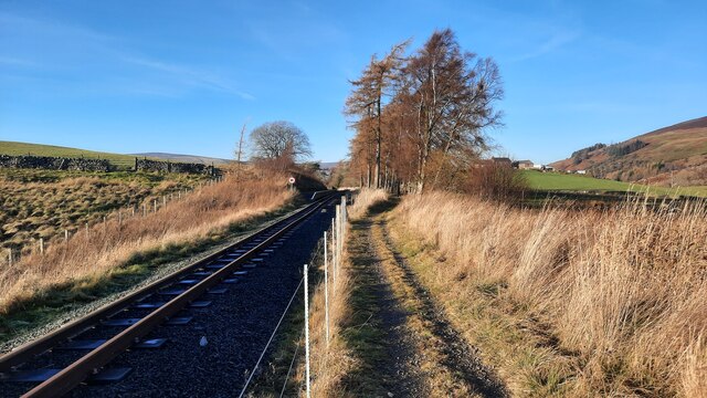
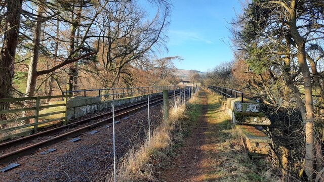
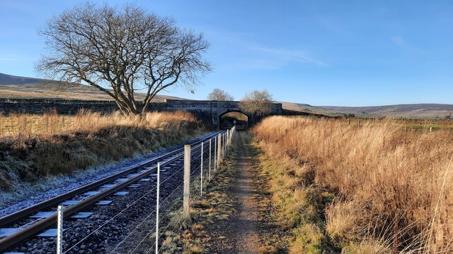
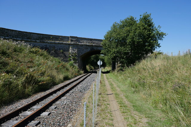
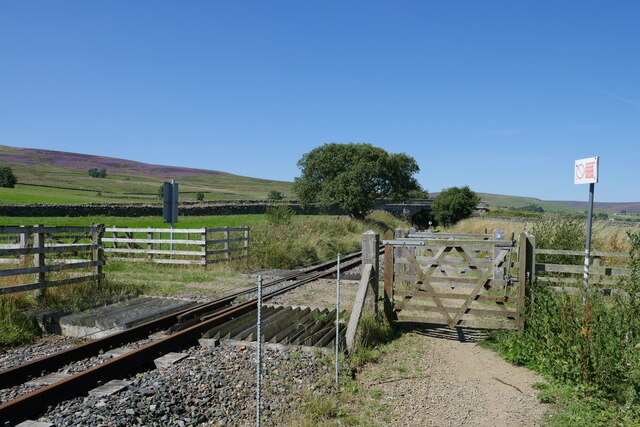
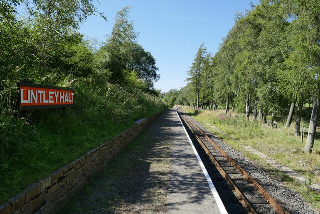
Lintley Halt railway station

Lintley Halt is a railway station on the South Tynedale Railway, which runs between Slaggyford and Alston. The station is located about 1+1⁄4 miles (2...

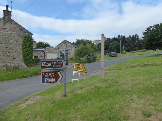
Slaggyford railway station

Slaggyford was a railway station on the Alston Line, which ran between Haltwhistle and Alston. The station served the village of Slaggyford in Northumberland...

Slaggyford

Slaggyford is a village in the civil parish of Knaresdale with Kirkhaugh, in Northumberland, England about 5 miles (8 km) north of Alston, Cumbria. It...

Knarsdale

Knarsdale, historically Knaresdale, is a village and former civil parish, now in the parish of Knaresdale with Kirkhaugh, in Northumberland, England about...

Nearby Amenities

Located within 500m of 54.867777,-2.474787
Wardley Law
Ele: 462
Man Made: survey_point
Natural: peak
Lat/Long: 54.8711898/-2.4749455
Williamston Common
Place: locality
Lat/Long: 54.8686898/-2.4744836
Note: Streetview says theres a small pool/pond here, but nothing on Bing - needs ground survey perhaps.
Lat/Long: 54.868305/-2.4801553
The data included in this document is from www.openstreetmap.org. The data is made available under ODbL.

Have you been to Stokeld Green?

Leave your review of Stokeld Green below (or comments, questions and feedback).