Oak Field

Downs, Moorland in Lancashire

England

Oak Field

Derelict road A narrow ribbon of  tarmac on what is still mapped as a yellow road.
Derelict road Credit: Richard Webb

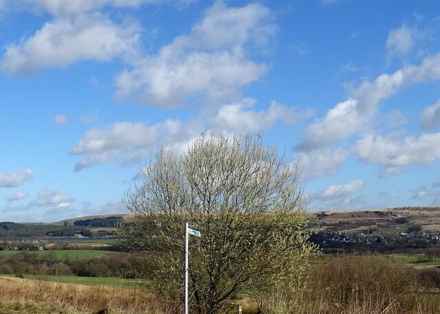
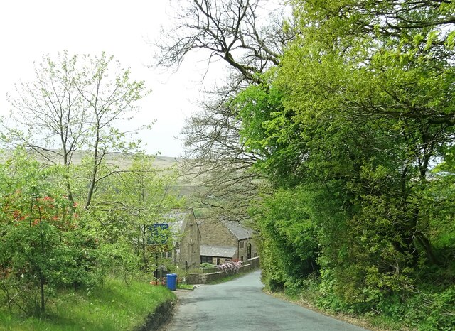
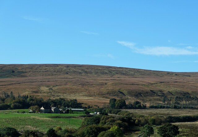
Oak Field is a picturesque area located in Lancashire, England, known for its stunning natural beauty and diverse landscapes. Situated in the southern part of the county, Oak Field is characterized by its rolling downs and expansive moorland, offering visitors a unique experience of the region's countryside.

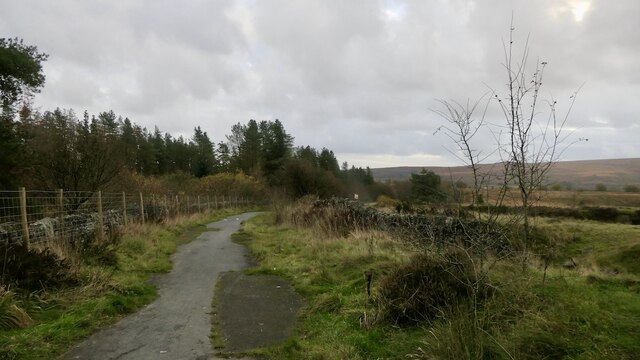
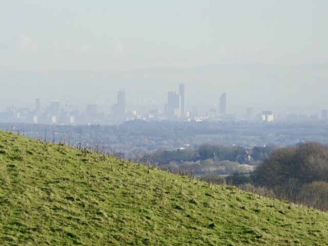
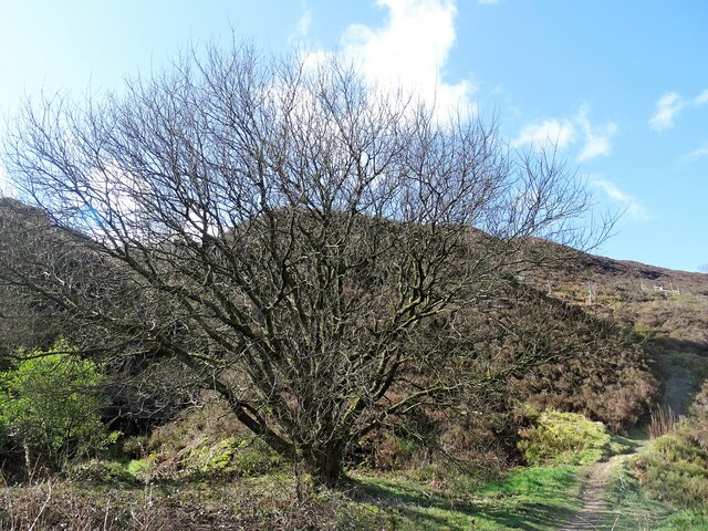
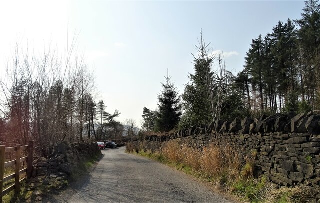
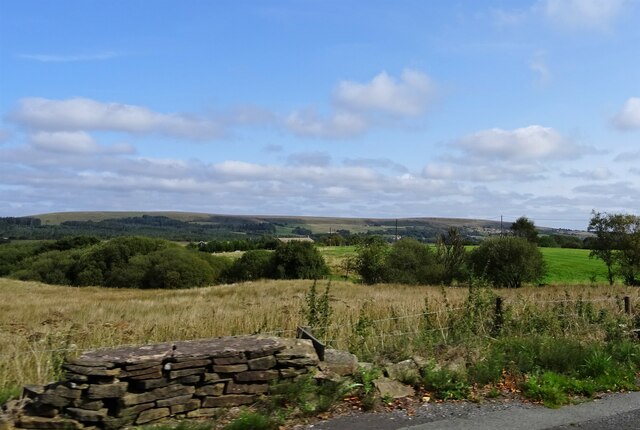
The downs of Oak Field are a sight to behold, with their gentle slopes covered in lush, green grass and dotted with ancient oak trees. These downs provide a perfect setting for leisurely walks, picnics, and even kite flying. The panoramic views from the top of the downs are simply breathtaking, offering glimpses of the surrounding countryside for miles around.

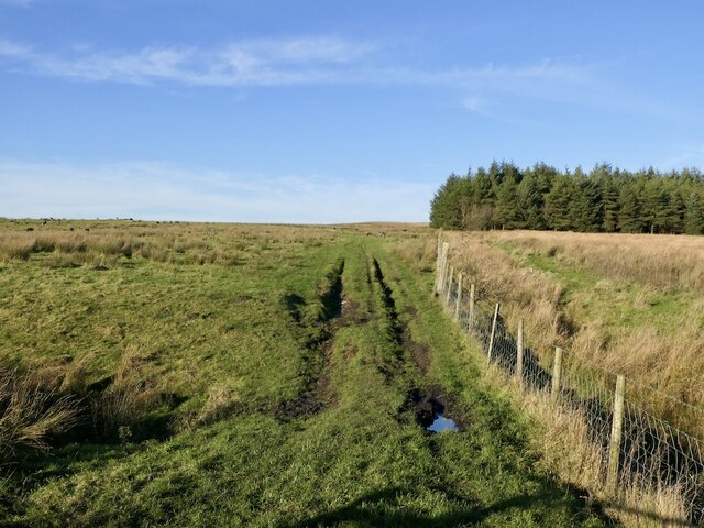
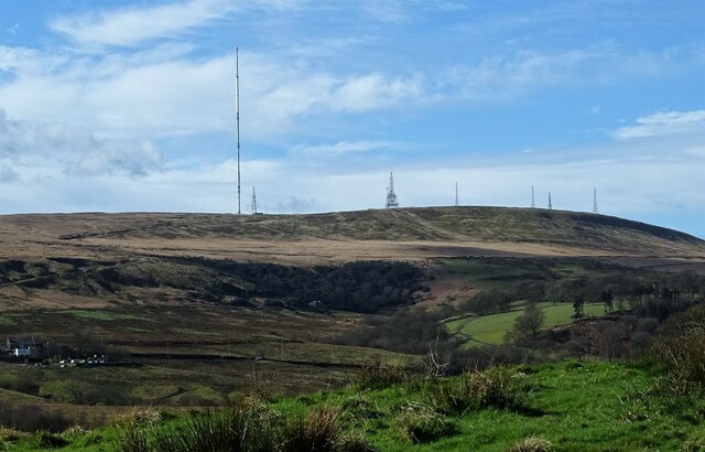
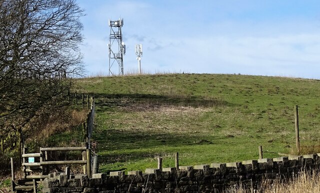
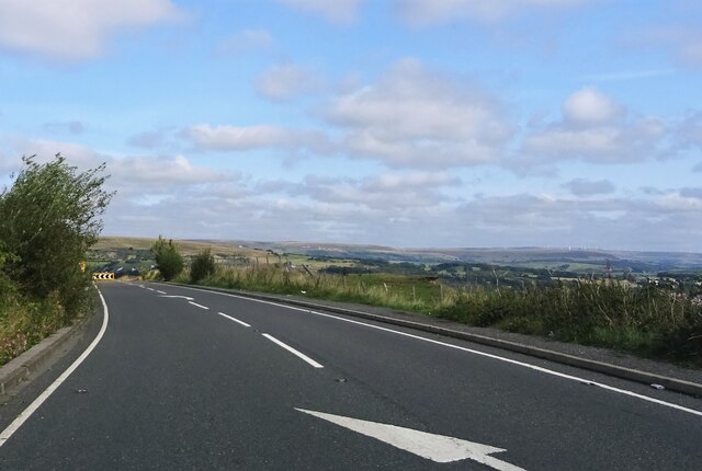
In contrast, the moorland in Oak Field offers a wilder and more rugged landscape. Stretching as far as the eye can see, the moors are covered in heather, bracken, and gorse bushes, creating a vibrant tapestry of colors throughout the year. This vast expanse of moorland is home to a variety of wildlife, including red grouse, curlews, and even the occasional deer.

Visitors to Oak Field can immerse themselves in the tranquility of nature, exploring the numerous walking trails that crisscross the area. The peacefulness and solitude found here make it a popular destination for those seeking a break from the hustle and bustle of city life.

Overall, Oak Field in Lancashire is a place of natural beauty, offering visitors the chance to experience the charm and serenity of the English countryside. Whether enjoying a leisurely stroll along the downs or venturing into the untamed moorland, Oak Field is a destination that leaves a lasting impression on all who visit.

If you have any feedback on the listing, please let us know in the comments section below.

Oak Field Images

Images are sourced within 2km of 53.632491/-2.4606495 or Grid Reference SD6915. Thanks to Geograph Open Source API. All images are credited.

Derelict road A narrow ribbon of  tarmac on what is still mapped as a yellow road.
Derelict road
A narrow ribbon of tarmac on what is still mapped as a yellow road.
Field off Egerton Road Sheep graze in front of a background of the A675 passing Winter Hill.
Field off Egerton Road
Sheep graze in front of a background of the A675 passing Winter Hill.
A675 leaving Bolton Beside the Wilton Arms
A675 leaving Bolton
Beside the Wilton Arms
Rough grazing Off Longworth Road North near Belmont. The now ubiquitous Herdwick sheep graze a rough pasture.
Rough grazing
Off Longworth Road North near Belmont. The now ubiquitous Herdwick sheep graze a rough pasture.
Skyscrapers amongst the moors View over a shoulder of Great Robert Hill towards a rather futuristic skyline.  Not been there for a while, and I don't remember so many skyscrapers. Not sure about the city - both Manchester and Salford?
Skyscrapers amongst the moors
View over a shoulder of Great Robert Hill towards a rather futuristic skyline. Not been there for a while, and I don't remember so many skyscrapers. Not sure about the city - both Manchester and Salford?
A view from Scout Road Springs reservoir is to the left and the village of Egerton is to the right.
A view from Scout Road
Springs reservoir is to the left and the village of Egerton is to the right.
Path on Horrocks Moor Off Scout Road and near the now disused Horrocks Fold quarry.
Path on Horrocks Moor
Off Scout Road and near the now disused Horrocks Fold quarry.
Winter Hill From Longworth Road.
Winter Hill
From Longworth Road.
Great Robert Hill A high point near Belmont suitable for the siting of communications masts.
Great Robert Hill
A high point near Belmont suitable for the siting of communications masts.
Stones Bank Road A narrow lane between the villages of Egerton and Belmont.
Stones Bank Road
A narrow lane between the villages of Egerton and Belmont.
Wittons Farmhouse On Egerton Road near Belmont.
Wittons Farmhouse
On Egerton Road near Belmont.
Fields off Belmont Road If the field nearest the camera position is used as pasture, I am not aware of it.
Fields off Belmont Road
If the field nearest the camera position is used as pasture, I am not aware of it.
Approaching a sharp bend On Scout Road.
Approaching a sharp bend
On Scout Road.
A view from Longworth Road Looking towards Higher Fold Farm and Smithills Moor.
A view from Longworth Road
Looking towards Higher Fold Farm and Smithills Moor.
Scout Road Approaching a sharp bend.
Scout Road
Approaching a sharp bend.
Fly tipping Anti social, criminal and possibly dangerous behaviour despoiling the countryside.
Fly tipping
Anti social, criminal and possibly dangerous behaviour despoiling the countryside.
Entering Belmont The pub/restaurant on the right (San Marino) was formerly called the Wright's Arms.
Entering Belmont
The pub/restaurant on the right (San Marino) was formerly called the Wright's Arms.
Google street view car Collecting images on Longworth Road.
Google street view car
Collecting images on Longworth Road.
Show me another place!

Oak Field is located at Grid Ref: SD6915 (Lat: 53.632491, Lng: -2.4606495)

Unitary Authority: Blackburn with Darwen

Police Authority: Lancashire

What 3 Words

///resides.remind.reputable. Near Edgworth, Lancashire

Related Wikis

Dingle Reservoir

Dingle Reservoir is an artificial, low alkalinity, shallow reservoir near the town of Egerton, Greater Manchester. It is a little under 400 metres from...

A666 road

The A666 is a major road in Greater Manchester and Lancashire, England. == Route == The road runs from its junction with the A6, and A580 at the Irlams...

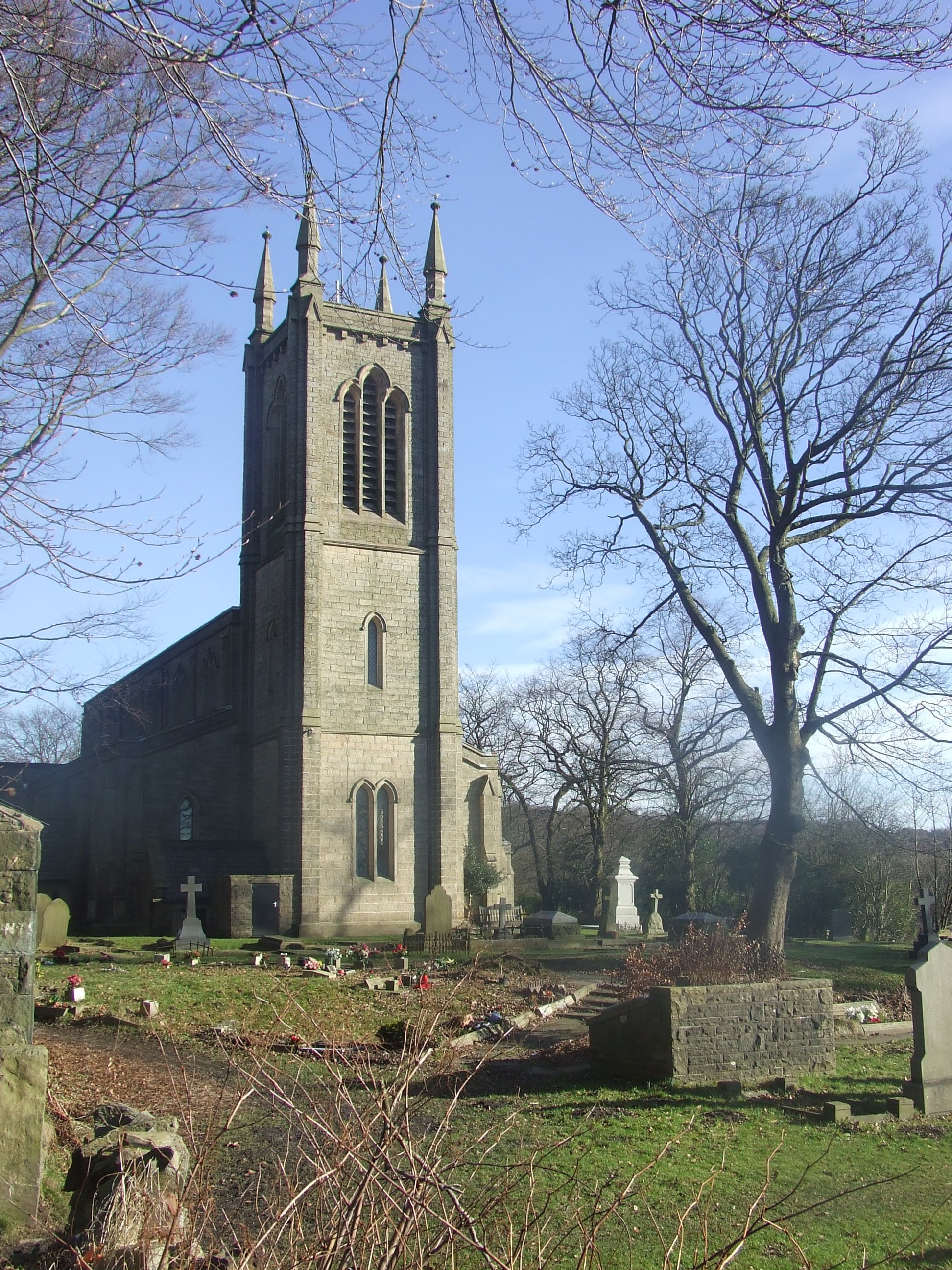
Christ Church, Walmsley

Christ Church is in Blackburn Road, Walmsley, Egerton, Greater Manchester, England. It is an active Church of England parish church in the deanery of Walmsley...

Egerton, Greater Manchester

Egerton, (pronounced "edgerton"), is a village in the northern part of the Metropolitan Borough of Bolton, Greater Manchester, England. Historically a...

Nearby Amenities

Located within 500m of 53.632491,-2.4606495
Barrier: yes
Lat/Long: 53.6311822/-2.4660158
The data included in this document is from www.openstreetmap.org. The data is made available under ODbL.

Have you been to Oak Field?

Leave your review of Oak Field below (or comments, questions and feedback).