Williamston Common

Downs, Moorland in Northumberland

England

Williamston Common

Old railway route approaching Slaggyford The railway route once connected Alston with Haltwhistle. Part of that route still operates out of Alston as a narrow gauge tourist attraction, but only as far as Slaggyford Station which is in view in the distance at the centre of the image. That part of the rail-bed behind the camera position is the route of two named walks, 'A Pennine Journey' and the River Tyne Trail. The course of the Pennine Way is also very nearby.
Old railway route approaching Slaggyford Credit: Trevor Littlewood

Located in the county of Northumberland, England, Williamston Common is a vast area encompassing downs, moorland, and other natural landscapes. Covering an approximate area of several square miles, it is a popular destination for nature enthusiasts and outdoor activities.

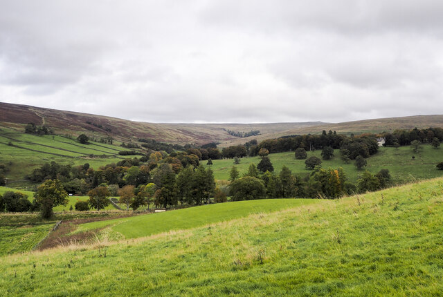
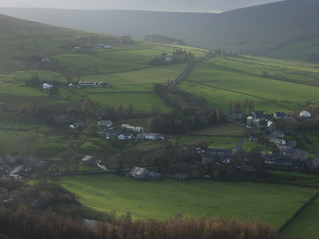
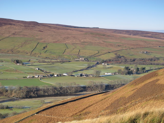
The downs of Williamston Common are characterized by their rolling hills and open grasslands. These areas provide breathtaking panoramic views of the surrounding countryside, making it an ideal spot for hiking, picnicking, and birdwatching. Visitors can often spot a variety of bird species, including skylarks, meadow pipits, and kestrels.

The moorland section of Williamston Common showcases a different kind of natural beauty. Dense heather covers the vast expanse, creating a vibrant purple landscape during the blooming season. It is home to several rare plant species and provides a habitat for various wildlife, such as adders, rabbits, and foxes.

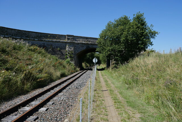
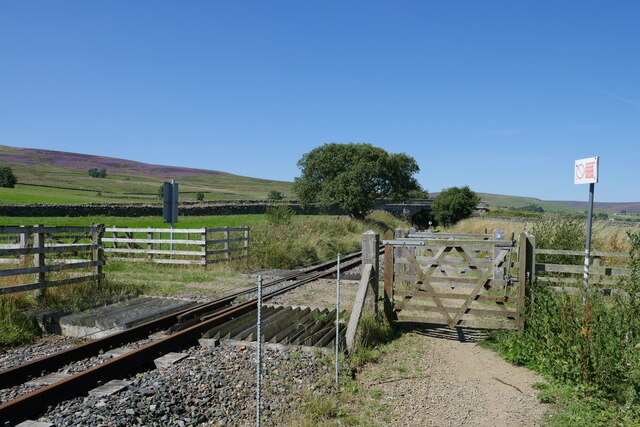
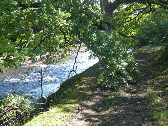
Walking trails crisscross the common, offering visitors the opportunity to explore its diverse terrain. The most renowned trail is the Williamston Way, a well-marked route that guides hikers through the most scenic parts of the area. Along the way, walkers can also glimpse ancient archaeological sites, including burial mounds and stone circles.

Williamston Common is managed by the local authorities, ensuring its preservation and protection for future generations. Visitors are encouraged to respect the natural environment and adhere to designated paths to minimize any disturbance to the wildlife and fragile ecosystems.

Overall, Williamston Common is a haven for nature lovers, offering a unique blend of downs, moorland, and historical sites, all waiting to be discovered and admired.

If you have any feedback on the listing, please let us know in the comments section below.

Williamston Common Images

Images are sourced within 2km of 54.865768/-2.4782534 or Grid Reference NY6952. Thanks to Geograph Open Source API. All images are credited.

Old railway route approaching Slaggyford The railway route once connected Alston with Haltwhistle. Part of that route still operates out of Alston as a narrow gauge tourist attraction, but only as far as Slaggyford Station which is in view in the distance at the centre of the image. That part of the rail-bed behind the camera position is the route of two named walks, 'A Pennine Journey' and the River Tyne Trail. The course of the Pennine Way is also very nearby.
Old railway route approaching Slaggyford
The railway route once connected Alston with Haltwhistle. Part of that route still operates out of Alston as a narrow gauge tourist attraction, but only as far as Slaggyford Station which is in view in the distance at the centre of the image. That part of the rail-bed behind the camera position is the route of two named walks, 'A Pennine Journey' and the River Tyne Trail. The course of the Pennine Way is also very nearby.
Fields descending towards Lintley Halt An embankment of the South Tynedale Railway can be seen entering the image at the lower left side of the image; the small building at Lintley Halt shows as a pale object just below trees.
The valley of the Barhaugh Burn extends into the distance beyond that of the River South Tyne.
Fields descending towards Lintley Halt
An embankment of the South Tynedale Railway can be seen entering the image at the lower left side of the image; the small building at Lintley Halt shows as a pale object just below trees. The valley of the Barhaugh Burn extends into the distance beyond that of the River South Tyne.
Slaggyford Station
Slaggyford Station
Ready for the return trip: Green Dragon at Slaggyford At the northern terminus of the South Tynedale Railway, the Green Dragon heads back to hitch up the carriages for the 1430 hrs return to Alston Station.

This photograph was taken during the Coronavirus (COVID-19) pandemic of 2020/21.
Ready for the return trip: Green Dragon at Slaggyford
At the northern terminus of the South Tynedale Railway, the Green Dragon heads back to hitch up the carriages for the 1430 hrs return to Alston Station. This photograph was taken during the Coronavirus (COVID-19) pandemic of 2020/21.
The approach to Lintley Halt Station on the South Tynedale Railway The path alongside is the South Tyne Trail to Haltwhistle.
The approach to Lintley Halt Station on the South Tynedale Railway
The path alongside is the South Tyne Trail to Haltwhistle.
South Tynedale Railway just south of Lintley Halt Station
The South Tynedale Railway bridge over Thornhope burn The path alongside the railway is the South Tyne Trail to Haltwhistle.
The South Tynedale Railway bridge over Thornhope burn
The path alongside the railway is the South Tyne Trail to Haltwhistle.
The South Tynedale Railway heading under an A689 road bridge The path alongside is the South Tyne Trail to Haltwhistle.
The South Tynedale Railway heading under an A689 road bridge
The path alongside is the South Tyne Trail to Haltwhistle.
Slaggyford Station - narrow gauge line Station closed 1976, now part of the South Tyne Railway.
Slaggyford Station - narrow gauge line
Station closed 1976, now part of the South Tyne Railway.
The Pennine Way leaving the A689 at Slaggyford
The Pennine Way leaving Slaggyford
Slaggyford Station A picture of serenity on a warm August day.  Despite this being a Wednesday, the South Tynedale Railway is operating to facilitate a coach party (and of course members of the general public).

This photograph was taken during the Coronavirus (COVID-19) pandemic of 2020/21/22.
Slaggyford Station
A picture of serenity on a warm August day. Despite this being a Wednesday, the South Tynedale Railway is operating to facilitate a coach party (and of course members of the general public). This photograph was taken during the Coronavirus (COVID-19) pandemic of 2020/21/22.
Siding south of Slaggyford A view from the adjacent path at the buffers of a small siding south of Slaggyford station on the South Tynedale Railway.

This photograph was taken during the Coronavirus (COVID-19) pandemic of 2020/21/22.
Siding south of Slaggyford
A view from the adjacent path at the buffers of a small siding south of Slaggyford station on the South Tynedale Railway. This photograph was taken during the Coronavirus (COVID-19) pandemic of 2020/21/22.
The A689 crosses the South Tynedale Railway near Lintley The view is captured alongside the railway on a cycle from Haltwhistle to Alston.

This photograph was taken during the Coronavirus (COVID-19) pandemic of 2020/21/22.
The A689 crosses the South Tynedale Railway near Lintley
The view is captured alongside the railway on a cycle from Haltwhistle to Alston. This photograph was taken during the Coronavirus (COVID-19) pandemic of 2020/21/22.
A crossing of the South Tynedale Railway near Lintley This crossing permits access to farmland east of the South Tynedale Railway.

This photograph was taken during the Coronavirus (COVID-19) pandemic of 2020/21/22.
A crossing of the South Tynedale Railway near Lintley
This crossing permits access to farmland east of the South Tynedale Railway. This photograph was taken during the Coronavirus (COVID-19) pandemic of 2020/21/22.
Lintley Halt on the South Tynedale Railway A view of the halt just after the 1500 hrs service from Alston has passed through en route to Slaggyford.

This photograph was taken during the Coronavirus (COVID-19) pandemic of 2020/21/22.
Lintley Halt on the South Tynedale Railway
A view of the halt just after the 1500 hrs service from Alston has passed through en route to Slaggyford. This photograph was taken during the Coronavirus (COVID-19) pandemic of 2020/21/22.
The Pennine Way near Lintley
The Pennine Way near Williamston
Show me another place!

Williamston Common is located at Grid Ref: NY6952 (Lat: 54.865768, Lng: -2.4782534)

Unitary Authority: Northumberland

Police Authority: Northumbria

What 3 Words

///ribcage.northward.recital. Near Alston, Cumbria

Related Wikis

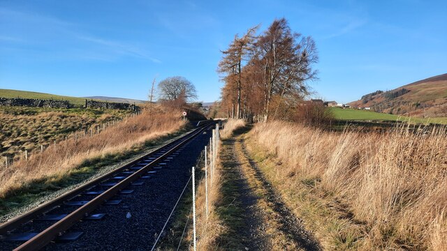
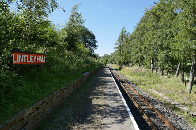
Lintley Halt railway station

Lintley Halt is a railway station on the South Tynedale Railway, which runs between Slaggyford and Alston. The station is located about 1+1⁄4 miles (2...

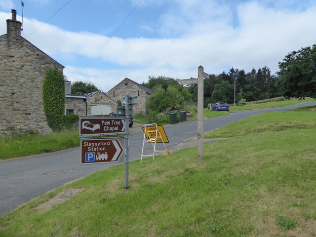
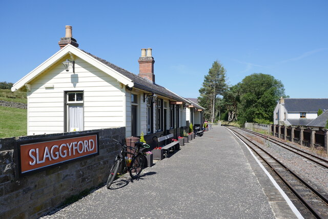
Slaggyford railway station

Slaggyford was a railway station on the Alston Line, which ran between Haltwhistle and Alston. The station served the village of Slaggyford in Northumberland...

Slaggyford

Slaggyford is a village in the civil parish of Knaresdale with Kirkhaugh, in Northumberland, England about 5 miles (8 km) north of Alston, Cumbria. It...

Knarsdale

Knarsdale, historically Knaresdale, is a village and former civil parish, now in the parish of Knaresdale with Kirkhaugh, in Northumberland, England about...

Nearby Amenities

Located within 500m of 54.865768,-2.4782534
Kitten Tom
Ele: 451.1
Man Made: survey_point
Natural: peak
Lat/Long: 54.8662628/-2.4830724
Williamston Common
Place: locality
Lat/Long: 54.8686898/-2.4744836
Note: Is this the Kitten Tom survey point? Seems to be something small but noticable here from Bing imagery.
Lat/Long: 54.8681041/-2.4835002
Note: Streetview says theres a small pool/pond here, but nothing on Bing - needs ground survey perhaps.
Lat/Long: 54.868305/-2.4801553
The data included in this document is from www.openstreetmap.org. The data is made available under ODbL.

Have you been to Williamston Common?

Leave your review of Williamston Common below (or comments, questions and feedback).