King's Moss

Downs, Moorland in Aberdeenshire

Scotland

King's Moss

Cattie farmhouse, Aberdeenshire
Cattie farmhouse, Aberdeenshire Credit: Stephen Stachowiak

King's Moss is a charming village located in Aberdeenshire, Scotland. Situated amidst the rolling hills and vast moorland, this picturesque village offers a serene and tranquil setting for its residents and visitors alike. The village is located on the eastern side of the county, approximately 20 miles northwest of Aberdeen.

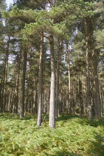
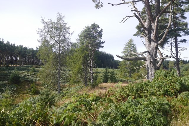
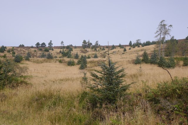
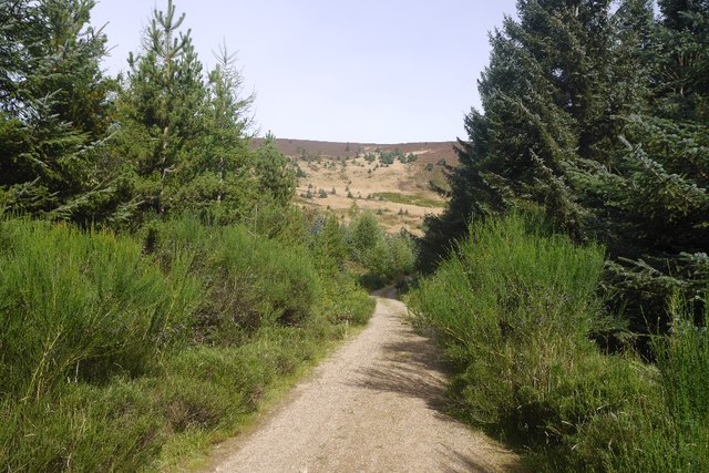
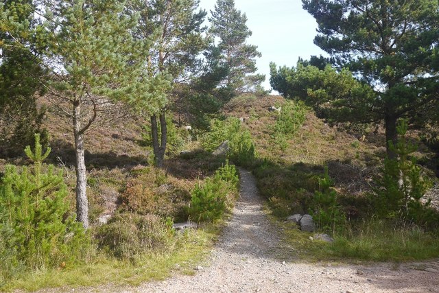
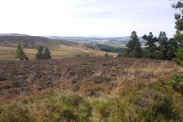
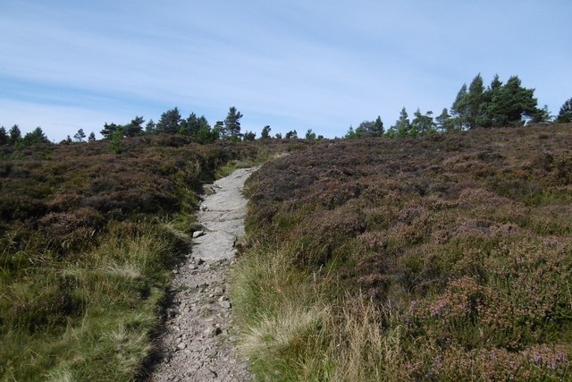
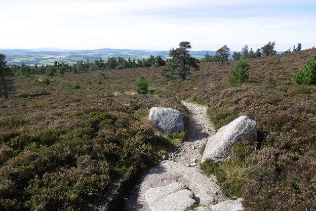
The landscape surrounding King's Moss is predominantly characterized by its downs and moorland. The downs, with their gently sloping hills and lush greenery, provide a stunning backdrop to the village. The moorland, on the other hand, offers a unique and wild beauty, with its vast expanses of heather and peat bogs.

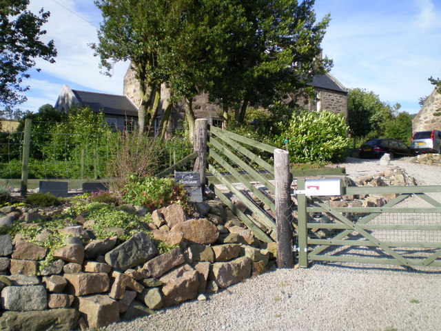
The village itself is small but full of character. It boasts a handful of traditional stone cottages, giving it a quaint and rustic feel. The community is close-knit, with friendly locals who take pride in their surroundings.

Nature enthusiasts will find King's Moss to be a haven for wildlife. The moorland is home to a variety of bird species, including grouse and curlews, while the downs attract hares and rabbits. The village is also surrounded by numerous walking trails, allowing visitors to explore the stunning countryside and take in the breathtaking views.

In terms of amenities, King's Moss has a small village shop for basic necessities, but for more extensive shopping and services, residents typically travel to nearby towns. However, the village's peaceful and idyllic setting more than compensates for its lack of commercial facilities.

Overall, King's Moss in Aberdeenshire is a hidden gem for those seeking a peaceful retreat surrounded by stunning downs and moorland. Its natural beauty and warm community spirit make it a truly special place to visit or call home.

If you have any feedback on the listing, please let us know in the comments section below.

King's Moss Images

Images are sourced within 2km of 57.232721/-2.5999717 or Grid Reference NJ6315. Thanks to Geograph Open Source API. All images are credited.

Cattie farmhouse, Aberdeenshire
Under Green Hill A field above Whitehills, under Pitfichie Forest.
Under Green Hill
A field above Whitehills, under Pitfichie Forest.
Scots pines, Pitfichie Forest The eastern slopes of Green Hill.
Scots pines, Pitfichie Forest
The eastern slopes of Green Hill.
Logging road, Pitfichie Forest The road runs the length of the forest and is waymarked as the "white" route. The full route runs around Cairn William.
Logging road, Pitfichie Forest
The road runs the length of the forest and is waymarked as the "white" route. The full route runs around Cairn William.
Pitfichie Forest The road runs along the eastern side of the woodland and goes up and down a bit.  The view is through an area of young trees towards Green Hill.
Pitfichie Forest
The road runs along the eastern side of the woodland and goes up and down a bit. The view is through an area of young trees towards Green Hill.
Logging road, Pitfichie Forest An older pine, perhaps from a time when Bogmore was a less formal woodland with scattered trees and moorland.
Logging road, Pitfichie Forest
An older pine, perhaps from a time when Bogmore was a less formal woodland with scattered trees and moorland.
Bogmore Land around the Pitmunie Burn has not been formally replanted.  There are still some old pines here.
Bogmore
Land around the Pitmunie Burn has not been formally replanted. There are still some old pines here.
Scots pines, Pitfichie Forest Eastern slopes of Cairn William.
Scots pines, Pitfichie Forest
Eastern slopes of Cairn William.
Cleared area, Pitfichie Forest Self seeded spruce dot a hillside which has been clear felled and left.
Cleared area, Pitfichie Forest
Self seeded spruce dot a hillside which has been clear felled and left.
Logging road, Pitfichie Forest Climbing to the col south of Cairn William. The view down the hill is towards a dun slope where there has been some clear felling in the past.
Logging road, Pitfichie Forest
Climbing to the col south of Cairn William. The view down the hill is towards a dun slope where there has been some clear felling in the past.
Granite Top Trail The mountain bike  route over Cairn William.  Cairn William is a significant hill and the path also gives a good walk to the summit.  It is a steady climb, so there should be no problems getting in the way of fast moving bikes.
Granite Top Trail
The mountain bike route over Cairn William. Cairn William is a significant hill and the path also gives a good walk to the summit. It is a steady climb, so there should be no problems getting in the way of fast moving bikes.
View over King's Moss Moorland above Pitfichie Forest.
View over King's Moss
Moorland above Pitfichie Forest.
Path, Cairn William The gently climbing, but technical mountain bike path route over Cairn William. It is also walkable and a good route to the summit with fine views.
Path, Cairn William
The gently climbing, but technical mountain bike path route over Cairn William. It is also walkable and a good route to the summit with fine views.
Path, Cairn William The Granite Top mountain bike trail has some interesting rock features. Unfortunately I am not fit enough to climb fast enough to clear a lot of them.  The descent beyond the summit was very easy though and nowhere near as technical.
Path, Cairn William
The Granite Top mountain bike trail has some interesting rock features. Unfortunately I am not fit enough to climb fast enough to clear a lot of them. The descent beyond the summit was very easy though and nowhere near as technical.
Col, Cairn William A view over to Millstone Hill and Mither Tap on Benachie from the mountain bike path on Cairn William.
Col, Cairn William
A view over to Millstone Hill and Mither Tap on Benachie from the mountain bike path on Cairn William.
Mountain bike track, Cairn William The path, used by bikes in ascent so fine to walk along too, uses granite bedrock and boulders for trail features.
Mountain bike track, Cairn William
The path, used by bikes in ascent so fine to walk along too, uses granite bedrock and boulders for trail features.
Cairn William There is a lot of exposed granite near the summit of Cairn William. It is used by a mountain bike track along the ridge.
Cairn William
There is a lot of exposed granite near the summit of Cairn William. It is used by a mountain bike track along the ridge.
Summit, Cairn William Bare granite and a triangulation pillar. The views are very fine.
Summit, Cairn William
Bare granite and a triangulation pillar. The views are very fine.
Show me another place!

King's Moss is located at Grid Ref: NJ6315 (Lat: 57.232721, Lng: -2.5999717)

Unitary Authority: Aberdeenshire

Police Authority: North East

What 3 Words

///spite.clutches.retraced. Near Alford, Aberdeenshire

Related Wikis

Whitehouse railway station (Scotland)

Whitehouse railway station was a station in Whitehouse, Aberdeenshire. It opened with the along with the rest of the Alford Valley Railway line from Kintore...

Castle Forbes

Castle Forbes is a 19th-century country house in the Scottish baronial architecture style near Alford in Aberdeenshire, Scotland. The 6,000-acre (2,400...

Tillyfourie railway station

Tillyfourie railway station was a railway station serving Tillyfourie, Aberdeenshire, Scotland. The station opened on 2 June 1860 on the Alford Valley...

Kirkton of Tough

Kirkton of Tough, usually shortened to Tough ( TUUKH), is a settlement in the Marr area of Aberdeenshire, Scotland at grid reference NJ615129. It is about...

Nearby Amenities

Located within 500m of 57.232721,-2.5999717
Power: pole
Lat/Long: 57.2308449/-2.5927865
Power: pole
Lat/Long: 57.2307108/-2.5938737
Power: pole
Lat/Long: 57.2305767/-2.5949695
Power: pole
Lat/Long: 57.2304356/-2.5961016
Power: pole
Lat/Long: 57.2302957/-2.5972295
Power: pole
Lat/Long: 57.2301593/-2.5983167
Power: pole
Lat/Long: 57.230009/-2.599468
Power: pole
Lat/Long: 57.2298806/-2.6005574
Power: pole
Lat/Long: 57.2297407/-2.601713
Power: pole
Lat/Long: 57.2296263/-2.6026486
Power: pole
Lat/Long: 57.2294887/-2.6037316
Power: pole
Lat/Long: 57.2293893/-2.6045711
The data included in this document is from www.openstreetmap.org. The data is made available under ODbL.

Have you been to King's Moss?

Leave your review of King's Moss below (or comments, questions and feedback).