Chapel Field
Downs, Moorland in Cumberland Carlisle
England
Chapel Field

Chapel Field, Cumberland (Downs, Moorland) is a picturesque area located in the county of Cumberland, England. Situated amidst beautiful rolling hills and vast stretches of moorland, this region offers a unique blend of natural beauty and historical significance.
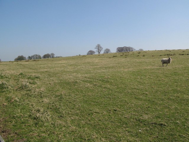
The area is known for its tranquil atmosphere, making it an ideal destination for those seeking peace and solitude. Visitors can immerse themselves in the stunning landscape, with panoramic views of the surrounding countryside. The moorland, in particular, is a sight to behold, with its striking hues of purple heather and vibrant green grass.
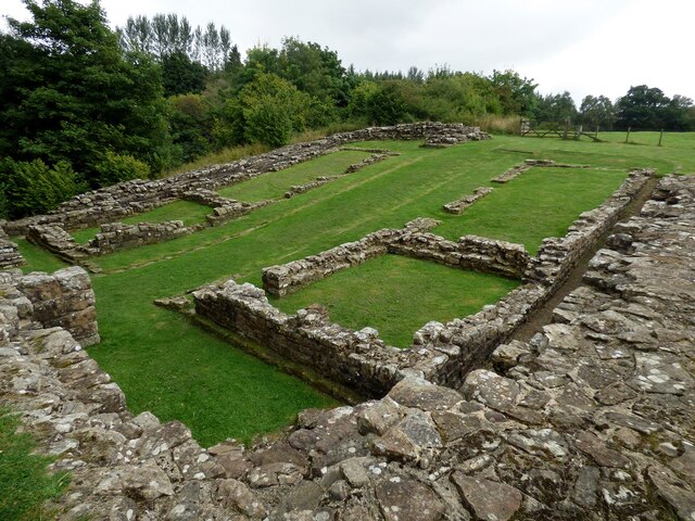
Chapel Field is also home to a number of ancient chapels and churches, which add to its historical charm. These architectural gems provide a glimpse into the region's rich religious heritage and are a testament to the area's cultural significance.
Nature enthusiasts will appreciate the diverse wildlife that inhabits Chapel Field. The moorland is home to a variety of bird species, including curlews, lapwings, and red grouse, making it a popular spot for birdwatching. The surrounding countryside is also teeming with wildlife, such as deer, rabbits, and hares, making it a haven for nature lovers.
For those interested in outdoor activities, Chapel Field offers ample opportunities for hiking, cycling, and horseback riding. The well-maintained trails and paths make exploring the area a joy, allowing visitors to fully immerse themselves in the natural beauty that surrounds them.
Chapel Field, Cumberland (Downs, Moorland) is truly a hidden gem, offering a tranquil escape from the bustling city life and providing a unique glimpse into the rich history and stunning natural beauty of the region.
If you have any feedback on the listing, please let us know in the comments section below.
Chapel Field Images
Images are sourced within 2km of 54.989711/-2.5993626 or Grid Reference NY6166. Thanks to Geograph Open Source API. All images are credited.


Chapel Field is located at Grid Ref: NY6166 (Lat: 54.989711, Lng: -2.5993626)
Administrative County: Cumbria
District: Carlisle
Police Authority: Cumbria
What 3 Words
///drizzly.rats.crucially. Near Greenhead, Northumberland
Nearby Locations
Related Wikis

Banna (Birdoswald)
Birdoswald Roman Fort was known as Banna ("horn" in Celtic) in Roman times, reflecting the geography of the site on a triangular spur of land bounded by...

Birdoswald
Birdoswald is a former farm in the civil parish of Waterhead in the English county of Cumberland. It stands on the site of the Roman fort of Banna. �...

Milecastle 49
Milecastle 49 (Harrows Scar) was a milecastle on Hadrian's Wall (grid reference NY6202866407). == Description == Milecastle 49 is immediately west of the...

Limes (Roman Empire)
Līmes (Latin, singular; plural: līmitēs) is a modern term used primarily for the Germanic border defence or delimiting system of Ancient Rome marking the...

Upper Denton
Upper Denton is a small village and civil parish in the north of Cumbria, England, about 1 km north of the A69 road linking Haltwhistle and Brampton. The...
Milecastle 50
Milecastle 50 (High House) was a milecastle on Hadrian's Wall (grid reference NY60676601). == Description == Milecastle 50 is west of Birdoswald fort....
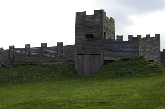
Milecastle 50TW
Milecastle 50TW (High House) was a milecastle on the Turf Wall section of Hadrian's Wall (grid reference NY60716583). The milecastle is located close...

Mumps Hall
Mumps Hall was an inn at the confluence of the Poltross Burn and the River Irthing, a site now at the centre of the village of Gilsland in Cumbria. It...
Nearby Amenities
Located within 500m of 54.989711,-2.5993626Have you been to Chapel Field?
Leave your review of Chapel Field below (or comments, questions and feedback).