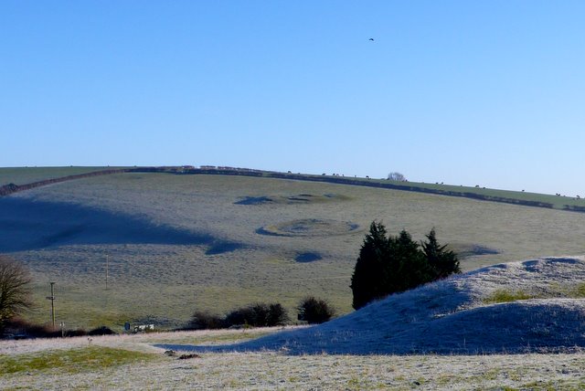
Pitcombe Down

Downs, Moorland in Dorset

England

Pitcombe Down

Bridehead Lake, Little Bredy
Bridehead Lake, Little Bredy Credit: Gary Rogers

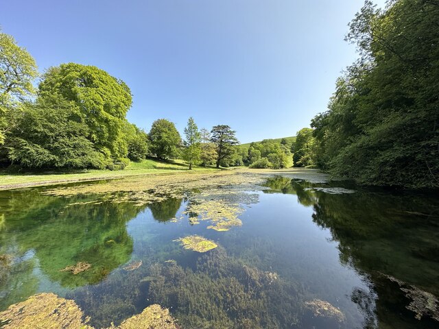
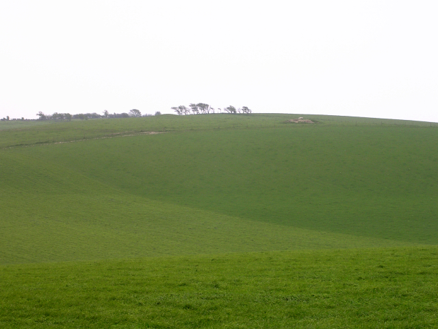
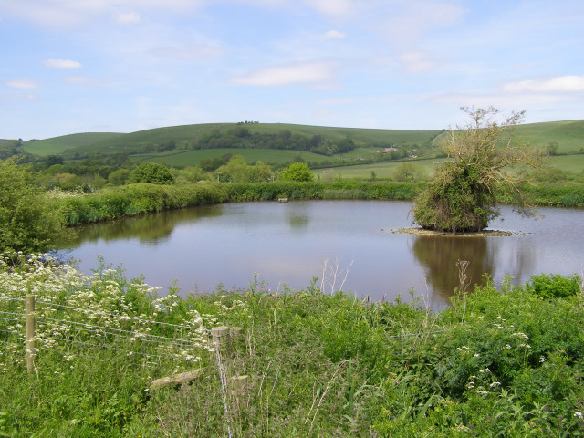
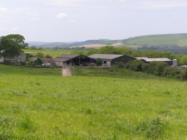
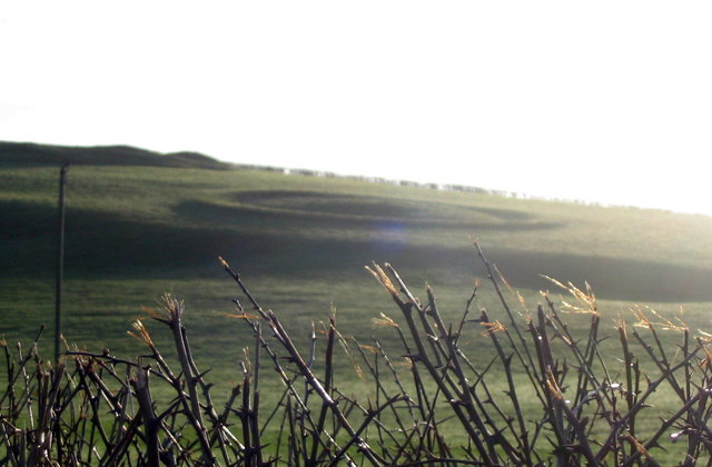
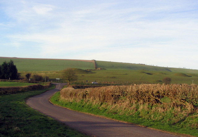
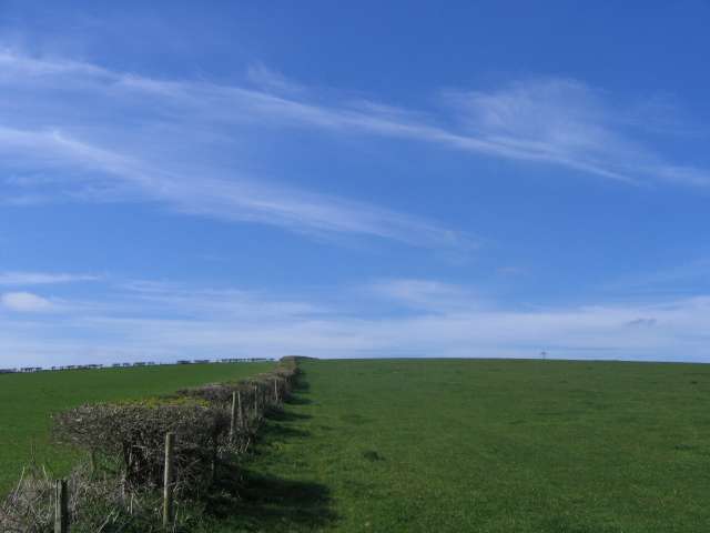
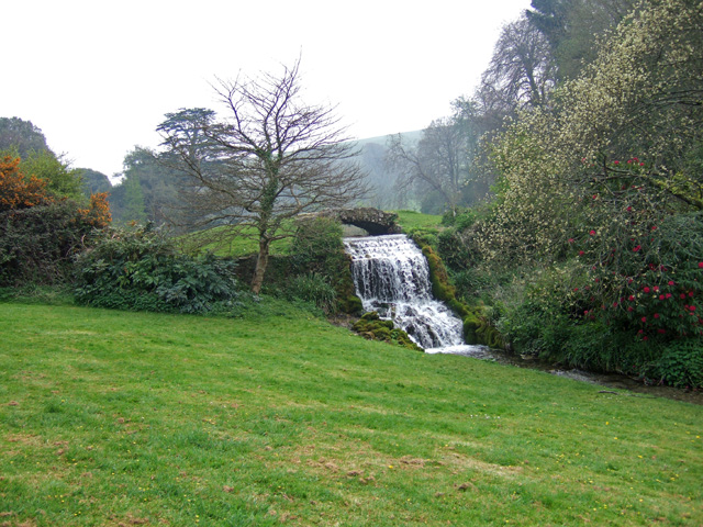
Pitcombe Down is a picturesque area located in the county of Dorset, England. Situated amidst the rolling hills and tranquil countryside, it is a popular destination for nature enthusiasts and outdoor adventurers. The downland landscape of Pitcombe Down provides visitors with breathtaking views of the surrounding countryside, making it an ideal spot for hiking, walking, and picnicking.

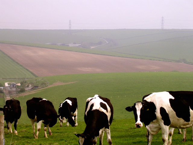
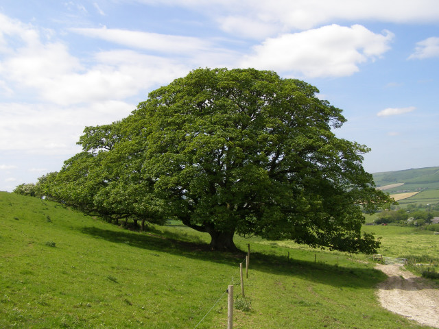
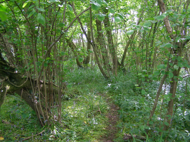
Covering an extensive area, Pitcombe Down is characterized by its diverse habitats, including open grassland, heathland, and patches of woodland. These habitats support a wide range of flora and fauna, making it an important site for biodiversity. Visitors can spot various species of wildflowers, such as orchids and primroses, as well as numerous butterflies and birds that call this area home.

The downland terrain of Pitcombe Down also offers opportunities for leisure activities like horse riding and cycling. Its network of footpaths and bridleways allows visitors to explore the area at their own pace, immersing themselves in the beauty of the natural surroundings.

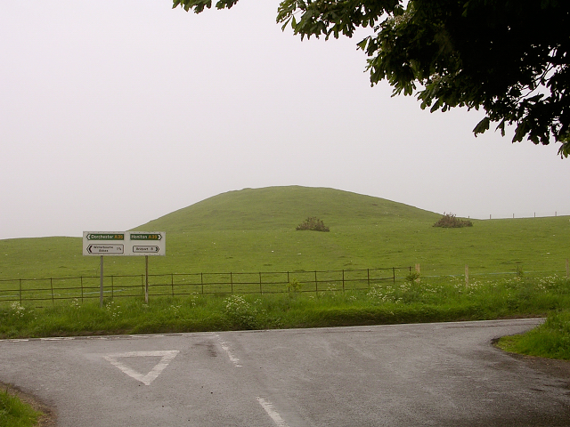
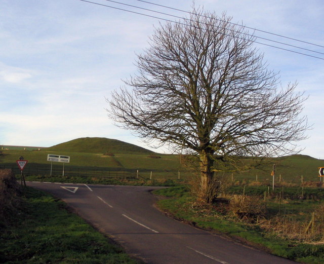
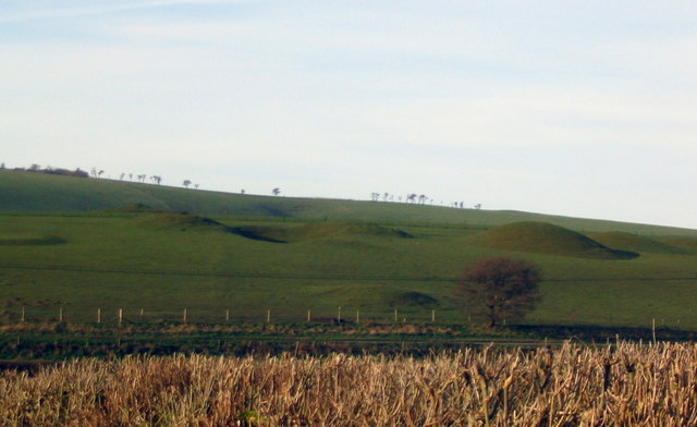
In addition to its natural features, Pitcombe Down is also known for its historical significance. The area is dotted with ancient burial mounds and earthworks, providing evidence of human presence dating back thousands of years. These archaeological sites contribute to the cultural heritage of the region, attracting history enthusiasts and archaeologists alike.

Overall, Pitcombe Down in Dorset is a stunning landscape that offers a blend of natural beauty and historical intrigue. Whether one seeks a peaceful walk in nature or an opportunity to delve into the past, this area has something to offer for everyone.

If you have any feedback on the listing, please let us know in the comments section below.

Pitcombe Down Images

Images are sourced within 2km of 50.705919/-2.5864174 or Grid Reference SY5889. Thanks to Geograph Open Source API. All images are credited.

Bridehead Lake, Little Bredy
St. Michael and All Angels Little Bredy
St. Michael and All Angels
Little Bredy
Junction of a minor road with the A35 at the Poor Lot barrow cemetery Looking southeast at the junction, with the largest of the Poor Lot bronze-age barrows behind. Part of the barrow cemetery is an English Heritage site, but there is no safe or convenient place to park.
Junction of a minor road with the A35 at the Poor Lot barrow cemetery
Looking southeast at the junction, with the largest of the Poor Lot bronze-age barrows behind. Part of the barrow cemetery is an English Heritage site, but there is no safe or convenient place to park.
Black Down and the Poor Lot barrows, Winterbourne Abbas Looking northeast across Black Down: the A35 is hidden in the valley below and the concave remains of round barrows can be seen in the ploughed fields on the opposite hillslope.
Black Down and the Poor Lot barrows, Winterbourne Abbas
Looking northeast across Black Down: the A35 is hidden in the valley below and the concave remains of round barrows can be seen in the ploughed fields on the opposite hillslope.
Verdant pasture south of the A35 between Martin's Down and Black Down The feature just the other side of the fence on the far side of the valley is a badly mutilated round barrow with a capstone, which lies just within this grid square.
Verdant pasture south of the A35 between Martin's Down and Black Down
The feature just the other side of the fence on the far side of the valley is a badly mutilated round barrow with a capstone, which lies just within this grid square.
Church of St Michael and All Angels, Little Bredy
St Peter's Church, Long Bredy, Dorset
Pond northwest of Lower Kingston Russell Farm This pond is alongside the Macmillan Way footpath, a few hundred metres northwest of Lower Kingston Russell Farm. One of the west Dorset chalk ridgeways dominates the background - with Long Barrow Hill on the far left and Whatcombe Down on the right.
Pond northwest of Lower Kingston Russell Farm
This pond is alongside the Macmillan Way footpath, a few hundred metres northwest of Lower Kingston Russell Farm. One of the west Dorset chalk ridgeways dominates the background - with Long Barrow Hill on the far left and Whatcombe Down on the right.
Spreading sycamore on the slopes of Tenants Hill Descending Tenants Hill on the Macmillan Way footpath, this huge spreading sycamore grows on the chalky slope with few other trees for company.
Spreading sycamore on the slopes of Tenants Hill
Descending Tenants Hill on the Macmillan Way footpath, this huge spreading sycamore grows on the chalky slope with few other trees for company.
Lower Kingston Russell farm Labelled on the 1940s OS map as "Kingston Russell Dairy" this farm still maintains a large dairy herd depastured on the chalky northern slopes of Tenants Hill.
Lower Kingston Russell farm
Labelled on the 1940s OS map as "Kingston Russell Dairy" this farm still maintains a large dairy herd depastured on the chalky northern slopes of Tenants Hill.
Hazel coppice near Lower Kingston Russell Farm The Macmillan Way footpath passes through this hazel coppice east of Lower Kingston Russell farm. A few bluebell flowers persist in the undergrowth, although now its June they are past their best.
Hazel coppice near Lower Kingston Russell Farm
The Macmillan Way footpath passes through this hazel coppice east of Lower Kingston Russell farm. A few bluebell flowers persist in the undergrowth, although now its June they are past their best.
Barrows at Black Down The barrows in this picture are two of many in the area, along with a multitude of dents, bumps and tumuli. These are in an area called the Poor Lot Barrows. The road at the T-junction is the A35. I am submitting further pictures of the area in this square and in <a href="https://www.geograph.org.uk/gridref/SY5990">SY5990</a>.
Barrows at Black Down
The barrows in this picture are two of many in the area, along with a multitude of dents, bumps and tumuli. These are in an area called the Poor Lot Barrows. The road at the T-junction is the A35. I am submitting further pictures of the area in this square and in SY5990.
Poor Lot Barrows, Black Down A view of the barrows from further up the road. More pictures around this site can be seen in square <a href="https://www.geograph.org.uk/gridref/SY5990">SY5990</a>.
Poor Lot Barrows, Black Down
A view of the barrows from further up the road. More pictures around this site can be seen in square SY5990.
Mysterious tumulus near Broad Stone Misty spring view of an ancient circular feature on a hillside overlooking the A35 west of Winterbourne Abbas. There is a similar feature among the tumuli on the other side of the road at Poor Lot Barrows.
Mysterious tumulus near Broad Stone
Misty spring view of an ancient circular feature on a hillside overlooking the A35 west of Winterbourne Abbas. There is a similar feature among the tumuli on the other side of the road at Poor Lot Barrows.
Minor road and Poor Lot barrows. This minor road is signposted to Compton Valence from the A35, but at its top end on the edge of <a href="https://www.geograph.org.uk/gridref/SY5991">SY5991</a> & <a href="https://www.geograph.org.uk/gridref/SY5992">SY5992</a> it is simply marked 'Main Road'. Not 'A35', not 'Dorchester, Bridport' but just 'Main Road'.
Just after the bend the road drops into <a href="https://www.geograph.org.uk/gridref/SY5890">SY5890</a>, and beyond the T-junction can be seen the ancient Poor Lot Barrows, complete with another one of those weird round features.
Minor road and Poor Lot barrows.
This minor road is signposted to Compton Valence from the A35, but at its top end on the edge of SY5991 & SY5992 it is simply marked 'Main Road'. Not 'A35', not 'Dorchester, Bridport' but just 'Main Road'. Just after the bend the road drops into SY5890, and beyond the T-junction can be seen the ancient Poor Lot Barrows, complete with another one of those weird round features.
Footpath This is part of the 'Jubilee Trail', a regional route leading northwest around Compton Valence.
Footpath
This is part of the 'Jubilee Trail', a regional route leading northwest around Compton Valence.
Bridehead The source of the River Bride at Littlebredy.
Bridehead
The source of the River Bride at Littlebredy.
Waterfall at the Bridehead Outflow
Show me another place!

Pitcombe Down is located at Grid Ref: SY5889 (Lat: 50.705919, Lng: -2.5864174)

Unitary Authority: Dorset

Police Authority: Dorset

What 3 Words

///chip.dreams.immediate. Near Maiden Newton, Dorset

Related Wikis

Pitcombe Down

Pitcombe Down (grid reference SY585897) is a 13.2 hectare biological Site of Special Scientific Interest in Dorset, notified in 1954. == Sources == English...

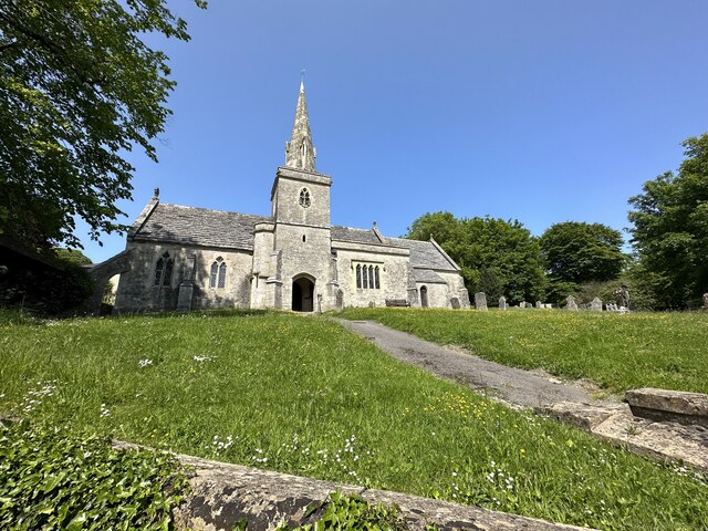
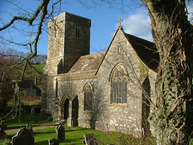
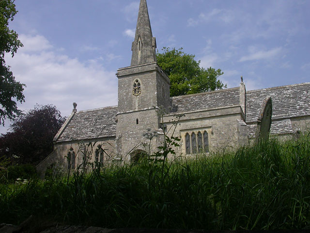
St Michael and All Angels Church, Littlebredy

St Michael and All Angels Church is a Grade II listed Anglican church in the village of Littlebredy, Dorset, England. == History == The tower dates from...

Littlebredy

Littlebredy (also written Little Bredy, pronounced ) is a small village and civil parish in the English county of Dorset, situated approximately 6.5 miles...

Poor Lot Barrow Cemetery

Poor Lot Barrow Cemetery is an archaeological site, a group of Bronze Age round barrows, near the A35 road about 2 miles (3.2 km) west of Winterbourne...

Kingston Russell House

Kingston Russell House is a large mansion house and manor near Long Bredy in Dorset, England, west of Dorchester. The present house dates from the late...

Kingston Russell

Kingston Russell is a settlement and civil parish 7 miles (11 km) west of Dorchester, in the Dorset district, in the county of Dorset, England. In 2001...

Long Bredy

Long Bredy is a village and civil parish in the county of Dorset in south-west England, situated approximately 7 miles (11 km) west of the county town...

Kingston Russell Stone Circle

Kingston Russell Stone Circle, also known as the Gorwell Circle, is a stone circle located between the villages of Abbotsbury and Littlebredy in the south...

Nearby Amenities

Located within 500m of 50.705919,-2.5864174
Turning Circle
Lat/Long: 50.7050354/-2.5926385
Pitcombe Down
Place: locality
Lat/Long: 50.7053594/-2.5851107
The data included in this document is from www.openstreetmap.org. The data is made available under ODbL.

Have you been to Pitcombe Down?

Leave your review of Pitcombe Down below (or comments, questions and feedback).