Sunny Brae

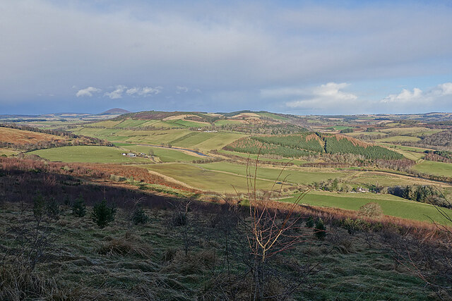
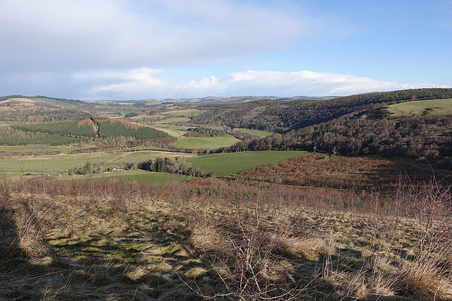
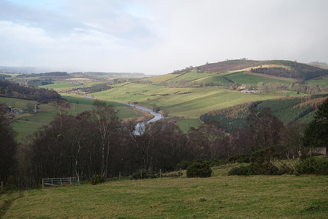
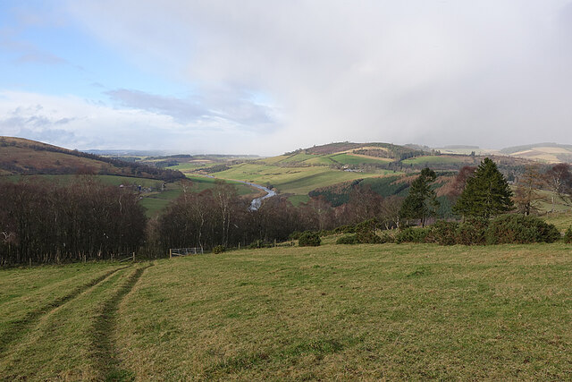
Downs, Moorland in Banffshire

Scotland

Sunny Brae

Drystane Dyke A rather haphazard-looking dyke on the side of the road to Redhill.
Drystane Dyke Credit: Anne Burgess

Sunny Brae is a picturesque village located in Banffshire, a region known for its stunning natural beauty and rugged landscapes in Scotland. Nestled amidst rolling downs and moorland, the village offers a serene and idyllic setting for locals and visitors alike.

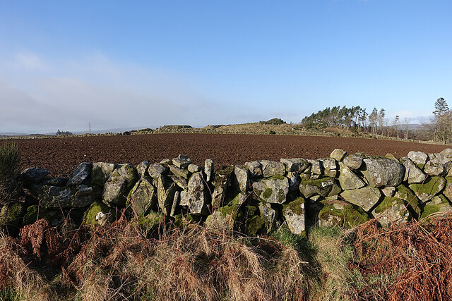
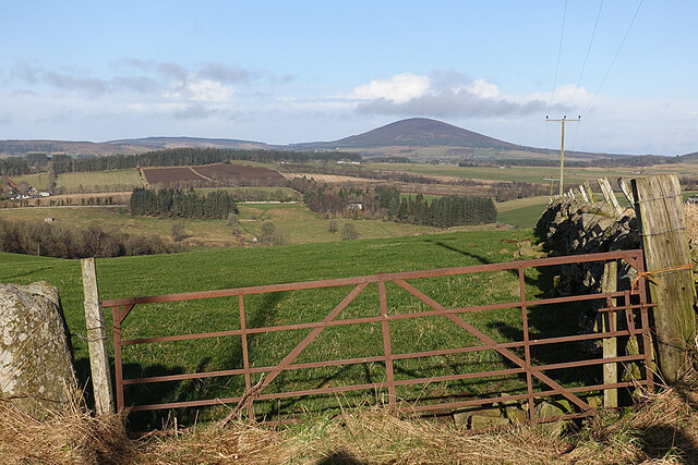
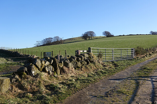
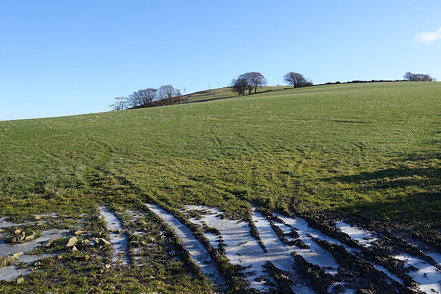
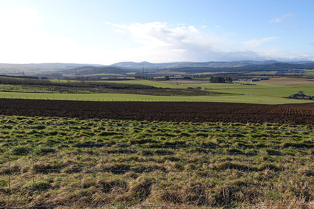
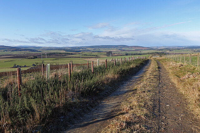
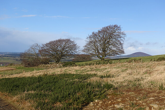
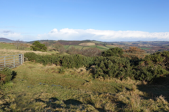
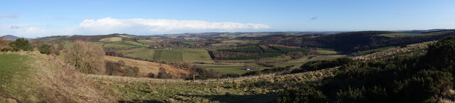
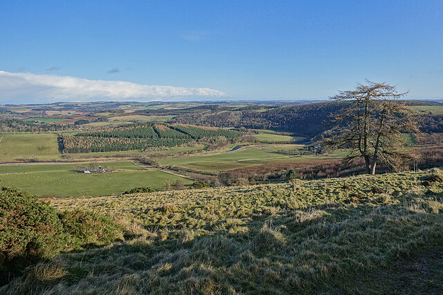
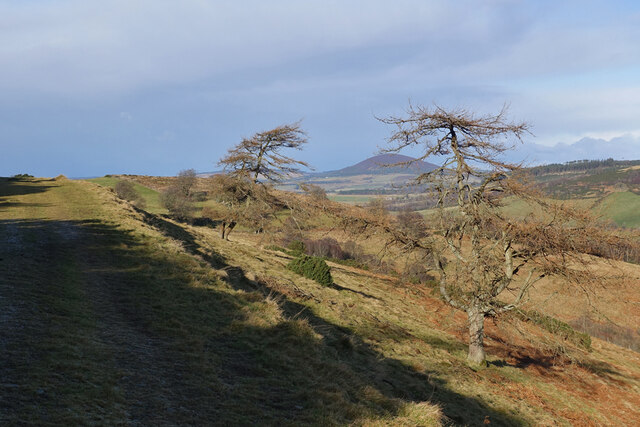
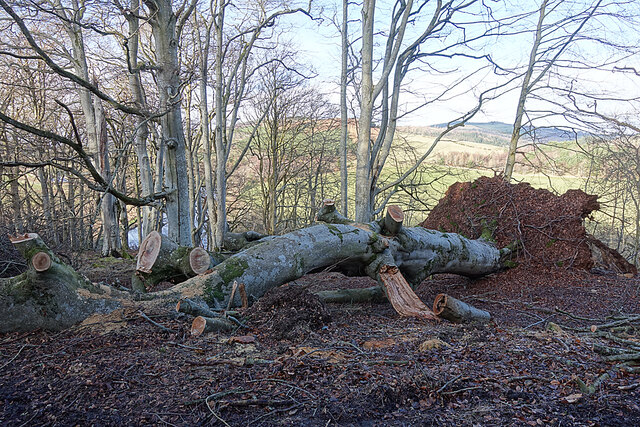
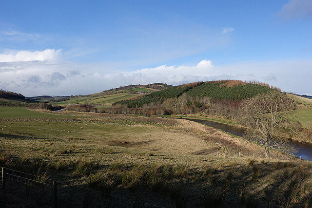
The downs surrounding Sunny Brae are characterized by their gentle slopes and lush greenery, providing breathtaking panoramic views of the surrounding countryside. These downs are perfect for leisurely walks and picnics, offering a peaceful escape from the hustle and bustle of city life. The moorland, on the other hand, showcases a more rugged and wild terrain, with heather-covered hills and rocky outcrops. This diverse landscape attracts nature enthusiasts, hikers, and photographers, who can explore the vast expanses and discover hidden gems.

Sunny Brae itself is a small community with a close-knit and friendly atmosphere. The village is dotted with charming cottages and traditional stone houses, adding to its quintessential Scottish charm. The locals are known for their warm hospitality and strong sense of community, making visitors feel welcome and at home.

In terms of amenities, Sunny Brae offers basic facilities such as a village store, a cozy pub serving local fare, and a community center where residents gather for social events and activities. The village also benefits from its proximity to larger towns in Banffshire, ensuring easy access to healthcare, education, and other essential services.

Overall, Sunny Brae, with its downs, moorland, and tight-knit community, is a hidden gem in the Banffshire region, offering a peaceful and picturesque escape for those seeking tranquility and natural beauty.

If you have any feedback on the listing, please let us know in the comments section below.

Sunny Brae Images

Images are sourced within 2km of 57.519304/-2.7198311 or Grid Reference NJ5647. Thanks to Geograph Open Source API. All images are credited.

Drystane Dyke A rather haphazard-looking dyke on the side of the road to Redhill.
Drystane Dyke
A rather haphazard-looking dyke on the side of the road to Redhill.
Gate with a View From the gate the land drops steeply to the River Deveren, rising again to the grounds of Rothiemay House, with its clumps of conifers. Knock Hill, on the skyline, dominates the view.
Gate with a View
From the gate the land drops steeply to the River Deveren, rising again to the grounds of Rothiemay House, with its clumps of conifers. Knock Hill, on the skyline, dominates the view.
Barn at North Redhill A large new barn beside the farm of North Redhill.
Barn at North Redhill
A large new barn beside the farm of North Redhill.
Field at North Redhill A field at North Redhill, just off the old road leading to Fourmanhill and Bognie.
Field at North Redhill
A field at North Redhill, just off the old road leading to Fourmanhill and Bognie.
Frost in the Ruts The almost inevitable water-filled ruts at the field entrance were frozen over. This heralded some excellent dry walking over ground that will be muddy when the frost lifts.
Frost in the Ruts
The almost inevitable water-filled ruts at the field entrance were frozen over. This heralded some excellent dry walking over ground that will be muddy when the frost lifts.
Care of Kinnoir Picking a subject point here is a bit arbitrary. The prominent peak on the skyline is Tap o' Noth. To its right, with some wisps of white cloud rising off it, is The Buck, and the slightly nearer low ridge extending to the right again is Clashmach Hill. Lower, and forested, is the Bin of Huntly. To the left of Tap o' Noth, lower down, is Kinnoir Wood. The low-lying ground is the Carse of Kinnoir, and the row of grey sheds is at Rivestone.
Care of Kinnoir
Picking a subject point here is a bit arbitrary. The prominent peak on the skyline is Tap o' Noth. To its right, with some wisps of white cloud rising off it, is The Buck, and the slightly nearer low ridge extending to the right again is Clashmach Hill. Lower, and forested, is the Bin of Huntly. To the left of Tap o' Noth, lower down, is Kinnoir Wood. The low-lying ground is the Carse of Kinnoir, and the row of grey sheds is at Rivestone.
Old Road The 1940s one-inch Ordnance Survey map <span class="nowrap"><a title="https://maps.nls.uk/geo/explore/#zoom=14&lat=57.51091&lon=-2.70471&layers=2&b=1" rel="nofollow ugc noopener" href="https://maps.nls.uk/geo/explore/#zoom=14&lat=57.51091&lon=-2.70471&layers=2&b=1">Link</a><img style="margin-left:2px;" alt="External link" title="External link - shift click to open in new window" src="https://s1.geograph.org.uk/img/external.png" width="10" height="10"/></span> shows this as a public road, but the Seventh Series (1959) shows it as a track. It links Rothiemay and Bognie by a far more direct route than any now available to motor traffic. The low hill in the distance is the Balloch, near Keith.
Old Road
The 1940s one-inch Ordnance Survey map LinkExternal link shows this as a public road, but the Seventh Series (1959) shows it as a track. It links Rothiemay and Bognie by a far more direct route than any now available to motor traffic. The low hill in the distance is the Balloch, near Keith.
Exposed Trees Standing on a ridge and exposed to evey wind direction, it's not surprising that one of these trees has succumbed to the effets of a recent gale. The prominent hill at right is Knock Hill.
Exposed Trees
Standing on a ridge and exposed to evey wind direction, it's not surprising that one of these trees has succumbed to the effets of a recent gale. The prominent hill at right is Knock Hill.
Roadside Whins This view will be ever better in a few weeks when the whins (gorse) are in flower.
Roadside Whins
This view will be ever better in a few weeks when the whins (gorse) are in flower.
Mayen and the River Deveron In the middle distance is Mayen, which is almost surrounded by a meander of the River Deveron, which turns from flowing south-eastwards to flowing northwards in just a couple of miles. The glen of the Deveron between Rothiemay and Turriff is an excellent example of incised meanders, where the twisting course of an ancient river has been preserved as the river has cut down into the underlying bedrock. The bedrock here is mainly pelite and psammite, formed by metamorphosis of mudstones and sandstones deposited in a deep sea environment between 500 and 1000 million years ago.
Mayen and the River Deveron
In the middle distance is Mayen, which is almost surrounded by a meander of the River Deveron, which turns from flowing south-eastwards to flowing northwards in just a couple of miles. The glen of the Deveron between Rothiemay and Turriff is an excellent example of incised meanders, where the twisting course of an ancient river has been preserved as the river has cut down into the underlying bedrock. The bedrock here is mainly pelite and psammite, formed by metamorphosis of mudstones and sandstones deposited in a deep sea environment between 500 and 1000 million years ago.
River Deveron The glen of the Deveron between Rothiemay and Turriff is an excellent example of incised meanders, where the twisting course of an ancient river has been preserved as the river has cut down into the underlying bedrock. The bedrock here is mainly pelite and psammite, formed by metamorphosis of mudstones and sandstones deposited in a deep sea environment between 500 and 1000 million years ago.
River Deveron
The glen of the Deveron between Rothiemay and Turriff is an excellent example of incised meanders, where the twisting course of an ancient river has been preserved as the river has cut down into the underlying bedrock. The bedrock here is mainly pelite and psammite, formed by metamorphosis of mudstones and sandstones deposited in a deep sea environment between 500 and 1000 million years ago.
Misshapen Larches These two larches beside the old road from Rothiemay to Bognie appear to have suffered from growing in a spot very exposed to winter gales. The prominent hill is Knock Hill.
Misshapen Larches
These two larches beside the old road from Rothiemay to Bognie appear to have suffered from growing in a spot very exposed to winter gales. The prominent hill is Knock Hill.
Mayen and the River Deveron The glen of the Deveron between Rothiemay and Turriff is an excellent example of incised meanders, where the twisting course of an ancient river has been preserved as the river has cut down into the underlying bedrock. The bedrock here is mainly pelite and psammite, formed by metamorphosis of mudstones and sandstones deposited in a deep sea environment between 500 and 1000 million years ago. Mayen is the low hill on the opposite bank of the river from here.
Mayen and the River Deveron
The glen of the Deveron between Rothiemay and Turriff is an excellent example of incised meanders, where the twisting course of an ancient river has been preserved as the river has cut down into the underlying bedrock. The bedrock here is mainly pelite and psammite, formed by metamorphosis of mudstones and sandstones deposited in a deep sea environment between 500 and 1000 million years ago. Mayen is the low hill on the opposite bank of the river from here.
River Deveron The glen of the Deveron between Rothiemay and Turriff is an excellent example of incised meanders, where the twisting course of an ancient river has been preserved as the river has cut down into the underlying bedrock. The bedrock here is mainly pelite and psammite, formed by metamorphosis of mudstones and sandstones deposited in a deep sea environment between 500 and 1000 million years ago.
River Deveron
The glen of the Deveron between Rothiemay and Turriff is an excellent example of incised meanders, where the twisting course of an ancient river has been preserved as the river has cut down into the underlying bedrock. The bedrock here is mainly pelite and psammite, formed by metamorphosis of mudstones and sandstones deposited in a deep sea environment between 500 and 1000 million years ago.
River Deveron The glen of the Deveron between Rothiemay and Turriff is an excellent example of incised meanders, where the twisting course of an ancient river has been preserved as the river has cut down into the underlying bedrock. The bedrock here is mainly pelite and psammite, formed by metamorphosis of mudstones and sandstones deposited in a deep sea environment between 500 and 1000 million years ago. Mayen is the cluster of buildings on the slope above the opposite bank.
River Deveron
The glen of the Deveron between Rothiemay and Turriff is an excellent example of incised meanders, where the twisting course of an ancient river has been preserved as the river has cut down into the underlying bedrock. The bedrock here is mainly pelite and psammite, formed by metamorphosis of mudstones and sandstones deposited in a deep sea environment between 500 and 1000 million years ago. Mayen is the cluster of buildings on the slope above the opposite bank.
River Deveron The glen of the Deveron between Rothiemay and Turriff is an excellent example of incised meanders, where the twisting course of an ancient river has been preserved as the river has cut down into the underlying bedrock. The bedrock here is mainly pelite and psammite, formed by metamorphosis of mudstones and sandstones deposited in a deep sea environment between 500 and 1000 million years ago. We were slightly hesitant because we were following a published walk description directing us straight across a field, and we were concerned about disturbing cattle, but the old maps confirm that there was a proper road here for a long time. We saw no cattle or other livestock, otherwise we would have gone round the edge of the field instead of straight across. Under the 'Right to Roam' (Land Reform (Scotland) Act 2003) we are of course entitled to walk across a field, even if it contains livestock, but I don't relish the idea of trying to explain the law to a belligerent bull or angry cow.
River Deveron
The glen of the Deveron between Rothiemay and Turriff is an excellent example of incised meanders, where the twisting course of an ancient river has been preserved as the river has cut down into the underlying bedrock. The bedrock here is mainly pelite and psammite, formed by metamorphosis of mudstones and sandstones deposited in a deep sea environment between 500 and 1000 million years ago. We were slightly hesitant because we were following a published walk description directing us straight across a field, and we were concerned about disturbing cattle, but the old maps confirm that there was a proper road here for a long time. We saw no cattle or other livestock, otherwise we would have gone round the edge of the field instead of straight across. Under the 'Right to Roam' (Land Reform (Scotland) Act 2003) we are of course entitled to walk across a field, even if it contains livestock, but I don't relish the idea of trying to explain the law to a belligerent bull or angry cow.
Fallen Beech A mature beech felled by a recent gale. It must have blocked the road, and has been dealt with by a chainsaw. There's going to be no shortage of firewood in the next year or two.
Fallen Beech
A mature beech felled by a recent gale. It must have blocked the road, and has been dealt with by a chainsaw. There's going to be no shortage of firewood in the next year or two.
River Deveron The River Deveron, looking upstream in the direction of Milltown of Rothiemay, with Tower Hill to the right above the incised meander. The glen of the Deveron between Rothiemay and Turriff is an excellent example of incised meanders, where the twisting course of an ancient river has been preserved as the river has cut down into the underlying bedrock. The bedrock here is mainly pelite and psammite, formed by metamorphosis of mudstones and sandstones deposited in a deep sea environment between 500 and 1000 million years ago.
River Deveron
The River Deveron, looking upstream in the direction of Milltown of Rothiemay, with Tower Hill to the right above the incised meander. The glen of the Deveron between Rothiemay and Turriff is an excellent example of incised meanders, where the twisting course of an ancient river has been preserved as the river has cut down into the underlying bedrock. The bedrock here is mainly pelite and psammite, formed by metamorphosis of mudstones and sandstones deposited in a deep sea environment between 500 and 1000 million years ago.
Show me another place!

Sunny Brae is located at Grid Ref: NJ5647 (Lat: 57.519304, Lng: -2.7198311)

Unitary Authority: Moray

Police Authority: North East

What 3 Words

///sailor.tripped.manicured. Near Aberchirder, Aberdeenshire

Nearby Locations

Sunny Brae Woodfold Wood

Related Wikis

Mountains Burn

Mountains Burn is a burn which marks the boundary of the parish of Huntly, Aberdeenshire, Scotland. == References ==

Fourman Hill

Fourman Hill is a hill located west of Bogniebrae, Aberdeenshire, Scotland. It has an elevation of 1,127 feet (344 m). A cairn near the summit marked the...

Milltown of Rothiemay

Milltown of Rothiemay (Scottish Gaelic: Ràth a' Mhuigh) is a small inland village, built mostly of granite, in the north-east of Scotland and is within...

River Isla, Moray

The River Isla (Scottish Gaelic: Uisge Ìle) is a tributary of the River Deveron in North-East Scotland. The area surrounding it is known as Strathisla...

Yonder Bognie

Yonder Bognie is a stone circle in Aberdeenshire, Scotland. It is located in an agricultural field under private ownership and is a scheduled monument...

Bognie Castle

Bognie Castle (also called Conzie Castle) is a ruined castle near Huntly and Banff in the Aberdeenshire region of Scotland. It was built in the 17th century...

Avochie Castle

Avochie Castle is a ruined tower house, dating from the 16th century, or early 17th century, around 4.5 miles (7.2 km) north of Huntly, east of the river...

Bogniebrae

Bogniebrae () is a small rural settlement in Aberdeenshire, Scotland. It is located at the junction of the A97 and B9001 roads, six miles (ten kilometres...

Nearby Amenities

Located within 500m of 57.519304,-2.7198311
Natural: spring
Lat/Long: 57.5235337/-2.7222334
Natural: spring
Lat/Long: 57.5220128/-2.7206027
Power: pole
Lat/Long: 57.5169796/-2.713717
Power: pole
Lat/Long: 57.5172842/-2.7147826
Power: pole
Lat/Long: 57.5176041/-2.7159146
Power: pole
Lat/Long: 57.5179176/-2.7170395
Power: pole
Lat/Long: 57.5182579/-2.7181596
Power: pole
Lat/Long: 57.5186135/-2.7192442
Power: pole
Lat/Long: 57.5189601/-2.7203382
Power: pole
Lat/Long: 57.5192966/-2.7213753
Power: pole
Lat/Long: 57.5196095/-2.7224171
Power: pole
Lat/Long: 57.5199364/-2.7234364
Power: pole
Lat/Long: 57.5202658/-2.724489
Power: pole
Lat/Long: 57.520564/-2.7254454
Power: pole
Lat/Long: 57.5209132/-2.7265536
The data included in this document is from www.openstreetmap.org. The data is made available under ODbL.

Have you been to Sunny Brae?

Leave your review of Sunny Brae below (or comments, questions and feedback).