Woodfold Wood

Wood, Forest in Banffshire

Scotland

Woodfold Wood

Forbes Arms Hotel The two-storey house is 18th century and the one-and-s-half storey extension is later. It is a Category B Listed building. See <span class="nowrap"><a title="http://portal.historicenvironment.scot/designation/LB15614" rel="nofollow ugc noopener" href="http://portal.historicenvironment.scot/designation/LB15614">Link</a><img style="margin-left:2px;" alt="External link" title="External link - shift click to open in new window" src="https://s1.geograph.org.uk/img/external.png" width="10" height="10"/></span> for details.
Forbes Arms Hotel Credit: Anne Burgess

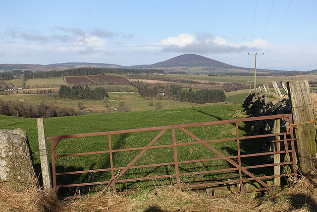
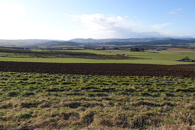
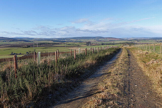
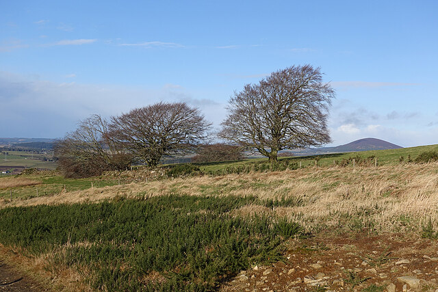
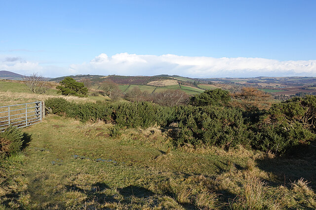
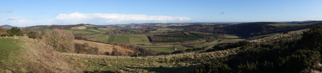
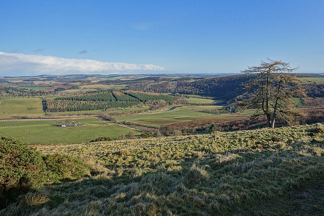
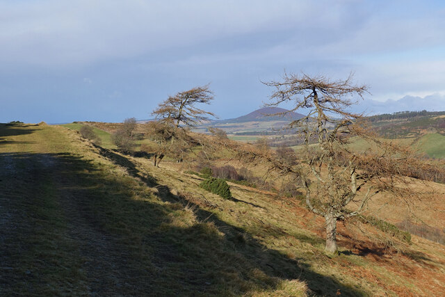
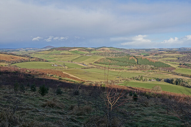
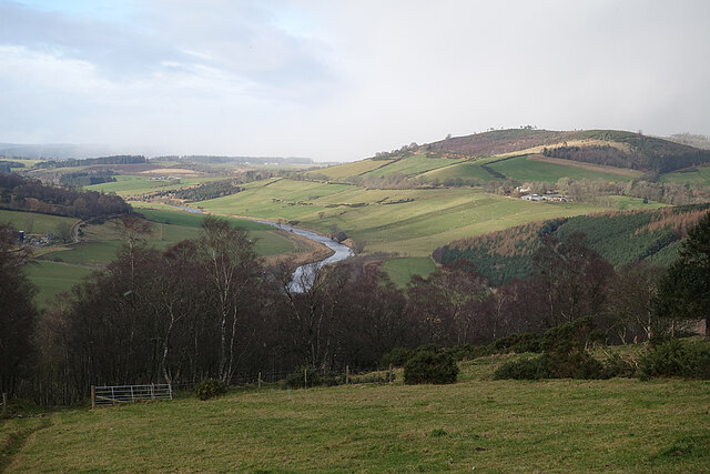
Woodfold Wood is a charming forest located in Banffshire, Scotland. Covering an area of approximately 200 acres, it is a haven for nature enthusiasts and outdoor adventurers alike. The forest is situated in a picturesque setting, surrounded by rolling hills and offering breathtaking views of the countryside.

Woodfold Wood is predominantly composed of native tree species such as oak, birch, and pine, creating a diverse and vibrant ecosystem. The dense vegetation provides a sanctuary for a wide range of wildlife, including deer, foxes, and numerous bird species. Birdwatchers will be delighted by the opportunity to spot species such as woodpeckers, owls, and various songbirds.

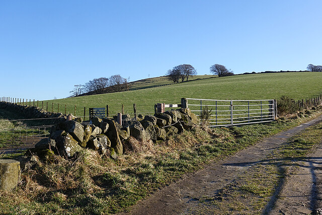
The forest features well-maintained walking trails that wind through its enchanting landscape, allowing visitors to explore its beauty at their own pace. These trails are suitable for all fitness levels and provide a peaceful setting for a leisurely stroll or a more vigorous hike. Along the way, visitors may encounter picturesque streams, charming bridges, and hidden clearings, adding to the sense of tranquility and natural beauty.

Woodfold Wood offers a variety of recreational activities, including picnicking, birdwatching, and photography. The forest is also a popular destination for nature workshops and educational programs, allowing visitors to learn more about the local flora and fauna.

Overall, Woodfold Wood is a must-visit destination for nature lovers and those seeking a peaceful retreat. Its stunning natural beauty, diverse wildlife, and well-maintained trails make it an ideal location for outdoor enthusiasts to connect with nature and appreciate the wonders of the Scottish countryside.

If you have any feedback on the listing, please let us know in the comments section below.

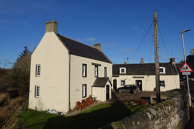
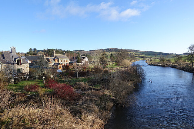
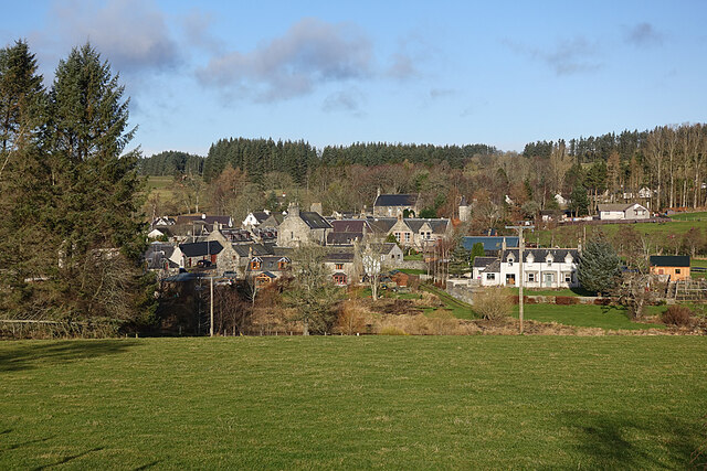
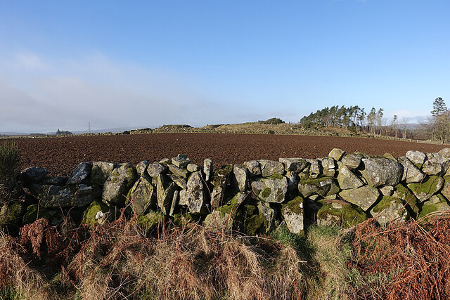
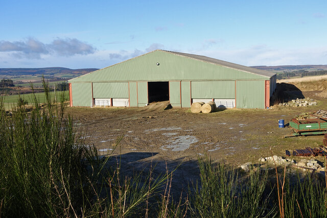
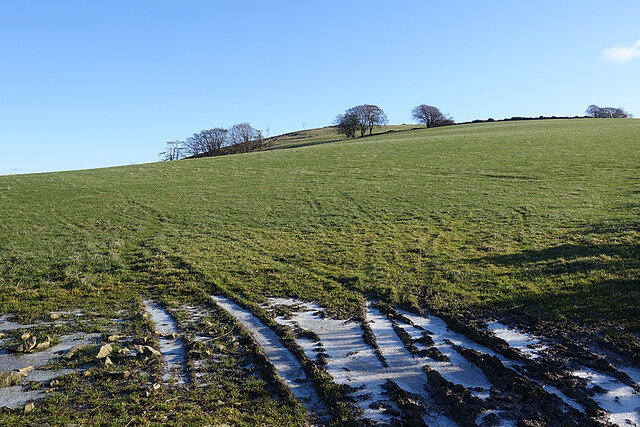
Woodfold Wood Images

Images are sourced within 2km of 57.513041/-2.7280871 or Grid Reference NJ5647. Thanks to Geograph Open Source API. All images are credited.

Forbes Arms Hotel The two-storey house is 18th century and the one-and-s-half storey extension is later. It is a Category B Listed building. See <span class="nowrap"><a title="http://portal.historicenvironment.scot/designation/LB15614" rel="nofollow ugc noopener" href="http://portal.historicenvironment.scot/designation/LB15614">Link</a><img style="margin-left:2px;" alt="External link" title="External link - shift click to open in new window" src="https://s1.geograph.org.uk/img/external.png" width="10" height="10"/></span> for details.
Forbes Arms Hotel
The two-storey house is 18th century and the one-and-s-half storey extension is later. It is a Category B Listed building. See LinkExternal link for details.
River Deveron Looking downstream from the bridge at Milltown.
River Deveron
Looking downstream from the bridge at Milltown.
Milltown of Rothiemay Although officially called Milltown of Rothiemay, most local people refer to it simply as Rothiemay. The River Deveron is in the dip between the foreground field and the village.
Milltown of Rothiemay
Although officially called Milltown of Rothiemay, most local people refer to it simply as Rothiemay. The River Deveron is in the dip between the foreground field and the village.
Drystane Dyke A rather haphazard-looking dyke on the side of the road to Redhill.
Drystane Dyke
A rather haphazard-looking dyke on the side of the road to Redhill.
Gate with a View From the gate the land drops steeply to the River Deveren, rising again to the grounds of Rothiemay House, with its clumps of conifers. Knock Hill, on the skyline, dominates the view.
Gate with a View
From the gate the land drops steeply to the River Deveren, rising again to the grounds of Rothiemay House, with its clumps of conifers. Knock Hill, on the skyline, dominates the view.
Barn at North Redhill A large new barn beside the farm of North Redhill.
Barn at North Redhill
A large new barn beside the farm of North Redhill.
Field at North Redhill A field at North Redhill, just off the old road leading to Fourmanhill and Bognie.
Field at North Redhill
A field at North Redhill, just off the old road leading to Fourmanhill and Bognie.
Frost in the Ruts The almost inevitable water-filled ruts at the field entrance were frozen over. This heralded some excellent dry walking over ground that will be muddy when the frost lifts.
Frost in the Ruts
The almost inevitable water-filled ruts at the field entrance were frozen over. This heralded some excellent dry walking over ground that will be muddy when the frost lifts.
Care of Kinnoir Picking a subject point here is a bit arbitrary. The prominent peak on the skyline is Tap o' Noth. To its right, with some wisps of white cloud rising off it, is The Buck, and the slightly nearer low ridge extending to the right again is Clashmach Hill. Lower, and forested, is the Bin of Huntly. To the left of Tap o' Noth, lower down, is Kinnoir Wood. The low-lying ground is the Carse of Kinnoir, and the row of grey sheds is at Rivestone.
Care of Kinnoir
Picking a subject point here is a bit arbitrary. The prominent peak on the skyline is Tap o' Noth. To its right, with some wisps of white cloud rising off it, is The Buck, and the slightly nearer low ridge extending to the right again is Clashmach Hill. Lower, and forested, is the Bin of Huntly. To the left of Tap o' Noth, lower down, is Kinnoir Wood. The low-lying ground is the Carse of Kinnoir, and the row of grey sheds is at Rivestone.
Old Road The 1940s one-inch Ordnance Survey map <span class="nowrap"><a title="https://maps.nls.uk/geo/explore/#zoom=14&lat=57.51091&lon=-2.70471&layers=2&b=1" rel="nofollow ugc noopener" href="https://maps.nls.uk/geo/explore/#zoom=14&lat=57.51091&lon=-2.70471&layers=2&b=1">Link</a><img style="margin-left:2px;" alt="External link" title="External link - shift click to open in new window" src="https://s1.geograph.org.uk/img/external.png" width="10" height="10"/></span> shows this as a public road, but the Seventh Series (1959) shows it as a track. It links Rothiemay and Bognie by a far more direct route than any now available to motor traffic. The low hill in the distance is the Balloch, near Keith.
Old Road
The 1940s one-inch Ordnance Survey map LinkExternal link shows this as a public road, but the Seventh Series (1959) shows it as a track. It links Rothiemay and Bognie by a far more direct route than any now available to motor traffic. The low hill in the distance is the Balloch, near Keith.
Exposed Trees Standing on a ridge and exposed to evey wind direction, it's not surprising that one of these trees has succumbed to the effets of a recent gale. The prominent hill at right is Knock Hill.
Exposed Trees
Standing on a ridge and exposed to evey wind direction, it's not surprising that one of these trees has succumbed to the effets of a recent gale. The prominent hill at right is Knock Hill.
Roadside Whins This view will be ever better in a few weeks when the whins (gorse) are in flower.
Roadside Whins
This view will be ever better in a few weeks when the whins (gorse) are in flower.
Mayen and the River Deveron In the middle distance is Mayen, which is almost surrounded by a meander of the River Deveron, which turns from flowing south-eastwards to flowing northwards in just a couple of miles. The glen of the Deveron between Rothiemay and Turriff is an excellent example of incised meanders, where the twisting course of an ancient river has been preserved as the river has cut down into the underlying bedrock. The bedrock here is mainly pelite and psammite, formed by metamorphosis of mudstones and sandstones deposited in a deep sea environment between 500 and 1000 million years ago.
Mayen and the River Deveron
In the middle distance is Mayen, which is almost surrounded by a meander of the River Deveron, which turns from flowing south-eastwards to flowing northwards in just a couple of miles. The glen of the Deveron between Rothiemay and Turriff is an excellent example of incised meanders, where the twisting course of an ancient river has been preserved as the river has cut down into the underlying bedrock. The bedrock here is mainly pelite and psammite, formed by metamorphosis of mudstones and sandstones deposited in a deep sea environment between 500 and 1000 million years ago.
River Deveron The glen of the Deveron between Rothiemay and Turriff is an excellent example of incised meanders, where the twisting course of an ancient river has been preserved as the river has cut down into the underlying bedrock. The bedrock here is mainly pelite and psammite, formed by metamorphosis of mudstones and sandstones deposited in a deep sea environment between 500 and 1000 million years ago.
River Deveron
The glen of the Deveron between Rothiemay and Turriff is an excellent example of incised meanders, where the twisting course of an ancient river has been preserved as the river has cut down into the underlying bedrock. The bedrock here is mainly pelite and psammite, formed by metamorphosis of mudstones and sandstones deposited in a deep sea environment between 500 and 1000 million years ago.
Misshapen Larches These two larches beside the old road from Rothiemay to Bognie appear to have suffered from growing in a spot very exposed to winter gales. The prominent hill is Knock Hill.
Misshapen Larches
These two larches beside the old road from Rothiemay to Bognie appear to have suffered from growing in a spot very exposed to winter gales. The prominent hill is Knock Hill.
End of a Yowe It looks as if this yowe (ewe to you) has climbed into the tank, been unable to climb out, and has drowned.
End of a Yowe
It looks as if this yowe (ewe to you) has climbed into the tank, been unable to climb out, and has drowned.
Mayen and the River Deveron The glen of the Deveron between Rothiemay and Turriff is an excellent example of incised meanders, where the twisting course of an ancient river has been preserved as the river has cut down into the underlying bedrock. The bedrock here is mainly pelite and psammite, formed by metamorphosis of mudstones and sandstones deposited in a deep sea environment between 500 and 1000 million years ago. Mayen is the low hill on the opposite bank of the river from here.
Mayen and the River Deveron
The glen of the Deveron between Rothiemay and Turriff is an excellent example of incised meanders, where the twisting course of an ancient river has been preserved as the river has cut down into the underlying bedrock. The bedrock here is mainly pelite and psammite, formed by metamorphosis of mudstones and sandstones deposited in a deep sea environment between 500 and 1000 million years ago. Mayen is the low hill on the opposite bank of the river from here.
River Deveron The glen of the Deveron between Rothiemay and Turriff is an excellent example of incised meanders, where the twisting course of an ancient river has been preserved as the river has cut down into the underlying bedrock. The bedrock here is mainly pelite and psammite, formed by metamorphosis of mudstones and sandstones deposited in a deep sea environment between 500 and 1000 million years ago. Mayen is the cluster of buildings on the slope above the opposite bank.
River Deveron
The glen of the Deveron between Rothiemay and Turriff is an excellent example of incised meanders, where the twisting course of an ancient river has been preserved as the river has cut down into the underlying bedrock. The bedrock here is mainly pelite and psammite, formed by metamorphosis of mudstones and sandstones deposited in a deep sea environment between 500 and 1000 million years ago. Mayen is the cluster of buildings on the slope above the opposite bank.
Show me another place!

Woodfold Wood is located at Grid Ref: NJ5647 (Lat: 57.513041, Lng: -2.7280871)

Unitary Authority: Moray

Police Authority: North East

What 3 Words

///awaiting.cheetahs.globe. Near Aberchirder, Aberdeenshire

Nearby Locations

Sunny Brae Woodfold Wood

Related Wikis

Mountains Burn

Mountains Burn is a burn which marks the boundary of the parish of Huntly, Aberdeenshire, Scotland. == References ==

Fourman Hill

Fourman Hill is a hill located west of Bogniebrae, Aberdeenshire, Scotland. It has an elevation of 1,127 feet (344 m). A cairn near the summit marked the...

Milltown of Rothiemay

Milltown of Rothiemay (Scottish Gaelic: Ràth a' Mhuigh) is a small inland village, built mostly of granite, in the north-east of Scotland and is within...

River Isla, Moray

The River Isla (Scottish Gaelic: Uisge Ìle) is a tributary of the River Deveron in North-East Scotland. The area surrounding it is known as Strathisla...

Nearby Amenities

Located within 500m of 57.513041,-2.7280871
The data included in this document is from www.openstreetmap.org. The data is made available under ODbL.

Have you been to Woodfold Wood?

Leave your review of Woodfold Wood below (or comments, questions and feedback).