Brougham Park

Downs, Moorland in Westmorland Eden

England

Brougham Park

Brougham Castle The castle is situated in the south to southeastern corner of the grid square, southwest of Penrith in Cumbria. The picture was taken looking eastwards towards the castle from the road.
Brougham Castle Credit: Pam Brophy

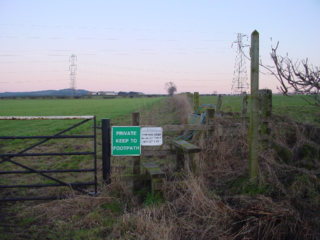
Brougham Park is a picturesque estate located in the county of Westmorland in northwest England. Nestled amidst the splendid Downs and Moorland, this historic property covers a vast area of natural beauty, offering visitors a serene and tranquil retreat.

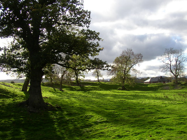
The park boasts breathtaking landscapes, with rolling hills, verdant meadows, and ancient woodlands. Visitors can enjoy leisurely walks along well-maintained trails, taking in the stunning vistas and immersing themselves in the surrounding nature. The park also features a variety of flora and fauna, including rare wildflowers and diverse bird species.

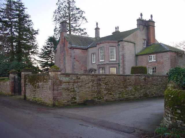
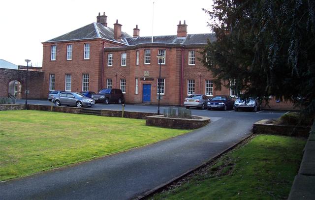
At the heart of Brougham Park lies a magnificent manor house, which dates back to the 18th century. With its grand architecture and elegant gardens, the house serves as a testament to the area's rich history. Guided tours allow visitors to explore the interior of the manor, admiring its exquisite period furnishings and learning about the prominent families who once resided there.

Additionally, Brougham Park offers various recreational activities for outdoor enthusiasts. Horse riding, fishing, and cycling are popular pursuits within the estate, providing an opportunity to engage with the surroundings in an active and immersive manner.

Furthermore, the estate provides a range of amenities, including a visitor center, picnic areas, and a café serving locally sourced delicacies. These facilities ensure that guests are well catered for during their visit.

Overall, Brougham Park in Westmorland is a captivating destination that seamlessly combines natural beauty, historical charm, and recreational opportunities, making it a must-visit location for those seeking a quintessentially English countryside experience.

If you have any feedback on the listing, please let us know in the comments section below.

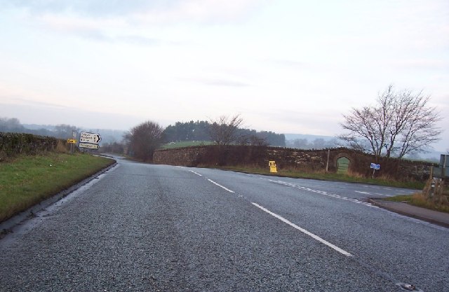
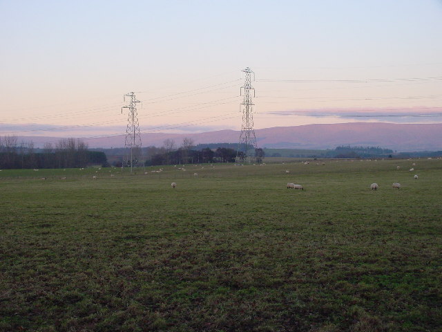
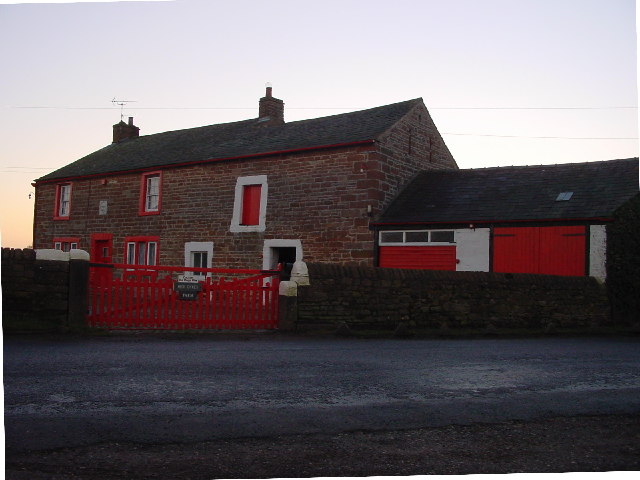
Brougham Park Images

Images are sourced within 2km of 54.645727/-2.7280221 or Grid Reference NY5328. Thanks to Geograph Open Source API. All images are credited.

Brougham Castle The castle is situated in the south to southeastern corner of the grid square, southwest of Penrith in Cumbria. The picture was taken looking eastwards towards the castle from the road.
Brougham Castle
The castle is situated in the south to southeastern corner of the grid square, southwest of Penrith in Cumbria. The picture was taken looking eastwards towards the castle from the road.
Brougham Hall This Manor House situated in the south eastern corner of the square, has seen all sorts of troubled times. It is now a craft centre and produces delicious smoked cheese.
Brougham Hall
This Manor House situated in the south eastern corner of the square, has seen all sorts of troubled times. It is now a craft centre and produces delicious smoked cheese.
One of a pair This photograph of the knocker on the door at Brougham Hall, is submitted as a supplementary photo, as it is of some interest. Its partner is to be found on the door of Durham Cathedral <a title="https://www.geograph.org.uk/photo/2532705" href="https://www.geograph.org.uk/photo/2532705">Link</a>.
One of a pair
This photograph of the knocker on the door at Brougham Hall, is submitted as a supplementary photo, as it is of some interest. Its partner is to be found on the door of Durham Cathedral Link.
Brougham Castle This ancient castle which was home to Lady Anne Clifford. Open to the public under the care of English Heritage.
Brougham Castle
This ancient castle which was home to Lady Anne Clifford. Open to the public under the care of English Heritage.
Brougham Castle near Penrith Photo shows the double gatehouse - started in the 13th century based on a roman fort.
Brougham Castle near Penrith
Photo shows the double gatehouse - started in the 13th century based on a roman fort.
Clifton Hall Pele, near Penrith, Cumbria Built in late 16th century
<span class="nowrap"><a title="www.visitcumbria.com/pen/clifthal.htm" rel="nofollow ugc noopener" href="http://www.visitcumbria.com/pen/clifthal.htm">Link</a><img style="margin-left:2px;" alt="External link" title="External link - shift click to open in new window" src="https://s1.geograph.org.uk/img/external.png" width="10" height="10"/></span>
Clifton Hall Pele, near Penrith, Cumbria
Built in late 16th century LinkExternal link
River Eamont at Brougham Castle, Cumbria This view shows the waters of the River Eamont and River Lowther meeting at Brougham Castle. <span class="nowrap"><a title="http://www.visitcumbria.com/pen/brougham.htm" rel="nofollow ugc noopener" href="http://www.visitcumbria.com/pen/brougham.htm">Link</a><img style="margin-left:2px;" alt="External link" title="External link - shift click to open in new window" src="https://s1.geograph.org.uk/img/external.png" width="10" height="10"/></span>
River Eamont at Brougham Castle, Cumbria
This view shows the waters of the River Eamont and River Lowther meeting at Brougham Castle. LinkExternal link
Old Church, Clifton, Penrith I think this could be a private house? There are no signs outside and I saw a man take his dog into the building.
Old Church, Clifton, Penrith
I think this could be a private house? There are no signs outside and I saw a man take his dog into the building.
Old Chapel, Clifton Now a private house, The plaque reads "Wesleyan Chapel 1885"
Old Chapel, Clifton
Now a private house, The plaque reads "Wesleyan Chapel 1885"
A6 to Cliburn Junction.
Evening Grazing Taken from Fremington, looking east towards the Pennines. The two power lines provide a contrast to the rural scene.
Evening Grazing
Taken from Fremington, looking east towards the Pennines. The two power lines provide a contrast to the rural scene.
Fremington House A large, imposing sandstone house.
Fremington House
A large, imposing sandstone house.
High Dykes Farm
High Dykes Farm
Footpath to High Ground Rather pointless, as there's a shorter path round the corner.
Footpath to High Ground
Rather pointless, as there's a shorter path round the corner.
Carleton Hall. Cumbria constabulary headquarters at the moment.
Carleton Hall.
Cumbria constabulary headquarters at the moment.
Mayburgh Henge, northern part with standing-stone, Yanwath and Eamont Bridge Mayburgh Henge consists of a single circular bank, up to 6.5 metres high, and 50m across its base, with a single entrance and enclosing a level area 90m dia. It contains a single monolith 2.8m high, one of eight that existed in the 18C, four in the centre and four at the entrance. The other seven were destroyed using gunpowder.  The henge probably dates from between 2000 and 1000BC, and may have been a meeting place or refuge for a large prehistoric community.
Mayburgh Henge, northern part with standing-stone, Yanwath and Eamont Bridge
Mayburgh Henge consists of a single circular bank, up to 6.5 metres high, and 50m across its base, with a single entrance and enclosing a level area 90m dia. It contains a single monolith 2.8m high, one of eight that existed in the 18C, four in the centre and four at the entrance. The other seven were destroyed using gunpowder. The henge probably dates from between 2000 and 1000BC, and may have been a meeting place or refuge for a large prehistoric community.
Mayburgh Henge, south-western part, Yanwath and Eamont Bridge A quick search on the internet will produce several other photographs, including aerial views.
Mayburgh Henge, south-western part, Yanwath and Eamont Bridge
A quick search on the internet will produce several other photographs, including aerial views.
The Eden Millennium Monument, Yanwath and Eamont Bridge This 50t block of granite was transported here and erected on 2 July 2000.  It is inscribed with an alpha and an omega, the first and last letters of the Greek alphabet signifying beginning and end, past and future. It is also inscribed with a cross and '2000' for 2000 years of Christianity. The site was chosen because of its proximity to Mayburgh Henge.
The Eden Millennium Monument, Yanwath and Eamont Bridge
This 50t block of granite was transported here and erected on 2 July 2000. It is inscribed with an alpha and an omega, the first and last letters of the Greek alphabet signifying beginning and end, past and future. It is also inscribed with a cross and '2000' for 2000 years of Christianity. The site was chosen because of its proximity to Mayburgh Henge.
Show me another place!

Brougham Park is located at Grid Ref: NY5328 (Lat: 54.645727, Lng: -2.7280221)

Administrative County: Cumbria

District: Eden

Police Authority: Cumbria

What 3 Words

///duties.crisis.recliner. Near Penrith, Cumbria

Related Wikis

Brougham, Cumbria

Brougham is a small village (or more properly a collection of hamlets) and civil parish on the outskirts of Penrith in the Eden District of Cumbria, England...
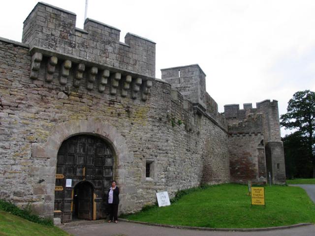
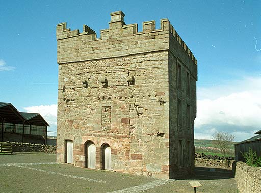
Brougham Hall

Brougham Hall is a historic house museum located in the village of Brougham just outside Penrith, Cumbria, England. == History == The de Burgham family...

Eamont Bridge

Eamont Bridge is a small village immediately to the south of Penrith, Cumbria, England. The village is named after the bridge over the River Eamont and...

King Arthur's Round Table

King Arthur's Round Table is a Neolithic henge in the village of Eamont Bridge in the English county of Cumbria, around 2 kilometres (1 mi) south east...

Yanwath and Eamont Bridge

Yanwath and Eamont Bridge is a civil parish in the Eden District of Cumbria, England, consisting of the small village of Yanwath and most of the neighbouring...

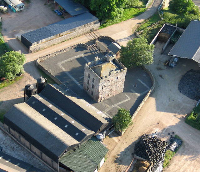
Clifton Hall, Cumbria

Clifton Hall was a fortified manor house in the village of Clifton, Cumbria. Dating from around 1400, it was constructed by either Elianor Engaine or her...
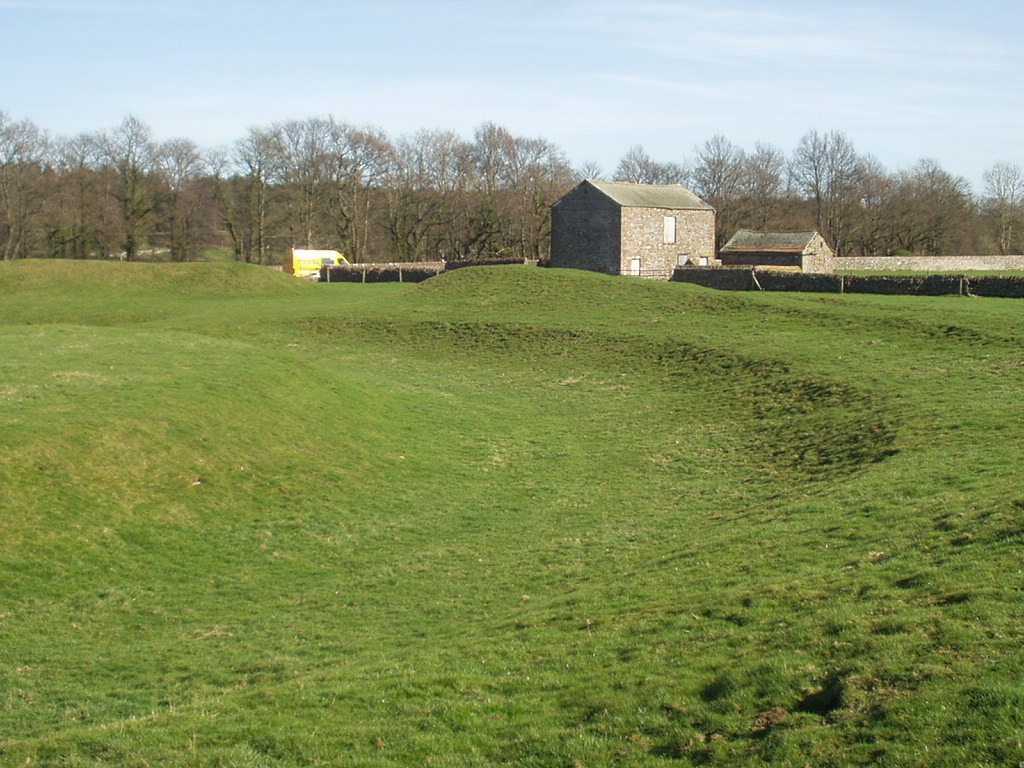
Brocavum

Brocavum is the Latin name of a Roman fort at Brougham near Penrith, Cumbria. The fort survives as earthworks, but no excavation of these has been carried...
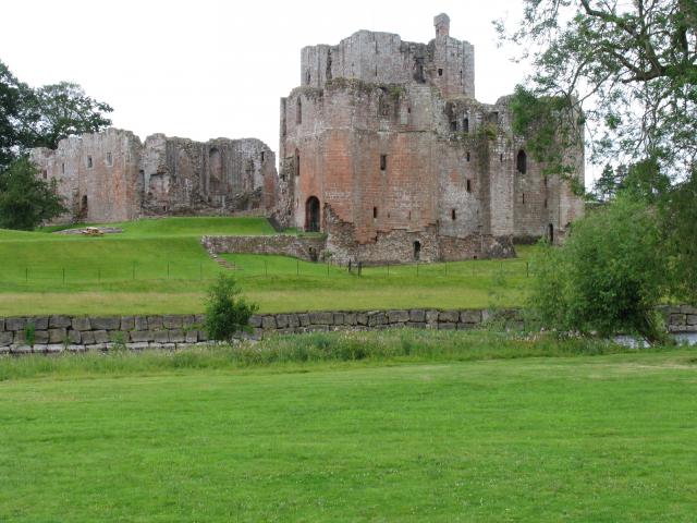
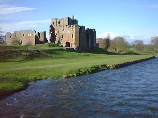
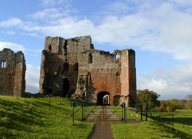
Brougham Castle

Brougham Castle (pronounced ) is a medieval building about 2 miles (3.2 km) south-east of Penrith, Cumbria, England. The castle was founded by Robert I...

Nearby Amenities

Located within 500m of 54.645727,-2.7280221
Cafe
Cafe 4 Eden
Addr Housename: Brougham Hall
Addr Postcode: CA10 2DE
Addr Unit: Unit 9
Fhrs Id: 1106536
Old Name: Fusion Cafe
Outdoor Seating: yes
Website: https://www.4eden.co.uk/portfolio-item/cafe4eden/
Lat/Long: 54.6480927/-2.7329783
Brougham
Name La: Brocavum
Place: hamlet
Source: NPE
Lat/Long: 54.6481197/-2.7296117
Brougham Hall Farm
Naptan AtcoCode: 090074122197
Naptan Bearing: E
Naptan BusStopType: CUS
Naptan CommonName: Brougham Hall Farm
Naptan Indicator: o/s
Naptan Landmark: Brougham Hall Farm
Naptan NaptanCode: cumdadta
Naptan Street: B6262
Naptan Verified: no
Source: naptan_import
Lat/Long: 54.6493382/-2.7286201
Parking
Parking: surface
Source: survey
Lat/Long: 54.6430006/-2.7319706
Clifton Cross
Place: locality
Lat/Long: 54.6418728/-2.7305988
Post Box
Ref: CA10 83
Source: survey
Lat/Long: 54.6480816/-2.7317893
Brougham Park
Place: locality
Lat/Long: 54.644626/-2.7306574
Power: pole
Lat/Long: 54.6424248/-2.7231556
Power: pole
Lat/Long: 54.6425071/-2.7246469
Power: pole
Lat/Long: 54.6425133/-2.7263314
Power: pole
Lat/Long: 54.6424993/-2.7279595
Power: pole
Lat/Long: 54.6424978/-2.7296627
Power: pole
Lat/Long: 54.6416969/-2.7299497
Direction: SSE
Generator Method: photovoltaic
Generator Output Electricity: yes
Generator Source: solar
Generator Type: solar_photovoltaic_panel
Location: roof
Power: generator
Lat/Long: 54.6489983/-2.7289272
Direction: SSE
Generator Method: photovoltaic
Generator Output Electricity: yes
Generator Source: solar
Generator Type: solar_photovoltaic_panel
Location: roof
Power: generator
Lat/Long: 54.6489083/-2.728203
Direction: SSW
Generator Method: photovoltaic
Generator Output Electricity: yes
Generator Source: solar
Generator Type: solar_photovoltaic_panel
Location: roof
Power: generator
Lat/Long: 54.6444141/-2.7241877
Interlude Ceramics
Craft: pottery
Shop: pottery
Website: https://www.interludeceramics.com/
Lat/Long: 54.6482635/-2.7328116
Entrance: yes
Lat/Long: 54.6479165/-2.7320698
Toilets
Access: customers
Lat/Long: 54.6479027/-2.7320445
Artwork Type: sculpture
Image: https://www.geograph.org.uk/photo/803392
Tourism: artwork
Lat/Long: 54.6477848/-2.7329175
Man Made: water_well
Lat/Long: 54.6481068/-2.7328075
Tourism: picnic_site
Lat/Long: 54.6480253/-2.7326533
Man Made: flagpole
Lat/Long: 54.6480653/-2.7322054
Parking
Access: customers
Fee: no
Lat/Long: 54.6479174/-2.7330905
Power: pole
Lat/Long: 54.6431376/-2.7232933
Power: pole
Lat/Long: 54.6439475/-2.7234695
Power: pole
Lat/Long: 54.6447587/-2.7236384
Power: pole
Lat/Long: 54.6453496/-2.7234504
Power: pole
Lat/Long: 54.6462847/-2.7231124
Power: pole
Lat/Long: 54.6436307/-2.7326237
Power: pole
Lat/Long: 54.6447863/-2.7331235
Power: pole
Lat/Long: 54.6457944/-2.7335663
Power: pole
Lat/Long: 54.6468205/-2.7340114
Power: pole
Lat/Long: 54.6475353/-2.7343113
The data included in this document is from www.openstreetmap.org. The data is made available under ODbL.

Have you been to Brougham Park?

Leave your review of Brougham Park below (or comments, questions and feedback).