Broom Brae

Downs, Moorland in Aberdeenshire

Scotland

Broom Brae

Cattle Field by Cairnborrow Cattle grazing by Cairnbarrow Lodge.
Cattle Field by Cairnborrow Credit: Andrew Wood

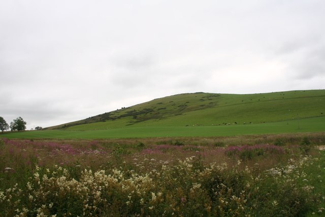
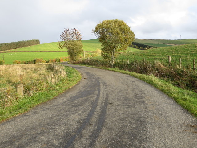
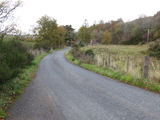
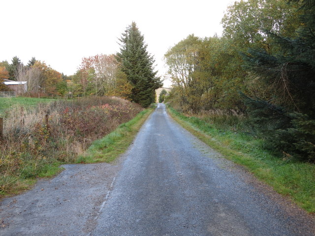
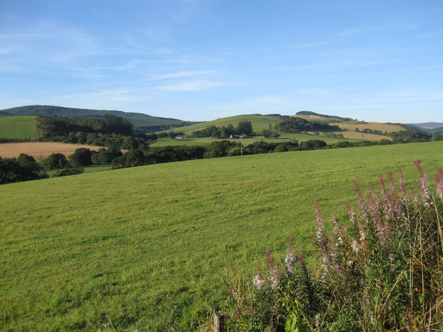
Broom Brae is a captivating area located in Aberdeenshire, Scotland. Situated amidst the stunning Downs and Moorland landscapes, it offers a picturesque setting that showcases the true beauty of the Scottish countryside.

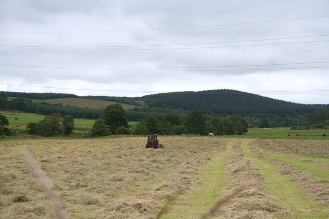
The area is characterized by its rolling hills, vast stretches of greenery, and an abundance of vibrant heather. Broom Brae is particularly known for its diverse wildlife, as it provides a habitat for various species of birds, mammals, and insects. Visitors can witness the graceful flight of birds soaring above, and may even be fortunate enough to spot majestic deer gracefully roaming the moorland.

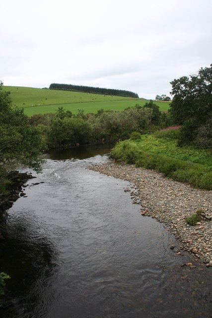
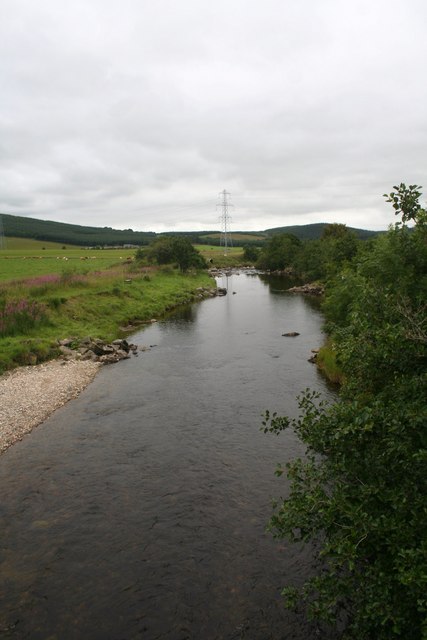
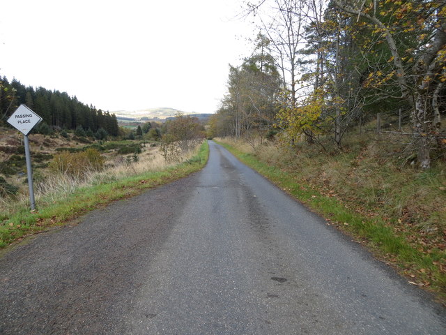
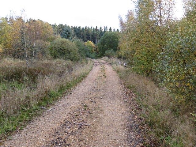
The landscape of Broom Brae is dominated by lush grasslands, dotted with clusters of trees and shrubs. The area is crisscrossed by numerous walking trails and paths, making it a haven for outdoor enthusiasts and nature lovers. Exploring these trails allows visitors to immerse themselves in the tranquility of the surroundings while enjoying breathtaking views of the rolling hills and the ever-changing colors of the moorland.

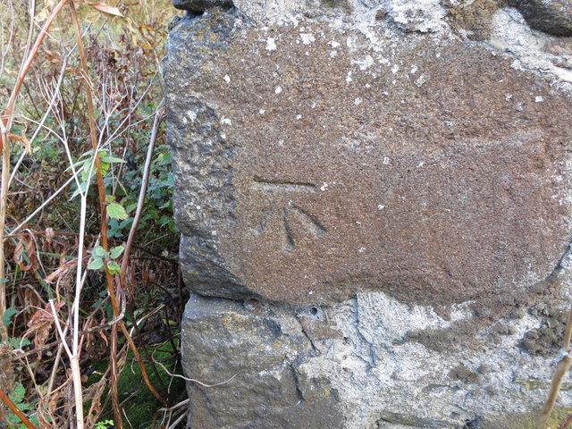
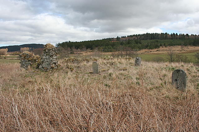
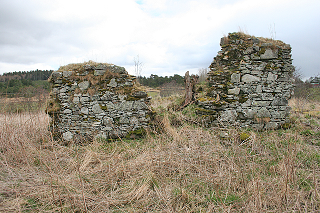
In addition to its natural beauty, Broom Brae also holds historical significance. The area is home to ancient archaeological sites, including standing stones and burial mounds, which provide insights into the rich history of the region.

Overall, Broom Brae in Aberdeenshire is a captivating destination that offers a perfect blend of natural beauty and historical intrigue. Whether one seeks a peaceful stroll through the countryside or a deeper connection with nature, this enchanting area is sure to leave a lasting impression on all who visit.

If you have any feedback on the listing, please let us know in the comments section below.

Broom Brae Images

Images are sourced within 2km of 57.44808/-2.8835058 or Grid Reference NJ4740. Thanks to Geograph Open Source API. All images are credited.

Cattle Field by Cairnborrow Cattle grazing by Cairnbarrow Lodge.
Cattle Field by Cairnborrow
Cattle grazing by Cairnbarrow Lodge.
Weeds and Clashmach Wild wetland with Clashmach Hill behind from Rob's Nook.
Weeds and Clashmach
Wild wetland with Clashmach Hill behind from Rob's Nook.
River Deveron The Deveron by Cairnford Bridge.
River Deveron
The Deveron by Cairnford Bridge.
Deveron Downstream The Deveron flowing away from Cairnford Bridge.
Deveron Downstream
The Deveron flowing away from Cairnford Bridge.
Hay Field Hay turning in a Deveronside field.
Hay Field
Hay turning in a Deveronside field.
Lane leading to Wellheads Looking eastward.
Lane leading to Wellheads
Looking eastward.
Minor road approaching Tigh Fada Looking north-eastward.
Minor road approaching Tigh Fada
Looking north-eastward.
Minor road between Lower Gordonsburn and Tigh Fada Looking north-eastward.
Minor road between Lower Gordonsburn and Tigh Fada
Looking north-eastward.
Forest track heading towards Torry Hillock and Brown Hill Looking southward.
Forest track heading towards Torry Hillock and Brown Hill
Looking southward.
Minor road approaching Cairnagat Steading Looking north-eastward.
Minor road approaching Cairnagat Steading
Looking north-eastward.
Ordnance Survey Cut Mark This mark can be found on the wall of a roadside building at Tigh Fada. The benchmark height is recorded as being 176.772 metres above sea level.
For more detail see : <span class="nowrap"><a title="https://www.bench-marks.org.uk/bm101700" rel="nofollow ugc noopener" href="https://www.bench-marks.org.uk/bm101700">Link</a><img style="margin-left:2px;" alt="External link" title="External link - shift click to open in new window" src="https://s1.geograph.org.uk/img/external.png" width="10" height="10"/></span>
Ordnance Survey Cut Mark
This mark can be found on the wall of a roadside building at Tigh Fada. The benchmark height is recorded as being 176.772 metres above sea level. For more detail see : LinkExternal link
From A920 farmland
From A920 farmland
Boulders from the Fields There's an uncultivated hollow here, which has been used as a handy spot for dumping boulders cleared from the surrounding fields. At the far side of the field are the ruins of St Peter's Church.
Boulders from the Fields
There's an uncultivated hollow here, which has been used as a handy spot for dumping boulders cleared from the surrounding fields. At the far side of the field are the ruins of St Peter's Church.
St Peter's Kirk and Kirkyard This ruin was the parish kirk of the parish of Drumdelgie, which was suppressed in 1615 and united with Cairnie. See <span class="nowrap"><a title="https://canmore.org.uk/site/17322/drumdelgie-parish-church" rel="nofollow ugc noopener" href="https://canmore.org.uk/site/17322/drumdelgie-parish-church">Link</a><img style="margin-left:2px;" alt="External link" title="External link - shift click to open in new window" src="https://s1.geograph.org.uk/img/external.png" width="10" height="10"/></span> for more details.
St Peter's Kirk and Kirkyard
This ruin was the parish kirk of the parish of Drumdelgie, which was suppressed in 1615 and united with Cairnie. See LinkExternal link for more details.
Drumdelgie Parish Kirk The parish of Drumdelgie was suppressed in 1615 and joined with Cairnie. The kirk was still usable in 1640 but soon fell into disrepair. This, the west gable, is the most substantial surviving masonry.  See <span class="nowrap"><a title="https://canmore.org.uk/site/17322/drumdelgie-parish-church" rel="nofollow ugc noopener" href="https://canmore.org.uk/site/17322/drumdelgie-parish-church">Link</a><img style="margin-left:2px;" alt="External link" title="External link - shift click to open in new window" src="https://s1.geograph.org.uk/img/external.png" width="10" height="10"/></span> for more details.
Drumdelgie Parish Kirk
The parish of Drumdelgie was suppressed in 1615 and joined with Cairnie. The kirk was still usable in 1640 but soon fell into disrepair. This, the west gable, is the most substantial surviving masonry. See LinkExternal link for more details.
Interior of St Peter's Kirk These days it is occupied only by vegetation, including a fine collection of snowdrops. See <span class="nowrap"><a title="https://canmore.org.uk/site/17322/drumdelgie-parish-church" rel="nofollow ugc noopener" href="https://canmore.org.uk/site/17322/drumdelgie-parish-church">Link</a><img style="margin-left:2px;" alt="External link" title="External link - shift click to open in new window" src="https://s1.geograph.org.uk/img/external.png" width="10" height="10"/></span> for more details.
Interior of St Peter's Kirk
These days it is occupied only by vegetation, including a fine collection of snowdrops. See LinkExternal link for more details.
Inside Drumdelgie Parish Kirk Looking towards the inside of the west gable. There are a couple of flat-lying gravestones among the snowdrops and long grass.  See <span class="nowrap"><a title="https://canmore.org.uk/site/17322/drumdelgie-parish-church" rel="nofollow ugc noopener" href="https://canmore.org.uk/site/17322/drumdelgie-parish-church">Link</a><img style="margin-left:2px;" alt="External link" title="External link - shift click to open in new window" src="https://s1.geograph.org.uk/img/external.png" width="10" height="10"/></span> for more details.
Inside Drumdelgie Parish Kirk
Looking towards the inside of the west gable. There are a couple of flat-lying gravestones among the snowdrops and long grass. See LinkExternal link for more details.
Drumdelgie Parish Kirkyard Although the kirk was abandoned in the 17th century, there are 19th century gravestones. The only legible one was erected in 1881.  See <span class="nowrap"><a title="https://canmore.org.uk/site/17322/drumdelgie-parish-church" rel="nofollow ugc noopener" href="https://canmore.org.uk/site/17322/drumdelgie-parish-church">Link</a><img style="margin-left:2px;" alt="External link" title="External link - shift click to open in new window" src="https://s1.geograph.org.uk/img/external.png" width="10" height="10"/></span> for more details.
Drumdelgie Parish Kirkyard
Although the kirk was abandoned in the 17th century, there are 19th century gravestones. The only legible one was erected in 1881. See LinkExternal link for more details.
Show me another place!

Broom Brae is located at Grid Ref: NJ4740 (Lat: 57.44808, Lng: -2.8835058)

Unitary Authority: Aberdeenshire

Police Authority: North East

What 3 Words

///refrained.pools.gums. Near Huntly, Aberdeenshire

Related Wikis

Torry Burn, Huntly

Torry Burn is a burn which marks the boundary of the parish of Huntly, Aberdeenshire, Scotland. == References ==

Kye Hill

Kye Hill is a hill by Huntly, Aberdeenshire, Scotland. It lies southwest of The Clashmach hill and is nearly the same height. There is a former limestone...

Blairmore School

Blairmore School was an independent boarding preparatory school in Glass near Huntly, Aberdeenshire until its closure in 1993. The site is now owned and...

Dunbennan

Dunbennan is a settlement near Huntly, Aberdeenshire, Scotland. The name comes from the Gaelic dun-beinnean, or the fort of the little hill, and originally...

Cairnie

Cairnie, also written Cairney, (Scottish Gaelic: CĂ rnaidh/A' ChĂ rnaich) is a village in Aberdeenshire, Scotland. It is in the district of Huntly. It has...

Ardonald

Ardonald is a rural area near Cairnie in Aberdeenshire, Scotland. == References ==

Burn of Tullochbeg

Burn of Tullochbeg is a burn which marks the boundary of the parish of Huntly, Aberdeenshire, Scotland. == References ==

Clean Pool

Clean Pool was an important boundary marker between the parishes of Huntly and Cairnie, Aberdeenshire, Scotland. It has now been dried up to plant conifer...

Nearby Amenities

Located within 500m of 57.44808,-2.8835058
Power: pole
Lat/Long: 57.4480895/-2.8883755
Power: pole
Lat/Long: 57.4484934/-2.8882314
Power: pole
Lat/Long: 57.4490082/-2.8880072
Power: pole
Lat/Long: 57.4498203/-2.8881193
Power: pole
Lat/Long: 57.4504514/-2.8882034
Power: pole
Lat/Long: 57.4511299/-2.8882915
Terryhorn
Place: isolated_dwelling
Lat/Long: 57.4491296/-2.8888038
Newbigging
Place: isolated_dwelling
Lat/Long: 57.4480905/-2.8897264
The data included in this document is from www.openstreetmap.org. The data is made available under ODbL.

Have you been to Broom Brae?

Leave your review of Broom Brae below (or comments, questions and feedback).