Artloch Pot

Lake, Pool, Pond, Freshwater Marsh in Aberdeenshire

Scotland

Artloch Pot

Weeds and Clashmach Wild wetland with Clashmach Hill behind from Rob's Nook.
Weeds and Clashmach Credit: Andrew Wood

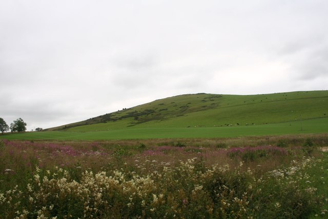
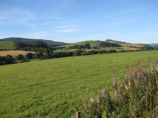
Artloch Pot is a picturesque freshwater loch located in Aberdeenshire, Scotland. This natural body of water covers an area of approximately 6 hectares and is nestled amidst the beautiful rolling hills of the Aberdeenshire countryside. Artloch Pot is known for its tranquil and serene atmosphere, making it a popular spot for nature enthusiasts and anglers alike.

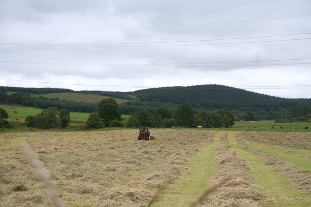
The loch is surrounded by lush vegetation, including reeds and grasses, creating a vibrant ecosystem that supports a variety of wildlife. The area is home to numerous species of birds, such as ducks, swans, and geese, which can often be seen paddling across the calm waters. In addition to avian life, Artloch Pot also provides a habitat for various fish species, including brown trout and pike, making it a sought-after destination for fishing enthusiasts.

The loch is easily accessible, with a well-maintained footpath that runs along its perimeter, allowing visitors to enjoy leisurely walks while taking in the breathtaking views. The surrounding area offers ample opportunities for picnicking and photography, with several picnic tables and viewpoints strategically placed to enhance the visitor experience.

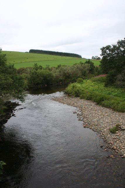
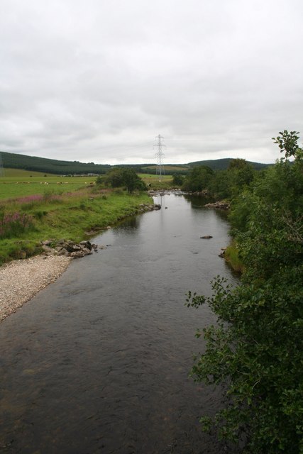
Artloch Pot also serves as a freshwater marsh, providing important ecological functions such as water filtration and flood prevention. The marshy areas around the loch are characterized by a diverse range of plant life, including sedges, rushes, and water lilies. These wetland plants not only add to the aesthetic appeal of the area but also provide crucial habitats for amphibians, insects, and other small creatures.

Overall, Artloch Pot is a natural gem in Aberdeenshire, offering a peaceful retreat for those seeking solace in nature's beauty. Its diverse ecosystem and stunning surroundings make it a must-visit destination for anyone with an appreciation for Scotland's natural wonders.

If you have any feedback on the listing, please let us know in the comments section below.
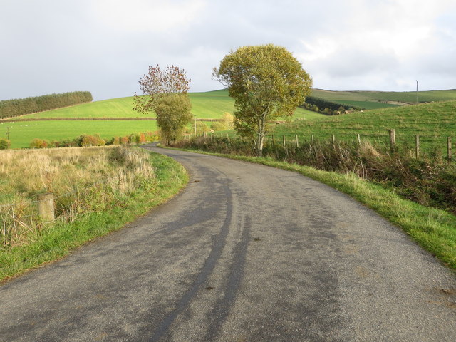
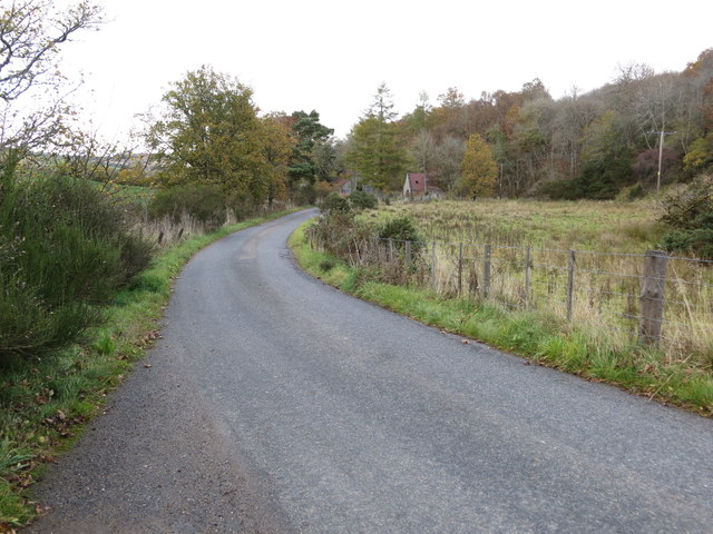
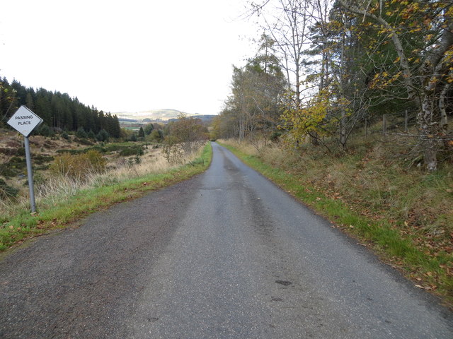
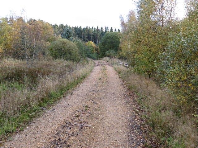
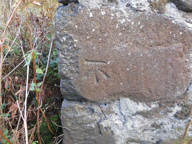
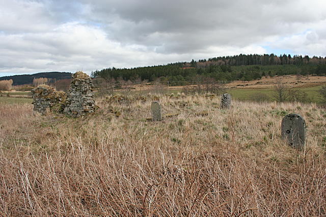
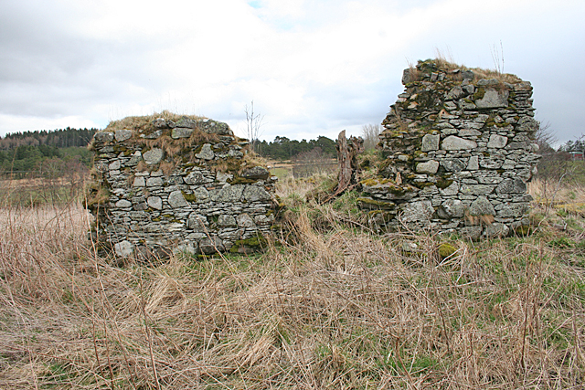
Artloch Pot Images

Images are sourced within 2km of 57.450866/-2.8756909 or Grid Reference NJ4740. Thanks to Geograph Open Source API. All images are credited.

Weeds and Clashmach Wild wetland with Clashmach Hill behind from Rob's Nook.
Weeds and Clashmach
Wild wetland with Clashmach Hill behind from Rob's Nook.
River Deveron The Deveron by Cairnford Bridge.
River Deveron
The Deveron by Cairnford Bridge.
Deveron Downstream The Deveron flowing away from Cairnford Bridge.
Deveron Downstream
The Deveron flowing away from Cairnford Bridge.
Hay Field Hay turning in a Deveronside field.
Hay Field
Hay turning in a Deveronside field.
Lane leading to Wellheads Looking eastward.
Lane leading to Wellheads
Looking eastward.
Minor road approaching Tigh Fada Looking north-eastward.
Minor road approaching Tigh Fada
Looking north-eastward.
Minor road between Lower Gordonsburn and Tigh Fada Looking north-eastward.
Minor road between Lower Gordonsburn and Tigh Fada
Looking north-eastward.
Forest track heading towards Torry Hillock and Brown Hill Looking southward.
Forest track heading towards Torry Hillock and Brown Hill
Looking southward.
Ordnance Survey Cut Mark This mark can be found on the wall of a roadside building at Tigh Fada. The benchmark height is recorded as being 176.772 metres above sea level.
For more detail see : <span class="nowrap"><a title="https://www.bench-marks.org.uk/bm101700" rel="nofollow ugc noopener" href="https://www.bench-marks.org.uk/bm101700">Link</a><img style="margin-left:2px;" alt="External link" title="External link - shift click to open in new window" src="https://s1.geograph.org.uk/img/external.png" width="10" height="10"/></span>
Ordnance Survey Cut Mark
This mark can be found on the wall of a roadside building at Tigh Fada. The benchmark height is recorded as being 176.772 metres above sea level. For more detail see : LinkExternal link
From A920 farmland
From A920 farmland
Boulders from the Fields There's an uncultivated hollow here, which has been used as a handy spot for dumping boulders cleared from the surrounding fields. At the far side of the field are the ruins of St Peter's Church.
Boulders from the Fields
There's an uncultivated hollow here, which has been used as a handy spot for dumping boulders cleared from the surrounding fields. At the far side of the field are the ruins of St Peter's Church.
St Peter's Kirk and Kirkyard This ruin was the parish kirk of the parish of Drumdelgie, which was suppressed in 1615 and united with Cairnie. See <span class="nowrap"><a title="https://canmore.org.uk/site/17322/drumdelgie-parish-church" rel="nofollow ugc noopener" href="https://canmore.org.uk/site/17322/drumdelgie-parish-church">Link</a><img style="margin-left:2px;" alt="External link" title="External link - shift click to open in new window" src="https://s1.geograph.org.uk/img/external.png" width="10" height="10"/></span> for more details.
St Peter's Kirk and Kirkyard
This ruin was the parish kirk of the parish of Drumdelgie, which was suppressed in 1615 and united with Cairnie. See LinkExternal link for more details.
Drumdelgie Parish Kirk The parish of Drumdelgie was suppressed in 1615 and joined with Cairnie. The kirk was still usable in 1640 but soon fell into disrepair. This, the west gable, is the most substantial surviving masonry.  See <span class="nowrap"><a title="https://canmore.org.uk/site/17322/drumdelgie-parish-church" rel="nofollow ugc noopener" href="https://canmore.org.uk/site/17322/drumdelgie-parish-church">Link</a><img style="margin-left:2px;" alt="External link" title="External link - shift click to open in new window" src="https://s1.geograph.org.uk/img/external.png" width="10" height="10"/></span> for more details.
Drumdelgie Parish Kirk
The parish of Drumdelgie was suppressed in 1615 and joined with Cairnie. The kirk was still usable in 1640 but soon fell into disrepair. This, the west gable, is the most substantial surviving masonry. See LinkExternal link for more details.
Interior of St Peter's Kirk These days it is occupied only by vegetation, including a fine collection of snowdrops. See <span class="nowrap"><a title="https://canmore.org.uk/site/17322/drumdelgie-parish-church" rel="nofollow ugc noopener" href="https://canmore.org.uk/site/17322/drumdelgie-parish-church">Link</a><img style="margin-left:2px;" alt="External link" title="External link - shift click to open in new window" src="https://s1.geograph.org.uk/img/external.png" width="10" height="10"/></span> for more details.
Interior of St Peter's Kirk
These days it is occupied only by vegetation, including a fine collection of snowdrops. See LinkExternal link for more details.
Inside Drumdelgie Parish Kirk Looking towards the inside of the west gable. There are a couple of flat-lying gravestones among the snowdrops and long grass.  See <span class="nowrap"><a title="https://canmore.org.uk/site/17322/drumdelgie-parish-church" rel="nofollow ugc noopener" href="https://canmore.org.uk/site/17322/drumdelgie-parish-church">Link</a><img style="margin-left:2px;" alt="External link" title="External link - shift click to open in new window" src="https://s1.geograph.org.uk/img/external.png" width="10" height="10"/></span> for more details.
Inside Drumdelgie Parish Kirk
Looking towards the inside of the west gable. There are a couple of flat-lying gravestones among the snowdrops and long grass. See LinkExternal link for more details.
Drumdelgie Parish Kirkyard Although the kirk was abandoned in the 17th century, there are 19th century gravestones. The only legible one was erected in 1881.  See <span class="nowrap"><a title="https://canmore.org.uk/site/17322/drumdelgie-parish-church" rel="nofollow ugc noopener" href="https://canmore.org.uk/site/17322/drumdelgie-parish-church">Link</a><img style="margin-left:2px;" alt="External link" title="External link - shift click to open in new window" src="https://s1.geograph.org.uk/img/external.png" width="10" height="10"/></span> for more details.
Drumdelgie Parish Kirkyard
Although the kirk was abandoned in the 17th century, there are 19th century gravestones. The only legible one was erected in 1881. See LinkExternal link for more details.
Moss-covered Gravestones Most of the stones, even if you can see them in the rank grass and withered rosebay stems, are so covered with moss that they are completely illegible.  See <span class="nowrap"><a title="https://canmore.org.uk/site/17322/drumdelgie-parish-church" rel="nofollow ugc noopener" href="https://canmore.org.uk/site/17322/drumdelgie-parish-church">Link</a><img style="margin-left:2px;" alt="External link" title="External link - shift click to open in new window" src="https://s1.geograph.org.uk/img/external.png" width="10" height="10"/></span> for more details.
Moss-covered Gravestones
Most of the stones, even if you can see them in the rank grass and withered rosebay stems, are so covered with moss that they are completely illegible. See LinkExternal link for more details.
Old Kirkyard Gate The old gate, rusty and askew, to the burial ground surrounding the ruins of St Peter's Kirk. The wrought iron arrowheads on the middle railing seem to have been bent or broken off.  See <span class="nowrap"><a title="https://canmore.org.uk/site/17322/drumdelgie-parish-church" rel="nofollow ugc noopener" href="https://canmore.org.uk/site/17322/drumdelgie-parish-church">Link</a><img style="margin-left:2px;" alt="External link" title="External link - shift click to open in new window" src="https://s1.geograph.org.uk/img/external.png" width="10" height="10"/></span> for more details.
Old Kirkyard Gate
The old gate, rusty and askew, to the burial ground surrounding the ruins of St Peter's Kirk. The wrought iron arrowheads on the middle railing seem to have been bent or broken off. See LinkExternal link for more details.
Show me another place!

Artloch Pot is located at Grid Ref: NJ4740 (Lat: 57.450866, Lng: -2.8756909)

Unitary Authority: Aberdeenshire

Police Authority: North East

What 3 Words

///fractions.goose.tricky. Near Huntly, Aberdeenshire

Related Wikis

Torry Burn, Huntly

Torry Burn is a burn which marks the boundary of the parish of Huntly, Aberdeenshire, Scotland. == References ==

Dunbennan

Dunbennan is a settlement near Huntly, Aberdeenshire, Scotland. The name comes from the Gaelic dun-beinnean, or the fort of the little hill, and originally...

Kye Hill

Kye Hill is a hill by Huntly, Aberdeenshire, Scotland. It lies southwest of The Clashmach hill and is nearly the same height. There is a former limestone...

Cairnie

Cairnie, also written Cairney, (Scottish Gaelic: Càrnaidh/A' Chàrnaich) is a village in Aberdeenshire, Scotland. It is in the district of Huntly. It has...

Ardonald

Ardonald is a rural area near Cairnie in Aberdeenshire, Scotland. == References ==

Blairmore School

Blairmore School was an independent boarding preparatory school in Glass near Huntly, Aberdeenshire until its closure in 1993. The site is now owned and...

Clean Pool

Clean Pool was an important boundary marker between the parishes of Huntly and Cairnie, Aberdeenshire, Scotland. It has now been dried up to plant conifer...

Burn of Tullochbeg

Burn of Tullochbeg is a burn which marks the boundary of the parish of Huntly, Aberdeenshire, Scotland. == References ==

Nearby Amenities

Located within 500m of 57.450866,-2.8756909
Power: pole
Lat/Long: 57.4502026/-2.8713184
Power: pole
Lat/Long: 57.4506658/-2.8710882
Power: pole
Lat/Long: 57.4512215/-2.8707599
Power: pole
Lat/Long: 57.4516727/-2.8714005
Power: pole
Lat/Long: 57.4521035/-2.871987
Power: pole
Lat/Long: 57.452558/-2.8726256
Material: wood
Power: pole
Lat/Long: 57.4526786/-2.8739388
Material: wood
Power: pole
Lat/Long: 57.4527691/-2.8749176
Material: wood
Power: pole
Lat/Long: 57.4529037/-2.8764089
Material: wood
Power: pole
Lat/Long: 57.4530135/-2.8776801
Material: wood
Power: pole
Lat/Long: 57.4531406/-2.8790032
Material: wood
Power: pole
Lat/Long: 57.4532526/-2.8802543
Material: wood
Power: pole
Lat/Long: 57.4533646/-2.8815035
Power: pole
Lat/Long: 57.4488983/-2.8705818
Power: pole
Lat/Long: 57.4492936/-2.8716848
Power: pole
Lat/Long: 57.4495995/-2.8725355
Power: pole
Lat/Long: 57.4498957/-2.8733723
Power: pole
Lat/Long: 57.4501876/-2.874187
Power: pole
Lat/Long: 57.4504267/-2.8748436
Power: pole
Lat/Long: 57.4506884/-2.8755742
Power: pole
Lat/Long: 57.451089/-2.8757163
Power: pole
Lat/Long: 57.4517374/-2.8759585
Power: pole
Lat/Long: 57.4523157/-2.8761787
Material: wood
Power: pole
Lat/Long: 57.4534066/-2.8765891
Power: pole
Lat/Long: 57.4540657/-2.8763709
Power: pole
Lat/Long: 57.4492428/-2.8688104
Milton of Cairnbarrow
Place: hamlet
Lat/Long: 57.4533546/-2.8724015
Artloch
Name Gd: Àird Chlach
Place: hamlet
Lat/Long: 57.4496714/-2.8703008
The data included in this document is from www.openstreetmap.org. The data is made available under ODbL.

Have you been to Artloch Pot?

Leave your review of Artloch Pot below (or comments, questions and feedback).