Savinhill Moss

Downs, Moorland in Westmorland South Lakeland

England

Savinhill Moss

Lane off Hyning Brow
Lane off Hyning Brow Credit: Anthony Parkes

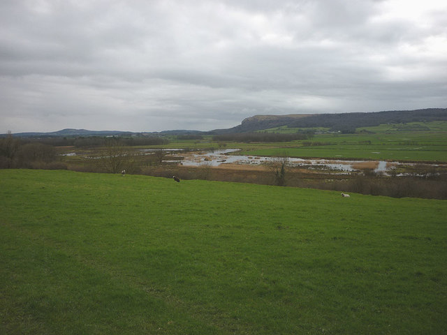
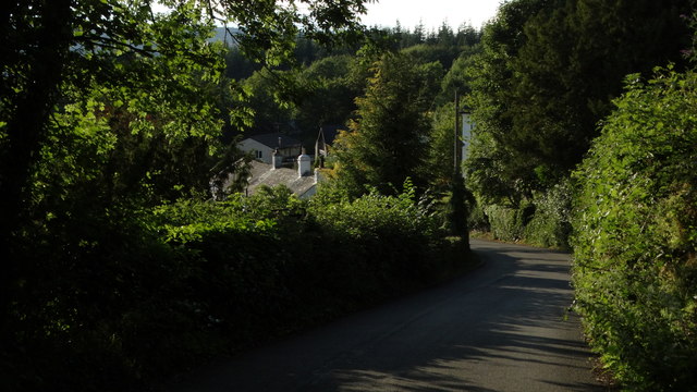
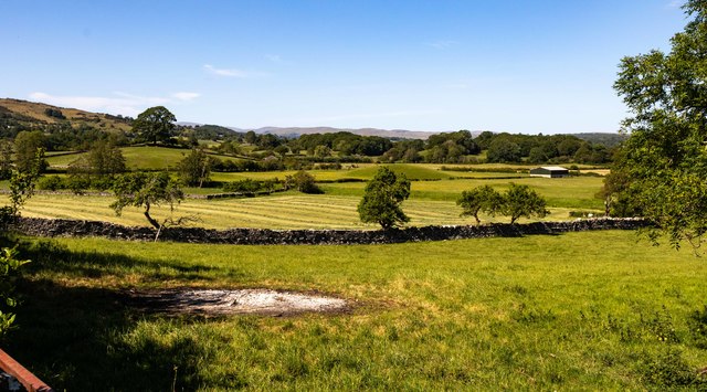
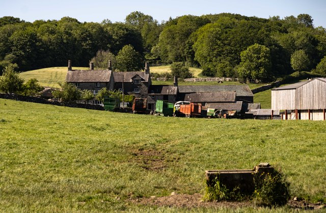
Savinhill Moss is a picturesque and serene region located in Westmorland, a county in the northwestern part of England. It is renowned for its stunning natural beauty, characterized by rolling downs and expansive moorlands. The area is a haven for nature enthusiasts and avid hikers, offering a plethora of scenic trails and breathtaking vistas.

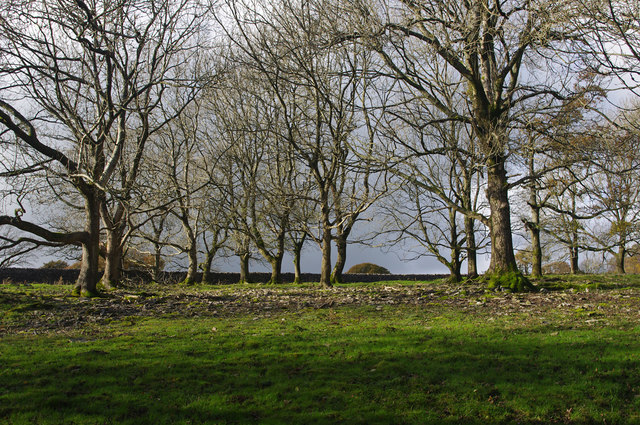
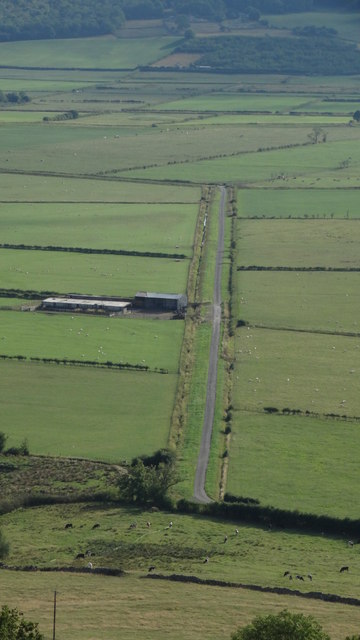
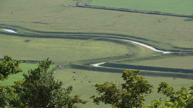
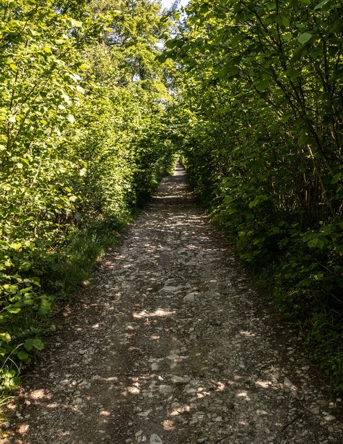
The downs of Savinhill Moss boast lush green grasslands that stretch as far as the eye can see. These undulating hills are ideal for leisurely walks or challenging hikes, catering to all levels of fitness and abilities. Visitors can revel in the tranquility of the surroundings, taking in the fresh air and immersing themselves in the peaceful ambiance.

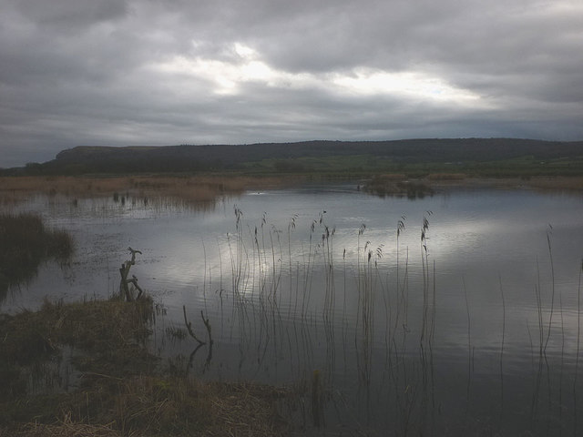
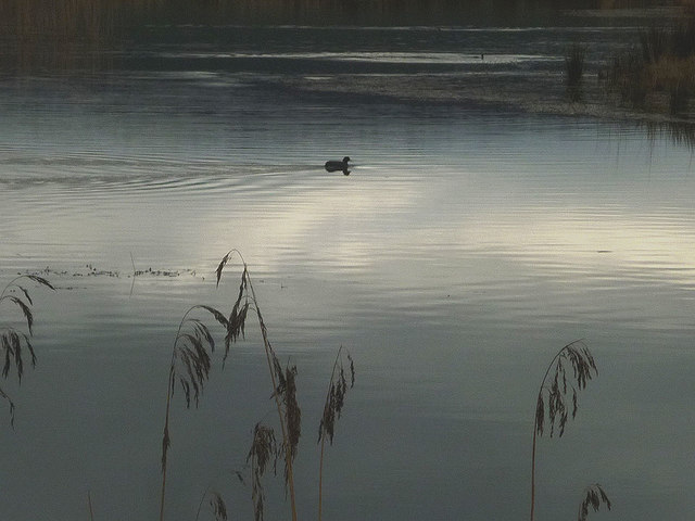
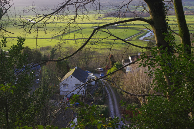
Adjacent to the downs, the moorlands of Savinhill Moss provide a distinct rugged beauty. These vast expanses of open heathland are interspersed with heather, gorse, and various wildflowers, offering a vibrant and ever-changing landscape throughout the seasons. The moorlands are home to a diverse array of wildlife, including birds of prey, such as kestrels and buzzards, as well as various small mammals and reptiles.

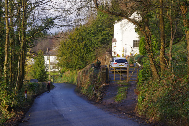
Savinhill Moss is a place where one can truly connect with nature, offering an escape from the hustle and bustle of city life. Whether it's a leisurely stroll, a challenging hike, or birdwatching, this idyllic region provides an unforgettable experience for all who venture there.

If you have any feedback on the listing, please let us know in the comments section below.

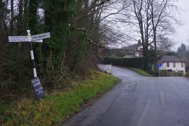
Savinhill Moss Images

Images are sourced within 2km of 54.295111/-2.8242103 or Grid Reference SD4689. Thanks to Geograph Open Source API. All images are credited.

Lane off Hyning Brow
Cottage at Row Beside the lane/public footpath which heads west of the hamlet towards open pastureland and the wooded heights of Whitbarrow.
Cottage at Row
Beside the lane/public footpath which heads west of the hamlet towards open pastureland and the wooded heights of Whitbarrow.
Lime kiln above Row This impressively large kiln above the footpath is remarkably well-preserved and is a Grade II listed structure <span class="nowrap"><a title="http://www.britishlistedbuildings.co.uk/en-77110-limekiln-approximately-150-metres-north-w#.V8KwdhI6tI4" rel="nofollow ugc noopener" href="http://www.britishlistedbuildings.co.uk/en-77110-limekiln-approximately-150-metres-north-w#.V8KwdhI6tI4">Link</a><img style="margin-left:2px;" alt="External link" title="External link - shift click to open in new window" src="https://s1.geograph.org.uk/img/external.png" width="10" height="10"/></span>
Lime kiln above Row
This impressively large kiln above the footpath is remarkably well-preserved and is a Grade II listed structure LinkExternal link
Park End Moss A wetland reserve created by the National Trust two years ago on farmland in the Lyth Valley. Beyond is the long ridge of Whitbarrow. This land is now also part of the Lake District national park.
Park End Moss
A wetland reserve created by the National Trust two years ago on farmland in the Lyth Valley. Beyond is the long ridge of Whitbarrow. This land is now also part of the Lake District national park.
A coot on Park End Moss A coot enjoying the new wetland created in 2015 by the National Trust.
A coot on Park End Moss
A coot enjoying the new wetland created in 2015 by the National Trust.
Park End Moss A view of the new (2015) wetland created on saturated farmland in the Lyth Valley by the National trust.
Park End Moss
A view of the new (2015) wetland created on saturated farmland in the Lyth Valley by the National trust.
Scattered trees, Township Allotment Old maps indicate that the wall on the west side of this woodland (visible in the photo) was built later than the plantation walls on the north and south sides.
Scattered trees, Township Allotment
Old maps indicate that the wall on the west side of this woodland (visible in the photo) was built later than the plantation walls on the north and south sides.
Brigsteer Causeway from road to Helsington Church
Helsington Pool (creek) as seen from S of Helsington Barrows
Brigsteer Brow leading into Brigsteer
Brigsteer Looking over part of Brigsteer village with the Lyth Valley beyond.
Brigsteer
Looking over part of Brigsteer village with the Lyth Valley beyond.
Brigsteer Brow The road drops down quite steeply into Brigsteer village.
Brigsteer Brow
The road drops down quite steeply into Brigsteer village.
Approaching Brigsteer Looking along the road from Underbarrow at the junction for a narrow lane that heads across the Lyth Valley. The blackboard advertises the Wheatsheaf 'Award winning inn'.
Approaching Brigsteer
Looking along the road from Underbarrow at the junction for a narrow lane that heads across the Lyth Valley. The blackboard advertises the Wheatsheaf 'Award winning inn'.
Old Milepost by Brigsteer Road, Brigsteer, Kendal parish Metal post with attached metal plates by the UC road, in parish of KENDAL (SOUTH LAKELAND District), Brigsteer, in bank, on East side of road. Day iron casting, erected by the County Council in the 20th century. 

Inscription reads:-
: KENDAL / 3 / MILES : : 1900 : : BRIG / STEER / ¼ / MILE :
Maker:-
: DAY / KENDAL : 

Milestone Society National ID: WE_KDBS03.
Old Milepost by Brigsteer Road, Brigsteer, Kendal parish
Metal post with attached metal plates by the UC road, in parish of KENDAL (SOUTH LAKELAND District), Brigsteer, in bank, on East side of road. Day iron casting, erected by the County Council in the 20th century. Inscription reads:- : KENDAL / 3 / MILES : : 1900 : : BRIG / STEER / ¼ / MILE : Maker:- : DAY / KENDAL : Milestone Society National ID: WE_KDBS03.
Whitbarrow Road
Whitbarrow Road
Lyth Valley
Lyth Valley
South Low Farm
South Low Farm
Flodder Hall Flodder Hall Farm.
Flodder Hall
Flodder Hall Farm.
Show me another place!

Savinhill Moss is located at Grid Ref: SD4689 (Lat: 54.295111, Lng: -2.8242103)

Administrative County: Cumbria

District: South Lakeland

Police Authority: Cumbria

What 3 Words

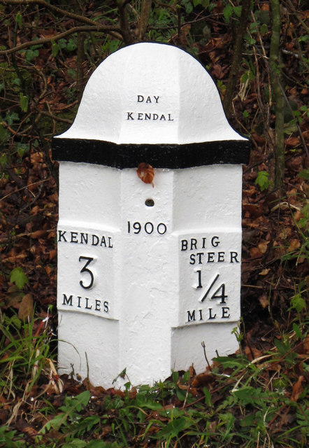
///direction.stag.cone. Near Kendal, Cumbria

Related Wikis

Lyth Valley

The Lyth Valley is on the edge of the Lake District National Park in Cumbria, England. It gives its name to an electoral ward (one of 45 in South Lakeland...
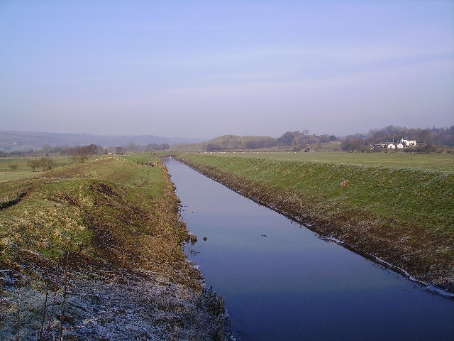
River Pool, Cumbria

The River Pool is a river in the English county of Cumbria. The Pool rises at Waingap near the village of Crook and follows a southerly course, past the...

Helsington

Helsington is a civil parish in the South Lakeland district of the English county of Cumbria. It includes the village of Brigsteer and Sizergh Castle...

Brigsteer

Brigsteer is a village in Cumbria, England. On 1 August 2016 it was included in the Lake District National Park. == Politics == In 1974, under the Local...

Crosthwaite and Lyth

Crosthwaite and Lyth is a civil parish in the South Lakeland district of Cumbria, England. In the 2001 census the parish had a population of 562, increasing...

Underbarrow

Underbarrow is a small village in Cumbria, England, located 3 miles (4.8 km) west of Kendal. The village is in the Lake District National Park. It is in...

Cotes, Cumbria

Cotes is a hamlet in Cumbria, England. == References ==
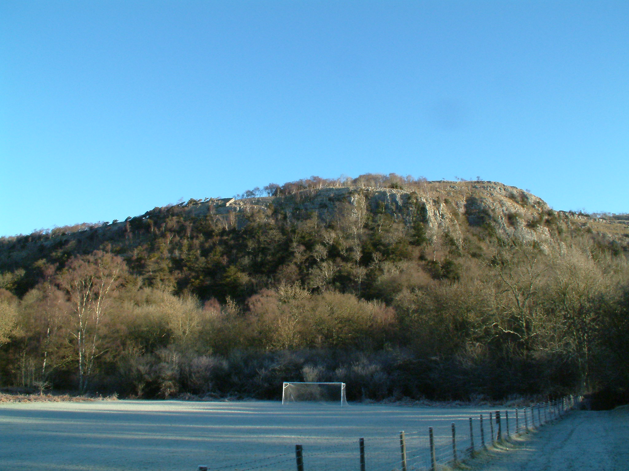
Whitbarrow

Whitbarrow is a hill in Cumbria, England. Designated a biological Site of Special Scientific Interest and national nature reserve, it forms part of the...

Related Videos

Travel Vlog #5: Beginner’s Friendly Hike | Lhing Bratinella

Mt. Haponang Banoi •Mt. Pamitinan (Side trip to) Wawa Dam, Rizal •Mt. Maculot •Mt. Balagbag Connect with me: ...

Bowland Bridge 2022

Easter weekend trip to The Lake District Good Times.

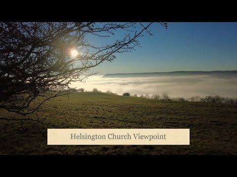
Helsington Church Viewpoint, Lake District

Looking out from the Helsington Church Viewpoint across the cloud inversion to Whitbarrow National Nature Reserve, we can see ...

A walk in the rain in Brigsteer Woods, Cumbria #forestbathing #mindfulness #mindbodyspirit

Join me on a gentle stroll through Brigsteer Woods, one of the oldest in England . It's raining but we're dressed for the ...

Nearby Amenities

Located within 500m of 54.295111,-2.8242103
Power: pole
Lat/Long: 54.2945203/-2.8299497
Power: pole
Lat/Long: 54.2958629/-2.8312259
Power: pole
Lat/Long: 54.2952506/-2.8306703
Power: pole
Lat/Long: 54.2928081/-2.8281972
Power: pole
Lat/Long: 54.2918388/-2.827209
Power: pole
Lat/Long: 54.2914823/-2.8260593
Power: pole
Lat/Long: 54.2911236/-2.8248491
Power: pole
Lat/Long: 54.2908172/-2.8238369
Power: pole
Lat/Long: 54.2926403/-2.8290491
The data included in this document is from www.openstreetmap.org. The data is made available under ODbL.

Have you been to Savinhill Moss?

Leave your review of Savinhill Moss below (or comments, questions and feedback).