Halmore

Settlement in Gloucestershire Stroud

England

Halmore

Drainage Ditch used as a wildlife sanctuary However, most of the wildlife appeared on the canal this joins on to.
Drainage Ditch used as a wildlife sanctuary Credit: Bob G

Halmore is a small village located in the county of Gloucestershire, England. Situated about 6 miles southwest of the town of Dursley, it falls within the Stroud district. The village is nestled in the beautiful countryside of the Severn Vale, surrounded by picturesque views and rolling hills.

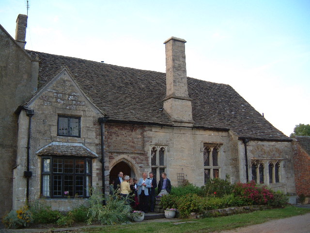
With its origins dating back to the medieval times, Halmore is steeped in history. It is home to several historic buildings, including the Grade II listed Halmore Manor, a stunning example of English architecture. The village also boasts a quaint parish church, St. Bartholomew's, which dates back to the 12th century and is known for its beautiful stained glass windows.

Despite its small size, Halmore is a vibrant community. The village has a close-knit population, and residents take pride in maintaining the village's charm and character. There are various community activities and events organized throughout the year, fostering a strong sense of community spirit.

Halmore benefits from its idyllic rural surroundings, making it an attractive place for nature lovers and outdoor enthusiasts. The area offers ample opportunities for walking, cycling, and exploring the nearby countryside. The nearby River Severn also provides recreational opportunities such as boating and fishing.

Although Halmore does not have its own amenities, the village is conveniently located within easy reach of nearby towns and villages that offer a range of services, including shops, schools, and healthcare facilities.

In summary, Halmore is a charming village in Gloucestershire, known for its rich history, beautiful countryside, and strong sense of community.

If you have any feedback on the listing, please let us know in the comments section below.
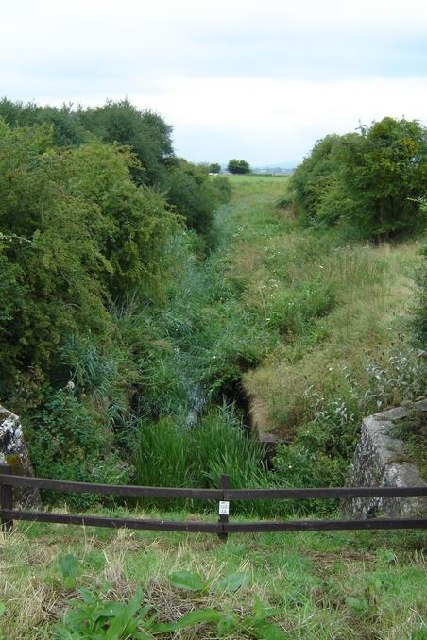
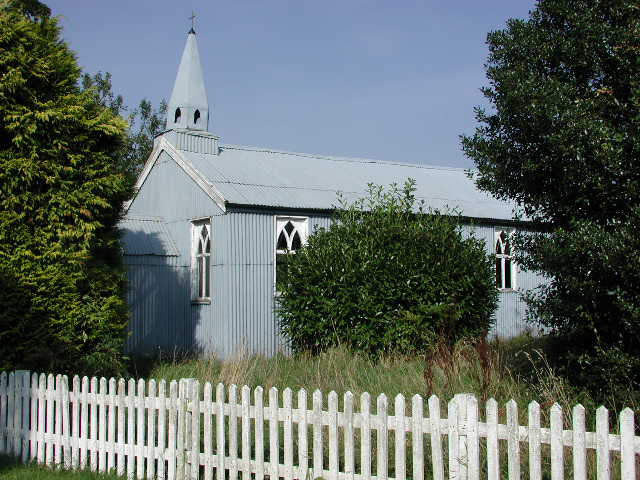
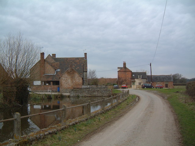
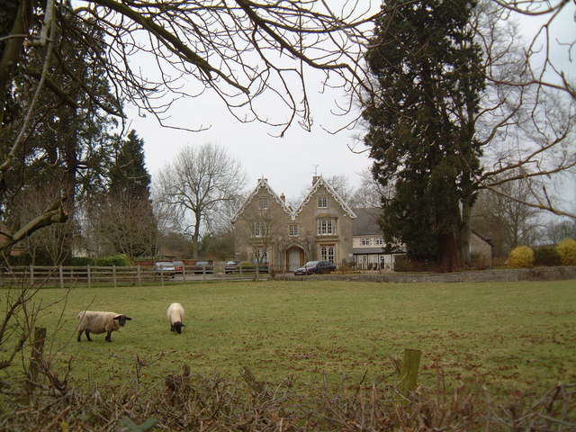
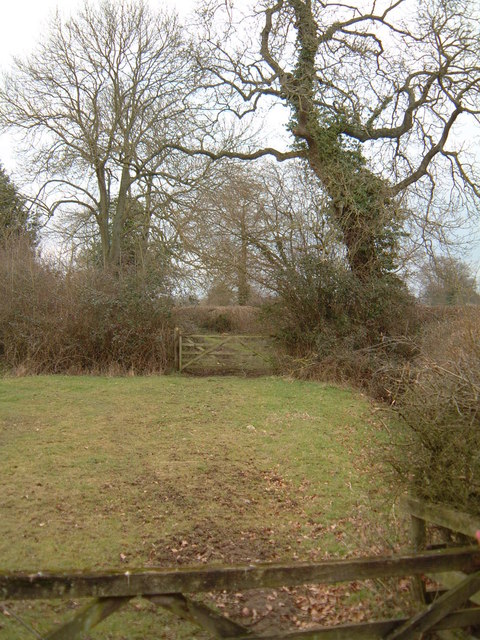
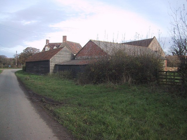
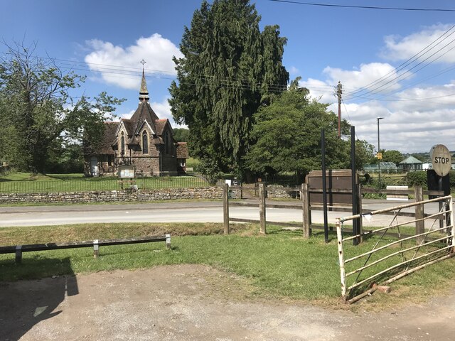
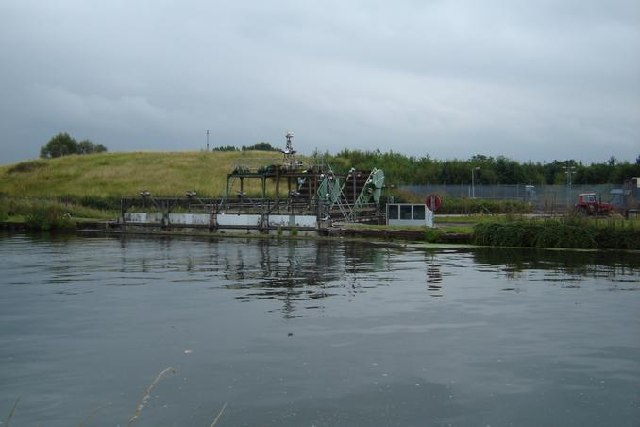
Halmore Images

Images are sourced within 2km of 51.719366/-2.440041 or Grid Reference SO6902. Thanks to Geograph Open Source API. All images are credited.

Drainage Ditch used as a wildlife sanctuary However, most of the wildlife appeared on the canal this joins on to.
Drainage Ditch used as a wildlife sanctuary
However, most of the wildlife appeared on the canal this joins on to.
Milestone, Gloucester and Sharpness Canal 13 miles to Gloucester, the other side indicated 3 miles to Sharpness
Milestone, Gloucester and Sharpness Canal
13 miles to Gloucester, the other side indicated 3 miles to Sharpness
Breadstone (Glos) St Michael's Church Scheduled for demolition after closure in 2000, the church still lingered on in March 2005.
Breadstone (Glos) St Michael's Church
Scheduled for demolition after closure in 2000, the church still lingered on in March 2005.
Pool Farm, Halmore Looking northwards on Slimbridge Lane, the aptly named Pool Farm is on the left.
Pool Farm, Halmore
Looking northwards on Slimbridge Lane, the aptly named Pool Farm is on the left.
Hurst Farm Hurst Farm (looking north) is almost the only set of buildings in this square. Despite looking fairly dilapidated, the building on the right was housing calves at the time.
Hurst Farm
Hurst Farm (looking north) is almost the only set of buildings in this square. Despite looking fairly dilapidated, the building on the right was housing calves at the time.
Hunting Country Looking southwest from Hurst Farm over the undulating farmland of the Vale of Berkeley. The hedge on the right hides the quaintly named Gilgal Brook, the boundary between Halmore and Gossington.
Hunting Country
Looking southwest from Hurst Farm over the undulating farmland of the Vale of Berkeley. The hedge on the right hides the quaintly named Gilgal Brook, the boundary between Halmore and Gossington.
Breadstone House This charming early Victorian house is viewed from the road. It is now a Residential Home for the elderly.
Breadstone House
This charming early Victorian house is viewed from the road. It is now a Residential Home for the elderly.
Green Lane This public footpath crosses the square diagonally from north-west to south-east. This view is as the path leaves the road in the top north-western corner of the square, just south of Halmore and heads south-east to Breadstone.
Green Lane
This public footpath crosses the square diagonally from north-west to south-east. This view is as the path leaves the road in the top north-western corner of the square, just south of Halmore and heads south-east to Breadstone.
Barn Complex at Pool Farm
Purton parish church
Dredging Equipment, Gloucester & Sharpness Canal Not quite sure what this equipment is for..
Dredging Equipment, Gloucester & Sharpness Canal
Not quite sure what this equipment is for..
Wanswell Court A mediaeval manor house in the parish of Berkeley. A former resident, George Thorpe was one of the early founders of the Berkeley Plantation in Virginia, USA, in 1619.
Wanswell Court
A mediaeval manor house in the parish of Berkeley. A former resident, George Thorpe was one of the early founders of the Berkeley Plantation in Virginia, USA, in 1619.
Wanswell The focus of Wanswell is the local pub, The Salmon, seen here with neighbouring 19th century houses. The pub garden is almost like a village green. The minor road leading to the houses is Rookery Lane.
Wanswell
The focus of Wanswell is the local pub, The Salmon, seen here with neighbouring 19th century houses. The pub garden is almost like a village green. The minor road leading to the houses is Rookery Lane.
The Lamastide Inn As can be seen from the number of card in the car park at Saturday lunchtime, this is a popular pub between the twin hamlets of Brookend and New Brookend.
The Lamastide Inn
As can be seen from the number of card in the car park at Saturday lunchtime, this is a popular pub between the twin hamlets of Brookend and New Brookend.
Kingshill Farm, Hinton Other than the hamlet of Hinton, this square is entirely agricultural land. Kingshill Farm sits on the summit of a small hill to the north of Hinton, with extensive views in all directions.
Kingshill Farm, Hinton
Other than the hamlet of Hinton, this square is entirely agricultural land. Kingshill Farm sits on the summit of a small hill to the north of Hinton, with extensive views in all directions.
Canal House at Purton Possibly designed in the early 19th century by the famous architect, Robert Mylne, to house the bridgekeeper. Similar houses, enlivened by doric columns, are a feature of the Gloucester & Sharpness Canal, which was opened in 1827 (having, in 1792, been intended to go from Gloucester to Berkeley).
Canal House at Purton
Possibly designed in the early 19th century by the famous architect, Robert Mylne, to house the bridgekeeper. Similar houses, enlivened by doric columns, are a feature of the Gloucester & Sharpness Canal, which was opened in 1827 (having, in 1792, been intended to go from Gloucester to Berkeley).
Purton village The village, and the tiny parish church of St John the Evangelist, seen from the canal towpath.
Purton village
The village, and the tiny parish church of St John the Evangelist, seen from the canal towpath.
Halmore This hamlet straggles along a country lane, and is without a shop or a church (and the pub has closed too). The sole focal point seems to be the phone box.
Halmore
This hamlet straggles along a country lane, and is without a shop or a church (and the pub has closed too). The sole focal point seems to be the phone box.
Show me another place!

Halmore is located at Grid Ref: SO6902 (Lat: 51.719366, Lng: -2.440041)

Administrative County: Gloucestershire

District: Stroud

Police Authority: Gloucestershire

What 3 Words

///crusaders.weekday.landowner. Near Sharpness, Gloucestershire

Related Wikis

Purton, Berkeley

Purton is a village on the east bank of the River Severn, 3 miles north of Berkeley, in Gloucestershire, England. The village is in the civil parish of...

Sharpness railway station

Sharpness railway station served the village and docks of Sharpness in Gloucestershire, England from 1875 to 1964. == History == The station was on the...

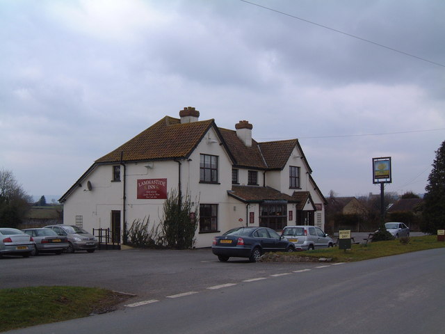
Berkeley Arms, Purton

The Berkeley Arms is a public house at Purton, Gloucestershire GL13 9HU. It is on the Campaign for Real Ale's National Inventory of Historic Pub Interiors...

Hamfallow

Hamfallow is a civil parish in the district of Stroud, Gloucestershire. There is no village centre, the parish consists of farms and hamlets such as Abwell...
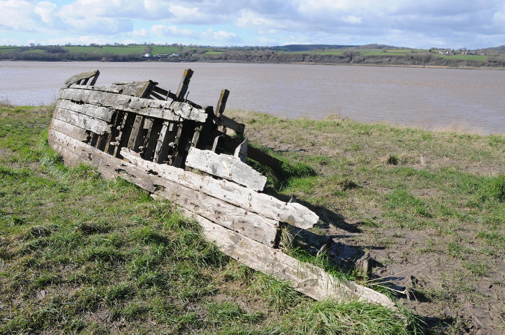
Purton Hulks

The Purton Hulks or Purton Ships' Graveyard is a number of abandoned boats and ships, deliberately beached beside the River Severn near Purton in Gloucestershire...

Berkeley railway station

Berkeley railway station served the town of Berkeley in Gloucestershire, England. The station was on the Sharpness Branch Line, part of the Midland Railway...
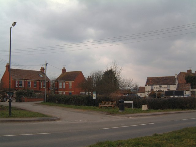
Sharpness

Sharpness ( sharp-NESS) is an English port in Gloucestershire, one of the most inland in Britain, and eighth largest in the South West England region....

Severn Railway Bridge

The Severn Railway Bridge (historically called the Severn Bridge) was a bridge carrying the railway across the River Severn between Sharpness and Lydney...

Nearby Amenities

Located within 500m of 51.719366,-2.440041
Halmore
Is In: Gloucestershire, England, UK
Place: village
Lat/Long: 51.7183886/-2.4368042
Post Box
Collection Times: Mo-Fr 16:15; Sa 09:00
Operator: Royal Mail
Post Box Mounting: brick_pillar
Post Box Type: wall
Ref: GL13 192
Royal Cypher: GR
Royal Cypher Wikidata: Q33102273
Lat/Long: 51.7163877/-2.4365516
Bus Stop
Fox & Goose
Naptan AtcoCode: 1600GL2309
Naptan Bearing: N
Naptan CommonName: Fox & Goose
Naptan Indicator: Opp
Naptan NaptanCode: gloamgjw
Naptan Street: Main Street
Naptan Verified: no
Source: naptan_import
Lat/Long: 51.7206297/-2.4381632
Bus Stop
Fox & Goose
Naptan AtcoCode: 1600GL2310
Naptan Bearing: S
Naptan CommonName: Fox & Goose
Naptan NaptanCode: gloamgma
Naptan Street: Main Street
Naptan Verified: no
Source: naptan_import
Lat/Long: 51.7211155/-2.4380955
Bus Stop
Slimbridge Lane
Naptan AtcoCode: 1600GL2311
Naptan Bearing: N
Naptan CommonName: Slimbridge Lane
Naptan Indicator: Opp
Naptan NaptanCode: gloamgpm
Naptan Street: Main Street
Naptan Verified: no
Source: naptan_import
Lat/Long: 51.7166879/-2.4367065
Bus Stop
Slimbridge Lane
Naptan AtcoCode: 1600GL2312
Naptan Bearing: S
Naptan CommonName: Slimbridge Lane
Naptan NaptanCode: gloamgpw
Naptan Street: Main Street
Naptan Verified: no
Source: naptan_import
Lat/Long: 51.7165448/-2.436517
Acton Farm
Landuse: farm
Note Retag: CS #48756035
Source: OS OpenData StreetView
Lat/Long: 51.7201704/-2.4387287
Waifers Farm
Landuse: farm
Note Retag: CS #48756035
Source: OS OpenData StreetView
Lat/Long: 51.7219117/-2.4385571
Post Box
Collection Times: Mo-Fr 16:00; Sa 12:00
Operator: Royal Mail
Post Box Mounting: pier
Post Box Type: lamp
Ref: GL13 136
Royal Cypher: EIIR
Royal Cypher Wikidata: Q33102113
Lat/Long: 51.7225854/-2.4383109
Power: pole
Lat/Long: 51.7235391/-2.4411374
Power: pole
Lat/Long: 51.7222813/-2.4413654
Power: pole
Lat/Long: 51.7209571/-2.4416015
Power: pole
Lat/Long: 51.7197989/-2.4417838
Power: pole
Lat/Long: 51.7186357/-2.4429882
Power: pole
Lat/Long: 51.7177118/-2.4438947
Power: pole
Lat/Long: 51.7170272/-2.4445948
Public Bookcase
Booth: K6
Covered: booth
Man Made: telephone_box
Public Bookcase Type: phone_box
Lat/Long: 51.7168561/-2.4368647
The data included in this document is from www.openstreetmap.org. The data is made available under ODbL.

Have you been to Halmore?

Leave your review of Halmore below (or comments, questions and feedback).