Coed-y-Venalog

Downs, Moorland in Monmouthshire

Wales

Coed-y-Venalog
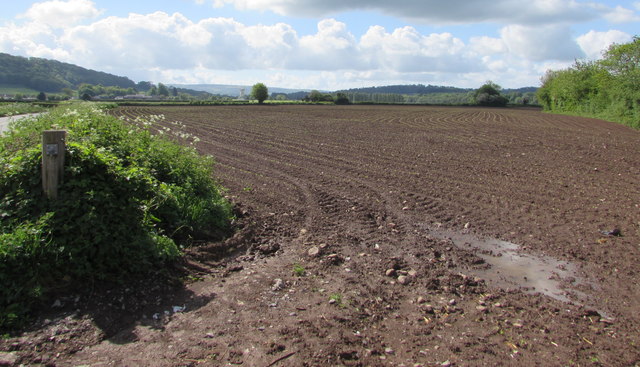
Brown field near Llancayo, Monmouthshire Located between the B4598 and the River Usk, viewed in mid May 2017.
Brown field near Llancayo, Monmouthshire Credit: Jaggery

Coed-y-Venalog is a picturesque area located in Monmouthshire, Wales. Nestled amid the stunning scenery of the Welsh countryside, it is renowned for its diverse landscape of downs and moorland. Spread over a vast expanse, the area offers a delightful escape for nature enthusiasts and outdoor lovers alike.

The downs of Coed-y-Venalog present visitors with rolling hills and breathtaking panoramic views. These grassy slopes are adorned with a variety of wildflowers and provide an idyllic setting for leisurely walks and hikes. The moorland, on the other hand, offers a rugged and untamed beauty. Blanketed by heather and gorse, it is a haven for wildlife and a perfect spot for birdwatching.

Coed-y-Venalog is also home to a rich array of flora and fauna. The diverse ecosystem supports a host of species, including rare orchids, butterflies, and birds such as the skylark and lapwing. The area is meticulously preserved, with conservation efforts aimed at maintaining the natural balance and protecting the delicate habitats.

For visitors seeking outdoor activities, Coed-y-Venalog provides ample opportunities for exploration and adventure. The extensive network of walking trails and footpaths allows visitors to discover hidden gems and soak in the tranquility of the surroundings. Additionally, the area is a popular destination for mountain biking, horse riding, and wildlife spotting.

Coed-y-Venalog truly embodies the beauty and diversity of the Welsh landscape. Its downs and moorland provide a haven for nature lovers and adventurers, offering a unique and memorable experience for all who visit.

If you have any feedback on the listing, please let us know in the comments section below.

Coed-y-Venalog Images

Images are sourced within 2km of 51.720542/-2.9505088 or Grid Reference SO3402. Thanks to Geograph Open Source API. All images are credited.

Brown field near Llancayo, Monmouthshire Located between the B4598 and the River Usk, viewed in mid May 2017.
Brown field near Llancayo, Monmouthshire
Located between the B4598 and the River Usk, viewed in mid May 2017.
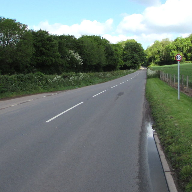
Road from Llancayo towards Kemeys Commander, Monmouthshire Looking to the northwest along the B4598 past a 50mph speed limit sign.
Road from Llancayo towards Kemeys Commander, Monmouthshire
Looking to the northwest along the B4598 past a 50mph speed limit sign.
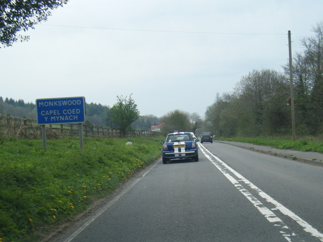
A472 at Monkswood village boundary
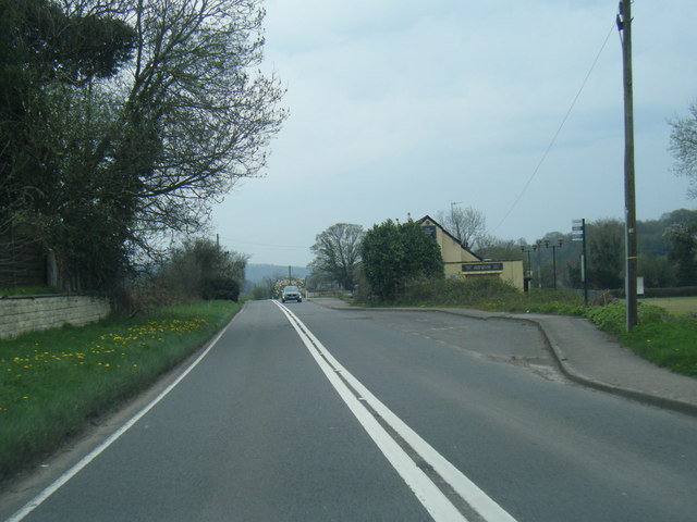
A472 at The Beaufort Arms
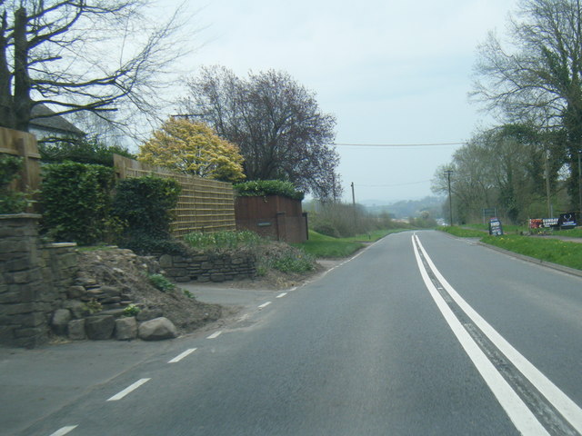
A472 east of Monkswood
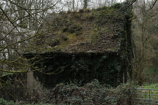
Pumping station on the banks of the Usk This is marked on the map as a pumping station (or more accurately, as "Ppg sta") but whether it's still in use as such, I don't know. It's acquired a lovely "green roof" over time!
Pumping station on the banks of the Usk
This is marked on the map as a pumping station (or more accurately, as "Ppg sta") but whether it's still in use as such, I don't know. It's acquired a lovely "green roof" over time!
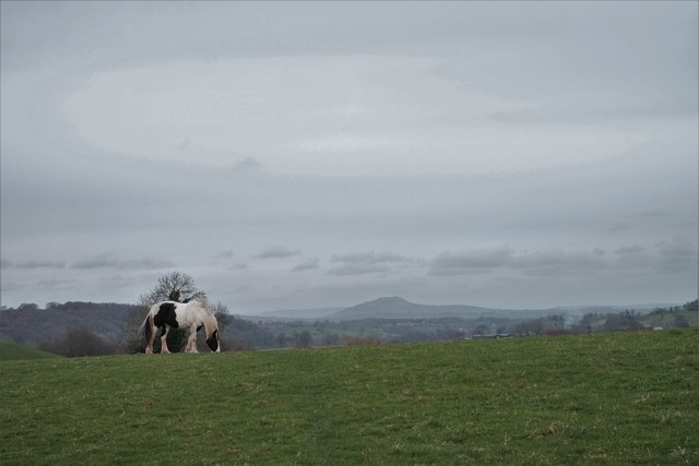
Grazing horse On the route of the Usk Valley Walk. I think the hill in the background is The Skirrid, near Abergavenny.
Grazing horse
On the route of the Usk Valley Walk. I think the hill in the background is The Skirrid, near Abergavenny.
River Usk at Kemeys Commander The Usk, taken near the oddly - named Kemeys Commander (no apostrophe). They're very protective of their fishing rights round here, and I suspect they're not keen on walkers, or anyone else, accessing the land via the public footpath ... see Jeremy Bolwell's <a href="https://www.geograph.org.uk/photo/3255229">SO3404 : Kemeys Fishing near Kemeys Commander</a>.
River Usk at Kemeys Commander
The Usk, taken near the oddly - named Kemeys Commander (no apostrophe). They're very protective of their fishing rights round here, and I suspect they're not keen on walkers, or anyone else, accessing the land via the public footpath ... see Jeremy Bolwell's SO3404 : Kemeys Fishing near Kemeys Commander.
North along Cae Melin, Little Mill, Monmouthshire From the A472 Berthon Road, Cae Melin leads to Clos Melin Coed.
North along Cae Melin, Little Mill, Monmouthshire
From the A472 Berthon Road, Cae Melin leads to Clos Melin Coed.
From 30 to 40 at the eastern edge of Little Mill, Monmouthshire The 30mph speed limit on the A472 Berthon Road increases to 40mph.
Ahead for Usk via Monkswood.
From 30 to 40 at the eastern edge of Little Mill, Monmouthshire
The 30mph speed limit on the A472 Berthon Road increases to 40mph. Ahead for Usk via Monkswood.
Warning sign - bends ahead, Berthon Road, Little Mill, Monmouthshire Facing eastbound traffic on the A472 Berthon Road. Ahead for Usk via Monkswood.
Warning sign - bends ahead, Berthon Road, Little Mill, Monmouthshire
Facing eastbound traffic on the A472 Berthon Road. Ahead for Usk via Monkswood.
From 40 to 30 on the A472, Little Mill, Monmouthshire At the eastern edge of the village, the 40mph speed limit on the road from Usk via Monkswood drops to 30mph.
From 40 to 30 on the A472, Little Mill, Monmouthshire
At the eastern edge of the village, the 40mph speed limit on the road from Usk via Monkswood drops to 30mph.
Yellow strips on the A472, Little Mill, Monmouthshire Facing westbound traffic on the road from Usk via Monkswood. The strips are on the approach to the reduction in the speed limit from 40mph to 30mph <a title="https://www.geograph.org.uk/photo/6846698" href="https://www.geograph.org.uk/photo/6846698">Link</a> at the eastern edge of the village.
Yellow strips on the A472, Little Mill, Monmouthshire
Facing westbound traffic on the road from Usk via Monkswood. The strips are on the approach to the reduction in the speed limit from 40mph to 30mph Link at the eastern edge of the village.
Sheep in a Little Mill field, Monmouthshire On the south side of the A472 in the east of the village in May 2021.
Sheep in a Little Mill field, Monmouthshire
On the south side of the A472 in the east of the village in May 2021.
Towards a bend in the A472 beyond  Little Mill, Monmouthshire Ahead for Monkswood and Usk.
Towards a bend in the A472 beyond Little Mill, Monmouthshire
Ahead for Monkswood and Usk.
Junction of Berthon Road and Cae Melin, Little Mill, Monmouthshire From the left, Cae Melin joins the A472 Berthon Road. Ahead for Usk via Monkswood.
Junction of Berthon Road and Cae Melin, Little Mill, Monmouthshire
From the left, Cae Melin joins the A472 Berthon Road. Ahead for Usk via Monkswood.
Combined traffic sign in Little Mill, Monmouthshire Facing westbound traffic on the A472 Berthon Road, the main road through Little Mill.
Combined traffic sign in Little Mill, Monmouthshire
Facing westbound traffic on the A472 Berthon Road, the main road through Little Mill.
Towards a bend in Cae Melin, Little Mill, Monmouthshire Viewed from the corner of the A472 Berthon Road.
Towards a bend in Cae Melin, Little Mill, Monmouthshire
Viewed from the corner of the A472 Berthon Road.
Show me another place!

Coed-y-Venalog is located at Grid Ref: SO3402 (Lat: 51.720542, Lng: -2.9505088)

Unitary Authority: Monmouthshire

Police Authority: Gwent

What 3 Words

///rekindle.cloud.lamp. Near Usk, Monmouthshire

Related Wikis

Monkswood, Monmouthshire

Monkswood (Welsh: Coed y Mynach) is a village in Monmouthshire, south east Wales, United Kingdom. == Location == Monkswood is located two miles west of...

Battle of Pwll Melyn

The Battle of Pwll Melyn (also known as the Battle of Usk) was a battle between the Welsh and English on 5 May 1405, it was part of the Glyndŵr Rising...

Glascoed Halt railway station

Glascoed Halt was a request stop on the former Coleford, Monmouth, Usk and Pontypool Railway. It was opened in 1927 to serve the village of Glascoed, Monmouthshire...

ROF Glascoed

ROF Glascoed (today BAE Systems Munitions Glascoed) was built as a UK government-owned, Royal Ordnance Factory (ROF). It was designed as one of 20 munitions...

Nearby Amenities

Located within 500m of 51.720542,-2.9505088
Created By: GPSBabel-1.3.6
Lat/Long: 51.718382/-2.953696
Turning Circle
Lat/Long: 51.7180203/-2.953316
Monkswood
Name Cy: Coed-y-mynach
Name En: Monkswood
Place: village
Wikidata: Q6900994
Lat/Long: 51.7184221/-2.9493052
Direction: 175
Generator Method: photovoltaic
Generator Output Electricity: yes
Generator Solar Modules: 10
Generator Source: solar
Generator Type: solar_photovoltaic_panel
Location: roof
Power: generator
Lat/Long: 51.7173587/-2.9501362
Direction: 175
Generator Method: photovoltaic
Generator Output Electricity: yes
Generator Solar Modules: 10
Generator Source: solar
Generator Type: solar_photovoltaic_panel
Location: roof
Power: generator
Lat/Long: 51.7173537/-2.9502006
Direction: 170
Generator Method: photovoltaic
Generator Output Electricity: yes
Generator Solar Modules: 18
Generator Source: solar
Generator Type: solar_photovoltaic_panel
Location: roof
Power: generator
Lat/Long: 51.7175357/-2.9519829
Place Of Worship
St Matthew
Addr City: Monkswood
Addr Postcode: NP15 1QH
Denomination: protestant
Email: kevinhasler@cinw.org.uk
Phone: +44 7836 795 753
Religion: christian
Website: https://www.churchinwales.org.uk/en/structure/church/4967/
Wikidata: Q25999305
Lat/Long: 51.7193596/-2.9472159
The data included in this document is from www.openstreetmap.org. The data is made available under ODbL.

Have you been to Coed-y-Venalog?

Leave your review of Coed-y-Venalog below (or comments, questions and feedback).