Above Beck Fells

Downs, Moorland in Lancashire South Lakeland

England

Above Beck Fells

Roughly grassed field at Dixon Ground Dixon Ground is an area of land lying west of Coniston. The view here is from the publicly accessible part of the Walna Scar Road which has risen from the village.
The steep, broken slope beyond lies across Church Beck and rises ultimately to Wetherlam.
Roughly grassed field at Dixon Ground Credit: Trevor Littlewood

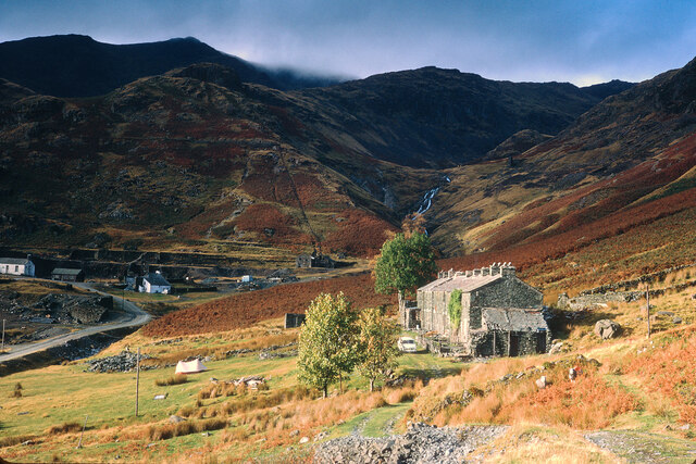
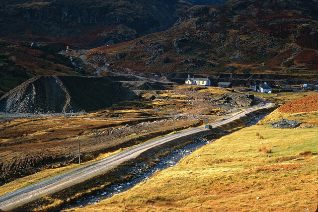
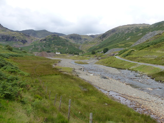
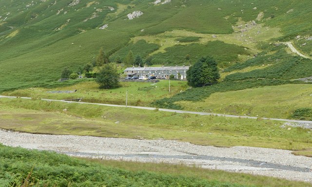
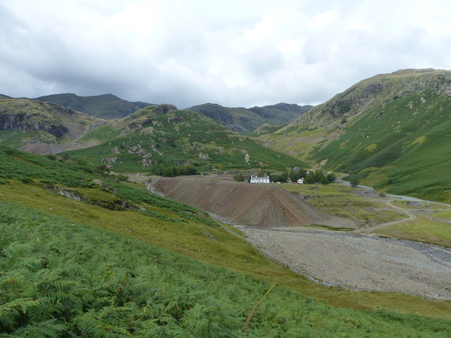
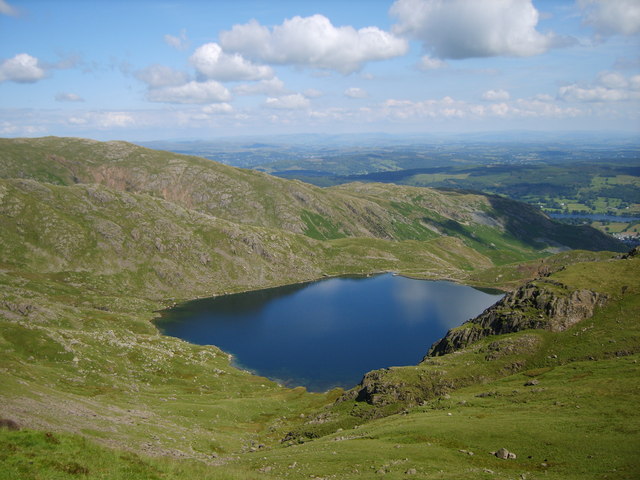
Above Beck Fells is a picturesque region located in Lancashire, England. This area is characterized by its rolling hills, vast moorland, and stunning landscapes. Situated in the southern part of the county, Above Beck Fells offers visitors a unique opportunity to explore the natural beauty of the region.

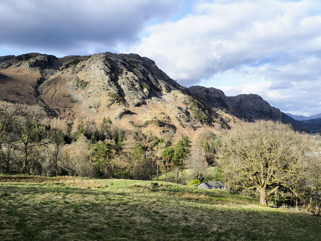
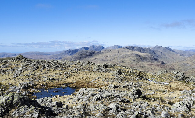
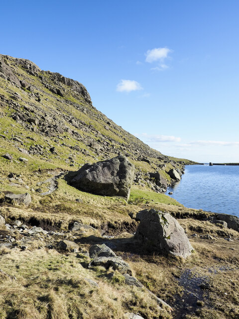
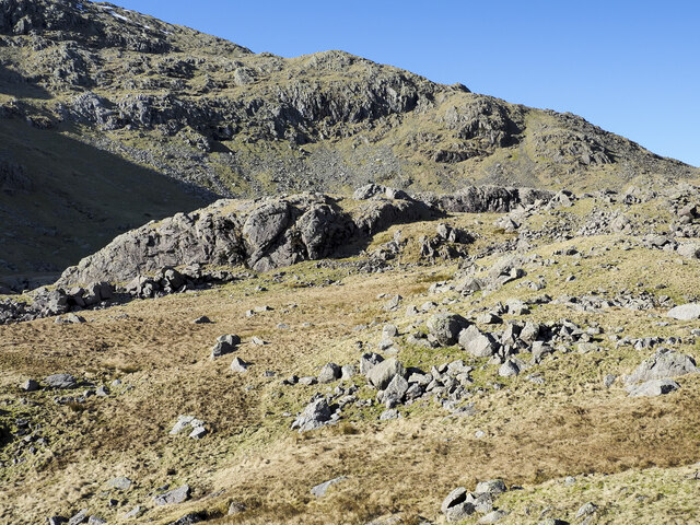
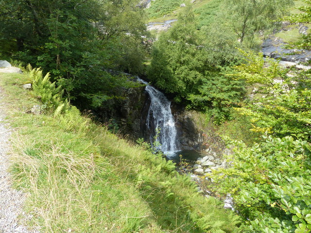
The fells in this area are a prominent feature, providing a dramatic backdrop to the surrounding countryside. These hills offer breathtaking views of the Lancashire landscape, with their lush greenery and scattered rock formations. Traversing these fells, visitors can immerse themselves in the tranquility of nature and enjoy the peacefulness that this region has to offer.

The moorland in Above Beck Fells is equally captivating. Stretching out as far as the eye can see, the moors are a haven for wildlife and provide a home to a variety of plant species. Visitors can witness an array of birds, including grouse and curlews, as they soar above the vast expanse of heather-covered moorland.

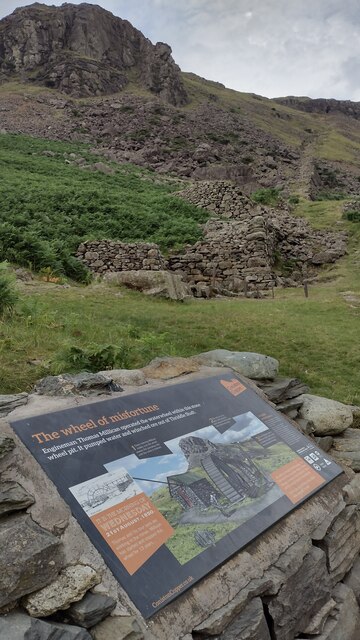
Aside from its natural beauty, Above Beck Fells boasts a rich history and cultural heritage. Ruins of ancient settlements and stone circles can be found scattered throughout the area, offering a glimpse into the past. The region also features numerous walking trails and paths, allowing visitors to explore the landscape at their own pace.

Above Beck Fells, Lancashire, is a destination that appeals to nature enthusiasts and history lovers alike. With its stunning fells, expansive moorland, and rich cultural heritage, this area offers a unique and memorable experience for all who visit.

If you have any feedback on the listing, please let us know in the comments section below.

Above Beck Fells Images

Images are sourced within 2km of 54.386098/-3.0816671 or Grid Reference SD2999. Thanks to Geograph Open Source API. All images are credited.

Roughly grassed field at Dixon Ground Dixon Ground is an area of land lying west of Coniston. The view here is from the publicly accessible part of the Walna Scar Road which has risen from the village.
The steep, broken slope beyond lies across Church Beck and rises ultimately to Wetherlam.
Roughly grassed field at Dixon Ground
Dixon Ground is an area of land lying west of Coniston. The view here is from the publicly accessible part of the Walna Scar Road which has risen from the village. The steep, broken slope beyond lies across Church Beck and rises ultimately to Wetherlam.
Irish Cottages, Coppermines Valley Irish Cottages in the valley of Church Beck is a terrace of houses above Coniston; two of them together form a climbing hut of the Yorkshire Mountaineering Club. The gravel flats through the centre of the image are where the Church Beck flows and winds.
Irish Cottages, Coppermines Valley
Irish Cottages in the valley of Church Beck is a terrace of houses above Coniston; two of them together form a climbing hut of the Yorkshire Mountaineering Club. The gravel flats through the centre of the image are where the Church Beck flows and winds.
Road heading for Coppermines Valley The valley is actually that of Church Beck but is popularly known as the Coppermines Valley because of the extensive disused mine workings there. The road is private but is used to access accommodation in the valley including houses, a youth hostel and two climbing club huts. The road is also a public footpath.
Coniston Old Man is the mountain seen against the sky.
Road heading for Coppermines Valley
The valley is actually that of Church Beck but is popularly known as the Coppermines Valley because of the extensive disused mine workings there. The road is private but is used to access accommodation in the valley including houses, a youth hostel and two climbing club huts. The road is also a public footpath. Coniston Old Man is the mountain seen against the sky.
Slope with minor rock outcrops The near slope is close to the feature named on OS maps as Flat Bield and is separated from the camera location by a steep stream groove. The valley beyond it is Red Dell.
The sunlit rockface at the centre of the image and beyond Red Dell is Kennel Crag, sometimes known as Kernel Crag.
Slope with minor rock outcrops
The near slope is close to the feature named on OS maps as Flat Bield and is separated from the camera location by a steep stream groove. The valley beyond it is Red Dell. The sunlit rockface at the centre of the image and beyond Red Dell is Kennel Crag, sometimes known as Kernel Crag.
Shallow pool on ridge rising to Wetherlam A broad, lengthy ridge which in its higher reach is fairly featureless rises generally northwards to the Wetherlam summit. There are minor knolls and a tarn or two; this is the more attractive of them.
Helvellyn and Fairfield and their satellite mountains are in the distance.
Shallow pool on ridge rising to Wetherlam
A broad, lengthy ridge which in its higher reach is fairly featureless rises generally northwards to the Wetherlam summit. There are minor knolls and a tarn or two; this is the more attractive of them. Helvellyn and Fairfield and their satellite mountains are in the distance.
Rock exposures at summit area of Wetherlam Extensive, knobbly exposures of bare rock lying to the north of the summit cairn with little of it standing much above the  general ground level.
The distant range of mountains has Slight Side and Scafell to the left with Bow Fell at the right.
Rock exposures at summit area of Wetherlam
Extensive, knobbly exposures of bare rock lying to the north of the summit cairn with little of it standing much above the general ground level. The distant range of mountains has Slight Side and Scafell to the left with Bow Fell at the right.
Large rocks at eastern shore of Levers Water Levers Water is an enlarged tarn, dammed to create a greater volume of water for the generation of power for use in the mines below. The dam can be seen in the distance.
Large rocks at eastern shore of Levers Water
Levers Water is an enlarged tarn, dammed to create a greater volume of water for the generation of power for use in the mines below. The dam can be seen in the distance.
Settling tanks at Bonsor upper mill The series of shallow depressions near to the Coppermines Youth Hostel is named as 'tanks' in the 1969 volume, 'Industrial Archaeology of the Lake Counties' - Marshall & Davies-Shiel. It's supposed that they were settling tanks in which small particles of rock etc. would be allowed to fall to the bottom before the then clearer water would be allowed to flow down to Coniston in the valley below.
Settling tanks at Bonsor upper mill
The series of shallow depressions near to the Coppermines Youth Hostel is named as 'tanks' in the 1969 volume, 'Industrial Archaeology of the Lake Counties' - Marshall & Davies-Shiel. It's supposed that they were settling tanks in which small particles of rock etc. would be allowed to fall to the bottom before the then clearer water would be allowed to flow down to Coniston in the valley below.
Coppermines Cottage In the past, when copper was being mined, the cottage was occupied by a mine official, presumably the site manager. In 1958 it was acquired by the Barrow Mountaineering and Ski Club which still uses it as a club hut.
Coppermines Cottage
In the past, when copper was being mined, the cottage was occupied by a mine official, presumably the site manager. In 1958 it was acquired by the Barrow Mountaineering and Ski Club which still uses it as a club hut.
Boulders on mountain slope Boulders, large, small and embedded below Sam Bottom in the valley of Swirl Hause Beck which runs down into Levers Water.
The slope rising beyond reaches Swirl How.
Boulders on mountain slope
Boulders, large, small and embedded below Sam Bottom in the valley of Swirl Hause Beck which runs down into Levers Water. The slope rising beyond reaches Swirl How.
Irish Cottages, Coppermine Valley In 2022, the foreground buildings, Irish Cottages,  were the property of the Yorkshire Mountaineering Club. I am unsure of their status in January 1973 when this image was taken. Mine workings can be seen in the background.
Irish Cottages, Coppermine Valley
In 2022, the foreground buildings, Irish Cottages, were the property of the Yorkshire Mountaineering Club. I am unsure of their status in January 1973 when this image was taken. Mine workings can be seen in the background.
The head of Coppermine Valley, Coniston In January 1973 the white building was the Youth Hostel.  A track continues beyond here into the Coniston Fells.
The head of Coppermine Valley, Coniston
In January 1973 the white building was the Youth Hostel. A track continues beyond here into the Coniston Fells.
The Air Ambulance on Wetherlam The Coniston Mountain Rescue Team (MRT) were training at base when the call came for a fell-runner who had slipped on descent, injured his ankle, and could no longer stand. The team attended and carried him down below the cloud. Fortunately a helicopter was available to transport the casualty to Furness General Hospital.
The Air Ambulance on Wetherlam
The Coniston Mountain Rescue Team (MRT) were training at base when the call came for a fell-runner who had slipped on descent, injured his ankle, and could no longer stand. The team attended and carried him down below the cloud. Fortunately a helicopter was available to transport the casualty to Furness General Hospital.
The Wheel of Misfortune The Thriddle Incline from the New Engine House Shaft waterwheel pit - The Wheel of Misfortune
The Wheel of Misfortune
The Thriddle Incline from the New Engine House Shaft waterwheel pit - The Wheel of Misfortune
Waterfall on Church Beck
Coppermines Valley, Coniston
Irish Row, Coppermines Valley
Coppermines Valley, Coniston
Show me another place!

Above Beck Fells is located at Grid Ref: SD2999 (Lat: 54.386098, Lng: -3.0816671)

Administrative County: Cumbria

District: South Lakeland

Police Authority: Cumbria

What 3 Words

///shoelaces.microfilm.responded. Near Ambleside, Cumbria

Nearby Locations

Long Hill Above Beck Fells

Related Wikis

Coniston copper mines

The Coniston copper mines were a copper mining operation in Lancashire, England. It was functional for hundreds of years in Coppermines Valley above Coniston...

Ruskin Museum

The Ruskin Museum is a small local museum in Coniston, Cumbria, northern England. It was established in 1901 by W. G. Collingwood, an artist and antiquarian...

Levers Water

Levers Water is a small lake in the English Lake District. It is located at the head of the Coppermines Valley, above Coniston village. To its south-west...

Wetherlam

Wetherlam (763 m) is a mountain in the English Lake District. It is the most northerly of the Coniston Fells, the range of fells to the north-west of Coniston...

Holme Fell

Holme Fell or Holm Fell is a fell in the Lake District in Cumbria, England. It is located between Coniston Water and Little Langdale, almost isolated from...

Coniston railway station (England)

Coniston railway station was the northern terminus of the Coniston branch line in the village of Coniston, Lancashire, England (now in Cumbria). ��2�...

Coniston, Cumbria

Coniston is a village and civil parish in the Westmorland and Furness district of Cumbria, England. In the 2001 census the parish had a population of 1...

John Ruskin School

John Ruskin School (JRS) is an 11–16 school on Lake Road in Coniston, Cumbria. The school is part of the Rural Academy, a group of nine small schools in...

Nearby Amenities

Located within 500m of 54.386098,-3.0816671
Ford: yes
Lat/Long: 54.384173/-3.0877174
Kitty Crag
Place: locality
Lat/Long: 54.3827429/-3.0846548
Long Hill
Place: locality
Lat/Long: 54.3847774/-3.0804743
Brackeny Crag
Place: locality
Lat/Long: 54.3882229/-3.0753036
Abandoned: yes
Man Made: adit
Mineral: copper
Lat/Long: 54.3874219/-3.0858248
Abandoned: yes
Direction: 120
Man Made: adit
Lat/Long: 54.385115/-3.08491
Abandoned: yes
Direction: 230
Man Made: adit
Lat/Long: 54.3854936/-3.0840925
The data included in this document is from www.openstreetmap.org. The data is made available under ODbL.

Have you been to Above Beck Fells?

Leave your review of Above Beck Fells below (or comments, questions and feedback).