Mòine Bhuidhe
Downs, Moorland in Aberdeenshire
Scotland
Mòine Bhuidhe

Mòine Bhuidhe, located in Aberdeenshire, Scotland, is a captivating expanse of downs and moorland. Covering an area of approximately 6 square kilometers, it offers visitors a unique and diverse landscape to explore. The name "Mòine Bhuidhe" translates to "Yellow Moor" in English, which accurately depicts the dominant vegetation found in the area.
The downs of Mòine Bhuidhe are characterized by their gently rolling hills and wide open spaces. These grassy areas are rich in biodiversity and are home to various species of plants and animals. Visitors can witness the vibrant colors of wildflowers, such as heather and gorse, which bloom in the summer months, creating a stunning display across the downs.
The moorland of Mòine Bhuidhe is a stark contrast to the downs, with its rugged and untamed nature. Here, visitors can experience the true wilderness of Aberdeenshire, as they traverse through wet and boggy terrain. The moorland is dotted with small lochs and streams, providing a habitat for numerous bird species, including curlews and lapwings.
Mòine Bhuidhe offers a wealth of recreational opportunities for nature enthusiasts. Hiking and walking trails crisscross the downs and moorland, allowing visitors to immerse themselves in the beauty of the landscape. The area is also popular for birdwatching and photography, as it provides ample opportunities to observe and capture the unique flora and fauna.
Overall, Mòine Bhuidhe is a remarkable natural treasure in Aberdeenshire, offering a combination of downs and moorland that showcases the diverse beauty of the Scottish countryside.
If you have any feedback on the listing, please let us know in the comments section below.
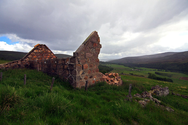
Mòine Bhuidhe Images
Images are sourced within 2km of 57.116223/-3.1599028 or Grid Reference NJ2903. Thanks to Geograph Open Source API. All images are credited.


Mòine Bhuidhe is located at Grid Ref: NJ2903 (Lat: 57.116223, Lng: -3.1599028)
Unitary Authority: Aberdeenshire
Police Authority: North East
What 3 Words
///taller.slowly.hunk. Near Ballater, Aberdeenshire
Nearby Locations
Related Wikis
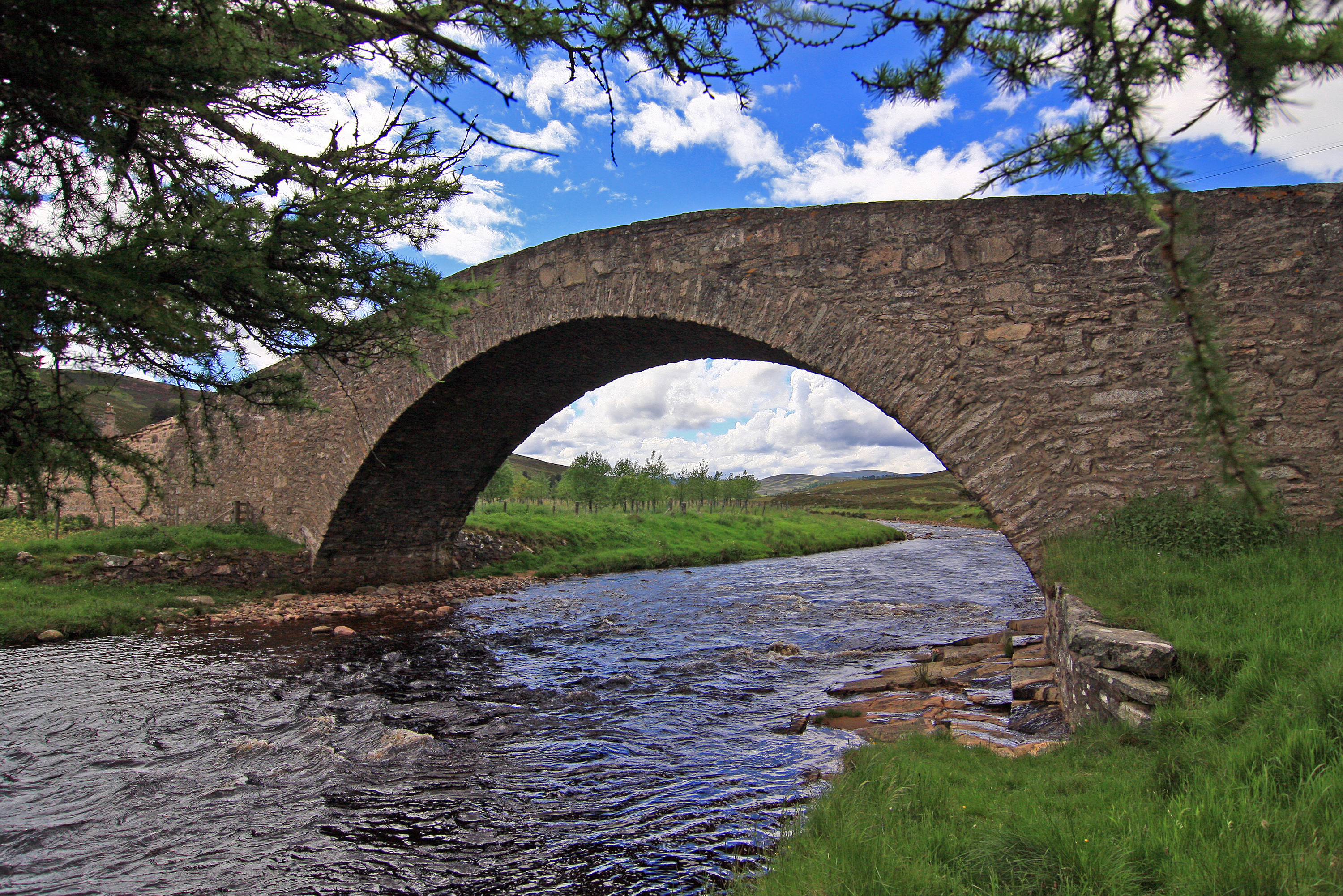
Gairnshiel Bridge
Gairnshiel Bridge is a road bridge that crosses the River Gairn in Aberdeenshire, Scotland. The bridge was built the mid-18th century. It is Category A...

Corgarff
Corgarff (Scottish Gaelic: Corr Garaidh) is a hamlet in Aberdeenshire, Scotland, in the Grampian Mountains. The nearby Corgarff Castle was used as a military...

Corgarff Castle
Corgarff Castle is located slightly west of the village of Corgarff, in Aberdeenshire, north-east Scotland. It stands by the Lecht road, which crosses...

Cock Bridge (Aberdeenshire)
Cock Bridge is a settlement in Aberdeenshire, Scotland, located in the Cairngorms National Park, on the A939 road near Corgarff and Corgarff Castle, between...
Have you been to Mòine Bhuidhe?
Leave your review of Mòine Bhuidhe below (or comments, questions and feedback).