Stubthwaite Moss

Downs, Moorland in Lancashire South Lakeland

England

Stubthwaite Moss

Goat's Water from Dow Crag View down Easter Gully to Goat’s Water from near the summit of Dow Crag.
Goat's Water from Dow Crag Credit: Adrian Taylor

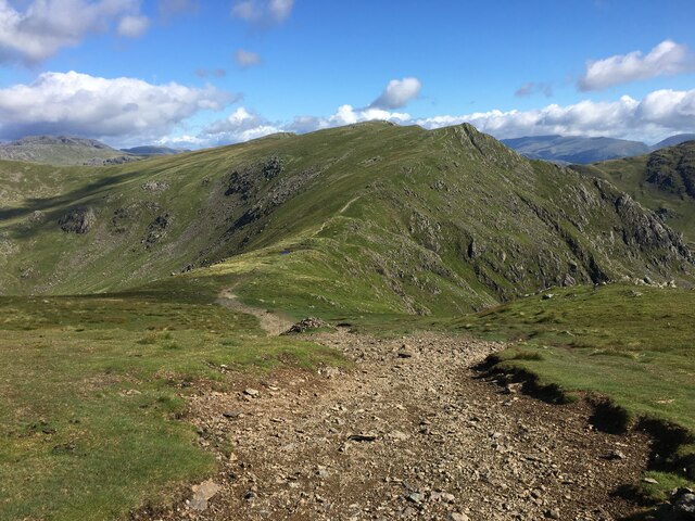
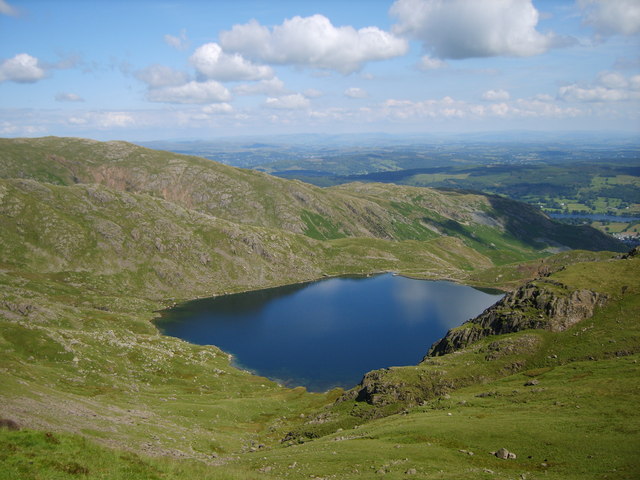
Stubthwaite Moss is a picturesque area located in the county of Lancashire, England. Situated amidst the rolling hills and vast moorlands, it offers breathtaking views and a tranquil atmosphere. The moss is nestled within the larger region known as the Lancashire Downs, renowned for its natural beauty and diverse wildlife.

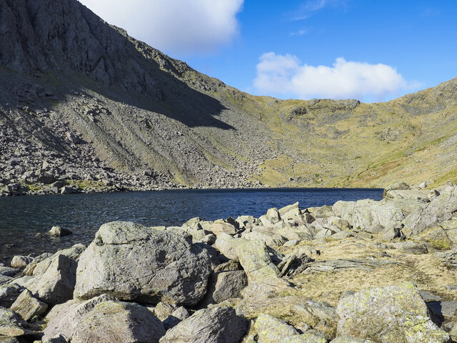
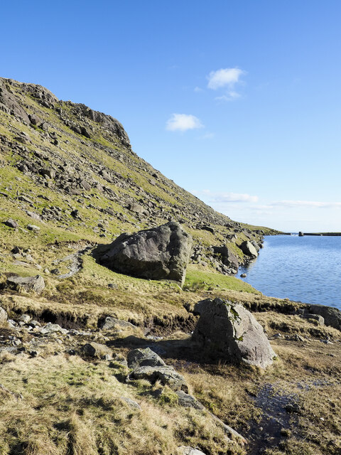
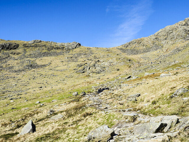
Covering an area of approximately 500 acres, Stubthwaite Moss is primarily composed of peat and boggy ground, which contributes to its unique ecosystem. The moss is characterized by its wetland environment, with numerous small pools and marshy areas scattered throughout. This creates ideal conditions for a variety of plant species, including sphagnum moss, heather, and cotton grass.

The moss is also home to a rich array of wildlife. Bird enthusiasts will be delighted by the presence of species such as curlews, lapwings, and skylarks, which can be spotted soaring above the moorland. Additionally, the moss provides habitat for various insects, amphibians, and small mammals, making it a haven for nature lovers and wildlife photographers.

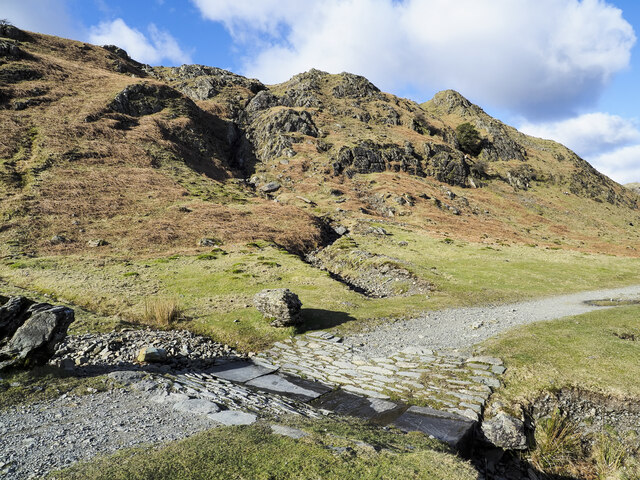
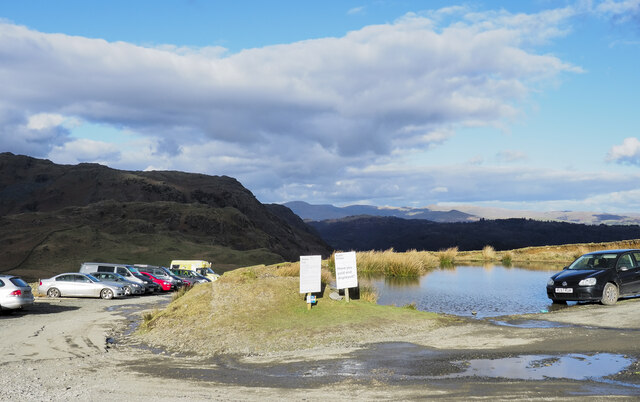
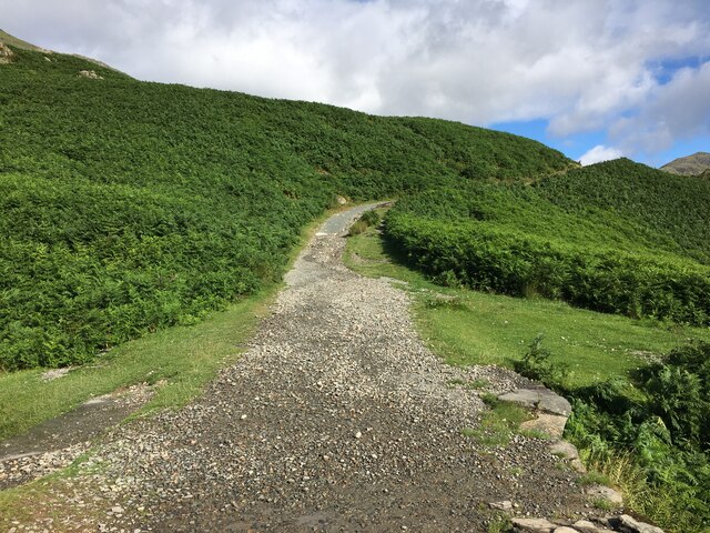
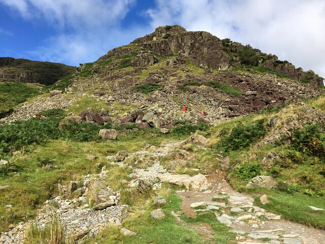
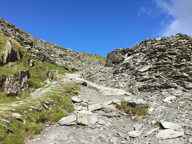
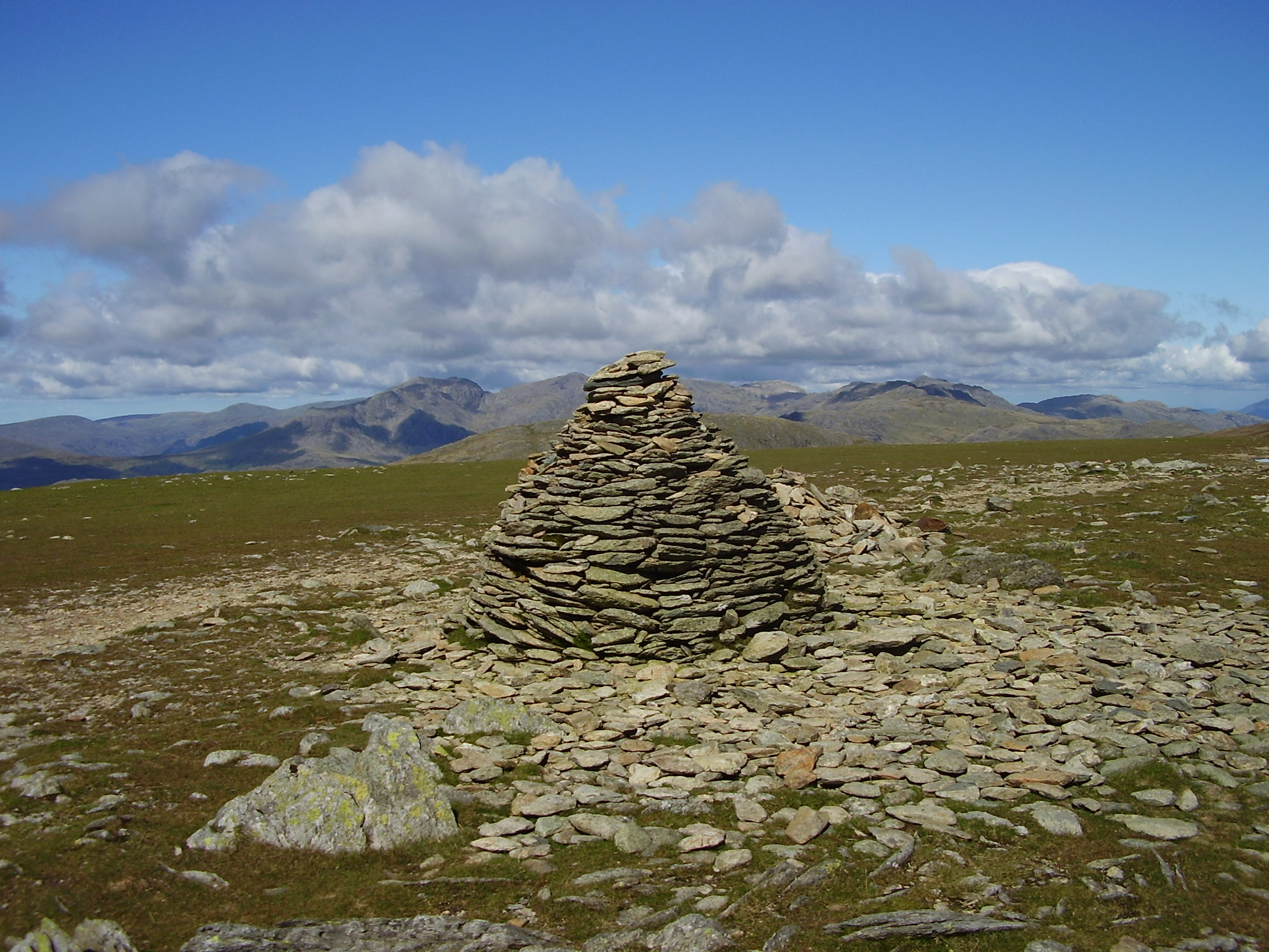
Access to Stubthwaite Moss is available via marked footpaths and trails, allowing visitors to explore the area at their own pace. The undulating landscape and unspoiled beauty make it an ideal location for hiking, birdwatching, and nature appreciation. The moss offers a peaceful retreat from the hustle and bustle of city life, providing a serene environment for visitors to connect with nature and enjoy the breathtaking views of the Lancashire countryside.

If you have any feedback on the listing, please let us know in the comments section below.

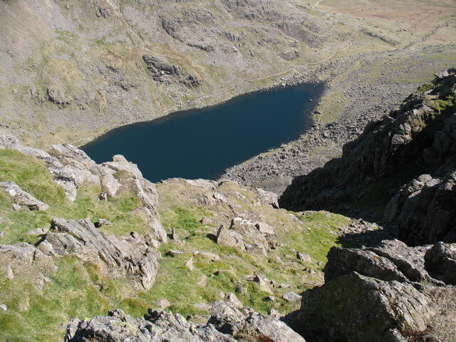
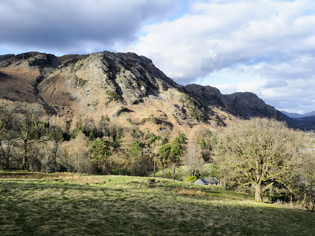
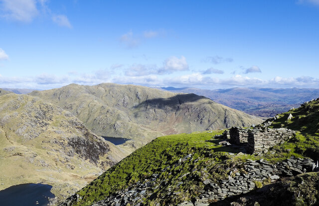
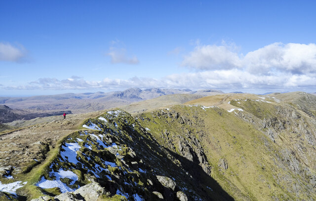
Stubthwaite Moss Images

Images are sourced within 2km of 54.371932/-3.1036923 or Grid Reference SD2897. Thanks to Geograph Open Source API. All images are credited.

Goat's Water from Dow Crag View down Easter Gully to Goat’s Water from near the summit of Dow Crag.
Goat's Water from Dow Crag
View down Easter Gully to Goat’s Water from near the summit of Dow Crag.
Roughly grassed field at Dixon Ground Dixon Ground is an area of land lying west of Coniston. The view here is from the publicly accessible part of the Walna Scar Road which has risen from the village.
The steep, broken slope beyond lies across Church Beck and rises ultimately to Wetherlam.
Roughly grassed field at Dixon Ground
Dixon Ground is an area of land lying west of Coniston. The view here is from the publicly accessible part of the Walna Scar Road which has risen from the village. The steep, broken slope beyond lies across Church Beck and rises ultimately to Wetherlam.
Irish Cottages, Coppermines Valley Irish Cottages in the valley of Church Beck is a terrace of houses above Coniston; two of them together form a climbing hut of the Yorkshire Mountaineering Club. The gravel flats through the centre of the image are where the Church Beck flows and winds.
Irish Cottages, Coppermines Valley
Irish Cottages in the valley of Church Beck is a terrace of houses above Coniston; two of them together form a climbing hut of the Yorkshire Mountaineering Club. The gravel flats through the centre of the image are where the Church Beck flows and winds.
Spoil terrace with ruined building A view from the 'Quarries Route', the main ascent path for the Old Man of Coniston. The grassed / mossed-over terrace of spoil is a very small one compared to a number of others along the way. Wetherlam is the mountain in the distance.
Spoil terrace with ruined building
A view from the 'Quarries Route', the main ascent path for the Old Man of Coniston. The grassed / mossed-over terrace of spoil is a very small one compared to a number of others along the way. Wetherlam is the mountain in the distance.
Crag rim at summit area of Coniston Old Man Snow residues lie at the edge of broken ground at the summit of the mountain. The crag rim and broad ridge extend initially to the north-west before turning north.
The Scafell group of mountains lie in the distance at the centre of the image.
Crag rim at summit area of Coniston Old Man
Snow residues lie at the edge of broken ground at the summit of the mountain. The crag rim and broad ridge extend initially to the north-west before turning north. The Scafell group of mountains lie in the distance at the centre of the image.
Boulders at shore of Goat's Water Goat's Water lies between two mountains of the Coniston group. The Old Man of Coniston rises unseen to the right, Dow Crag, to the left, across the lake.
Goat's Hause is the col in the distance.
Boulders at shore of Goat's Water
Goat's Water lies between two mountains of the Coniston group. The Old Man of Coniston rises unseen to the right, Dow Crag, to the left, across the lake. Goat's Hause is the col in the distance.
Walna Scar Road stream crossing A well constructed, stone-built feature allowing Hussey Well Beck to flow across the Walna Scar Road without causing undue erosion to its surface.
Walna Scar Road stream crossing
A well constructed, stone-built feature allowing Hussey Well Beck to flow across the Walna Scar Road without causing undue erosion to its surface.
Road heading for Coppermines Valley The valley is actually that of Church Beck but is popularly known as the Coppermines Valley because of the extensive disused mine workings there. The road is private but is used to access accommodation in the valley including houses, a youth hostel and two climbing club huts. The road is also a public footpath.
Coniston Old Man is the mountain seen against the sky.
Road heading for Coppermines Valley
The valley is actually that of Church Beck but is popularly known as the Coppermines Valley because of the extensive disused mine workings there. The road is private but is used to access accommodation in the valley including houses, a youth hostel and two climbing club huts. The road is also a public footpath. Coniston Old Man is the mountain seen against the sky.
Slope with minor rock outcrops The near slope is close to the feature named on OS maps as Flat Bield and is separated from the camera location by a steep stream groove. The valley beyond it is Red Dell.
The sunlit rockface at the centre of the image and beyond Red Dell is Kennel Crag, sometimes known as Kernel Crag.
Slope with minor rock outcrops
The near slope is close to the feature named on OS maps as Flat Bield and is separated from the camera location by a steep stream groove. The valley beyond it is Red Dell. The sunlit rockface at the centre of the image and beyond Red Dell is Kennel Crag, sometimes known as Kernel Crag.
Large rocks at eastern shore of Levers Water Levers Water is an enlarged tarn, dammed to create a greater volume of water for the generation of power for use in the mines below. The dam can be seen in the distance.
Large rocks at eastern shore of Levers Water
Levers Water is an enlarged tarn, dammed to create a greater volume of water for the generation of power for use in the mines below. The dam can be seen in the distance.
Settling tanks at Bonsor upper mill The series of shallow depressions near to the Coppermines Youth Hostel is named as 'tanks' in the 1969 volume, 'Industrial Archaeology of the Lake Counties' - Marshall & Davies-Shiel. It's supposed that they were settling tanks in which small particles of rock etc. would be allowed to fall to the bottom before the then clearer water would be allowed to flow down to Coniston in the valley below.
Settling tanks at Bonsor upper mill
The series of shallow depressions near to the Coppermines Youth Hostel is named as 'tanks' in the 1969 volume, 'Industrial Archaeology of the Lake Counties' - Marshall & Davies-Shiel. It's supposed that they were settling tanks in which small particles of rock etc. would be allowed to fall to the bottom before the then clearer water would be allowed to flow down to Coniston in the valley below.
Coppermines Cottage In the past, when copper was being mined, the cottage was occupied by a mine official, presumably the site manager. In 1958 it was acquired by the Barrow Mountaineering and Ski Club which still uses it as a club hut.
Coppermines Cottage
In the past, when copper was being mined, the cottage was occupied by a mine official, presumably the site manager. In 1958 it was acquired by the Barrow Mountaineering and Ski Club which still uses it as a club hut.
Have you paid and displayed? The 'waste ground' here at the end of the publicly motorable stretch of the Walna Scar Road was for years accepted as a free car parking area for visitors and walkers, the photographer has used it a number of times in the past. Now, (early 2022), the Rydal estate levies a charge of £8 for all day parking! There are no facilities, no surfacing to the area, in fact no improvement to the space other than the embedding of a few logs to demarcate some spaces. As can be seen, at least one vehicle has even had to be parked with the driver's side of it including the driver's exit, in a flood!
Have you paid and displayed?
The 'waste ground' here at the end of the publicly motorable stretch of the Walna Scar Road was for years accepted as a free car parking area for visitors and walkers, the photographer has used it a number of times in the past. Now, (early 2022), the Rydal estate levies a charge of £8 for all day parking! There are no facilities, no surfacing to the area, in fact no improvement to the space other than the embedding of a few logs to demarcate some spaces. As can be seen, at least one vehicle has even had to be parked with the driver's side of it including the driver's exit, in a flood!
Path rising towards Goat's Hause The path is partly constructed using rocks set into the ground to minimise erosion. More work on the route seems to be planned - along the path line, below the image centre there are bagged boulders awaiting use to improve or repair the way.
Goat's Hause is the obvious dip on the horizon.
Path rising towards Goat's Hause
The path is partly constructed using rocks set into the ground to minimise erosion. More work on the route seems to be planned - along the path line, below the image centre there are bagged boulders awaiting use to improve or repair the way. Goat's Hause is the obvious dip on the horizon.
Path on Big Hill
Path on Big Hill
Path towards The Old Man Of Coniston
Path up past Coniston Mines
Path between Brim Fell and Swirl How
Show me another place!

Stubthwaite Moss is located at Grid Ref: SD2897 (Lat: 54.371932, Lng: -3.1036923)

Administrative County: Cumbria

District: South Lakeland

Police Authority: Cumbria

What 3 Words

///blotting.thighs.reliving. Near Ambleside, Cumbria

Related Wikis

Coniston copper mines

The Coniston copper mines were a copper mining operation in Lancashire, England. It was functional for hundreds of years in Coppermines Valley above Coniston...

Old Man of Coniston

The Old Man of Coniston is a fell in the Furness Fells of the Lake District in Cumbria, England, and is the highest point (county top) of the historic...

Levers Water

Levers Water is a small lake in the English Lake District. It is located at the head of the Coppermines Valley, above Coniston village. To its south-west...

Brim Fell

Brim Fell is a fell in the English Lake District. It stands to the west of Coniston village in the southern part of the District. == Topography == The...

Coniston railway station (England)

Coniston railway station was the northern terminus of the Coniston branch line in the village of Coniston, Lancashire, England (now in Cumbria). ��2�...

Ruskin Museum

The Ruskin Museum is a small local museum in Coniston, Cumbria, northern England. It was established in 1901 by W. G. Collingwood, an artist and antiquarian...

Goat's Water

Goat's Water is a small accessible tarn in the English Lake District, located between Dow Crag and The Old Man of Coniston to the Duddon Valley, near the...

John Ruskin School

John Ruskin School (JRS) is an 11–16 school on Lake Road in Coniston, Cumbria. The school is part of the Rural Academy, a group of nine small schools in...

Nearby Amenities

Located within 500m of 54.371932,-3.1036923
The Bell
Ele: 335
Natural: peak
Lat/Long: 54.3718778/-3.0976286
Abandoned: yes
Historic: mine_adit
Man Made: adit
Lat/Long: 54.3747238/-3.1068132
Crowberry Haws
Place: locality
Lat/Long: 54.3734874/-3.1057046
Brandy Crag
Place: locality
Lat/Long: 54.3751853/-3.1086763
Levers Moss
Place: locality
Lat/Long: 54.3753375/-3.1016991
Abandoned: yes
Power: pole
Source: GPS Survey
Lat/Long: 54.3732195/-3.1100227
Abandoned: yes
Man Made: adit
Lat/Long: 54.3756541/-3.1058887
Saddle Stone Quarry
Abandoned: yes
Man Made: mine
Lat/Long: 54.3746199/-3.1084221
Abandoned: yes
Historic: mine_adit
Man Made: adit
Lat/Long: 54.3761896/-3.1043214
Saddlestone Mill
Place: locality
Lat/Long: 54.3731829/-3.1102603
The data included in this document is from www.openstreetmap.org. The data is made available under ODbL.

Have you been to Stubthwaite Moss?

Leave your review of Stubthwaite Moss below (or comments, questions and feedback).