Castlerigg Fell

Downs, Moorland in Cumberland Allerdale

England

Castlerigg Fell

A591 near Rough How Bridge
A591 near Rough How Bridge Credit: Colin Pyle

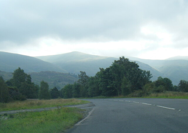
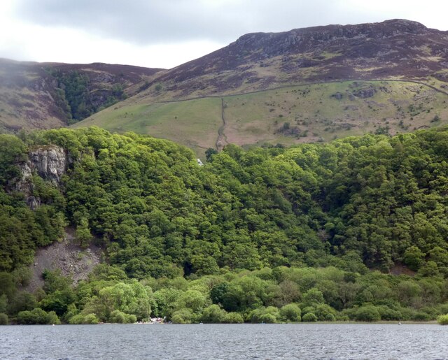
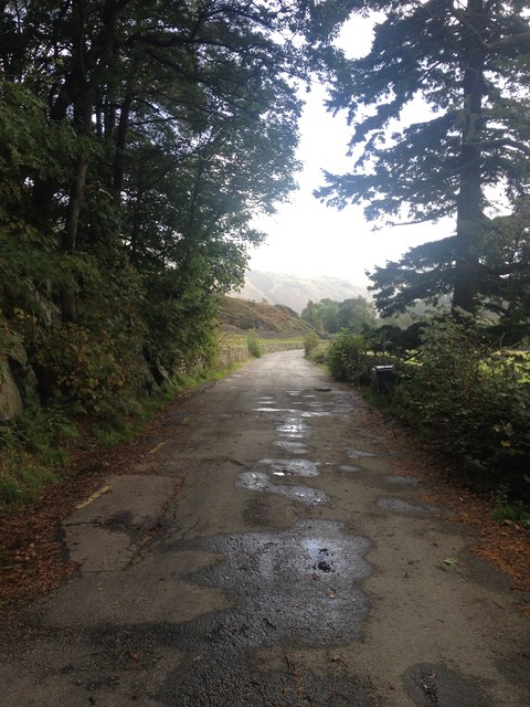
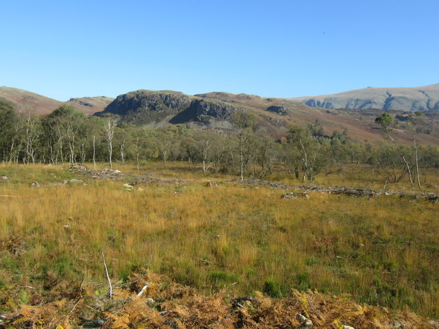
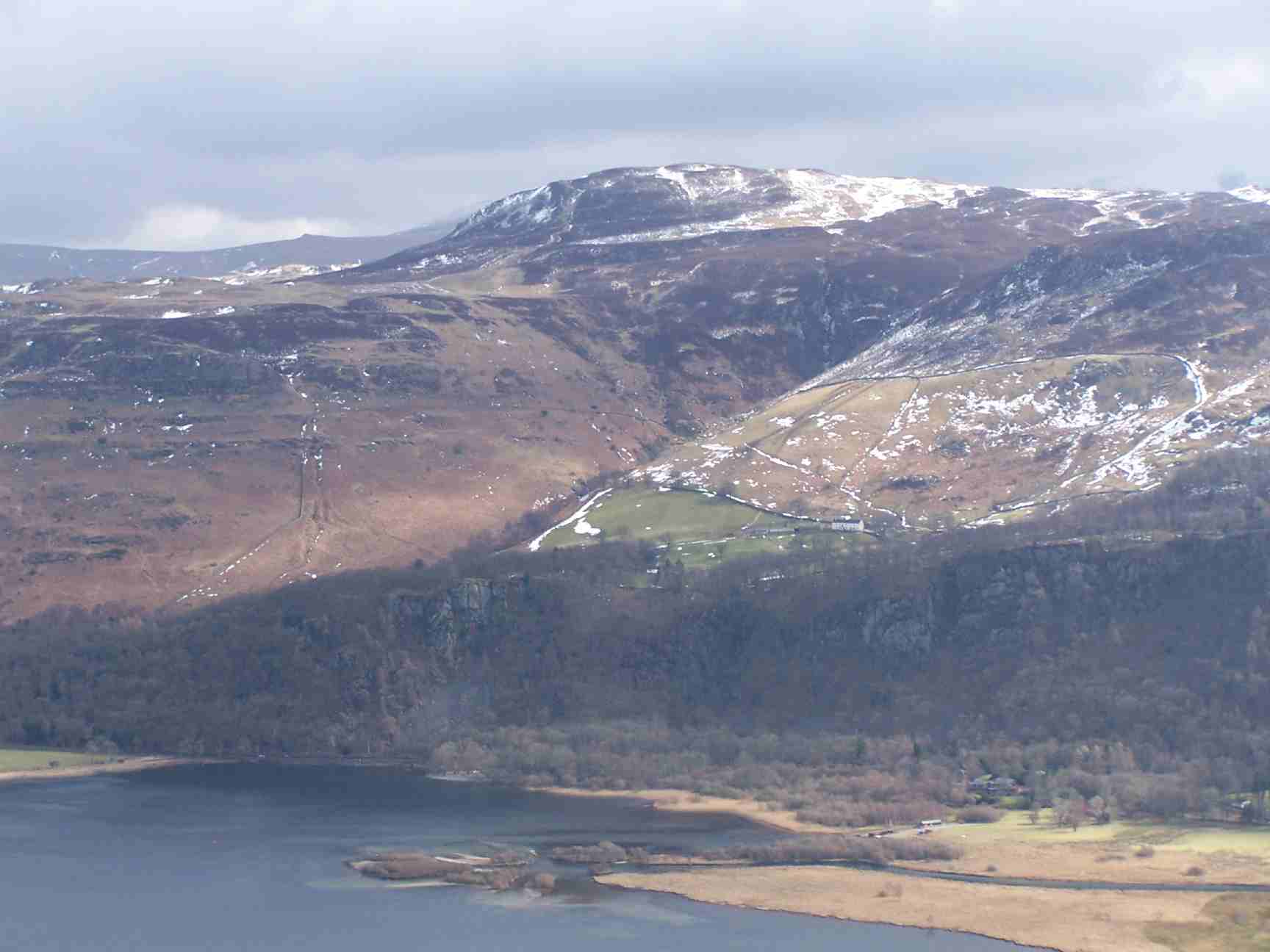
Castlerigg Fell is a prominent hill located in the county of Cumberland, England. Situated in the picturesque Lake District National Park, it is a popular destination for adventure seekers and nature enthusiasts alike. The fell offers stunning views of the surrounding landscape, including the nearby Derwentwater and the majestic Skiddaw mountain.

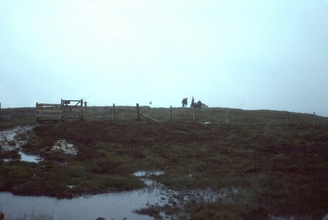
Covered in lush greenery and heather, Castlerigg Fell is a haven for wildlife and boasts a diverse range of flora and fauna. The moorland habitat supports a variety of bird species, such as curlews, lapwings, and golden plovers, making it a paradise for birdwatchers. The hill is also home to a population of red deer and other mammals, which can occasionally be spotted grazing on its slopes.

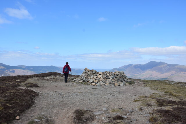
At the summit of Castlerigg Fell, visitors can find the remains of an ancient stone circle, known as the Castlerigg Stone Circle. This Neolithic monument is believed to have been constructed around 3000 BC and is one of the oldest stone circles in the country. It consists of 38 stones, some of which are up to 10 feet tall, arranged in an elliptical shape. The stone circle is not only of historical significance but also adds to the mystical atmosphere of the fell, attracting tourists and spiritual seekers.

With its breathtaking natural beauty and historical significance, Castlerigg Fell offers a unique and enchanting experience for those who venture to its slopes. Whether it's a leisurely hike, birdwatching, or exploring ancient history, this Cumberland gem never fails to captivate visitors with its charm.

If you have any feedback on the listing, please let us know in the comments section below.

Castlerigg Fell Images

Images are sourced within 2km of 54.571117/-3.1091305 or Grid Reference NY2820. Thanks to Geograph Open Source API. All images are credited.

A591 near Rough How Bridge
OS Cut Mark - Rough How Bridge <span class="nowrap"><a title="https://www.bench-marks.org.uk/bm27678" rel="nofollow ugc noopener" href="https://www.bench-marks.org.uk/bm27678">Link</a><img style="margin-left:2px;" alt="External link" title="External link - shift click to open in new window" src="https://s1.geograph.org.uk/img/external.png" width="10" height="10"/></span>
OS Cut Mark - Rough How Bridge
Summit, Bleaberry Fell
Ashness Bridge On the minor road from Barrow Bay to Watendlath, the Grade II listed Ashness Bridge over Barrow Beck is a popular tourist attraction.
Barrow Beck flows into Derwentwater and thence into the River Derwent.
Ashness Bridge
On the minor road from Barrow Bay to Watendlath, the Grade II listed Ashness Bridge over Barrow Beck is a popular tourist attraction. Barrow Beck flows into Derwentwater and thence into the River Derwent.
Ashness Bridge
Ashness Bridge
Gate on Brown Knotts
Bleaberry Fell The wind shelter on the summit of the fell. Looking north west with Skiddaw in the distance on the right of the shot.
Bleaberry Fell
The wind shelter on the summit of the fell. Looking north west with Skiddaw in the distance on the right of the shot.
Wooded cliffs overlooking Derwentwater 
Between the Bleaberry Fell and the lakeside are cliffs covered in trees. On the left, above a landslide, there seems to be some kind of face.
Wooded cliffs overlooking Derwentwater
Between the Bleaberry Fell and the lakeside are cliffs covered in trees. On the left, above a landslide, there seems to be some kind of face.
Derwent Water Derwentwater - one word or two? - either is acceptable. The boat in the photograph has obviously sunk. The amount visible above the water shows that the lake is not actually very deep at this point - maybe it simply ran aground.
Derwent Water
Derwentwater - one word or two? - either is acceptable. The boat in the photograph has obviously sunk. The amount visible above the water shows that the lake is not actually very deep at this point - maybe it simply ran aground.
Ashness Bridge The one and only!
Ashness Bridge
The one and only!
Artist at work - Ashness Bridge A popular place to linger with a good impression of the view on the canvas.
Artist at work - Ashness Bridge
A popular place to linger with a good impression of the view on the canvas.
Ashness Bridge near Derwentwater Ashness Bridge over Barrow Beck is a highly popular tourist attraction. This is an old packhorse bridge on the single track road to Watendlath. Barrow Beck flows into Derwentwater. This is one of the most photographed bridges in Britain. Viewed on a day in early autumn.
Ashness Bridge near Derwentwater
Ashness Bridge over Barrow Beck is a highly popular tourist attraction. This is an old packhorse bridge on the single track road to Watendlath. Barrow Beck flows into Derwentwater. This is one of the most photographed bridges in Britain. Viewed on a day in early autumn.
Land below Low Strutta Wood The view is along the eastern side of Derwent Water from the Lodore landing stage.
The deciduous trees of Low Strutta Wood rise at the right side of the image, above the reeds.
Buttresses of Falcon Crag are partially sunlit high on the mountain slope.
The distant hills are Lonscale Fell and Latrigg.
Land below Low Strutta Wood
The view is along the eastern side of Derwent Water from the Lodore landing stage. The deciduous trees of Low Strutta Wood rise at the right side of the image, above the reeds. Buttresses of Falcon Crag are partially sunlit high on the mountain slope. The distant hills are Lonscale Fell and Latrigg.
In Naddle Dale An area of cleared and light woodland on the valley floor below The Benn, with Skiddaw in the distance.
In Naddle Dale
An area of cleared and light woodland on the valley floor below The Benn, with Skiddaw in the distance.
The old road now by-passed
The old A591
The old A591
Rainbow and Latrigg
Rainbow and Latrigg
Looking towards Yew Crag Most of the conifers in this area have been felled.
Looking towards Yew Crag
Most of the conifers in this area have been felled.
Show me another place!

Castlerigg Fell is located at Grid Ref: NY2820 (Lat: 54.571117, Lng: -3.1091305)

Administrative County: Cumbria

District: Allerdale

Police Authority: Cumbria

What 3 Words

///triathlon.flooding.zipped. Near Keswick, Cumbria

Nearby Locations

Castlerigg Fell Low Moss

Related Wikis

Bleaberry Fell

Bleaberry Fell is a fell in the Lake District in Cumbria, England, with a height of 590 metres (1,936 ft). It stands on the main watershed between Borrowdale...

Walla Crag

Walla Crag is a fell in the English Lake District, near Keswick. The fell is a short walk from Keswick and overlooks Derwentwater. == Topography == The...
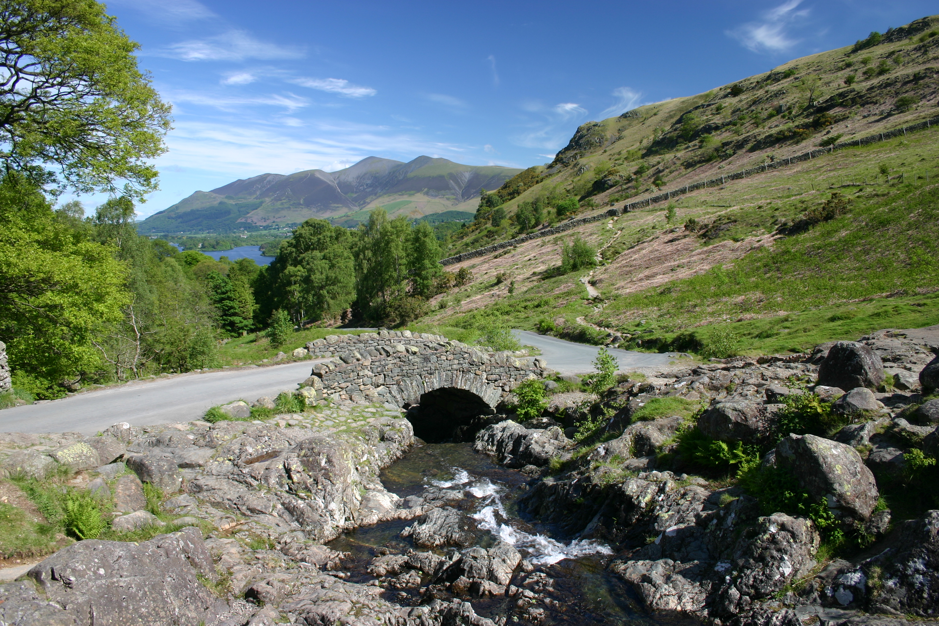
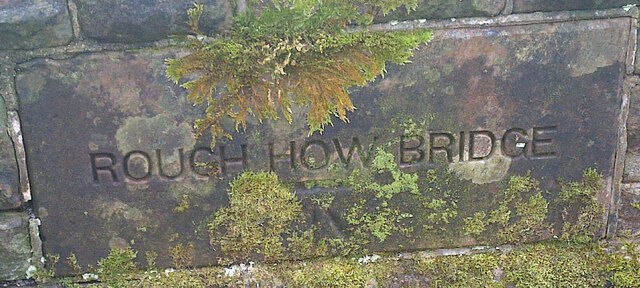
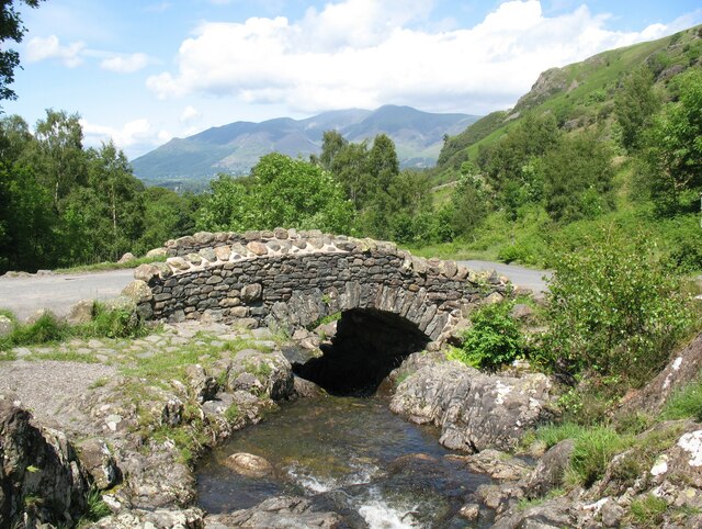
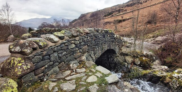
Ashness Bridge

Ashness Bridge is a traditional stone-built bridge on the single-track road from the Borrowdale road (B5289) to Watendlath, in the English Lake District...

Barrow House, Cumbria

Barrow House is a late 18th-century mansion situated on the eastern shore of Derwentwater in Borrowdale within the Lake District National Park, in the...

High Seat (Lake District)

High Seat is a fell in the centre of the English Lake District. Despite being below 2,000 ft it is the highest point for about 5 miles (8 km) in any direction...

Cataract of Lodore

"The Cataract of Lodore" is a poem written in 1820 by the English poet Robert Southey which describes the Lodore Falls on the Watendlath. == Publication... ==

Castlerigg

Castlerigg is an area of Keswick, Cumbria, England. Castlerigg is named after a hill in the immediate area. Until the early twentieth century much of the...

Herbert of Derwentwater

Saint Herbert of Derwentwater (died 20 March 687) was an Anglo-Saxon priest and hermit who lived on the small St Herbert's Island in Derwentwater, Cumbria...

Nearby Amenities

Located within 500m of 54.571117,-3.1091305
Castlerigg Fell
Natural: fell
Source: npe
Lat/Long: 54.570883/-3.1043377
Low Moss
Place: locality
Lat/Long: 54.5752103/-3.1118166
Wythburn Fells
Place: locality
Lat/Long: 54.5712404/-3.1115657
The data included in this document is from www.openstreetmap.org. The data is made available under ODbL.

Have you been to Castlerigg Fell?

Leave your review of Castlerigg Fell below (or comments, questions and feedback).