Beck Head Moss

Downs, Moorland in Lancashire South Lakeland

England

Beck Head Moss

Ordnance Survey Rivet This OS rivet can be found on the wall east side of Woodlands Road. It marks a point 79.376m above mean sea level.
Ordnance Survey Rivet Credit: Adrian Dust

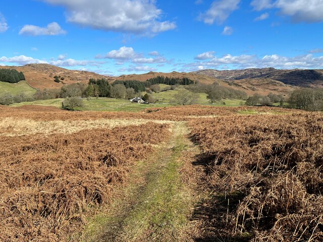
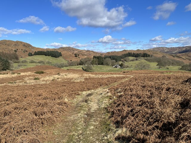
Beck Head Moss is a vast expanse of moorland located in Lancashire, England. Situated in the picturesque region of the Lancashire Downs, this area is renowned for its stunning natural beauty and diverse flora and fauna.

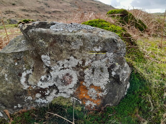
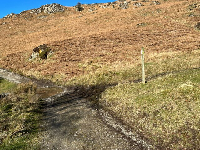
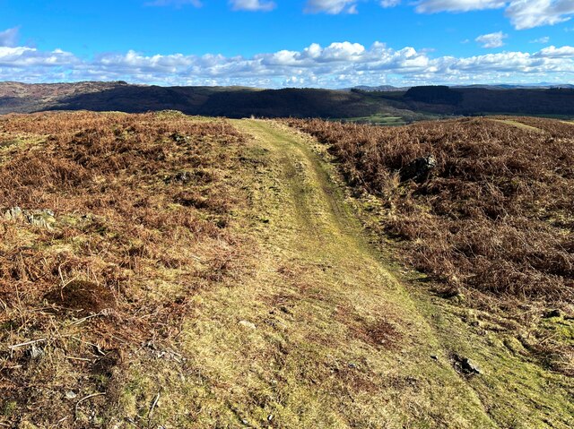
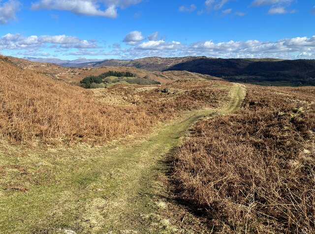
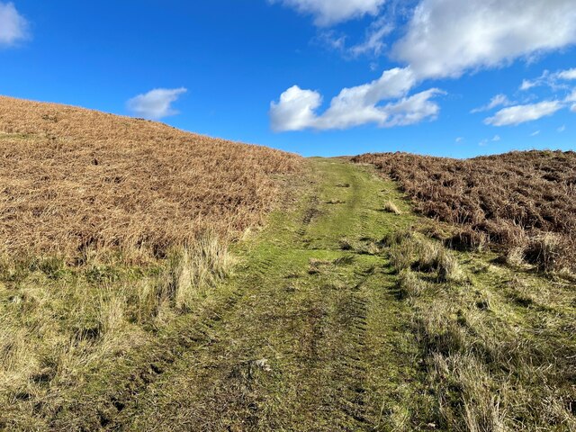
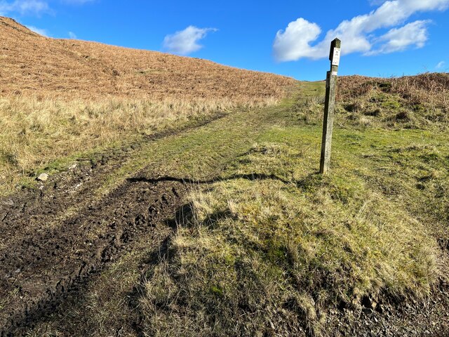
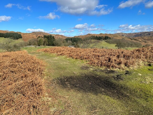
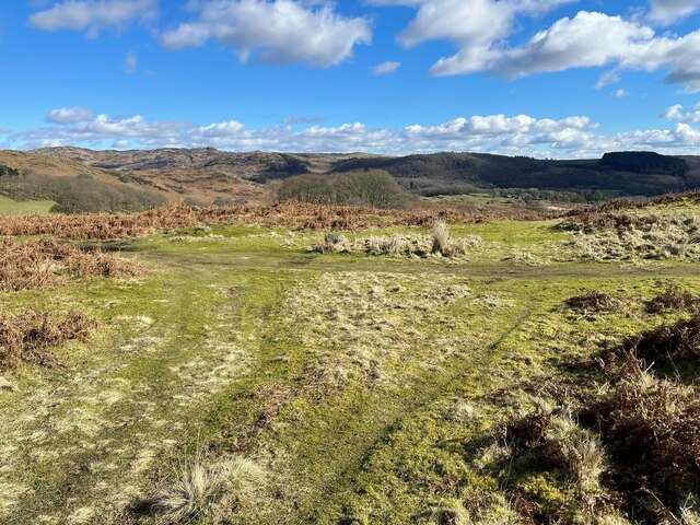
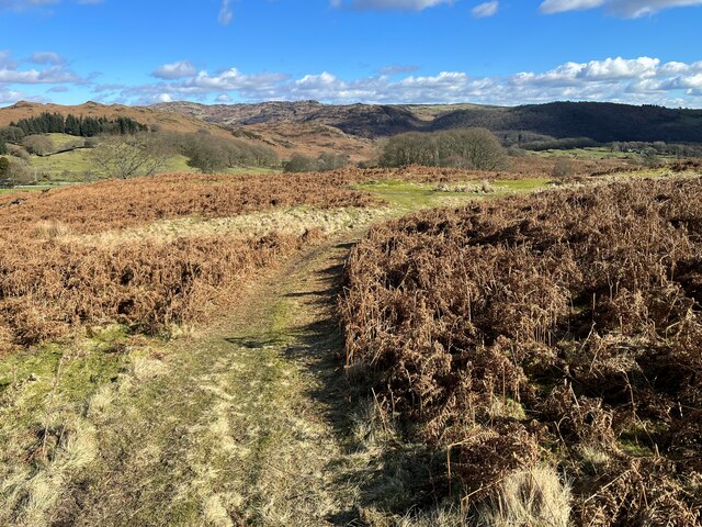
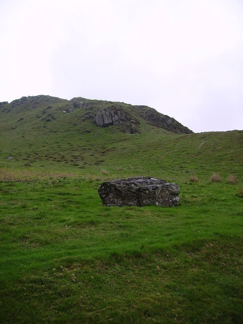
Covering an area of approximately 500 hectares, Beck Head Moss is characterized by its undulating terrain, heather-covered hills, and numerous peat bogs. The moss is primarily composed of peat, which has accumulated over thousands of years due to the slow decomposition of plant matter. This unique landscape provides a habitat for a variety of plant species, including sphagnum moss, cotton grass, and heather, which bloom in vibrant hues during the summer months.

This moorland is a sanctuary for numerous bird species, such as curlews, lapwings, and golden plovers, making it a popular destination for birdwatchers. The area is also home to small mammals like rabbits, voles, and weasels, as well as reptiles like adders and slow worms.

Beck Head Moss offers several walking trails that allow visitors to explore its stunning surroundings, providing magnificent views of the surrounding Lancashire Downs. The tranquil atmosphere, punctuated only by the calls of birds and the rustling of the wind through the heather, makes it an ideal location for those seeking solace in nature.

It is important to note that access to Beck Head Moss may be limited during certain times of the year due to conservation efforts aimed at protecting the delicate ecosystem. Visitors are advised to check local guidelines before planning their visit to ensure the preservation of this remarkable moorland.

If you have any feedback on the listing, please let us know in the comments section below.

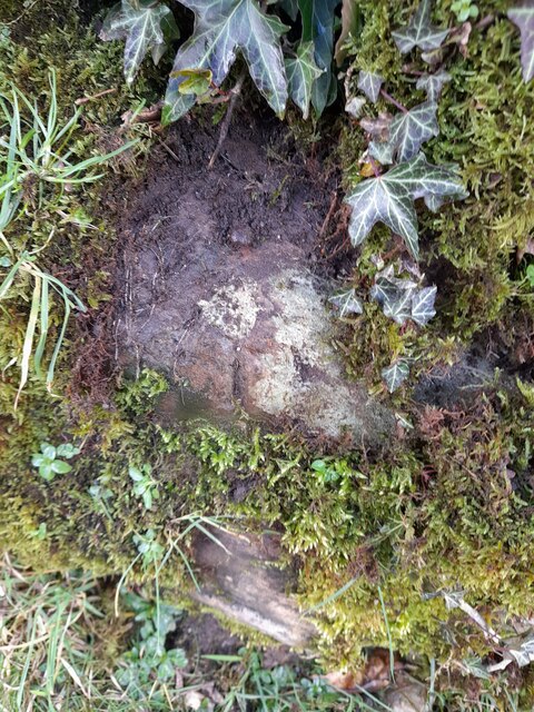
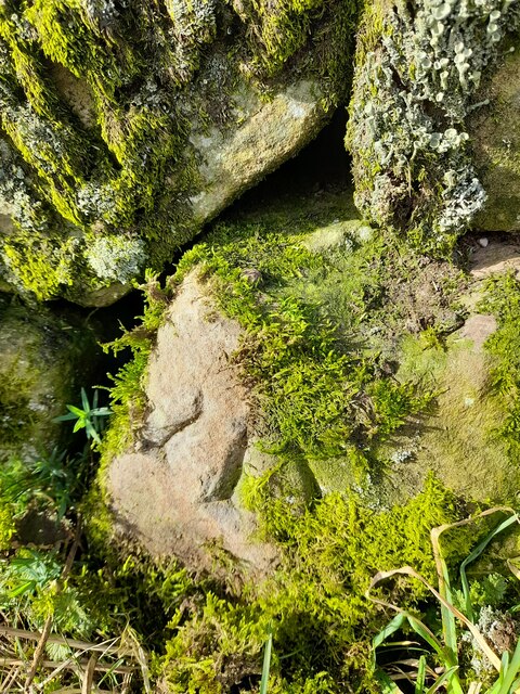
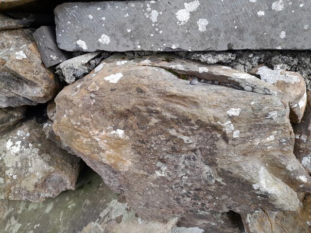
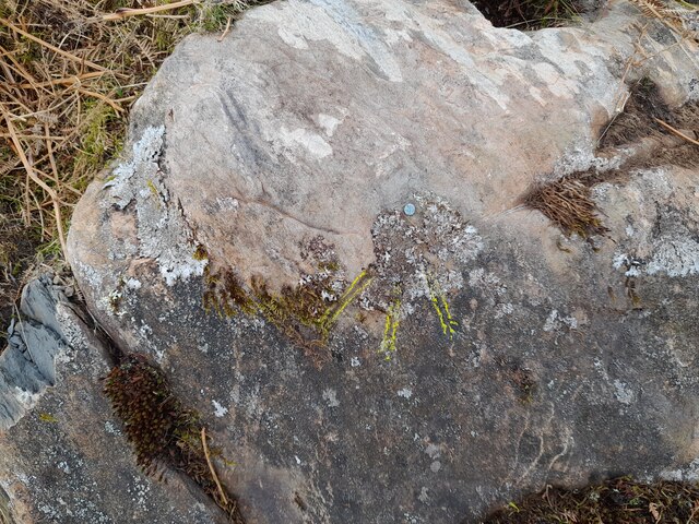
Beck Head Moss Images

Images are sourced within 2km of 54.282217/-3.1413976 or Grid Reference SD2587. Thanks to Geograph Open Source API. All images are credited.

Ordnance Survey Rivet This OS rivet can be found on the wall east side of Woodlands Road. It marks a point 79.376m above mean sea level.
Ordnance Survey Rivet
This OS rivet can be found on the wall east side of Woodlands Road. It marks a point 79.376m above mean sea level.
Ordnance Survey Rivet This OS rivet can be found on the wall west side of Woodlands Road. It marks a point 93.637m above mean sea level.
Ordnance Survey Rivet
This OS rivet can be found on the wall west side of Woodlands Road. It marks a point 93.637m above mean sea level.
Ordnance Survey Rivet This OS rivet can be found on the wall east side of Woodlands Road. It marks a point 69.758m above mean sea level.
Ordnance Survey Rivet
This OS rivet can be found on the wall east side of Woodlands Road. It marks a point 69.758m above mean sea level.
Ordnance Survey Rivet This OS rivet can be found on a rock south side of the road. It marks a point 124.383m above mean sea level.
Ordnance Survey Rivet
This OS rivet can be found on a rock south side of the road. It marks a point 124.383m above mean sea level.
Ordnance Survey Cut Mark This OS cut mark can be found on a rock south side of the road. It marks a point 126.204m above mean sea level.
Ordnance Survey Cut Mark
This OS cut mark can be found on a rock south side of the road. It marks a point 126.204m above mean sea level.
Ordnance Survey Rivet This OS rivet can be found on a boulder east side of the road. It marks a point 139.317m above mean sea level.
Ordnance Survey Rivet
This OS rivet can be found on a boulder east side of the road. It marks a point 139.317m above mean sea level.
Ordnance Survey Rivet This OS rivet can be found on boulder SW side of the track. It marks a point 133.905m above mean sea level.
Ordnance Survey Rivet
This OS rivet can be found on boulder SW side of the track. It marks a point 133.905m above mean sea level.
Ordnance Survey Rivet This OS rivet can be found on the culvert NE side of the road. It marks a point 124.724m above mean sea level.
Ordnance Survey Rivet
This OS rivet can be found on the culvert NE side of the road. It marks a point 124.724m above mean sea level.
The Cumbria Way, Tottlebank The main track is the public bridleway from Tottlebank to Heathwaite; the track to the right is a public footpath to Cockenskell.
Northbound walkers following The Cumbria Way turn right here to follow the footpath up the hill (next photograph <a href="https://www.geograph.org.uk/photo/7428087">SD2688 : The Cumbria Way, Tottlebank</a>).
The Cumbria Way, Tottlebank
The main track is the public bridleway from Tottlebank to Heathwaite; the track to the right is a public footpath to Cockenskell. Northbound walkers following The Cumbria Way turn right here to follow the footpath up the hill (next photograph SD2688 : The Cumbria Way, Tottlebank).
Path on Tottlebank Height This path is the route of The Cumbria Way over the open fell between Tottlebank Farm and Cockenskell (next photograph <a href="https://www.geograph.org.uk/photo/7432096">SD2788 : The Cumbria Way near The Low</a>).
Path on Tottlebank Height
This path is the route of The Cumbria Way over the open fell between Tottlebank Farm and Cockenskell (next photograph SD2788 : The Cumbria Way near The Low).
Path on Tottlebank Height This undulating path is the route of The Cumbria Way over the open fell between Tottlebank Farm and Cockenskell (next photograph <a href="https://www.geograph.org.uk/photo/7427169">SD2788 : Path on Tottlebank Height</a>).
Path on Tottlebank Height
This undulating path is the route of The Cumbria Way over the open fell between Tottlebank Farm and Cockenskell (next photograph SD2788 : Path on Tottlebank Height).
Public footpath near Tottlebank This footpath is the route of The Cumbria Way over the open fell between Tottlebank Farm and Cockenskell (next photograph <a href="https://www.geograph.org.uk/photo/7432849">SD2788 : Public footpath near Tottlebank</a>).
Public footpath near Tottlebank
This footpath is the route of The Cumbria Way over the open fell between Tottlebank Farm and Cockenskell (next photograph SD2788 : Public footpath near Tottlebank).
The Cumbria Way, Tottlebank This Cumbria Way leaves a public bridleway by Tottlebank Farm and follows the public footpath to Cockenskell up the hill (next photograph <a href="https://www.geograph.org.uk/photo/7428052">SD2788 : Public footpath near Tottlebank</a>).
The Cumbria Way, Tottlebank
This Cumbria Way leaves a public bridleway by Tottlebank Farm and follows the public footpath to Cockenskell up the hill (next photograph SD2788 : Public footpath near Tottlebank).
Path near Appletree Holme This path on Blawith Common near Appletree Holme is the route of The Cumbria Way (next photograph <a href="https://www.geograph.org.uk/photo/6883308">SD2788 : The Cumbria Way near Cockenskell</a>).
Path near Appletree Holme
This path on Blawith Common near Appletree Holme is the route of The Cumbria Way (next photograph SD2788 : The Cumbria Way near Cockenskell).
Paths near Appletree Holme At this junction of paths on Blawith Common northbound walkers following The Cumbria Way keep left (next photograph <a href="https://www.geograph.org.uk/photo/7429743">SD2788 : Path near Appletree Holme</a>).
Paths near Appletree Holme
At this junction of paths on Blawith Common northbound walkers following The Cumbria Way keep left (next photograph SD2788 : Path near Appletree Holme).
Path near Appletree Holme This path on Blawith Common near Appletree Holme is the route of The Cumbria Way long distance path (next photograph <a href="https://www.geograph.org.uk/photo/7429783">SD2788 : Paths near Appletree Holme</a>).
Path near Appletree Holme
This path on Blawith Common near Appletree Holme is the route of The Cumbria Way long distance path (next photograph SD2788 : Paths near Appletree Holme).
Path near Appletree Holme This path through bracken near Appletree Holme is the route of The Cumbria Way long distance path (next photograph <a href="https://www.geograph.org.uk/photo/7429793">SD2788 : Path near Appletree Holme</a>).
Cockenskell Farm House is in the distance.
Path near Appletree Holme
This path through bracken near Appletree Holme is the route of The Cumbria Way long distance path (next photograph SD2788 : Path near Appletree Holme). Cockenskell Farm House is in the distance.
Footpath near Appletree Holme This path through bracken near Appletree Holme is the public footpath from Tottlebank Farm to Cockenskell; it is also The Cumbria Way long distance path (next photograph <a href="https://www.geograph.org.uk/photo/7429808">SD2788 : Path near Appletree Holme</a>).
Cockenskell Farm House is in the distance.
Footpath near Appletree Holme
This path through bracken near Appletree Holme is the public footpath from Tottlebank Farm to Cockenskell; it is also The Cumbria Way long distance path (next photograph SD2788 : Path near Appletree Holme). Cockenskell Farm House is in the distance.
Show me another place!

Beck Head Moss is located at Grid Ref: SD2587 (Lat: 54.282217, Lng: -3.1413976)

Administrative County: Cumbria

District: South Lakeland

Police Authority: Cumbria

What 3 Words

///regulates.brave.remaking. Near Ulverston, Cumbria

Related Wikis

Blawith Knott

Blawith Knott is a hill in the south of the English Lake District, near Woodland, Cumbria. It is the subject of a chapter of Wainwright's book The Outlying...

St John the Evangelist's Church, Woodland

St John the Evangelist's Church is in the hamlet of Woodland, about 4 kilometres (2 mi) to the northeast of Broughton-in-Furness, Cumbria, England. It...

Woodland, Cumbria

Woodland is a dispersed hamlet within the civil parish of Kirkby Ireleth in the Furness region of Cumbria, England, and is located in the southern part...

Burney (hill)

Burney is a hill in Cumbria, England, to the north of the A5092 road between Greenodd and Broughton-in-Furness. It is the subject of a chapter of Wainwright...

Woodland Fell

Woodland Fell is an upland area in the south of the English Lake District, south of Torver, Cumbria. It is the subject of a chapter of Wainwright's book...

Rosthwaite, Broughton West

Rosthwaite is a settlement in the Broughton West civil parish of Westmorland and Furness, Cumbria England. It is part of the Lake District, 3 miles (4...

Woodland railway station

Woodland railway station served the hamlet of Woodland, in Lancashire, England (now in Cumbria). It was on the branch line to Coniston. == History == Authorised...

Blawith and Subberthwaite

Blawith and Subberthwaite is a civil parish in the South Lakeland district of Cumbria, England. It is situated in the Lake District National Park, and...

Nearby Amenities

Located within 500m of 54.282217,-3.1413976
Giant's Grave
Historic: archaeological_site
Lat/Long: 54.2817172/-3.1431939
Blawith Knott
Ele: 248
Natural: peak
Wikidata: Q4925560
Wikipedia: en:Blawith Knott
Lat/Long: 54.2858424/-3.1372719
Long Rigg
Place: locality
Lat/Long: 54.2797377/-3.140488
Man Made: cairn
Lat/Long: 54.2858485/-3.1375437
The data included in this document is from www.openstreetmap.org. The data is made available under ODbL.

Have you been to Beck Head Moss?

Leave your review of Beck Head Moss below (or comments, questions and feedback).