Balance Meadows

Downs, Moorland in Monmouthshire

Wales

Balance Meadows

Former railway building by NCN492
Former railway building by NCN492 Credit: David Smith

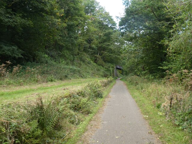
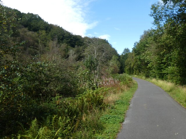
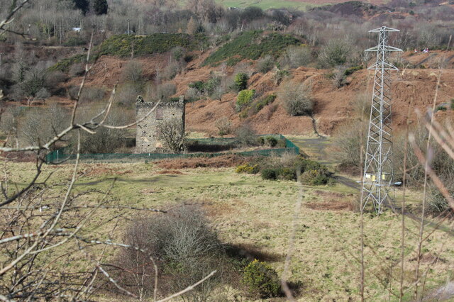
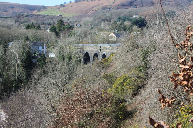
Balance Meadows is a picturesque area located in Monmouthshire, Wales, known for its stunning downs and moorland landscapes. Spanning approximately 200 hectares, this natural haven offers visitors a unique and diverse experience.

The meadows are characterized by their rolling hills, covered in lush green grasses and dotted with vibrant wildflowers, creating a breathtaking sight during spring and summer. These downs provide a home to a variety of bird species, including skylarks and lapwings, making it a popular spot for birdwatching enthusiasts.

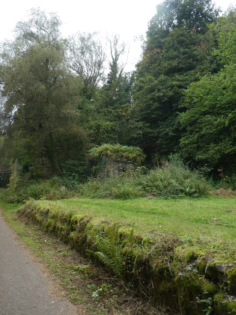
As visitors explore the meadows, they will also come across areas of moorland, characterized by heather-covered hills and peat bogs. The moorland provides habitat for several species of rare plants and animals, including the iconic Welsh mountain ponies that graze freely in the area.

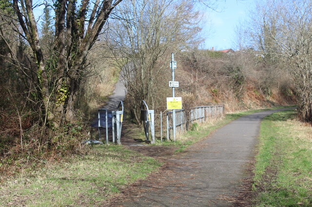
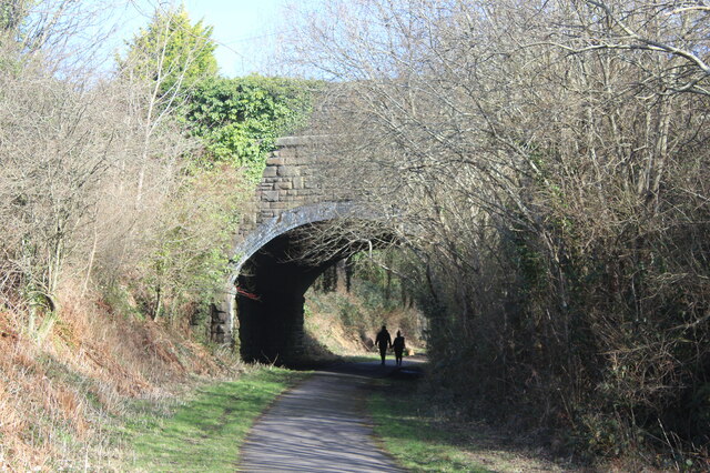
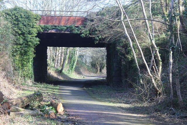
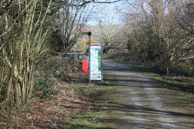
Nature lovers can indulge in long walks or hikes, taking in the stunning panoramic views of the surrounding countryside. The meadows and moorland are crisscrossed by well-maintained footpaths, ensuring accessibility for all visitors.

Balance Meadows is not only a natural paradise but also a site of historical significance. The area has a rich cultural heritage, with traces of ancient settlements and burial mounds dating back thousands of years. Archaeological enthusiasts can explore these remnants, gaining insights into the lives of early inhabitants of the region.

Overall, Balance Meadows in Monmouthshire is a haven for nature enthusiasts and history buffs alike. Its stunning downs, moorland landscapes, and cultural significance make it a must-visit destination for those seeking tranquility and a deeper connection with the natural world.

If you have any feedback on the listing, please let us know in the comments section below.

Balance Meadows Images

Images are sourced within 2km of 51.742348/-3.0813481 or Grid Reference SO2505. Thanks to Geograph Open Source API. All images are credited.

Former railway building by NCN492
Bridge over NCN492 (former railway) The National Cycle Network is a network of cycle routes. It was created by the charity Sustrans <span class="nowrap"><a title="http://www.sustrans.org.uk/what-we-do/national-cycle-network" rel="nofollow ugc noopener" href="http://www.sustrans.org.uk/what-we-do/national-cycle-network">Link</a><img style="margin-left:2px;" alt="External link" title="External link - shift click to open in new window" src="https://s1.geograph.org.uk/img/external.png" width="10" height="10"/></span>  (Sustainable Transport), aided by a National Lottery grant.

Many routes aim to minimise contact with motor traffic, though 70% of them are on roads. In some cases the NCN uses pedestrian routes, disused railways, minor roads, canal towpaths, or traffic-calmed routes in towns and cities.
Bridge over NCN492 (former railway)
The National Cycle Network is a network of cycle routes. It was created by the charity Sustrans LinkExternal link (Sustainable Transport), aided by a National Lottery grant. Many routes aim to minimise contact with motor traffic, though 70% of them are on roads. In some cases the NCN uses pedestrian routes, disused railways, minor roads, canal towpaths, or traffic-calmed routes in towns and cities.
Cycle route (former railway) crossing viaduct in Talywain
Cycle track on old railway through Talywain The National Cycle Network is a network of cycle routes. It was created by the charity Sustrans <span class="nowrap"><a title="http://www.sustrans.org.uk/what-we-do/national-cycle-network" rel="nofollow ugc noopener" href="http://www.sustrans.org.uk/what-we-do/national-cycle-network">Link</a><img style="margin-left:2px;" alt="External link" title="External link - shift click to open in new window" src="https://s1.geograph.org.uk/img/external.png" width="10" height="10"/></span>  (Sustainable Transport), aided by a National Lottery grant.

Many routes aim to minimise contact with motor traffic, though 70% of them are on roads. In some cases the NCN uses pedestrian routes, disused railways, minor roads, canal towpaths, or traffic-calmed routes in towns and cities.
Cycle track on old railway through Talywain
The National Cycle Network is a network of cycle routes. It was created by the charity Sustrans LinkExternal link (Sustainable Transport), aided by a National Lottery grant. Many routes aim to minimise contact with motor traffic, though 70% of them are on roads. In some cases the NCN uses pedestrian routes, disused railways, minor roads, canal towpaths, or traffic-calmed routes in towns and cities.
NCN492 in Pen-y-lan Woods, using old railway line
Bridge over NCN492 The National Cycle Network is a network of cycle routes. It was created by the charity Sustrans <span class="nowrap"><a title="http://www.sustrans.org.uk/what-we-do/national-cycle-network" rel="nofollow ugc noopener" href="http://www.sustrans.org.uk/what-we-do/national-cycle-network">Link</a><img style="margin-left:2px;" alt="External link" title="External link - shift click to open in new window" src="https://s1.geograph.org.uk/img/external.png" width="10" height="10"/></span>  (Sustainable Transport), aided by a National Lottery grant.

Many routes aim to minimise contact with motor traffic, though 70% of them are on roads. In some cases the NCN uses pedestrian routes, disused railways, minor roads, canal towpaths, or traffic-calmed routes in towns and cities.
Bridge over NCN492
The National Cycle Network is a network of cycle routes. It was created by the charity Sustrans LinkExternal link (Sustainable Transport), aided by a National Lottery grant. Many routes aim to minimise contact with motor traffic, though 70% of them are on roads. In some cases the NCN uses pedestrian routes, disused railways, minor roads, canal towpaths, or traffic-calmed routes in towns and cities.
NCN492 passing former Varteg railway station The National Cycle Network is a network of cycle routes. It was created by the charity Sustrans <span class="nowrap"><a title="http://www.sustrans.org.uk/what-we-do/national-cycle-network" rel="nofollow ugc noopener" href="http://www.sustrans.org.uk/what-we-do/national-cycle-network">Link</a><img style="margin-left:2px;" alt="External link" title="External link - shift click to open in new window" src="https://s1.geograph.org.uk/img/external.png" width="10" height="10"/></span>  (Sustainable Transport), aided by a National Lottery grant.

Many routes aim to minimise contact with motor traffic, though 70% of them are on roads. In some cases the NCN uses pedestrian routes, disused railways, minor roads, canal towpaths, or traffic-calmed routes in towns and cities.
NCN492 passing former Varteg railway station
The National Cycle Network is a network of cycle routes. It was created by the charity Sustrans LinkExternal link (Sustainable Transport), aided by a National Lottery grant. Many routes aim to minimise contact with motor traffic, though 70% of them are on roads. In some cases the NCN uses pedestrian routes, disused railways, minor roads, canal towpaths, or traffic-calmed routes in towns and cities.
NCN492 in woodland near Gallowsgreen The National Cycle Network is a network of cycle routes. It was created by the charity Sustrans <span class="nowrap"><a title="http://www.sustrans.org.uk/what-we-do/national-cycle-network" rel="nofollow ugc noopener" href="http://www.sustrans.org.uk/what-we-do/national-cycle-network">Link</a><img style="margin-left:2px;" alt="External link" title="External link - shift click to open in new window" src="https://s1.geograph.org.uk/img/external.png" width="10" height="10"/></span>  (Sustainable Transport), aided by a National Lottery grant.

Many routes aim to minimise contact with motor traffic, though 70% of them are on roads. In some cases the NCN uses pedestrian routes, disused railways, minor roads, canal towpaths, or traffic-calmed routes in towns and cities.
NCN492 in woodland near Gallowsgreen
The National Cycle Network is a network of cycle routes. It was created by the charity Sustrans LinkExternal link (Sustainable Transport), aided by a National Lottery grant. Many routes aim to minimise contact with motor traffic, though 70% of them are on roads. In some cases the NCN uses pedestrian routes, disused railways, minor roads, canal towpaths, or traffic-calmed routes in towns and cities.
Overgrown railway platform and building, former Varteg station
Bridge over NCN492 with retaining wall The National Cycle Network is a network of cycle routes. It was created by the charity Sustrans <span class="nowrap"><a title="http://www.sustrans.org.uk/what-we-do/national-cycle-network" rel="nofollow ugc noopener" href="http://www.sustrans.org.uk/what-we-do/national-cycle-network">Link</a><img style="margin-left:2px;" alt="External link" title="External link - shift click to open in new window" src="https://s1.geograph.org.uk/img/external.png" width="10" height="10"/></span>  (Sustainable Transport), aided by a National Lottery grant.

Many routes aim to minimise contact with motor traffic, though 70% of them are on roads. In some cases the NCN uses pedestrian routes, disused railways, minor roads, canal towpaths, or traffic-calmed routes in towns and cities.
Bridge over NCN492 with retaining wall
The National Cycle Network is a network of cycle routes. It was created by the charity Sustrans LinkExternal link (Sustainable Transport), aided by a National Lottery grant. Many routes aim to minimise contact with motor traffic, though 70% of them are on roads. In some cases the NCN uses pedestrian routes, disused railways, minor roads, canal towpaths, or traffic-calmed routes in towns and cities.
The north side of the viaduct at Talywain
Former goods shed, Abersychan & Talywain Station A LNWR goods shed from the 1870s, now an engineering works, next to NCR 492 on a former railway, foreground.
Former goods shed, Abersychan & Talywain Station
A LNWR goods shed from the 1870s, now an engineering works, next to NCR 492 on a former railway, foreground.
Derelict pumping engine house, The British Early Victorian sandstone engine house to drain the local coal mines.
Derelict pumping engine house, The British
Early Victorian sandstone engine house to drain the local coal mines.
Path up to Commercial Road, Talywain The white sign says,'Siopau Shops'; the yellow sign cautions those using the cycle route that they are entering a mining area with possible hazards.
Path up to Commercial Road, Talywain
The white sign says,'Siopau Shops'; the yellow sign cautions those using the cycle route that they are entering a mining area with possible hazards.
Walkers on NCR 492 under road bridge Southwest side of bridge carrying Commercial Road over the route of the former LNWR Abersychan Extension Branch.
Walkers on NCR 492 under road bridge
Southwest side of bridge carrying Commercial Road over the route of the former LNWR Abersychan Extension Branch.
Bridge over Afon Lwyd Trail, NCR 492 Cycle way on former LNWR Abersychan Extension Branch.
Bridge over Afon Lwyd Trail, NCR 492
Cycle way on former LNWR Abersychan Extension Branch.
Garndiffaith Railway Viaduct Curved viaduct of nine arches which originally carried the LNWR Abersychan Extension Branch and now carries NCR 492 over the River Ffrwd.
Garndiffaith Railway Viaduct
Curved viaduct of nine arches which originally carried the LNWR Abersychan Extension Branch and now carries NCR 492 over the River Ffrwd.
Information board and signpost at Harper's Road Cycle track, NCR 492, board on former LNWR railway at exit to Harper's Road.
Information board and signpost at Harper's Road
Cycle track, NCR 492, board on former LNWR railway at exit to Harper's Road.
Show me another place!

Balance Meadows is located at Grid Ref: SO2505 (Lat: 51.742348, Lng: -3.0813481)

Unitary Authority: Torfaen

Police Authority: Gwent

What 3 Words

///dizziness.means.locate. Near Blaenavon, Torfaen

Nearby Locations

Balance Meadows Abersychan

Related Wikis

Varteg

Varteg is a village in the county borough of Torfaen in Wales. == Location == It lies near Abersychan on the hills above the valley of the Afon Llwyd,...

Varteg railway station

Varteg railway station was a railway station which served the village of Varteg, in the county of Monmouthshire, on the Brynmawr and Blaenavon Railway...

Garndiffaith

Garndiffaith is a village located in Torfaen, south east Wales. It is a small rural area situated between Talywain and Varteg, three miles north of the...

Dog Stone, Mynydd Varteg

The Dog Stone (or Pillar Stone), on Mynydd Farteg, a subsidiary top of Coity Mountain, near the village of Abersychan, Torfaen, Wales, is a memorial, dating...

Have you been to Balance Meadows?

Leave your review of Balance Meadows below (or comments, questions and feedback).