Crow Wood

Downs, Moorland in Perthshire

Scotland

Crow Wood

Tullybaccart viewpoint This small cairn marks the highest point of the land around the Tullybaccart quarry. The point is surrounded mostly by tree plantations. This is the view towards the south into Fife - the Lomond hills on the horizon on the right.
Tullybaccart viewpoint Credit: Aleks Scholz

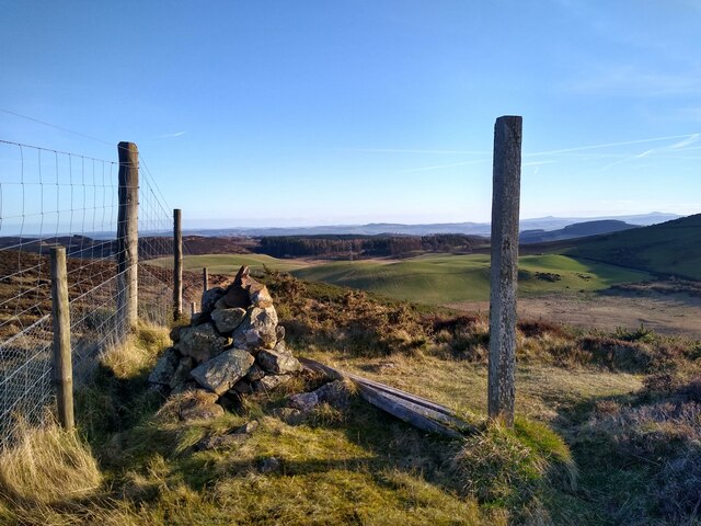
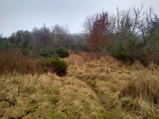
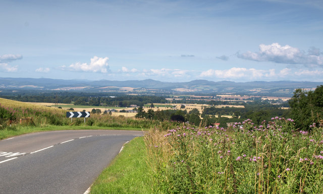
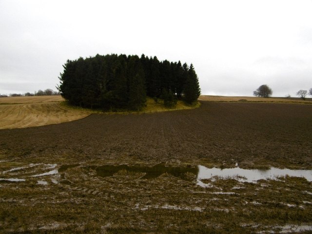
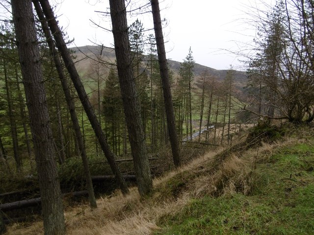
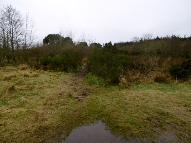
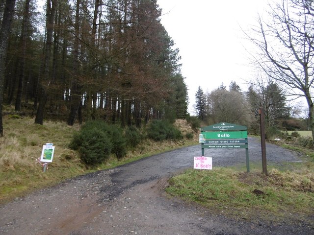
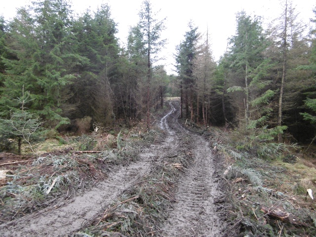
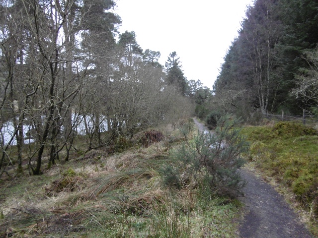
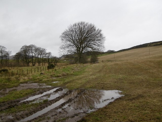
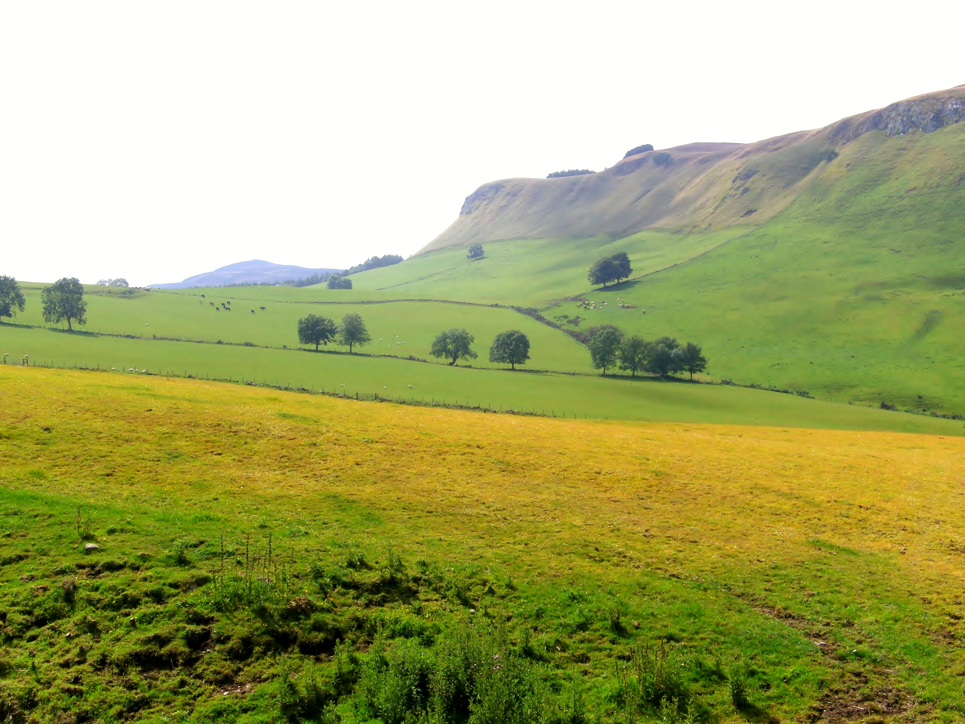
Crow Wood is a stunning natural area located in Perthshire, Scotland. This beautiful wood is characterized by its dense tree cover, predominantly made up of oak, birch, and pine trees. The wood is home to a variety of wildlife, including deer, foxes, and various species of birds.

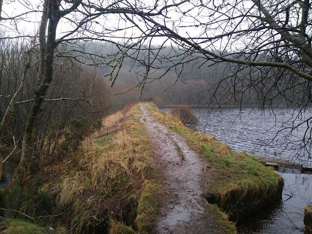
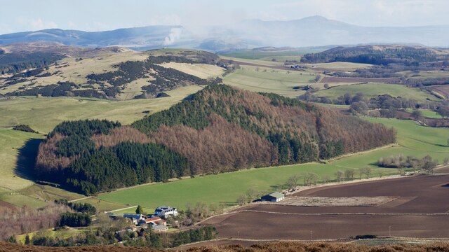
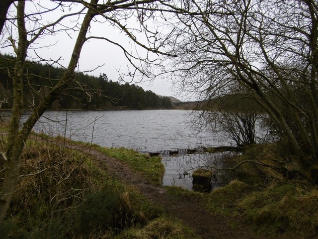
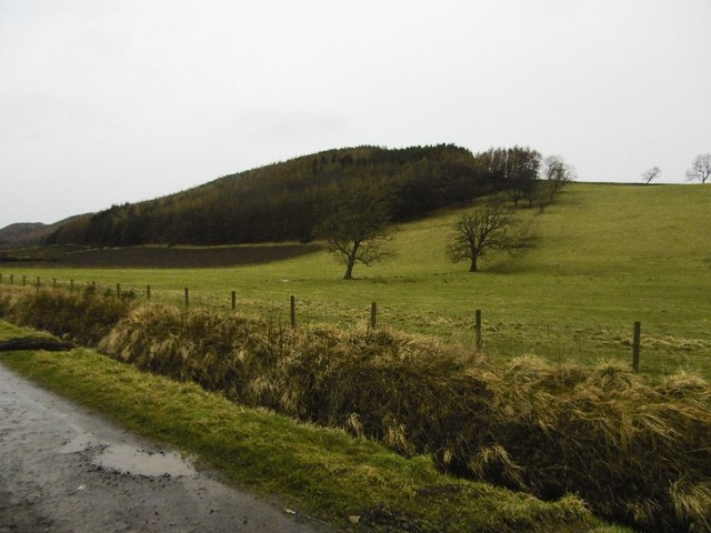
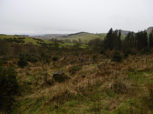
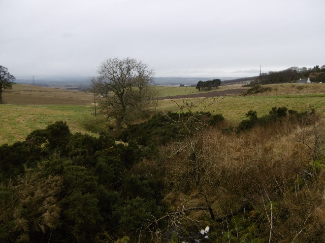
The terrain of Crow Wood is varied, featuring rolling hills, rocky outcrops, and open moorland. The wood offers breathtaking views of the surrounding countryside and is a popular destination for hikers and nature lovers.

In addition to its natural beauty, Crow Wood also has a rich history, with evidence of ancient settlements and burial sites dating back thousands of years. The wood is a protected area, managed by conservationists to preserve its unique flora and fauna.

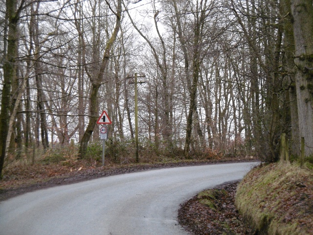
Visitors to Crow Wood can enjoy peaceful walks through the wood, taking in the sights and sounds of nature. The wood is also a great spot for birdwatching, with a variety of species to be spotted throughout the year.

Overall, Crow Wood is a tranquil and picturesque natural area, perfect for those looking to escape the hustle and bustle of everyday life and immerse themselves in the beauty of the Scottish countryside.

If you have any feedback on the listing, please let us know in the comments section below.

Crow Wood Images

Images are sourced within 2km of 56.498188/-3.2126189 or Grid Reference NO2534. Thanks to Geograph Open Source API. All images are credited.

Tullybaccart viewpoint This small cairn marks the highest point of the land around the Tullybaccart quarry. The point is surrounded mostly by tree plantations. This is the view towards the south into Fife - the Lomond hills on the horizon on the right.
Tullybaccart viewpoint
This small cairn marks the highest point of the land around the Tullybaccart quarry. The point is surrounded mostly by tree plantations. This is the view towards the south into Fife - the Lomond hills on the horizon on the right.
Laird's Loch dam This is the western limit of Laird's Loch, on a day with low clouds.
Laird's Loch dam
This is the western limit of Laird's Loch, on a day with low clouds.
This is a path It's hard to tell, but this is a path that branches off the main track to Laird's Loch, and leads towards Ballo Hill. It eventually reaches a fence, but a network of similarly faint and muddy tracks covers the slopes south of the loch.
This is a path
It's hard to tell, but this is a path that branches off the main track to Laird's Loch, and leads towards Ballo Hill. It eventually reaches a fence, but a network of similarly faint and muddy tracks covers the slopes south of the loch.
Glenbran From the Dundee Evening Telegraph - Thursday 27 November 1941:

"Not Proven" Verdict in Ploughing of Lands Case 

"A verdict of not proven was returned by Sheriff Valentine at Perth Sheriff Court today after hearing case in which two Carse of Cowrie men were charged. Accused were Messrs G. & J. Craig, Glenbran, Inchture, who denied that being the owners and occupiers of the lands at Glenbran they failed to cultivate the lands after being instructed to do so by the Agricultural Executive Committee for Perth East. Evidence for the prosecution was that a letter was sent to accused directing them to plough the lands. The defence maintained that no letter was received. Mr Norman C. Hunter, solicitor, Perth, appeared for the two accused. Mr M. Howman, procurator fiscal, conducted the case for the prosecution."
Glenbran
From the Dundee Evening Telegraph - Thursday 27 November 1941: "Not Proven" Verdict in Ploughing of Lands Case "A verdict of not proven was returned by Sheriff Valentine at Perth Sheriff Court today after hearing case in which two Carse of Cowrie men were charged. Accused were Messrs G. & J. Craig, Glenbran, Inchture, who denied that being the owners and occupiers of the lands at Glenbran they failed to cultivate the lands after being instructed to do so by the Agricultural Executive Committee for Perth East. Evidence for the prosecution was that a letter was sent to accused directing them to plough the lands. The defence maintained that no letter was received. Mr Norman C. Hunter, solicitor, Perth, appeared for the two accused. Mr M. Howman, procurator fiscal, conducted the case for the prosecution."
Bend on A923 With a view in the direction of Pitcur and Coupar Angus.
Bend on A923
With a view in the direction of Pitcur and Coupar Angus.
Roundel woodland, Lochton Ploughing is going to be an issue this year with so much rainfall.
Roundel woodland, Lochton
Ploughing is going to be an issue this year with so much rainfall.
Ballo Glack Looking down on the road from the forest on Northballo Hill.
Ballo Glack
Looking down on the road from the forest on Northballo Hill.
Path to Laird's Loch A muddy narrow path through undergrowth - well used though, I wheeled a bike across and somebody carried an inflatable canoe through a few minutes earlier.
Path to Laird's Loch
A muddy narrow path through undergrowth - well used though, I wheeled a bike across and somebody carried an inflatable canoe through a few minutes earlier.
Car park, North Ballo Lots of closure notices due to felling by the Laird's Loch.  No notices on the other side and I got through from Laird's Loch without problems   - it was a Saturday and also looked like the timber extraction work was complete.
Car park, North Ballo
Lots of closure notices due to felling by the Laird's Loch. No notices on the other side and I got through from Laird's Loch without problems - it was a Saturday and also looked like the timber extraction work was complete.
Laird's Loch Outflow beside the dam.
Laird's Loch
Outflow beside the dam.
Aiver Wood A small wood above Glenbran.
Aiver Wood
A small wood above Glenbran.
Road by South Lochton A road across the Sidlaw Hills between Abernyte and Burrelton.
Road by South Lochton
A road across the Sidlaw Hills between Abernyte and Burrelton.
Timber tracks The block to the south of Laird's Loch had been recently felled and the timber extracted by this track to a logging road further up Northballo Hill.  Great news as the track to the south of Northballo Hill was undamaged.
Timber tracks
The block to the south of Laird's Loch had been recently felled and the timber extracted by this track to a logging road further up Northballo Hill. Great news as the track to the south of Northballo Hill was undamaged.
Woodland, Northballo Hill A replanted area gives a view out of the forest.
Woodland, Northballo Hill
A replanted area gives a view out of the forest.
Tullybachart A view down the Kettins Burn, or what will become the Kettins Burn from the farm driveway.
Tullybachart
A view down the Kettins Burn, or what will become the Kettins Burn from the farm driveway.
Path beside Laird's Loch After the muddy bit in the Hallyburton Community Wood, a solid surface passing the loch.
Path beside Laird's Loch
After the muddy bit in the Hallyburton Community Wood, a solid surface passing the loch.
Stubble, Little Ballo Stubble covered slopes of Little Ballo Hill beside a wetland area.
Stubble, Little Ballo
Stubble covered slopes of Little Ballo Hill beside a wetland area.
Yellow road, Little Ballo
Show me another place!

Crow Wood is located at Grid Ref: NO2534 (Lat: 56.498188, Lng: -3.2126189)

Unitary Authority: Perth and Kinross

Police Authority: Tayside

What 3 Words

///flexed.spearing.insist. Near Coupar Angus, Perth & Kinross

Related Wikis

Northballo Hill

Northballo Hill is one of the hills of the Sidlaw range in South East Perthshire, and is located near Coupar Angus. It is popular with dog walkers and...

Gask Hill

Gask Hill is one of the least climbed hills of the Sidlaw range in south east Perthshire, Scotland. Gask Hill is located near Coupar Angus and is seen...

Pitcur

Pitcur is a hamlet at the eastern edge of Perth and Kinross, Scotland, about 2.5 miles (4.0 km) southeast of Coupar Angus.It is home to the ruined 16th...

Sidlaws

The Sidlaws are a range of hills in the counties of Perthshire and Angus in Scotland that extend for 30 miles (45 km) from Kinnoull Hill, near Perth, northeast...

Nearby Amenities

Located within 500m of 56.498188,-3.2126189
Southballo Hill
Ele: 303
Natural: peak
Lat/Long: 56.4994633/-3.2091277
Dundriven
Place: hamlet
Lat/Long: 56.4952754/-3.2175739
Power: pole
Lat/Long: 56.4938644/-3.2144772
Power: pole
Lat/Long: 56.4942457/-3.214992
Power: pole
Lat/Long: 56.494593/-3.2154708
Power: pole
Lat/Long: 56.4949614/-3.2159347
Power: pole
Lat/Long: 56.4949088/-3.2170576
The data included in this document is from www.openstreetmap.org. The data is made available under ODbL.

Have you been to Crow Wood?

Leave your review of Crow Wood below (or comments, questions and feedback).