Abersychan

Community in Monmouthshire

Wales

Abersychan

Cycle route (former railway) near Pen-twyn The National Cycle Network is a network of cycle routes. It was created by the charity Sustrans <span class="nowrap"><a title="http://www.sustrans.org.uk/what-we-do/national-cycle-network" rel="nofollow ugc noopener" href="http://www.sustrans.org.uk/what-we-do/national-cycle-network">Link</a><img style="margin-left:2px;" alt="External link" title="External link - shift click to open in new window" src="https://s1.geograph.org.uk/img/external.png" width="10" height="10"/></span>  (Sustainable Transport), aided by a National Lottery grant.

Many routes aim to minimise contact with motor traffic, though 70% of them are on roads. In some cases the NCN uses pedestrian routes, disused railways, minor roads, canal towpaths, or traffic-calmed routes in towns and cities.
Cycle route (former railway) near Pen-twyn Credit: David Smith

Abersychan is a community located in the county of Monmouthshire, Wales. Situated in the southern part of the country, it is nestled in the beautiful Afon Lwyd valley. The community is made up of several villages and hamlets, including Abersychan, Garndiffaith, Pentwyn, and Talywain.

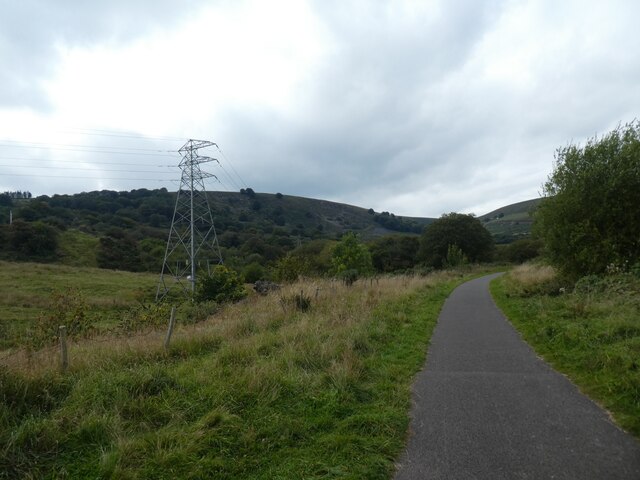
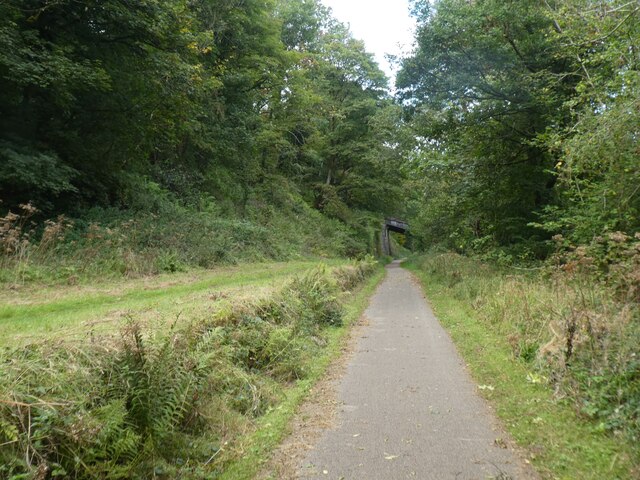
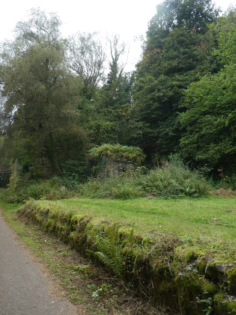
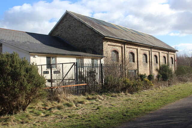
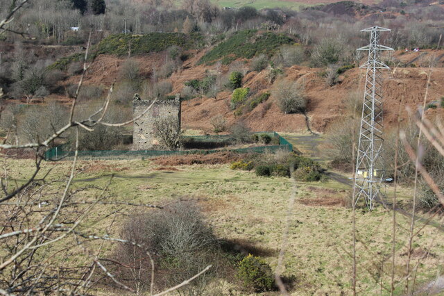
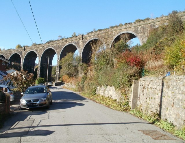
Abersychan is known for its rich industrial heritage. In the 19th century, it was a thriving coal mining area, with numerous collieries operating in the vicinity. The remnants of this industrial past can still be seen in the form of old mine buildings and disused railways. The community also played a significant role in the iron and steel industry during this time.

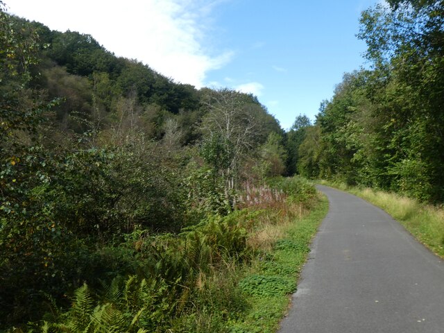
Today, Abersychan has transformed into a peaceful residential area with a strong sense of community. It offers a range of amenities, including shops, schools, and recreational facilities. The community is surrounded by picturesque countryside, making it an ideal place for nature lovers and outdoor enthusiasts.

Abersychan is also home to several notable landmarks and attractions. The St. Thomas Church, built in the 19th century, is a prominent feature in the area. The Pontypool and Blaenavon Railway, a heritage railway that runs through the community, is a popular tourist attraction, allowing visitors to experience a nostalgic journey on a steam train.

Overall, Abersychan is a charming community that combines its industrial past with natural beauty, providing residents and visitors with a unique blend of history and tranquility.

If you have any feedback on the listing, please let us know in the comments section below.

Abersychan Images

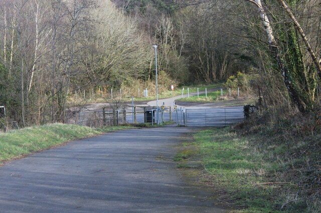
Images are sourced within 2km of 51.739186/-3.074475 or Grid Reference SO2505. Thanks to Geograph Open Source API. All images are credited.

Cycle route (former railway) near Pen-twyn The National Cycle Network is a network of cycle routes. It was created by the charity Sustrans <span class="nowrap"><a title="http://www.sustrans.org.uk/what-we-do/national-cycle-network" rel="nofollow ugc noopener" href="http://www.sustrans.org.uk/what-we-do/national-cycle-network">Link</a><img style="margin-left:2px;" alt="External link" title="External link - shift click to open in new window" src="https://s1.geograph.org.uk/img/external.png" width="10" height="10"/></span>  (Sustainable Transport), aided by a National Lottery grant.

Many routes aim to minimise contact with motor traffic, though 70% of them are on roads. In some cases the NCN uses pedestrian routes, disused railways, minor roads, canal towpaths, or traffic-calmed routes in towns and cities.
Cycle route (former railway) near Pen-twyn
The National Cycle Network is a network of cycle routes. It was created by the charity Sustrans LinkExternal link (Sustainable Transport), aided by a National Lottery grant. Many routes aim to minimise contact with motor traffic, though 70% of them are on roads. In some cases the NCN uses pedestrian routes, disused railways, minor roads, canal towpaths, or traffic-calmed routes in towns and cities.
Former railway building by NCN492
Bridge over NCN492 (former railway) The National Cycle Network is a network of cycle routes. It was created by the charity Sustrans <span class="nowrap"><a title="http://www.sustrans.org.uk/what-we-do/national-cycle-network" rel="nofollow ugc noopener" href="http://www.sustrans.org.uk/what-we-do/national-cycle-network">Link</a><img style="margin-left:2px;" alt="External link" title="External link - shift click to open in new window" src="https://s1.geograph.org.uk/img/external.png" width="10" height="10"/></span>  (Sustainable Transport), aided by a National Lottery grant.

Many routes aim to minimise contact with motor traffic, though 70% of them are on roads. In some cases the NCN uses pedestrian routes, disused railways, minor roads, canal towpaths, or traffic-calmed routes in towns and cities.
Bridge over NCN492 (former railway)
The National Cycle Network is a network of cycle routes. It was created by the charity Sustrans LinkExternal link (Sustainable Transport), aided by a National Lottery grant. Many routes aim to minimise contact with motor traffic, though 70% of them are on roads. In some cases the NCN uses pedestrian routes, disused railways, minor roads, canal towpaths, or traffic-calmed routes in towns and cities.
Cycle route (former railway) crossing viaduct in Talywain
Cycle track on old railway through Talywain The National Cycle Network is a network of cycle routes. It was created by the charity Sustrans <span class="nowrap"><a title="http://www.sustrans.org.uk/what-we-do/national-cycle-network" rel="nofollow ugc noopener" href="http://www.sustrans.org.uk/what-we-do/national-cycle-network">Link</a><img style="margin-left:2px;" alt="External link" title="External link - shift click to open in new window" src="https://s1.geograph.org.uk/img/external.png" width="10" height="10"/></span>  (Sustainable Transport), aided by a National Lottery grant.

Many routes aim to minimise contact with motor traffic, though 70% of them are on roads. In some cases the NCN uses pedestrian routes, disused railways, minor roads, canal towpaths, or traffic-calmed routes in towns and cities.
Cycle track on old railway through Talywain
The National Cycle Network is a network of cycle routes. It was created by the charity Sustrans LinkExternal link (Sustainable Transport), aided by a National Lottery grant. Many routes aim to minimise contact with motor traffic, though 70% of them are on roads. In some cases the NCN uses pedestrian routes, disused railways, minor roads, canal towpaths, or traffic-calmed routes in towns and cities.
NCN492 in Pen-y-lan Woods, using old railway line
Bridge over NCN492 The National Cycle Network is a network of cycle routes. It was created by the charity Sustrans <span class="nowrap"><a title="http://www.sustrans.org.uk/what-we-do/national-cycle-network" rel="nofollow ugc noopener" href="http://www.sustrans.org.uk/what-we-do/national-cycle-network">Link</a><img style="margin-left:2px;" alt="External link" title="External link - shift click to open in new window" src="https://s1.geograph.org.uk/img/external.png" width="10" height="10"/></span>  (Sustainable Transport), aided by a National Lottery grant.

Many routes aim to minimise contact with motor traffic, though 70% of them are on roads. In some cases the NCN uses pedestrian routes, disused railways, minor roads, canal towpaths, or traffic-calmed routes in towns and cities.
Bridge over NCN492
The National Cycle Network is a network of cycle routes. It was created by the charity Sustrans LinkExternal link (Sustainable Transport), aided by a National Lottery grant. Many routes aim to minimise contact with motor traffic, though 70% of them are on roads. In some cases the NCN uses pedestrian routes, disused railways, minor roads, canal towpaths, or traffic-calmed routes in towns and cities.
NCN492 passing former Varteg railway station The National Cycle Network is a network of cycle routes. It was created by the charity Sustrans <span class="nowrap"><a title="http://www.sustrans.org.uk/what-we-do/national-cycle-network" rel="nofollow ugc noopener" href="http://www.sustrans.org.uk/what-we-do/national-cycle-network">Link</a><img style="margin-left:2px;" alt="External link" title="External link - shift click to open in new window" src="https://s1.geograph.org.uk/img/external.png" width="10" height="10"/></span>  (Sustainable Transport), aided by a National Lottery grant.

Many routes aim to minimise contact with motor traffic, though 70% of them are on roads. In some cases the NCN uses pedestrian routes, disused railways, minor roads, canal towpaths, or traffic-calmed routes in towns and cities.
NCN492 passing former Varteg railway station
The National Cycle Network is a network of cycle routes. It was created by the charity Sustrans LinkExternal link (Sustainable Transport), aided by a National Lottery grant. Many routes aim to minimise contact with motor traffic, though 70% of them are on roads. In some cases the NCN uses pedestrian routes, disused railways, minor roads, canal towpaths, or traffic-calmed routes in towns and cities.
NCN492 in woodland near Gallowsgreen The National Cycle Network is a network of cycle routes. It was created by the charity Sustrans <span class="nowrap"><a title="http://www.sustrans.org.uk/what-we-do/national-cycle-network" rel="nofollow ugc noopener" href="http://www.sustrans.org.uk/what-we-do/national-cycle-network">Link</a><img style="margin-left:2px;" alt="External link" title="External link - shift click to open in new window" src="https://s1.geograph.org.uk/img/external.png" width="10" height="10"/></span>  (Sustainable Transport), aided by a National Lottery grant.

Many routes aim to minimise contact with motor traffic, though 70% of them are on roads. In some cases the NCN uses pedestrian routes, disused railways, minor roads, canal towpaths, or traffic-calmed routes in towns and cities.
NCN492 in woodland near Gallowsgreen
The National Cycle Network is a network of cycle routes. It was created by the charity Sustrans LinkExternal link (Sustainable Transport), aided by a National Lottery grant. Many routes aim to minimise contact with motor traffic, though 70% of them are on roads. In some cases the NCN uses pedestrian routes, disused railways, minor roads, canal towpaths, or traffic-calmed routes in towns and cities.
Overgrown railway platform and building, former Varteg station
Bridge over NCN492 with retaining wall The National Cycle Network is a network of cycle routes. It was created by the charity Sustrans <span class="nowrap"><a title="http://www.sustrans.org.uk/what-we-do/national-cycle-network" rel="nofollow ugc noopener" href="http://www.sustrans.org.uk/what-we-do/national-cycle-network">Link</a><img style="margin-left:2px;" alt="External link" title="External link - shift click to open in new window" src="https://s1.geograph.org.uk/img/external.png" width="10" height="10"/></span>  (Sustainable Transport), aided by a National Lottery grant.

Many routes aim to minimise contact with motor traffic, though 70% of them are on roads. In some cases the NCN uses pedestrian routes, disused railways, minor roads, canal towpaths, or traffic-calmed routes in towns and cities.
Bridge over NCN492 with retaining wall
The National Cycle Network is a network of cycle routes. It was created by the charity Sustrans LinkExternal link (Sustainable Transport), aided by a National Lottery grant. Many routes aim to minimise contact with motor traffic, though 70% of them are on roads. In some cases the NCN uses pedestrian routes, disused railways, minor roads, canal towpaths, or traffic-calmed routes in towns and cities.
The north side of the viaduct at Talywain
Underpass to cycle route from Pentwyn Road The subway goes under a former LNWR trackbed to NCR 492.
Underpass to cycle route from Pentwyn Road
The subway goes under a former LNWR trackbed to NCR 492.
Junction of cycle route with Pentwyn Road & The Promenade NCR 492 goes up to the left off Pentwyn Road, out of shot <a href="https://www.geograph.org.uk/photo/7107360">SO2603 : Cycle route 492 at Pentwyn Road</a>. The Promenade is on the route of a former mineral line which went through the historic 'Big Arch' at the end of the road to the British Iron Works.
Junction of cycle route with Pentwyn Road & The Promenade
NCR 492 goes up to the left off Pentwyn Road, out of shot SO2603 : Cycle route 492 at Pentwyn Road. The Promenade is on the route of a former mineral line which went through the historic 'Big Arch' at the end of the road to the British Iron Works.
Junction of Lodge Road & The Promenade Lodge Road, B4246, is on the left. The Promenade, on the route of a former mineral line <a href="https://www.geograph.org.uk/photo/7107211">SO2603 : Junction of cycle route with Pentwyn Road & The Promenade</a>, leads to NCR 492. Viewed from cycle route where it crosses 'Big Arch', part of the route of the mineral line.
Junction of Lodge Road & The Promenade
Lodge Road, B4246, is on the left. The Promenade, on the route of a former mineral line SO2603 : Junction of cycle route with Pentwyn Road & The Promenade, leads to NCR 492. Viewed from cycle route where it crosses 'Big Arch', part of the route of the mineral line.
Former goods shed, Abersychan & Talywain Station A LNWR goods shed from the 1870s, now an engineering works, next to NCR 492 on a former railway, foreground.
Former goods shed, Abersychan & Talywain Station
A LNWR goods shed from the 1870s, now an engineering works, next to NCR 492 on a former railway, foreground.
Cycle route 492 at Pentwyn Road The cycleway goes down through the squeeze stile to cross the end of Pentwyn Road and continues to the right on a former railway line <a href="https://www.geograph.org.uk/photo/7107211">SO2603 : Junction of cycle route with Pentwyn Road & The Promenade</a>.
Cycle route 492 at Pentwyn Road
The cycleway goes down through the squeeze stile to cross the end of Pentwyn Road and continues to the right on a former railway line SO2603 : Junction of cycle route with Pentwyn Road & The Promenade.
Derelict pumping engine house, The British Early Victorian sandstone engine house to drain the local coal mines.
Derelict pumping engine house, The British
Early Victorian sandstone engine house to drain the local coal mines.
Show me another place!

Abersychan is located at Grid Ref: SO2505 (Lat: 51.739186, Lng: -3.074475)

Unitary Authority: Torfaen

Police Authority: Gwent

What 3 Words

///remedy.brand.confetti. Near Blaenavon, Torfaen

Nearby Locations

Balance Meadows Abersychan

Related Wikis

Nearby Amenities

Located within 500m of 51.739186,-3.074475
Traffic Calming: bump
Lat/Long: 51.7377292/-3.0681614
Mini Roundabout
Direction: clockwise
Lat/Long: 51.7379755/-3.070902
Traffic Calming: bump
Lat/Long: 51.739197/-3.0685556
Power: tower
Lat/Long: 51.7354672/-3.0755711
Power: tower
Lat/Long: 51.736507/-3.0744365
Power: tower
Lat/Long: 51.7397874/-3.0737203
Power: tower
Lat/Long: 51.7419333/-3.0732295
Power: tower
Lat/Long: 51.7434031/-3.0729023
Direction: SSW
Generator Method: photovoltaic
Generator Output Electricity: yes
Generator Solar Modules: 14
Generator Source: solar
Generator Type: solar_photovoltaic_panel
Location: roof
Power: generator
Lat/Long: 51.7408892/-3.0679579
Direction: SSW
Generator Method: photovoltaic
Generator Output Electricity: yes
Generator Solar Modules: 14
Generator Source: solar
Generator Type: solar_photovoltaic_panel
Location: roof
Power: generator
Lat/Long: 51.7408643/-3.067851
Direction: SW
Generator Method: photovoltaic
Generator Output Electricity: yes
Generator Solar Modules: 8
Generator Source: solar
Generator Type: solar_photovoltaic_panel
Location: roof
Power: generator
Lat/Long: 51.7357263/-3.0702308
Direction: SW
Generator Method: photovoltaic
Generator Output Electricity: yes
Generator Solar Modules: 8
Generator Source: solar
Generator Type: solar_photovoltaic_panel
Location: roof
Power: generator
Lat/Long: 51.7359888/-3.0700162
Direction: SW
Generator Method: photovoltaic
Generator Output Electricity: yes
Generator Solar Modules: 8
Generator Source: solar
Generator Type: solar_photovoltaic_panel
Location: roof
Power: generator
Lat/Long: 51.7360386/-3.0700913
Direction: SW
Generator Method: photovoltaic
Generator Output Electricity: yes
Generator Solar Modules: 8
Generator Source: solar
Generator Type: solar_photovoltaic_panel
Location: roof
Power: generator
Lat/Long: 51.7363193/-3.0705097
Direction: SW
Generator Method: photovoltaic
Generator Output Electricity: yes
Generator Solar Modules: 8
Generator Source: solar
Generator Type: solar_photovoltaic_panel
Location: roof
Power: generator
Lat/Long: 51.7372296/-3.0710006
Direction: 255
Generator Method: photovoltaic
Generator Output Electricity: yes
Generator Solar Modules: 8
Generator Source: solar
Generator Type: solar_photovoltaic_panel
Location: roof
Power: generator
Lat/Long: 51.7369646/-3.0696689
Direction: 145
Generator Method: photovoltaic
Generator Output Electricity: yes
Generator Solar Modules: 8
Generator Source: solar
Generator Type: solar_photovoltaic_panel
Location: roof
Power: generator
Lat/Long: 51.7365153/-3.0698901
Direction: 145
Generator Method: photovoltaic
Generator Output Electricity: yes
Generator Solar Modules: 8
Generator Source: solar
Generator Type: solar_photovoltaic_panel
Location: roof
Power: generator
Lat/Long: 51.7365652/-3.0698016
Direction: SE
Generator Method: photovoltaic
Generator Output Electricity: yes
Generator Solar Modules: 8
Generator Source: solar
Generator Type: solar_photovoltaic_panel
Location: roof
Power: generator
Lat/Long: 51.7368932/-3.0702308
Direction: SW
Generator Method: photovoltaic
Generator Output Electricity: yes
Generator Solar Modules: 8
Generator Source: solar
Generator Type: solar_photovoltaic_panel
Location: roof
Power: generator
Lat/Long: 51.7369771/-3.0703247
Direction: 255
Generator Method: photovoltaic
Generator Output Electricity: yes
Generator Solar Modules: 8
Generator Source: solar
Generator Type: solar_photovoltaic_panel
Location: roof
Power: generator
Lat/Long: 51.7369688/-3.06998
Direction: SSW
Generator Method: photovoltaic
Generator Output Electricity: yes
Generator Solar Modules: 8
Generator Source: solar
Generator Type: solar_photovoltaic_panel
Location: roof
Power: generator
Lat/Long: 51.7375509/-3.0678128
Direction: SW
Generator Method: photovoltaic
Generator Output Electricity: yes
Generator Solar Modules: 13
Generator Source: solar
Generator Type: solar_photovoltaic_panel
Location: roof
Power: generator
Lat/Long: 51.7393706/-3.0689567
Direction: SSW
Generator Method: photovoltaic
Generator Output Electricity: yes
Generator Solar Modules: 12
Generator Source: solar
Generator Type: solar_photovoltaic_panel
Location: roof
Power: generator
Lat/Long: 51.7386264/-3.0683754
Direction: SW
Generator Method: photovoltaic
Generator Output Electricity: yes
Generator Solar Modules: 12
Generator Source: solar
Generator Type: solar_photovoltaic_panel
Location: roof
Power: generator
Lat/Long: 51.7399635/-3.0684739
Direction: 305
Generator Method: photovoltaic
Generator Output Electricity: yes
Generator Solar Modules: 10
Generator Source: solar
Generator Type: solar_photovoltaic_panel
Location: roof
Power: generator
Lat/Long: 51.7401578/-3.0706063
Direction: 305
Generator Method: photovoltaic
Generator Output Electricity: yes
Generator Solar Modules: 10
Generator Source: solar
Generator Type: solar_photovoltaic_panel
Location: roof
Power: generator
Lat/Long: 51.7402973/-3.0704266
Direction: 305
Generator Method: photovoltaic
Generator Output Electricity: yes
Generator Solar Modules: 10
Generator Source: solar
Generator Type: solar_photovoltaic_panel
Location: roof
Power: generator
Lat/Long: 51.740495/-3.0701906
Direction: 265
Generator Method: photovoltaic
Generator Output Electricity: yes
Generator Solar Modules: 5
Generator Source: solar
Generator Type: solar_photovoltaic_panel
Location: roof
Power: generator
Lat/Long: 51.7387651/-3.0676129
Direction: 85
Generator Method: photovoltaic
Generator Output Electricity: yes
Generator Solar Modules: 6
Generator Source: solar
Generator Type: solar_photovoltaic_panel
Location: roof
Power: generator
Lat/Long: 51.738766/-3.0675513
Direction: WNW
Generator Method: photovoltaic
Generator Output Electricity: yes
Generator Solar Modules: 7
Generator Source: solar
Generator Type: solar_photovoltaic_panel
Location: roof
Power: generator
Lat/Long: 51.7413175/-3.0683526
Direction: 175
Generator Method: photovoltaic
Generator Output Electricity: yes
Generator Solar Modules: 3
Generator Source: solar
Generator Type: solar_photovoltaic_panel
Location: roof
Power: generator
Lat/Long: 51.7387236/-3.0675741
Direction: 215
Generator Method: photovoltaic
Generator Output Electricity: yes
Generator Solar Modules: 12
Generator Source: solar
Generator Type: solar_photovoltaic_panel
Location: roof
Power: generator
Lat/Long: 51.7379471/-3.0688763
Direction: SW
Generator Method: photovoltaic
Generator Output Electricity: yes
Generator Solar Modules: 8
Generator Source: solar
Generator Type: solar_photovoltaic_panel
Location: roof
Power: generator
Lat/Long: 51.7370219/-3.070389
Direction: SSW
Generator Method: photovoltaic
Generator Output Electricity: yes
Generator Solar Modules: 10
Generator Source: solar
Generator Type: solar_photovoltaic_panel
Location: roof
Power: generator
Lat/Long: 51.7416194/-3.0696809
Direction: SSW
Generator Method: photovoltaic
Generator Output Electricity: yes
Generator Solar Modules: 14
Generator Source: solar
Generator Type: solar_photovoltaic_panel
Location: roof
Power: generator
Lat/Long: 51.7416626/-3.0698901
Direction: ESE
Generator Method: photovoltaic
Generator Output Electricity: yes
Generator Solar Modules: 7
Generator Source: solar
Generator Type: solar_photovoltaic_panel
Location: roof
Power: generator
Lat/Long: 51.7412939/-3.0682808
Direction: SE
Generator Method: photovoltaic
Generator Output Electricity: yes
Generator Solar Modules: 8
Generator Source: solar
Generator Type: solar_photovoltaic_panel
Location: roof
Power: generator
Lat/Long: 51.740539/-3.0685279
Pub
Garndiffaith Workmans
Addr City: Pontypool
Addr Postcode: NP4 7QJ
Addr Street: Herbert's Close
Alt Name: Garndiffaith Working Mens Club
Opening Hours: Mo Off; Tu Off; We-Th 16:00-23:30; Fr 15:00-00:00; Sa 12:00-23:30; Su 12:00-23:30
Phone: +44 1495 775 548
Lat/Long: 51.7377845/-3.0703697
Bus Stop
Bus: yes
Public Transport: platform
Lat/Long: 51.736509/-3.0725743
Bus Stop
Bus: yes
Naptan AtcoCode: 5340AWB30301
Naptan NaptanCode: toramwt
Public Transport: platform
Lat/Long: 51.7366602/-3.0726805
Bus Stop
Bus: yes
Public Transport: platform
Lat/Long: 51.736406/-3.0702561
Bus Stop
Bus: yes
Public Transport: platform
Lat/Long: 51.7363403/-3.0692475
Bus Stop
Bus: yes
Naptan AtcoCode: 5340AWB30321
Naptan NaptanCode: toramp
Public Transport: platform
Lat/Long: 51.7373572/-3.0698987
Bus Stop
Bus: yes
Naptan AtcoCode: 5340AWB30303
Naptan NaptanCode: torapag
Public Transport: platform
Lat/Long: 51.7395554/-3.0704614
Traffic Calming: bump
Lat/Long: 51.7386568/-3.0693249
Traffic Calming: bump
Lat/Long: 51.7399005/-3.0680362
The data included in this document is from www.openstreetmap.org. The data is made available under ODbL.

Have you been to Abersychan?

Leave your review of Abersychan below (or comments, questions and feedback).