Derwent Fells

Downs, Moorland in Cumberland Allerdale

England

Derwent Fells

Force Crag Pudding Beck has accumulated enough water to form a spectacular waterfall, Low Force, by the time it encounters the eponymous Force Crag. Although it hasn't cut much of a notch, and certainly nothing deep enough to be called a canyon, it nonetheless looks as if it would be a splendid venue for the sport of canyoning, albeit on a warmer day with perhaps less flow than today. To the right, the screes show evidence of mining activity which continued until quite recently, leaving scars which remind everyone that much of the Lake District National Park is, in fact, a highly degraded, post-industrial landscape slowly returning to nature, not helped one iota by the ugly buildings being declared an ancient monument rather than the former owners being pursued assiduously to cover the costs of removal and remediation.
Force Crag Credit: Andy Waddington

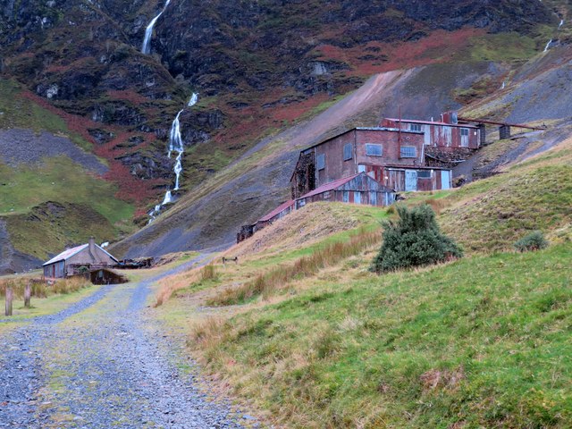
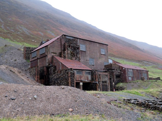
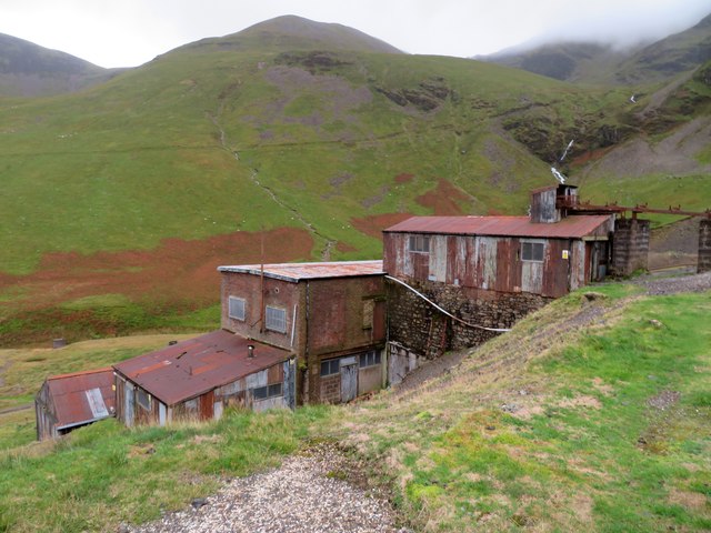
Derwent Fells, located in Cumberland, England, is a picturesque area encompassing a range of hills, downs, and moorland. Situated in the northwestern part of the Lake District National Park, it boasts stunning natural beauty and offers a wide array of outdoor activities for visitors to enjoy.

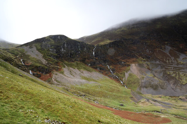
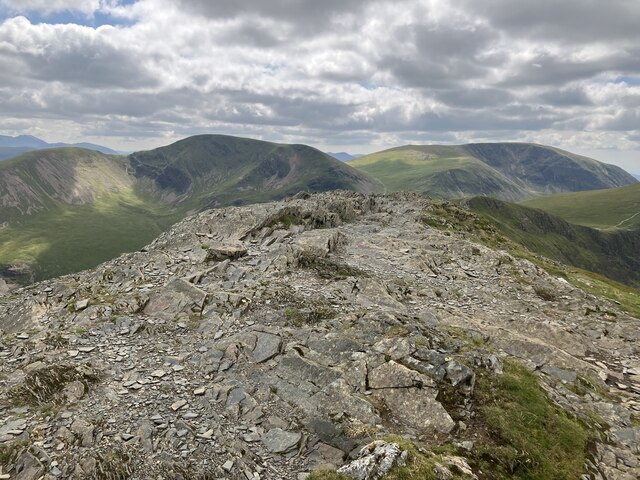
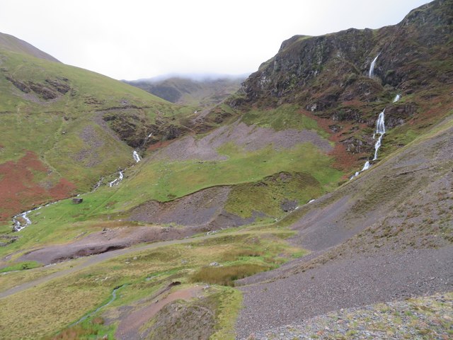
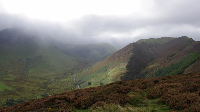
The landscape of Derwent Fells is characterized by rolling hills, expansive downs, and vast stretches of moorland. The hills rise gradually, providing gentle slopes that make for pleasant walking and hiking trails. The downs, with their open grassy spaces, offer panoramic views of the surrounding countryside, while the moorland provides a rugged and wild terrain, dotted with heather and bracken.

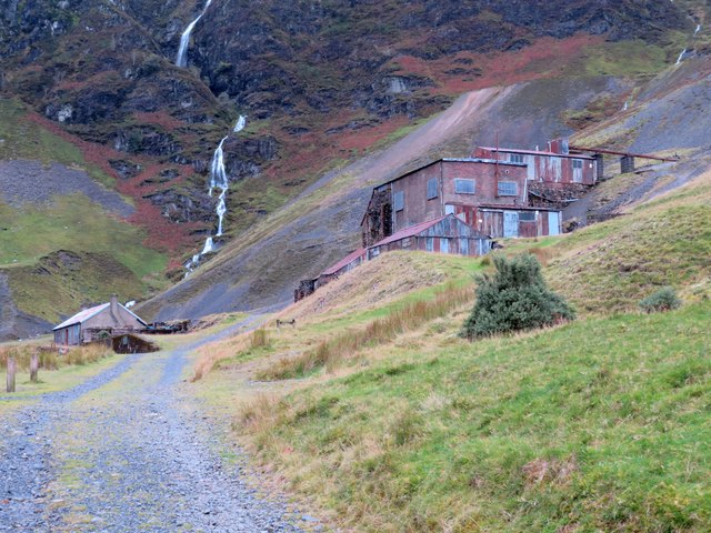
The area is intersected by several rivers and streams, the most prominent being the River Derwent, which meanders through the Fells, adding to the charm of the landscape. This water also provides opportunities for fishing, with the River Derwent being renowned for its trout and salmon.

Derwent Fells is a haven for nature enthusiasts, as it is home to a diverse range of wildlife. Visitors may catch a glimpse of red deer, foxes, and various bird species, including buzzards and curlews. The flora is equally impressive, with colorful wildflowers adorning the hills and moorland during the spring and summer months.

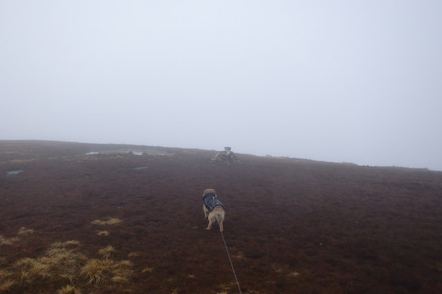
The Fells are a popular destination for outdoor activities such as walking, hiking, cycling, and birdwatching. There are numerous well-maintained trails and paths that cater to different levels of difficulty, ensuring there is something for everyone. Additionally, the Fells offer opportunities for rock climbing, horse riding, and picnicking, making it a versatile destination for outdoor enthusiasts.

Overall, Derwent Fells, Cumberland, is a captivating region filled with natural beauty, diverse wildlife, and a plethora of outdoor activities, making it an idyllic location for nature lovers and adventure seekers alike.

If you have any feedback on the listing, please let us know in the comments section below.

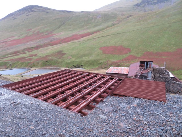
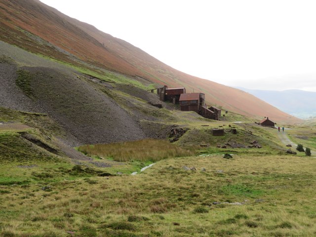
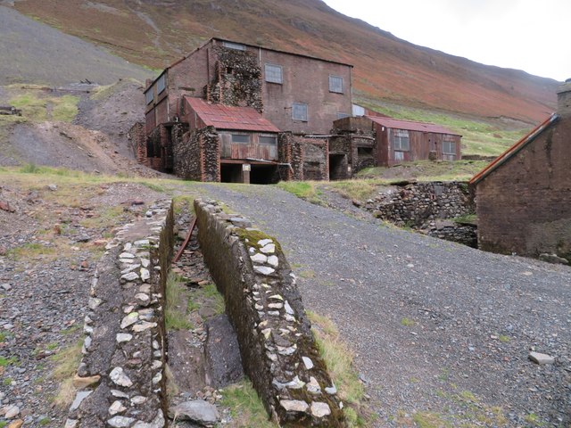
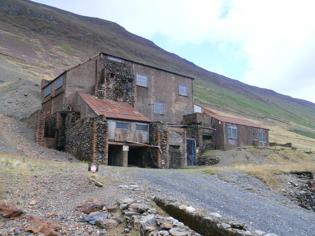
Derwent Fells Images

Images are sourced within 2km of 54.581369/-3.2168972 or Grid Reference NY2121. Thanks to Geograph Open Source API. All images are credited.

Force Crag Pudding Beck has accumulated enough water to form a spectacular waterfall, Low Force, by the time it encounters the eponymous Force Crag. Although it hasn't cut much of a notch, and certainly nothing deep enough to be called a canyon, it nonetheless looks as if it would be a splendid venue for the sport of canyoning, albeit on a warmer day with perhaps less flow than today. To the right, the screes show evidence of mining activity which continued until quite recently, leaving scars which remind everyone that much of the Lake District National Park is, in fact, a highly degraded, post-industrial landscape slowly returning to nature, not helped one iota by the ugly buildings being declared an ancient monument rather than the former owners being pursued assiduously to cover the costs of removal and remediation.
Force Crag
Pudding Beck has accumulated enough water to form a spectacular waterfall, Low Force, by the time it encounters the eponymous Force Crag. Although it hasn't cut much of a notch, and certainly nothing deep enough to be called a canyon, it nonetheless looks as if it would be a splendid venue for the sport of canyoning, albeit on a warmer day with perhaps less flow than today. To the right, the screes show evidence of mining activity which continued until quite recently, leaving scars which remind everyone that much of the Lake District National Park is, in fact, a highly degraded, post-industrial landscape slowly returning to nature, not helped one iota by the ugly buildings being declared an ancient monument rather than the former owners being pursued assiduously to cover the costs of removal and remediation.
Grisedale Pike summit
Force Crag Mine, Coledale At the head of Coledale is the Scheduled ancient Monument that is the Force Crag Mine processing plant. The mine variously mined silver, lead and barytes, closing in 1990 and passing into the care of the National Trust. In 2023 there were three open days at the processing plant but this wasn't one of them. The walk in is approximately 4 kilometres.
Force Crag Mine, Coledale
At the head of Coledale is the Scheduled ancient Monument that is the Force Crag Mine processing plant. The mine variously mined silver, lead and barytes, closing in 1990 and passing into the care of the National Trust. In 2023 there were three open days at the processing plant but this wasn't one of them. The walk in is approximately 4 kilometres.
Force Crag Mine, Coledale At the head of Coledale is the Scheduled Ancient Monument that is the Force Crag Mine processing plant. The mine variously mined silver, lead and barytes, closing in 1990 and passing into the care of the National Trust. In 2023 there were three open days at the processing plant but this wasn't one of them. The walk in is approximately 4 kilometres.
Force Crag Mine, Coledale
At the head of Coledale is the Scheduled Ancient Monument that is the Force Crag Mine processing plant. The mine variously mined silver, lead and barytes, closing in 1990 and passing into the care of the National Trust. In 2023 there were three open days at the processing plant but this wasn't one of them. The walk in is approximately 4 kilometres.
Force Crag Mine, Coledale - processing plant At the head of Coledale is the Scheduled Ancient Monument that is the Force Crag Mine processing plant. The mine variously mined silver, lead and barytes, closing in 1990 and passing into the care of the National Trust. In 2023 there were three open days at the processing plant but this wasn't one of them. The walk in is approximately 4 kilometres.
Force Crag Mine, Coledale - processing plant
At the head of Coledale is the Scheduled Ancient Monument that is the Force Crag Mine processing plant. The mine variously mined silver, lead and barytes, closing in 1990 and passing into the care of the National Trust. In 2023 there were three open days at the processing plant but this wasn't one of them. The walk in is approximately 4 kilometres.
Force Crag Mine, Coledale - Level 1 entrance At the head of Coledale is the Scheduled Ancient Monument that is the Force Crag Mine processing plant. The mine variously mined silver, lead and barytes, closing in 1990 and passing into the care of the National Trust. In 2023 there were three open days at the processing plant but this wasn't one of them. The walk in is approximately 4 kilometres.
This shows the entrance to Level 1 that is above the processing plant. This has a gate just inside the opening. The manhole in the foreground covers the drainage water that can be heard rushing forth below.
Force Crag Mine, Coledale - Level 1 entrance
At the head of Coledale is the Scheduled Ancient Monument that is the Force Crag Mine processing plant. The mine variously mined silver, lead and barytes, closing in 1990 and passing into the care of the National Trust. In 2023 there were three open days at the processing plant but this wasn't one of them. The walk in is approximately 4 kilometres. This shows the entrance to Level 1 that is above the processing plant. This has a gate just inside the opening. The manhole in the foreground covers the drainage water that can be heard rushing forth below.
Force Crag Mine, Coledale - grizzly At the head of Coledale is the Scheduled Ancient Monument that is the Force Crag Mine processing plant. The mine variously mined silver, lead and barytes, closing in 1990 and passing into the care of the National Trust. In 2023 there were three open days at the processing plant but this wasn't one of them. The walk in is approximately 4 kilometres.
This shows the very coarse sieve or grizzly where the ore is tipped out to be screened and then transported to the processing plant below.
Force Crag Mine, Coledale - grizzly
At the head of Coledale is the Scheduled Ancient Monument that is the Force Crag Mine processing plant. The mine variously mined silver, lead and barytes, closing in 1990 and passing into the care of the National Trust. In 2023 there were three open days at the processing plant but this wasn't one of them. The walk in is approximately 4 kilometres. This shows the very coarse sieve or grizzly where the ore is tipped out to be screened and then transported to the processing plant below.
Force Crag Mine, Coledale At the head of Coledale is the Scheduled Ancient Monument that is the Force Crag Mine processing plant. The mine variously mined silver, lead and barytes, closing in 1990 and passing into the care of the National Trust. In 2023 there were three open days at the processing plant but this wasn't one of them. The walk in is approximately 4 kilometres.
Force Crag Mine, Coledale
At the head of Coledale is the Scheduled Ancient Monument that is the Force Crag Mine processing plant. The mine variously mined silver, lead and barytes, closing in 1990 and passing into the care of the National Trust. In 2023 there were three open days at the processing plant but this wasn't one of them. The walk in is approximately 4 kilometres.
The head of Coledale from Force Crag Mine The positions are approximations.
The head of Coledale from Force Crag Mine
The positions are approximations.
Force Crag Mine, Coledale At the head of Coledale is the Scheduled Ancient Monument that is the Force Crag Mine processing plant. The mine variously mined silver, lead and barytes, closing in 1990 and passing into the care of the National Trust. In 2023 there were three open days at the processing plant but this wasn't one of them. The walk in is approximately 4 kilometres.
Force Crag Mine, Coledale
At the head of Coledale is the Scheduled Ancient Monument that is the Force Crag Mine processing plant. The mine variously mined silver, lead and barytes, closing in 1990 and passing into the care of the National Trust. In 2023 there were three open days at the processing plant but this wasn't one of them. The walk in is approximately 4 kilometres.
On Aikin Knott Hindscarth and Robinson are in cloud on the left, with Keskadale below. Knott Rigg is on the right.
On Aikin Knott
Hindscarth and Robinson are in cloud on the left, with Keskadale below. Knott Rigg is on the right.
Force Cragg Mine buildings The mine is up a long track west of Keswick.
Force Cragg Mine buildings
The mine is up a long track west of Keswick.
Approaching Sail Summit Another misty day on the fells
Approaching Sail Summit
Another misty day on the fells
Force Crag Mine
Force Crag Mine
Force Crag Mine
Force Crag Mine
Force Crag Mine
Force Crag Mine
Show me another place!

Derwent Fells is located at Grid Ref: NY2121 (Lat: 54.581369, Lng: -3.2168972)

Administrative County: Cumbria

District: Allerdale

Police Authority: Cumbria

What 3 Words

///zoomed.hope.outermost. Near Keswick, Cumbria

Related Wikis

Outerside

Outerside is a fell in the Lake District in Cumbria, England. It is located 6 kilometres (4 miles) west of Keswick in the north western part of the national...

Rowling End

Rowling End is a peak in the Lake District about 433 meters it is a steep slope leading up towards Causey Pike. It is briefly mentioned in books however...

Causey Pike

Causey Pike is a fell in the English Lake District. It is situated in the Newlands Valley, 5 kilometres (3 miles) south-west of the town of Keswick. Even...

Scar Crags

Scar Crags is a fell in the north western part of the English Lake District in the county of Cumbria. It is one of the Coledale group of fells situated...

Nearby Amenities

Located within 500m of 54.581369,-3.2168972
Outerside
Ele: 568
Natural: peak
Source: npe
Wikidata: Q7112053
Wikipedia: en:Outerside
Lat/Long: 54.58216/-3.2221425
The data included in this document is from www.openstreetmap.org. The data is made available under ODbL.

Have you been to Derwent Fells?

Leave your review of Derwent Fells below (or comments, questions and feedback).