Reidhlean na Cloiche
Downs, Moorland in Caithness
Scotland
Reidhlean na Cloiche
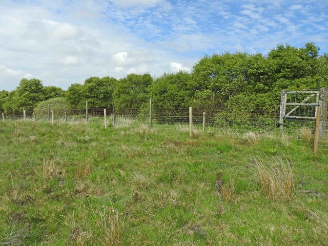
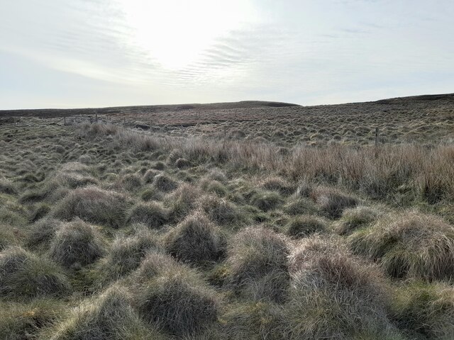
Reidhlean na Cloiche, also known as Caithness Downs or Moorland, is a vast and picturesque landscape located in Caithness, Scotland. Spanning approximately 200 square miles, it is characterized by its rolling hills, heather-covered moors, and scattered rock formations.
The area is mostly made up of peat bogs, which have been formed over thousands of years and provide a unique habitat for various flora and fauna. The moorland is home to a diverse range of wildlife, including red deer, mountain hares, and various bird species, such as curlews and golden plovers.
Reidhlean na Cloiche offers breathtaking views, with its rugged terrain and panoramic vistas stretching out as far as the eye can see. The landscape is dotted with ancient archaeological sites, including standing stones and burial cairns, which provide a glimpse into the area's rich history.
Due to its remote location, the area is largely untouched by human development, allowing visitors to experience a sense of tranquility and solitude. Hiking and nature enthusiasts are drawn to Reidhlean na Cloiche for its extensive network of trails, which offer opportunities for exploration and wildlife spotting. The moorland is also popular among birdwatchers, who come to witness the impressive displays of birdlife during the breeding season.
Overall, Reidhlean na Cloiche, Caithness Downs, is a captivating and unspoiled landscape that showcases the beauty of Scotland's natural heritage.
If you have any feedback on the listing, please let us know in the comments section below.
Reidhlean na Cloiche Images
Images are sourced within 2km of 58.371123/-3.3444828 or Grid Reference ND2143. Thanks to Geograph Open Source API. All images are credited.


Reidhlean na Cloiche is located at Grid Ref: ND2143 (Lat: 58.371123, Lng: -3.3444828)
Unitary Authority: Highland
Police Authority: Highlands and Islands
What 3 Words
///boater.bigger.dreamers. Near Dunbeath, Highland
Nearby Locations
Related Wikis

Achavanich
Achavanich ( ak-ə-VAN-ik; Scottish Gaelic: Achadh a’ Mhanaich) is an unusual megalithic horseshoe-shaped structure near Loch Stemster in Caithness, Scotland...
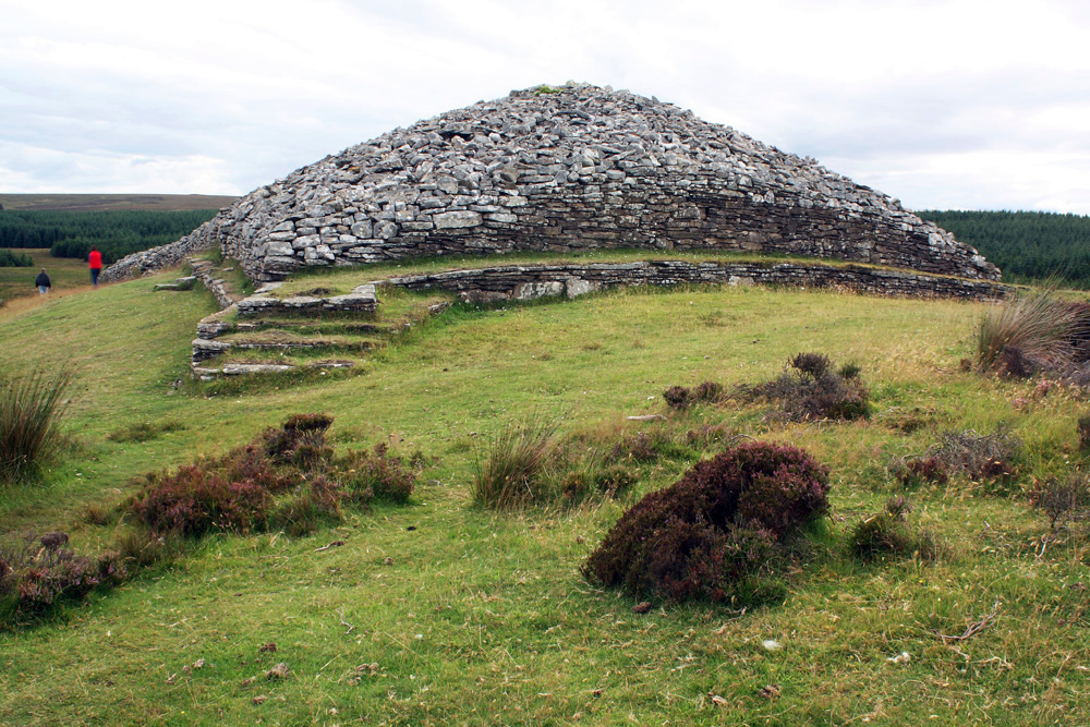
Grey Cairns of Camster
The Grey Cairns of Camster are two large Neolithic chambered cairns located about 8+1⁄2 miles (14 kilometres) south of Watten and 5 miles (8 km) north...

Rumster Forest transmitting station
The Rumster Forest transmitting station is a broadcasting and telecommunications facility near the town of Wick, in Caithness, Scotland (grid reference...

Upper Camster
Upper Camster is a small hamlet, which lies at the source of the Camster Burn, 4 miles north of Lybster, in Caithness, Scottish Highlands and is in the...
Achairn Burn
Achairn Burn, known also as Haster Burn, is one of the major tributaries of Wick River, in Caithness, in the Highland area of Scotland. The burn's source...
Roster, Caithness
Roster is a remote scattered crofting township, in Caithness, Scottish Highlands and is in the Scottish council area of Highland. Roster is located 2 miles...
Upper Lybster
Upper Lybster is a scattered and crofting village, situated 2 miles north of Lybster, in eastern Caithness, Scottish Highlands and is in the Scottish council...
Parkside Halt railway station
Parkside Halt was a railway station located between Ulbster and Lybster, Highland. == History == The station was opened on the Wick and Lybster Railway...
Have you been to Reidhlean na Cloiche?
Leave your review of Reidhlean na Cloiche below (or comments, questions and feedback).