Bad a' Chreagain

Downs, Moorland in Morayshire

Scotland

Bad a' Chreagain

Wetland, Dava Moor
Wetland, Dava Moor Credit: Richard Webb

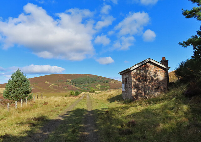
Bad a' Chreagain is a small rural settlement located in the county of Morayshire, Scotland. Situated on the eastern edge of the Highlands, it is known for its picturesque downs and moorland landscapes. The name "Bad a' Chreagain" translates to "place of the rocky hill" in Gaelic, which accurately describes the terrain of the area.

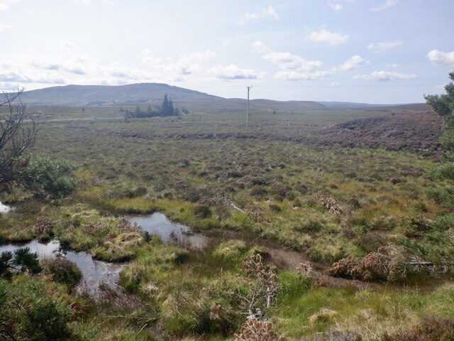
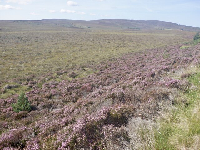
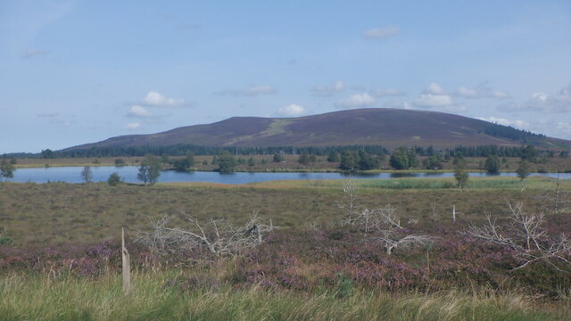
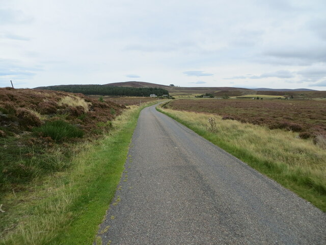
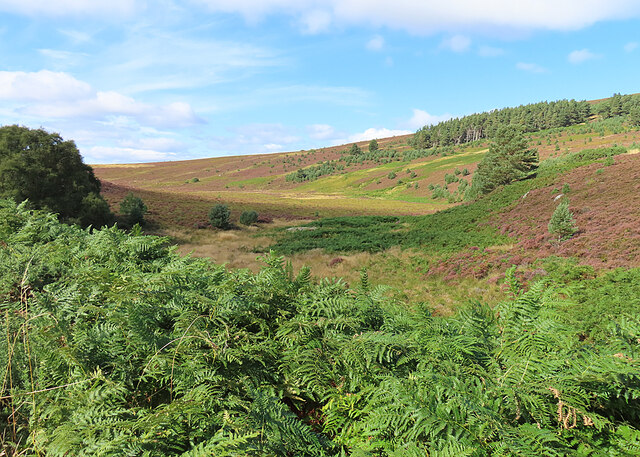
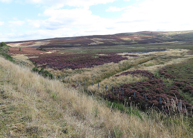
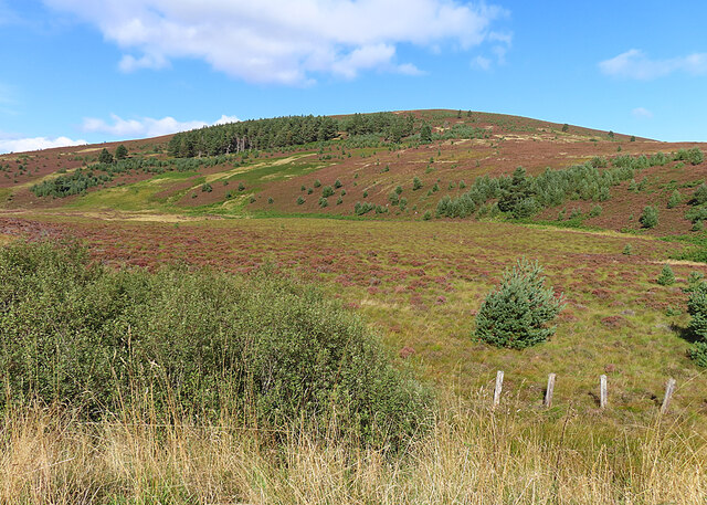
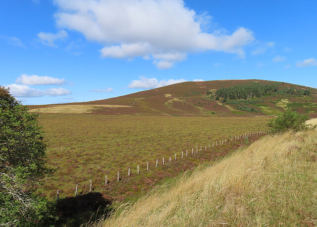
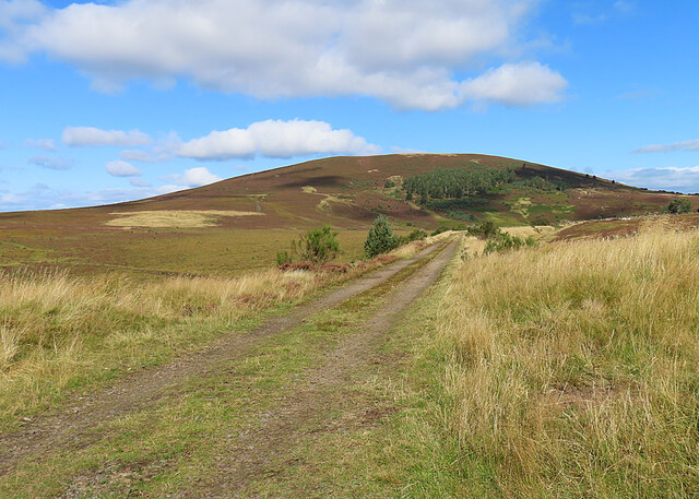
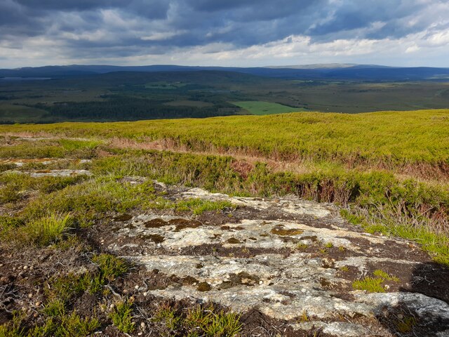
The downs of Bad a' Chreagain are characterized by rolling hills and grassy plains, offering breathtaking views of the surrounding countryside. The rich greenery is dotted with clusters of trees, adding to the natural beauty of the landscape. This area is popular among hikers, nature enthusiasts, and photographers, who are drawn to the tranquility and untouched beauty of the downs.

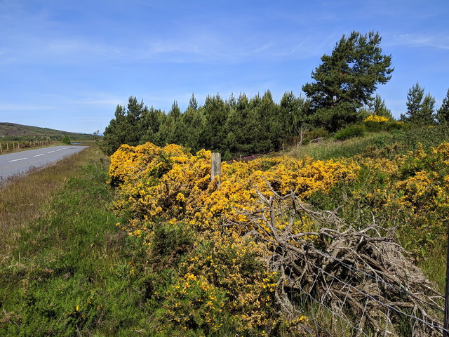
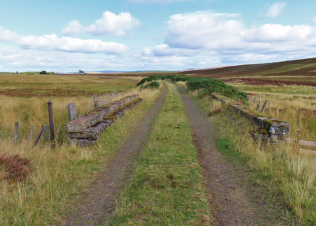
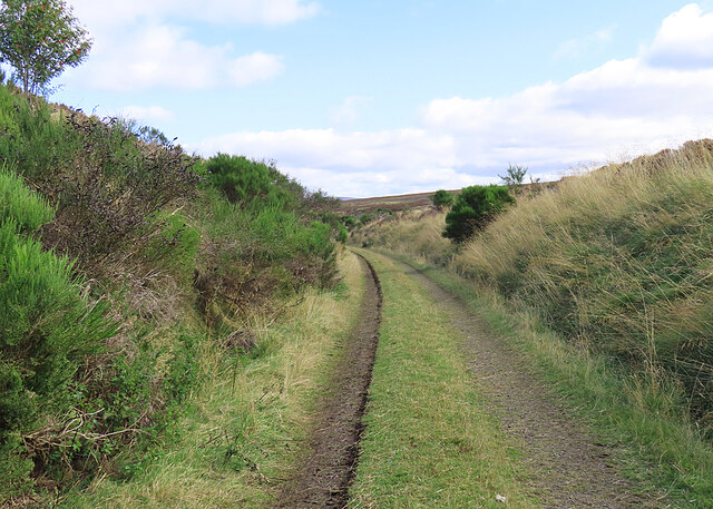
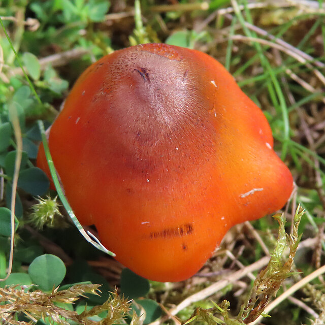
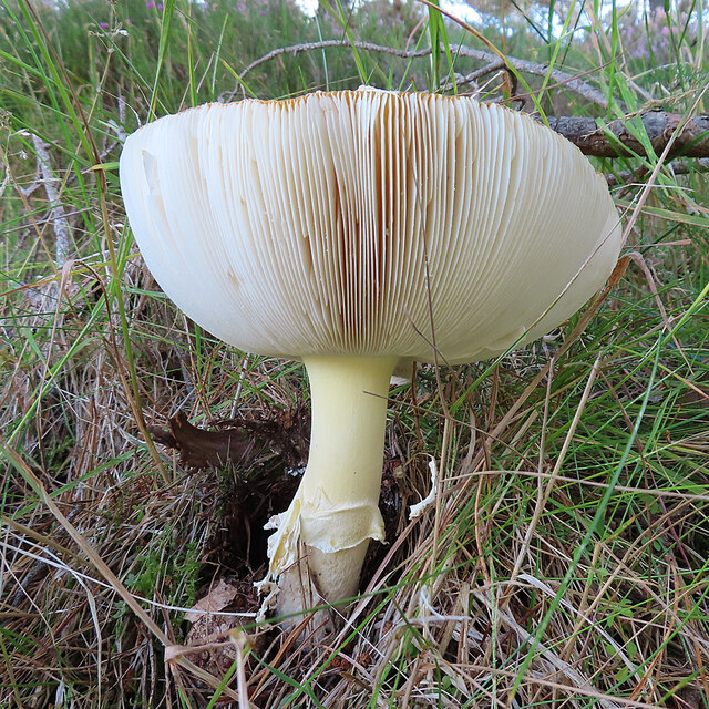
The moorland in Bad a' Chreagain is a vast expanse of heather and wildflowers, creating a vibrant and colorful display during the summer months. The moors are home to a diverse range of wildlife, including birds, small mammals, and insects. Walking along the moorland paths, visitors can enjoy the peacefulness of the surroundings and perhaps catch a glimpse of the elusive Scottish wildcat or red deer.

Despite its remote location, Bad a' Chreagain is not far from the town of Elgin, which offers amenities such as accommodation, restaurants, and shops. The nearby Glen Moray distillery is also a popular attraction for whisky enthusiasts.

Overall, Bad a' Chreagain is a hidden gem in Morayshire, offering a serene escape into Scotland's natural beauty. Whether strolling through the downs or exploring the moorland, visitors are sure to be captivated by the charm and tranquility of this picturesque countryside.

If you have any feedback on the listing, please let us know in the comments section below.

Bad a' Chreagain Images

Images are sourced within 2km of 57.434465/-3.647249 or Grid Reference NJ0139. Thanks to Geograph Open Source API. All images are credited.

Wetland, Dava Moor
Wetland, Dava Moor
Dava Moor Beside the A939.
Dava Moor
Beside the A939.
Loch Allan and Knock of Braemoray On Dava Moor at heather time.
Loch Allan and Knock of Braemoray
On Dava Moor at heather time.
A939 near Loch Allan A short section of the A939 passes through this grid square.
A939 near Loch Allan
A short section of the A939 passes through this grid square.
Flowering gorse bushes next to the A939
Moorland minor road near Dava Looking north-eastward.
Moorland minor road near Dava
Looking north-eastward.
Dava Way This bridge seems to have uninterrupted parapets. (See <a href="https://www.geograph.org.uk/photo/7287759">NJ0242 : Inverness and Perth Junction Railway</a> and <a href="https://www.geograph.org.uk/photo/7287763">NJ0242 : Inverness and Perth Junction Railway</a>.) Note the classic iron fence post on the left. They seem to have been used by all the railway companies.
Dava Way
This bridge seems to have uninterrupted parapets. (See NJ0242 : Inverness and Perth Junction Railway and NJ0242 : Inverness and Perth Junction Railway.) Note the classic iron fence post on the left. They seem to have been used by all the railway companies.
Railway Trackbed This was the trackbed of the Inverness and Perth Junction Railway, and is now maintained by volunteers as part of the Dava Way.
Railway Trackbed
This was the trackbed of the Inverness and Perth Junction Railway, and is now maintained by volunteers as part of the Dava Way.
Fungus Growing in the middle of the path.
Fungus
Growing in the middle of the path.
Glacial Channel This flat-bottomed boggy channel is far too wide to have been created by the very minor burn that drains it, so is obviously of glacial origin.
Glacial Channel
This flat-bottomed boggy channel is far too wide to have been created by the very minor burn that drains it, so is obviously of glacial origin.
Coire Gorm It looks as if this has at one time been a loch, probably of glacial origin. In spite of the ditch across it, it looks pretty boggy.
Coire Gorm
It looks as if this has at one time been a loch, probably of glacial origin. In spite of the ditch across it, it looks pretty boggy.
Knock of Braemoray Between the former railway and the gently-sloping Knock of Braemoray is a flat boggy area formed at the end of the last Ice Age.
Knock of Braemoray
Between the former railway and the gently-sloping Knock of Braemoray is a flat boggy area formed at the end of the last Ice Age.
Knock of Braemoray There's a wide swathe of boggy flat ground between the former railway line and the Knock of Braemoray.
Knock of Braemoray
There's a wide swathe of boggy flat ground between the former railway line and the Knock of Braemoray.
Highland Railway Trackbed Originally part of the Inverness and Perth Junction Railway, the line became part of the Highland Railway when the various railway companies merged.
Highland Railway Trackbed
Originally part of the Inverness and Perth Junction Railway, the line became part of the Highland Railway when the various railway companies merged.
Fungus A fungus with its cap upturned to form a sort of cup, thus displaying its gills.
Fungus
A fungus with its cap upturned to form a sort of cup, thus displaying its gills.
Hut beside the Track There's an information board on the wall of the hut, but it doesn't say who built it or why. Probably the railwaymen, to provide some shelter in bad weather.
Hut beside the Track
There's an information board on the wall of the hut, but it doesn't say who built it or why. Probably the railwaymen, to provide some shelter in bad weather.
Fungus This young toadstool has just emerged from the ground.
Fungus
This young toadstool has just emerged from the ground.
Rock Exposure An exposure of rock on the Knock of Braemoray.
Rock Exposure
An exposure of rock on the Knock of Braemoray.
Show me another place!

Bad a' Chreagain is located at Grid Ref: NJ0139 (Lat: 57.434465, Lng: -3.647249)

Unitary Authority: Moray

Police Authority: North East

What 3 Words

///poorly.stencil.bead. Near Grantown-on-Spey, Highland

Related Wikis

Dava railway station

Dava railway station was opened in 1864, on the Inverness and Perth Junction Railway, one year after the route was opened. == Station layout == The station...

Dorback Burn, Findhorn

The Dorback Burn (Scottish Gaelic: Dorbag / Uisge Dhorbaig) is a right-bank tributary of the River Findhorn in northeast Scotland. It emerges from the...

Lochindorb

Lochindorb (from the Scottish Gaelic: Loch nan Doirb meaning "loch of the minnows") is a freshwater loch north of Grantown on Spey in the Highland council...

Edinkillie House

Edinkillie House is a country house in Edinkillie in Moray, Scotland, built in 1822–1823 by John Paterson as a manse for the nearby Edinkillie Church....

Nearby Amenities

Located within 500m of 57.434465,-3.647249
Power: pole
Lat/Long: 57.4314579/-3.6532334
Power: pole
Lat/Long: 57.4321287/-3.653089
Power: pole
Lat/Long: 57.4326546/-3.6524357
The data included in this document is from www.openstreetmap.org. The data is made available under ODbL.

Have you been to Bad a' Chreagain?

Leave your review of Bad a' Chreagain below (or comments, questions and feedback).