Carn Biorach

Hill, Mountain in Morayshire

Scotland

Carn Biorach

Wetland, Dava Moor
Wetland, Dava Moor Credit: Richard Webb

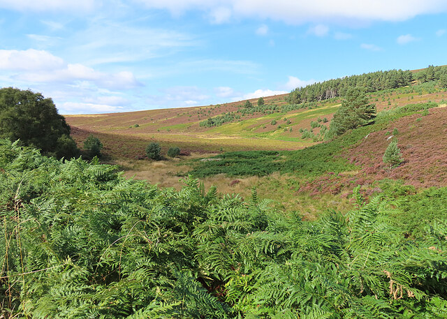
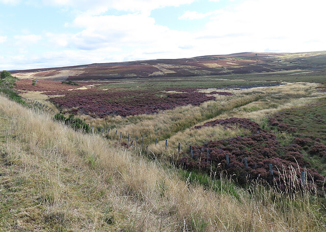
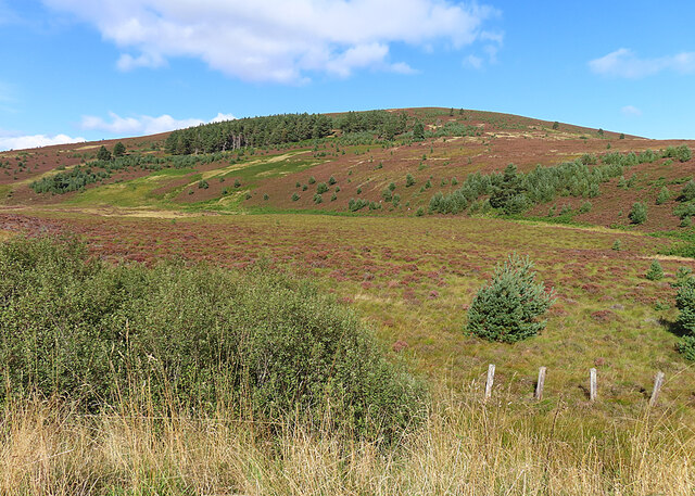
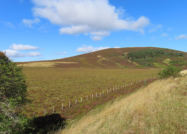
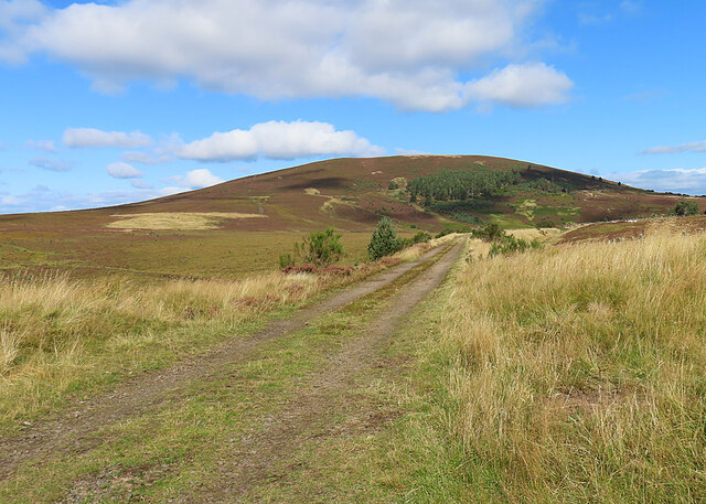
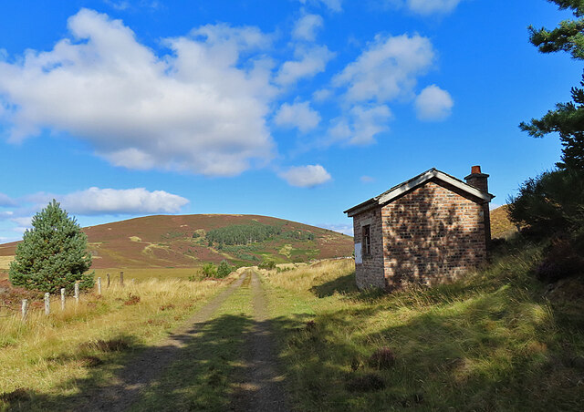
Carn Biorach is a prominent hill located in Morayshire, a historic county in Scotland. Rising to a height of approximately 509 meters (1,670 feet), it is a popular destination for hikers and nature enthusiasts. Situated near the village of Tomintoul, Carn Biorach offers breathtaking panoramic views of the surrounding countryside.

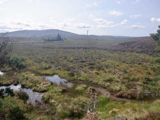
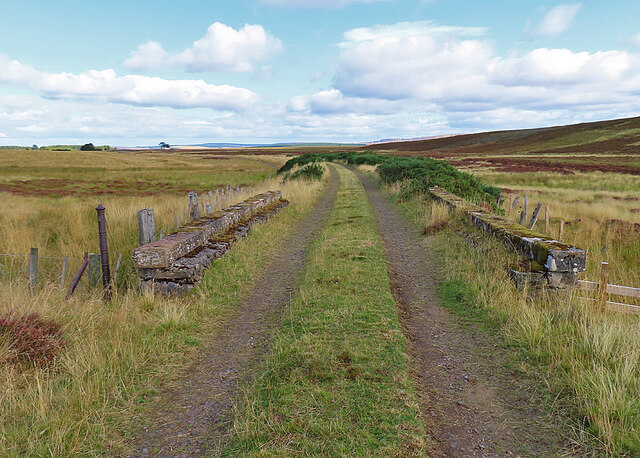
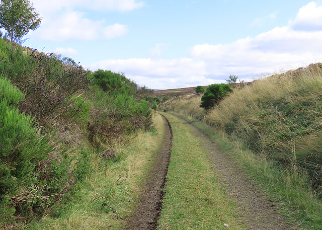
The hill is characterized by its distinctive pyramid shape, which stands out against the rolling landscape of Morayshire. Its slopes are covered in heather and grass, providing a picturesque backdrop for those who venture to its summit. The ascent to the top can be challenging, with some steep sections and uneven terrain, making it an ideal destination for experienced walkers.

At the summit of Carn Biorach, visitors are rewarded with stunning vistas of the Cairngorms National Park, which lies to the south. On a clear day, it is possible to see the iconic peaks of Ben Macdui and Braeriach in the distance, adding to the allure of the hill.

Aside from its natural beauty, Carn Biorach also holds historical significance. The hill has been a site of human activity for centuries, with evidence of prehistoric settlements and burial cairns found in the area. These archaeological remains contribute to the rich cultural heritage of Morayshire.

In conclusion, Carn Biorach is a striking hill in Morayshire, Scotland, known for its pyramid shape, stunning views, and historical significance. Its challenging ascent and picturesque surroundings make it a must-visit destination for outdoor enthusiasts and those seeking a deeper connection to the region's natural and cultural heritage.

If you have any feedback on the listing, please let us know in the comments section below.

Carn Biorach Images

Images are sourced within 2km of 57.431095/-3.6355543 or Grid Reference NJ0139. Thanks to Geograph Open Source API. All images are credited.

Wetland, Dava Moor
Wetland, Dava Moor
Dava Way This bridge seems to have uninterrupted parapets. (See <a href="https://www.geograph.org.uk/photo/7287759">NJ0242 : Inverness and Perth Junction Railway</a> and <a href="https://www.geograph.org.uk/photo/7287763">NJ0242 : Inverness and Perth Junction Railway</a>.) Note the classic iron fence post on the left. They seem to have been used by all the railway companies.
Dava Way
This bridge seems to have uninterrupted parapets. (See NJ0242 : Inverness and Perth Junction Railway and NJ0242 : Inverness and Perth Junction Railway.) Note the classic iron fence post on the left. They seem to have been used by all the railway companies.
Railway Trackbed This was the trackbed of the Inverness and Perth Junction Railway, and is now maintained by volunteers as part of the Dava Way.
Railway Trackbed
This was the trackbed of the Inverness and Perth Junction Railway, and is now maintained by volunteers as part of the Dava Way.
Fungus Growing in the middle of the path.
Fungus
Growing in the middle of the path.
Glacial Channel This flat-bottomed boggy channel is far too wide to have been created by the very minor burn that drains it, so is obviously of glacial origin.
Glacial Channel
This flat-bottomed boggy channel is far too wide to have been created by the very minor burn that drains it, so is obviously of glacial origin.
Coire Gorm It looks as if this has at one time been a loch, probably of glacial origin. In spite of the ditch across it, it looks pretty boggy.
Coire Gorm
It looks as if this has at one time been a loch, probably of glacial origin. In spite of the ditch across it, it looks pretty boggy.
Knock of Braemoray Between the former railway and the gently-sloping Knock of Braemoray is a flat boggy area formed at the end of the last Ice Age.
Knock of Braemoray
Between the former railway and the gently-sloping Knock of Braemoray is a flat boggy area formed at the end of the last Ice Age.
Knock of Braemoray There's a wide swathe of boggy flat ground between the former railway line and the Knock of Braemoray.
Knock of Braemoray
There's a wide swathe of boggy flat ground between the former railway line and the Knock of Braemoray.
Highland Railway Trackbed Originally part of the Inverness and Perth Junction Railway, the line became part of the Highland Railway when the various railway companies merged.
Highland Railway Trackbed
Originally part of the Inverness and Perth Junction Railway, the line became part of the Highland Railway when the various railway companies merged.
Fungus A fungus with its cap upturned to form a sort of cup, thus displaying its gills.
Fungus
A fungus with its cap upturned to form a sort of cup, thus displaying its gills.
Hut beside the Track There's an information board on the wall of the hut, but it doesn't say who built it or why. Probably the railwaymen, to provide some shelter in bad weather.
Hut beside the Track
There's an information board on the wall of the hut, but it doesn't say who built it or why. Probably the railwaymen, to provide some shelter in bad weather.
Fungus This young toadstool has just emerged from the ground.
Fungus
This young toadstool has just emerged from the ground.
Road junction, Dava Very much an East of Scotland speciality, AA box and pine trees. The road on the left (A939) follows the course of Caulfeild's road from Grantown to Fort George.
Road junction, Dava
Very much an East of Scotland speciality, AA box and pine trees. The road on the left (A939) follows the course of Caulfeild's road from Grantown to Fort George.
Young trees, Dava Scattered self seeded Scots pines beside the A939.
Young trees, Dava
Scattered self seeded Scots pines beside the A939.
Loch Allan AA box at Dava This seems to have survived after an almost total external restoration/rebuild.
Loch Allan AA box at Dava
This seems to have survived after an almost total external restoration/rebuild.
Road to Bank Cottage, Dava
Truncated Fungus Someone or something has cut a slice off the side of this fungus, showing the internal structure of the cap.
Truncated Fungus
Someone or something has cut a slice off the side of this fungus, showing the internal structure of the cap.
Tree-lined Track This part of the Dava Way passes through a patch of Scots Pines that must have grown up since the days of the railway.
Tree-lined Track
This part of the Dava Way passes through a patch of Scots Pines that must have grown up since the days of the railway.
Show me another place!

Carn Biorach is located at Grid Ref: NJ0139 (Lat: 57.431095, Lng: -3.6355543)

Unitary Authority: Highland

Police Authority: Highlands and Islands

What 3 Words

///amended.laser.televise. Near Grantown-on-Spey, Highland

Related Wikis

Dava railway station

Dava railway station was opened in 1864, on the Inverness and Perth Junction Railway, one year after the route was opened. == Station layout == The station...

Lochindorb

Lochindorb (from the Scottish Gaelic: Loch nan Doirb meaning "loch of the minnows") is a freshwater loch north of Grantown on Spey in the Highland council...

Dorback Burn, Findhorn

The Dorback Burn (Scottish Gaelic: Dorbag / Uisge Dhorbaig) is a right-bank tributary of the River Findhorn in northeast Scotland. It emerges from the...

Edinkillie House

Edinkillie House is a country house in Edinkillie in Moray, Scotland, built in 1822–1823 by John Paterson as a manse for the nearby Edinkillie Church....

Ferness

Ferness (Scottish Gaelic: Feàrnais) is a settlement and rural area in Strathdearn, in the council area of Highland.The settlement is situated in a forested...

Dunphail House

Dunphail House is an Italianate country house in Moray, Scotland. It was designed by William Henry Playfair for Charles Lennox Cumming-Bruce, and was completed...

Castle Grant platform railway station

Castle Grant platform railway station was a railway station serving Castle Grant, in Strathspey in Scotland. == History == This station was opened with...

Ardclach Bell Tower

Ardclach Bell Tower is an historic structure in Ardclach, Scottish Highlands. Dating to at least 1655, it is now a Category A listed building. It is believed...

Nearby Amenities

Located within 500m of 57.431095,-3.6355543
Ruighsean
Place: locality
Lat/Long: 57.4278742/-3.6328802
The data included in this document is from www.openstreetmap.org. The data is made available under ODbL.

Have you been to Carn Biorach?

Leave your review of Carn Biorach below (or comments, questions and feedback).