Bagpath

Settlement in Gloucestershire Cotswold

England

Bagpath

Stone Stile, Ozleworth Park To the left of the main gates to the Old Rectory, on Gloucestershire footpath NOZ2 (listed as a Bridleway). Off Blacksmiths Hill.
Stone Stile, Ozleworth Park Credit: Mike Kom

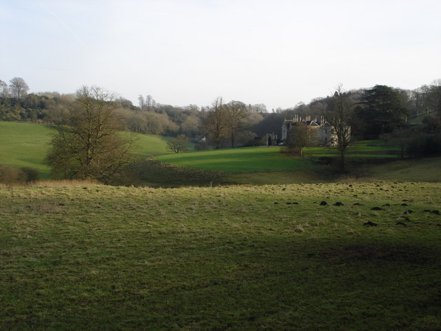
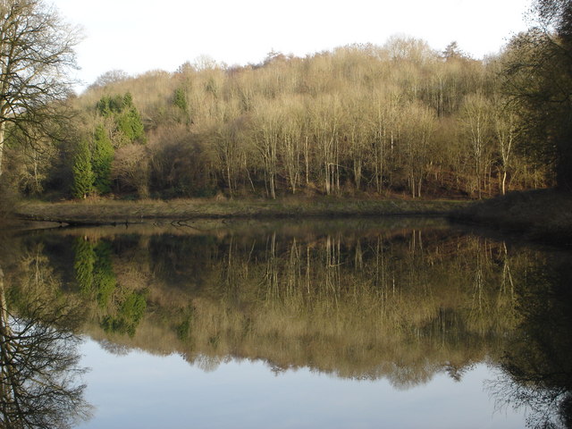
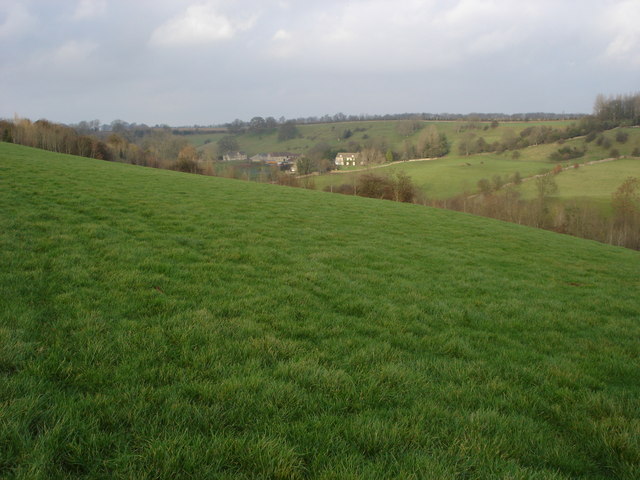
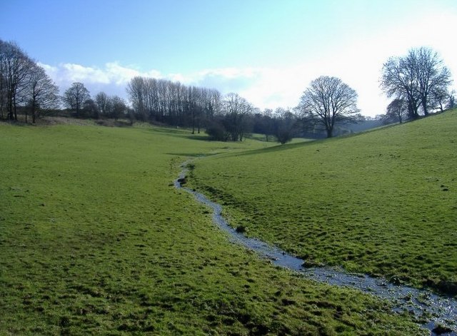
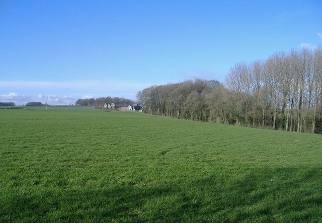
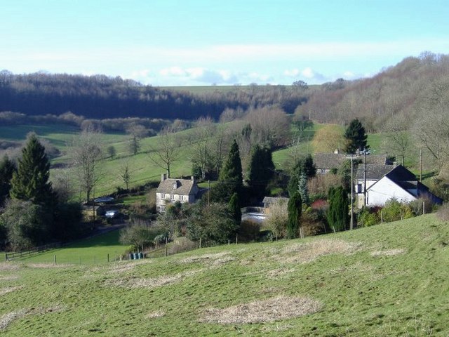
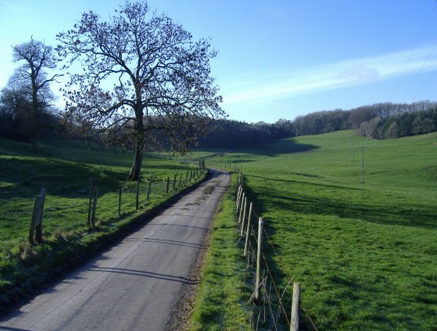
Bagpath is a small village located in the county of Gloucestershire, England. Situated in the picturesque Cotswold Hills, it is part of the Cotswold District and lies approximately 10 miles southwest of the city of Gloucester. The village is nestled amidst a beautiful rural landscape, characterized by rolling hills, charming stone cottages, and lush green fields.

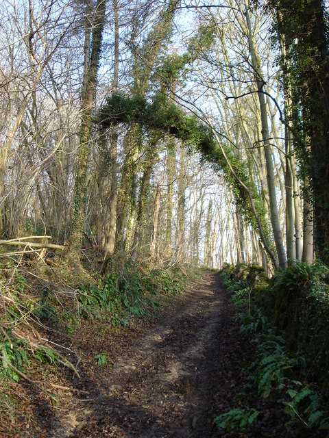
Bagpath is a quiet and close-knit community, with a population of around 200 residents. The village is known for its peaceful and idyllic atmosphere, making it an ideal place for those seeking a tranquil countryside lifestyle. The surrounding area offers ample opportunities for outdoor activities, such as hiking, cycling, and horse riding, with scenic trails and bridleways crisscrossing the countryside.

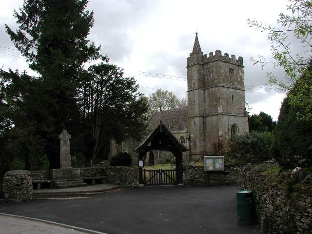
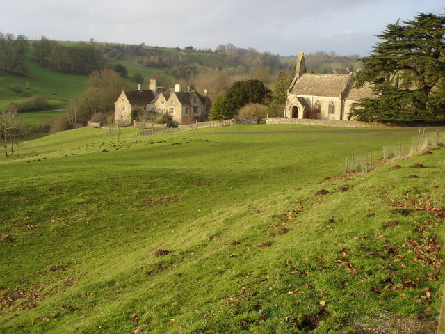
Despite its small size, Bagpath has a rich history. The village dates back to medieval times and was mentioned in the Domesday Book of 1086. It has retained much of its historic charm, with several well-preserved buildings and landmarks, including the medieval Church of St. Bartholomew, which is a Grade II listed structure.

While Bagpath does not have its own amenities, such as shops or schools, it is conveniently located near the larger towns of Stroud and Nailsworth, which offer a range of services and facilities. The village benefits from its proximity to the A46 road, providing easy access to neighboring towns and cities.

In summary, Bagpath is a small and picturesque village in Gloucestershire, known for its tranquil setting, stunning countryside, and rich history. It offers a peaceful retreat for those seeking a rural lifestyle, while still being within reach of nearby amenities.

If you have any feedback on the listing, please let us know in the comments section below.
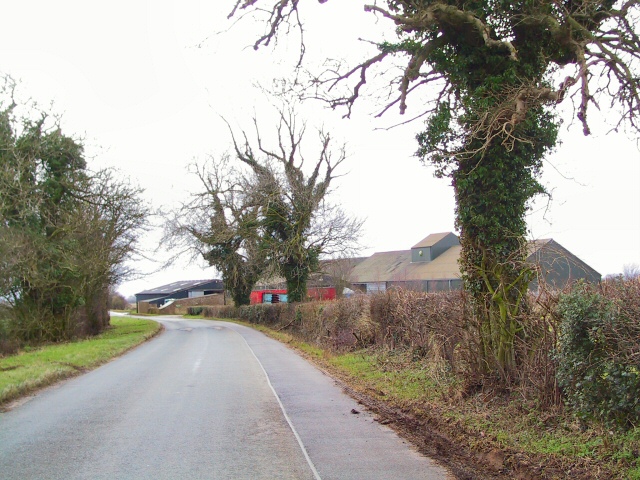
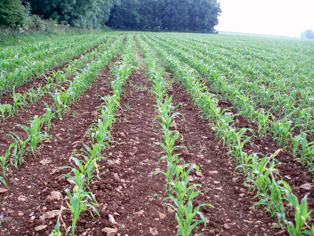
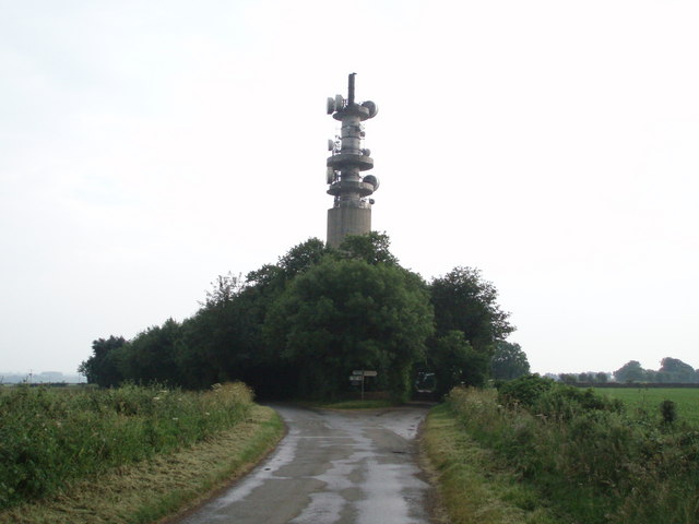
Bagpath Images

Images are sourced within 2km of 51.650325/-2.2805142 or Grid Reference ST8094. Thanks to Geograph Open Source API. All images are credited.

Stone Stile, Ozleworth Park To the left of the main gates to the Old Rectory, on Gloucestershire footpath NOZ2 (listed as a Bridleway). Off Blacksmiths Hill.
Stone Stile, Ozleworth Park
To the left of the main gates to the Old Rectory, on Gloucestershire footpath NOZ2 (listed as a Bridleway). Off Blacksmiths Hill.
Kingscote (Glos) St John's Church and War Memorial
Newington Bagpath (Glos) St Bartholomew's Church The sad semi-derelict church, sold by the Gloucester diocese and still awaiting conversion by its new owners at the point of submission of this picture, which dates from 2002
Newington Bagpath (Glos) St Bartholomew's Church
The sad semi-derelict church, sold by the Gloucester diocese and still awaiting conversion by its new owners at the point of submission of this picture, which dates from 2002
Ozleworth (Glos) St Nicholas of Myra's Church Difficult to find but a delightful walk to this church vested in the Churches Conservation Trust
Ozleworth (Glos) St Nicholas of Myra's Church
Difficult to find but a delightful walk to this church vested in the Churches Conservation Trust
Newington Barn Farm complex on minor country road near Lasborough. View looking south-east.
Newington Barn
Farm complex on minor country road near Lasborough. View looking south-east.
St Nicholas of Myra, Ozleworth
Lines of maize
Lines of maize
Choices To the left lies the lane to Ozleworth Bottom, to the right the lane to Newark Park.  In the middle is Goose Green radio station mast.
Choices
To the left lies the lane to Ozleworth Bottom, to the right the lane to Newark Park. In the middle is Goose Green radio station mast.
Boxwell Court This substantial house is located in the upper reaches of Ozleworth Bottom.
Boxwell Court
This substantial house is located in the upper reaches of Ozleworth Bottom.
Track through Mill Wood, Ozleworth Bottom This track which descends into Ozleworth Bottom is a continuation of Scrubbett's Lane to the south of Bagpath.
Track through Mill Wood, Ozleworth Bottom
This track which descends into Ozleworth Bottom is a continuation of Scrubbett's Lane to the south of Bagpath.
Lasborough Park This large country house near the very small village of Lasborough was built in 1797 for Edmund Estcourt to a design by James Wyatt.
Lasborough Park
This large country house near the very small village of Lasborough was built in 1797 for Edmund Estcourt to a design by James Wyatt.
Lake in Ozleworth Bottom This lake in Ozleworth Bottom has not been mapped on the OS map, however I have been informed by the person who created it that it was made in 1962 by damming the outlet stream.
Lake in Ozleworth Bottom
This lake in Ozleworth Bottom has not been mapped on the OS map, however I have been informed by the person who created it that it was made in 1962 by damming the outlet stream.
Newington Bagpath Newington Bagpath is no more than a few houses in a valley with an abandoned and disused church above.
Newington Bagpath
Newington Bagpath is no more than a few houses in a valley with an abandoned and disused church above.
Lasborough church and manor The small church is dedicated to St Mary the Virgin and the parish is Westonbirt with Lasborough. The church was rebuilt in 1861-2, the manor house in the background is the surviving south wing of a larger house much of which was demolished in the 19th century.
Lasborough church and manor
The small church is dedicated to St Mary the Virgin and the parish is Westonbirt with Lasborough. The church was rebuilt in 1861-2, the manor house in the background is the surviving south wing of a larger house much of which was demolished in the 19th century.
Lasborough Manor and St Mary's Church Lasborough Church is dedicated to St Mary and was rebuilt in 1861-2 by Lewis Vulliamy for RS Holford of nearby Westonbirt. Lasborough Manor, below the church is the south wing of a larger manor house built in the very early 17th century for Sir Thomas Estcourt. The main manor house and north wing were demolished in the 19th century.

This picture was used in a publication by the BBC as it is a location used by the BBC in the production of the television programme 'Lark Rise to Candleford'.
Lasborough Manor and St Mary's Church
Lasborough Church is dedicated to St Mary and was rebuilt in 1861-2 by Lewis Vulliamy for RS Holford of nearby Westonbirt. Lasborough Manor, below the church is the south wing of a larger manor house built in the very early 17th century for Sir Thomas Estcourt. The main manor house and north wing were demolished in the 19th century. This picture was used in a publication by the BBC as it is a location used by the BBC in the production of the television programme 'Lark Rise to Candleford'.
Hay Bottom A tiny brook meanders through idyllic pastureland.
Hay Bottom
A tiny brook meanders through idyllic pastureland.
Wooded margin A deciduous wood, occupies a small valley, to the right of this hill-top field.
Wooded margin
A deciduous wood, occupies a small valley, to the right of this hill-top field.
Ozleworth Bottom A group of dwellings occupy a lovely spot near the head of this secluded valley.
Ozleworth Bottom
A group of dwellings occupy a lovely spot near the head of this secluded valley.
Show me another place!

Bagpath is located at Grid Ref: ST8094 (Lat: 51.650325, Lng: -2.2805142)

Administrative County: Gloucestershire

District: Cotswold

Police Authority: Gloucestershire

What 3 Words

///loft.bookshop.cherub. Near Wotton-under-Edge, Gloucestershire

Related Wikis

Bagpath

Bagpath is a hamlet in Gloucestershire, England, in the Ozleworth valley south of the village of Kingscote and forming part of Kingscote civil parish....
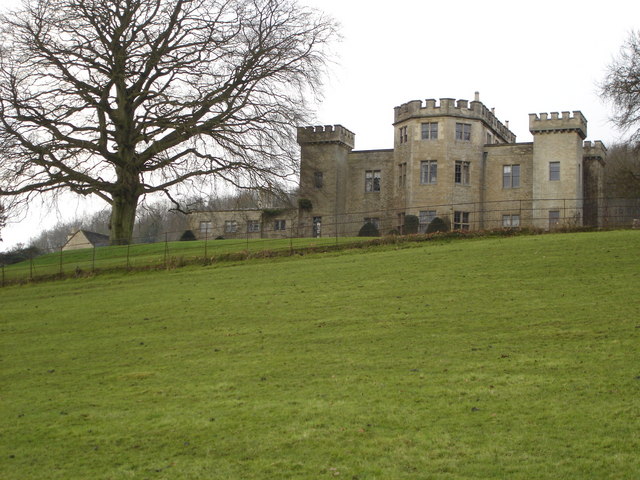
Lasborough Park

Lasborough Park (or Lasborough House) is a Grade II listed country house in Newington Bagpath/Lasborough, Tetbury, Gloucestershire, England. The estate...

Lasborough

Lasborough is a settlement in Gloucestershire, England, part of the Westonbirt with Lasborough civil parish. Lasborough lies to the west of the A46, about...

Kingscote Park, Gloucestershire

Kingscote Park (formerly Kingscote Cottage) is a Grade II listed house and country estate in Kingscote, near Tetbury, Gloucestershire, England. The original...

Nearby Amenities

Located within 500m of 51.650325,-2.2805142
Bagpath
Is In: Gloucestershire, England, UK
Place: hamlet
Wikidata: Q4842086
Lat/Long: 51.6525435/-2.2808498
Post Box
Collection Times: Mo-Fr 16:45; Sa 08:15; Su off
Drive Through: no
Operator: Royal Mail
Post Box Type: lamp
Ref: GL8 171
Royal Cypher: EIIR
Royal Cypher Wikidata: Q33102113
Source: survey
Lat/Long: 51.6538975/-2.2813235
Barrier: stile
Bicycle: no
Foot: yes
Material: wood
Stile: squeezer
Lat/Long: 51.6521756/-2.2798439
Power: pole
Transformer: distribution
Lat/Long: 51.6528792/-2.2825074
Power: pole
Lat/Long: 51.6529318/-2.2833393
Power: pole
Lat/Long: 51.6530101/-2.2844577
Power: pole
Lat/Long: 51.6531239/-2.2861261
Power: pole
Lat/Long: 51.6537623/-2.282657
Fixme: line possibly incomplete - where does it go next? survey needed
Power: pole
Lat/Long: 51.6502468/-2.2823047
Power: pole
Lat/Long: 51.6506322/-2.2823257
Power: pole
Lat/Long: 51.6514116/-2.2823911
Power: pole
Lat/Long: 51.6521715/-2.2824506
Board Type: notice
Information: board
Tourism: information
Lat/Long: 51.6538591/-2.2813181
Barrier: stile
Step Count: 1
Stile: stepover
Lat/Long: 51.651991/-2.282922
Barrier: stile
Stile: squeezer
Lat/Long: 51.6513147/-2.2810028
Turning Circle
Lat/Long: 51.6522635/-2.2811185
Ford: yes
Lat/Long: 51.6486971/-2.2870224
Bench
Backrest: no
Material: wood
Lat/Long: 51.6544219/-2.2812023
Information: guidepost
Tourism: information
Lat/Long: 51.6544056/-2.2811994
Grit Bin
Seasonal: no
Lat/Long: 51.6544193/-2.2811675
The data included in this document is from www.openstreetmap.org. The data is made available under ODbL.

Have you been to Bagpath?

Leave your review of Bagpath below (or comments, questions and feedback).