Anstey Money Common

Downs, Moorland in Devon North Devon

England

Anstey Money Common

Exmoor Ponies on Anstey Money Common
Exmoor Ponies on Anstey Money Common Credit: Grant Sherman

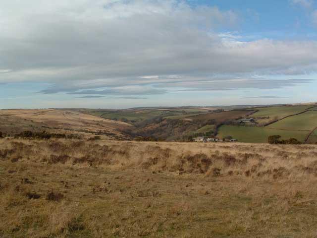
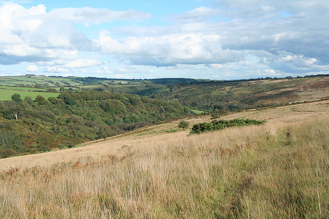
Anstey Money Common is a picturesque area located in Devon, England. Situated amidst the rolling hills and expansive moorland, this common is a nature lover's paradise. Covering a vast expanse of land, it is known for its breathtaking beauty and diverse wildlife.

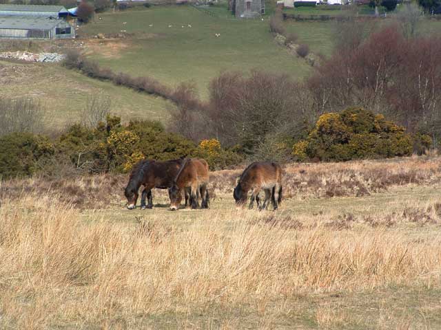
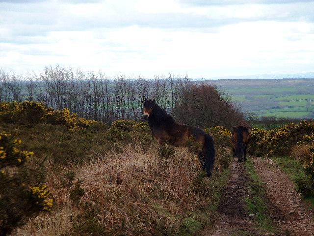
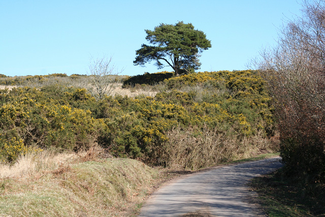
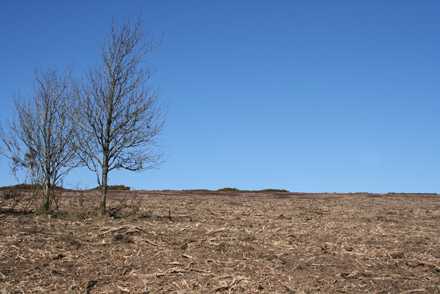
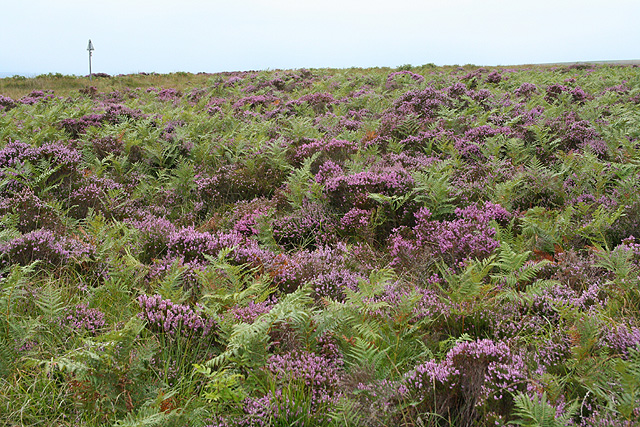
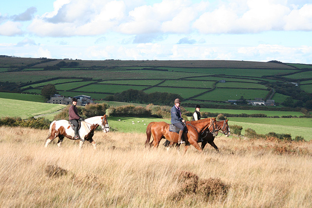
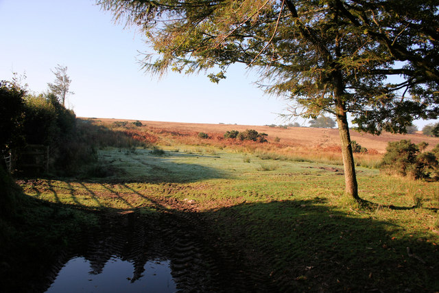
The common is characterized by its open grassland, scattered with heather and gorse bushes, creating a vibrant and colorful landscape. The area is also home to several streams and small ponds, adding to its natural charm. Visitors can often spot a variety of bird species, including skylarks and stonechats, as well as small mammals like rabbits and voles.

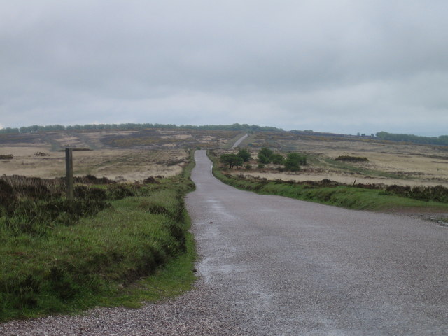
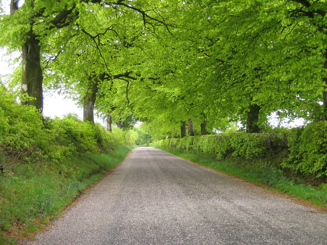
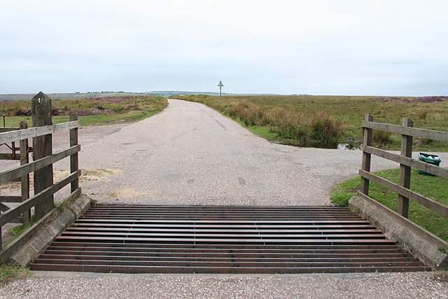
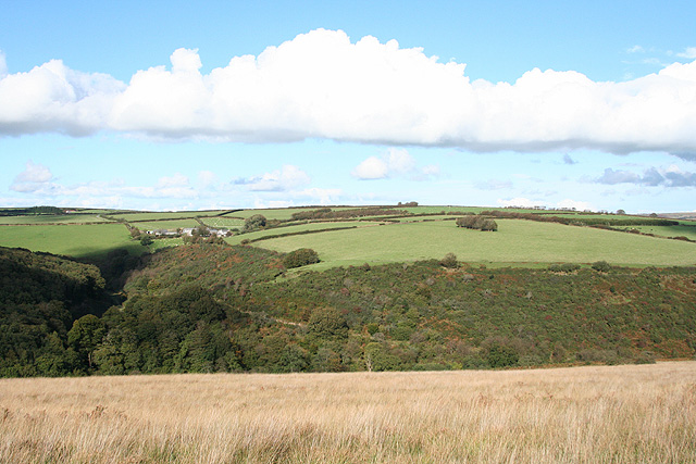
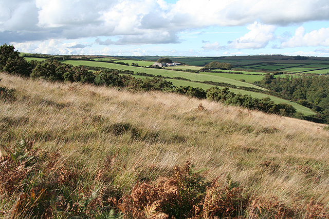
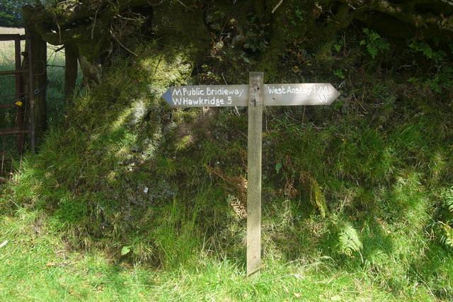
Anstey Money Common is a popular destination for outdoor enthusiasts and hikers, offering numerous walking trails that wind their way through the stunning countryside. The paths provide stunning views of the surrounding moorland and the distant hills, making it a favorite spot for photographers and nature enthusiasts.

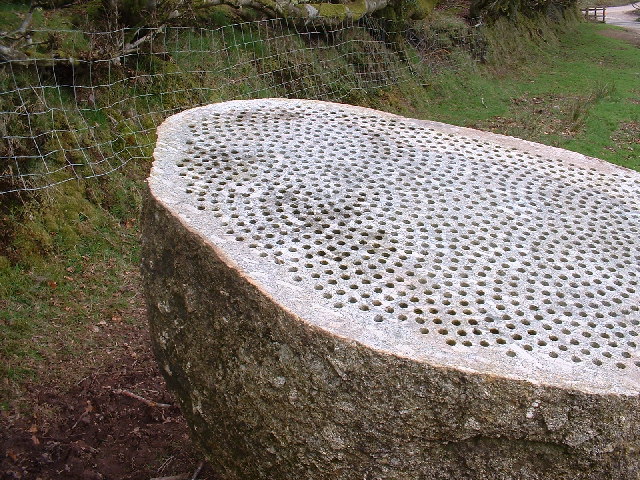
The common is also known for its historical significance, with remnants of ancient settlements and burial sites scattered throughout the area. These archaeological sites offer a glimpse into the rich history of the region and attract history buffs and archaeology enthusiasts.

In summary, Anstey Money Common in Devon is a captivating natural landscape, with its open grassland, diverse wildlife, and stunning views of the surrounding moorland. It offers a peaceful retreat for visitors seeking a connection with nature and an opportunity to explore the area's rich history.

If you have any feedback on the listing, please let us know in the comments section below.

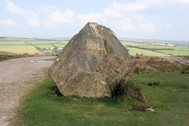
Anstey Money Common Images

Images are sourced within 2km of 51.053931/-3.6359289 or Grid Reference SS8529. Thanks to Geograph Open Source API. All images are credited.

Exmoor Ponies on Anstey Money Common
Anstey Money Common On the Two Moors Way
Anstey Money Common
On the Two Moors Way
Exmoor ponies on Woodland Common Near Badlake Moor Cross
Exmoor ponies on Woodland Common
Near Badlake Moor Cross
IIMW sculpture by Peter Randall Page See also Granite Song in <a href="https://www.geograph.org.uk/gridref/SX7189">SX7189</a>
IIMW sculpture by Peter Randall Page
See also Granite Song in SX7189
West Anstey: near Woodland Common Looking east
West Anstey: near Woodland Common
Looking east
West Anstey: Woodland Common The common has recently stripped of gorse. Looking north east from a point above Woodland Farm
West Anstey: Woodland Common
The common has recently stripped of gorse. Looking north east from a point above Woodland Farm
West Anstey Common The Ridge Road over West Anstey Common.
West Anstey Common
The Ridge Road over West Anstey Common.
Spring Beeches Beech trees lining the road on Twitchen Common.
Spring Beeches
Beech trees lining the road on Twitchen Common.
Molland: Brimblecombe Hill Heather and bracken close to the road at Anstey Gate: the road sign on the horizon indicates the location. It warns of a cattle grid at the gate. Looking west
Molland: Brimblecombe Hill
Heather and bracken close to the road at Anstey Gate: the road sign on the horizon indicates the location. It warns of a cattle grid at the gate. Looking west
West Anstey: Anstey Gate Looking west-north-west towards Molland Common
West Anstey: Anstey Gate
Looking west-north-west towards Molland Common
West Anstey: on West Anstey Common Looking north towards Shircombe Farm. Below the farm, nearer the camera, the Dane’s Brook turns through a right angle to run south-south-west past Lyshwell Wood before resuming a more easterly course. It has a confluence with the Barle near Mounsey Castle.
West Anstey: on West Anstey Common
Looking north towards Shircombe Farm. Below the farm, nearer the camera, the Dane’s Brook turns through a right angle to run south-south-west past Lyshwell Wood before resuming a more easterly course. It has a confluence with the Barle near Mounsey Castle.
West Anstey: towards Lyshwell Farm Looking north west on the edge of the moor towards Exmoor farmland
West Anstey: towards Lyshwell Farm
Looking north west on the edge of the moor towards Exmoor farmland
West Anstey: Anstey Rhiney Moor Looking east-north-east over the Dane’s Brook valley
West Anstey: Anstey Rhiney Moor
Looking east-north-east over the Dane’s Brook valley
West Anstey: riders near Anstey Gate Looking north on West Anstey Common with Lyshwell, left, and Cloggs farms in shadow in the distance
West Anstey: riders near Anstey Gate
Looking north on West Anstey Common with Lyshwell, left, and Cloggs farms in shadow in the distance
Badlake Moor Cross This finger post gives distances on the Two Moors Way.
Badlake Moor Cross
This finger post gives distances on the Two Moors Way.
East Anstey Common Looking south-west with the morning dew visible on the grass.
East Anstey Common
Looking south-west with the morning dew visible on the grass.
Froude Hancock Memorial This boulder is a memorial to Froude Hancock a local celebrity and England Rugby player.
Froude Hancock Memorial
This boulder is a memorial to Froude Hancock a local celebrity and England Rugby player.
Inscription on Froude Hancock Memorial Simple, if indistinct, inscription is "Froude Hancock 1865 - 1933".
Inscription on Froude Hancock Memorial
Simple, if indistinct, inscription is "Froude Hancock 1865 - 1933".
Show me another place!

Anstey Money Common is located at Grid Ref: SS8529 (Lat: 51.053931, Lng: -3.6359289)

Administrative County: Devon

District: North Devon

Police Authority: Devon and Cornwall

What 3 Words

///upsetting.unlimited.healers. Near Dulverton, Somerset

Related Wikis

Church of St Giles, Hawkridge

The Anglican Church of St Giles in Hawkridge, Somerset, England was built in the 14th century. It is a Grade II* listed building. == History == The oldest...

West Anstey

West Anstey is a village and civil parish on the River Yeo, about 5 miles west of Dulverton, in the North Devon district, in the county of Devon, England...

Tarr Steps

The Tarr Steps is a clapper bridge across the River Barle in the Exmoor National Park, Somerset, England. They are located in a national nature reserve...

Brewer's Castle

Brewer's Castle is a defended Iron Age settlement in the West Somerset district of Somerset, England. The hill fort is situated approximately 2 miles...

Mounsey Castle

Mounsey Castle is an Iron Age irregular triangular earthwork of 1.75 hectares (4.3 acres) north west of Dulverton, Somerset, England. It has been scheduled...

Ashwick House, Dulverton

not to be confused with the 17th century Ashwick Court in eastern Somerset.Ashwick House is an Edwardian mansion in Ashwick, four miles northwest of Dulverton...

Oldways End

Oldways End is a hamlet in the civil parish of East Anstey in the North Devon district of Devon, England. Its nearest town is Tiverton, which lies approximately...

East Anstey

East Anstey is a village and civil parish in the North Devon district of Devon, England. The parish is located in an area which has been designated as...

Nearby Amenities

Located within 500m of 51.053931,-3.6359289
Zeal Farm B&B
Addr City: Dulverton
Addr Housename: Zeal Farm
Addr Postcode: TA22 9QJ
Addr Village: Hawkridge
Tourism: guest_house
Lat/Long: 51.0580304/-3.6376329
The data included in this document is from www.openstreetmap.org. The data is made available under ODbL.

Have you been to Anstey Money Common?

Leave your review of Anstey Money Common below (or comments, questions and feedback).