Collieston Moor

Downs, Moorland in Dumfriesshire

Scotland

Collieston Moor

Sitka forestry A plantation between Craigdasher Hill and Whiteside Hill, viewed from a rough grazing area to the southwest of Darngarroch Hill.
Sitka forestry Credit: Walter Baxter

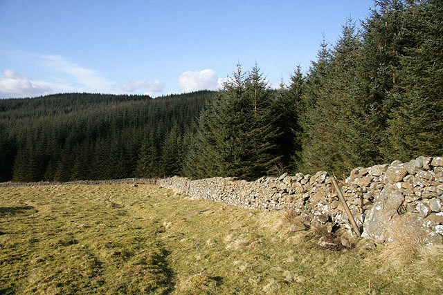
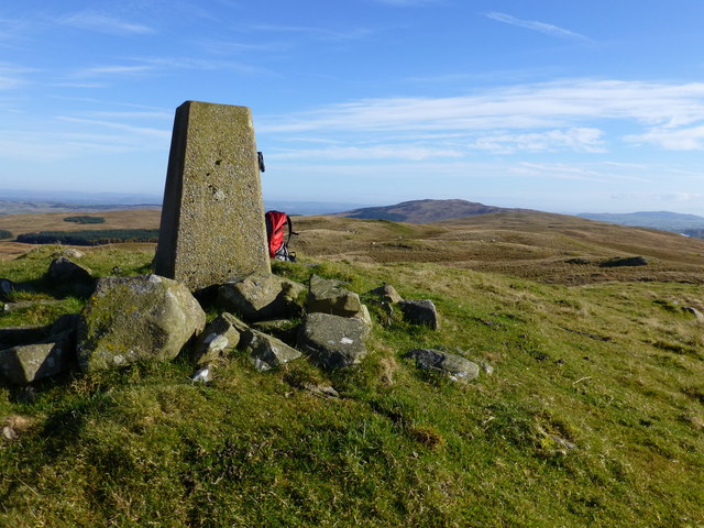
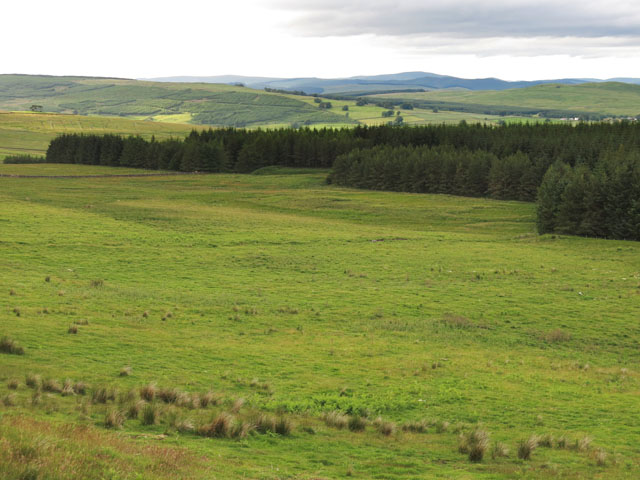
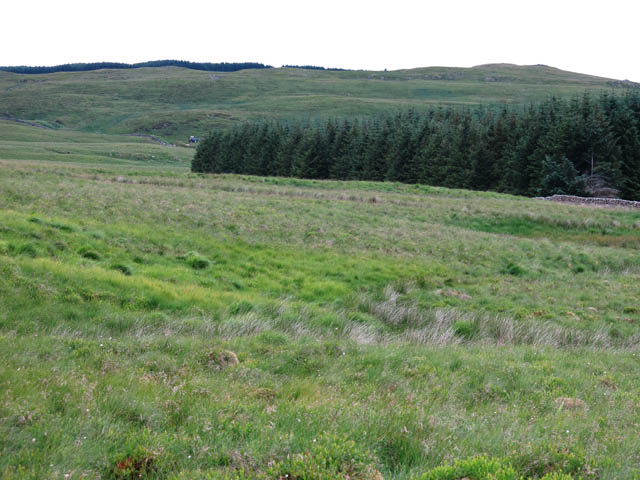
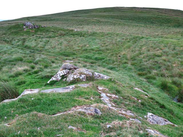
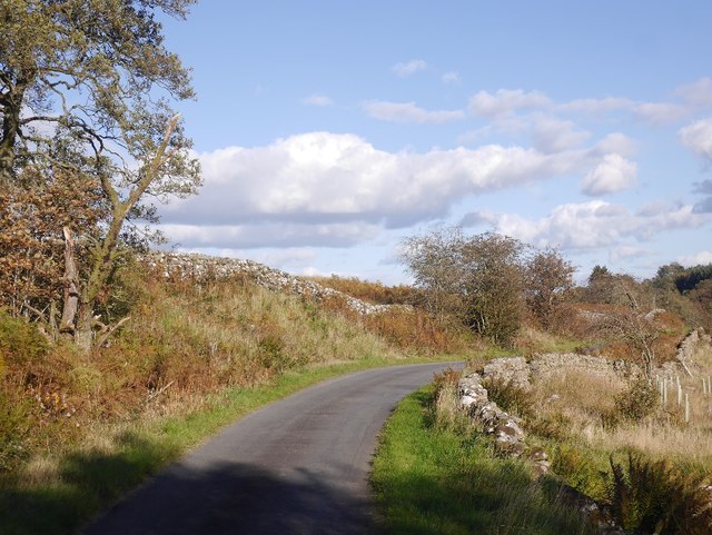
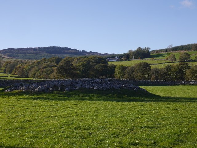
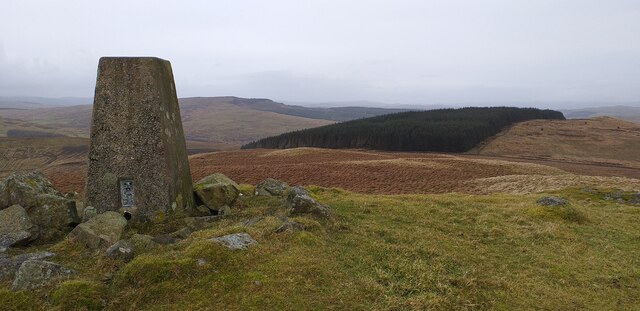
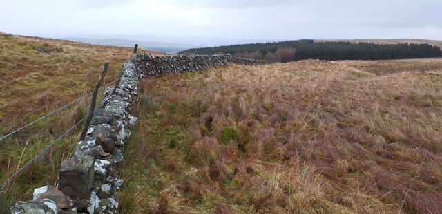
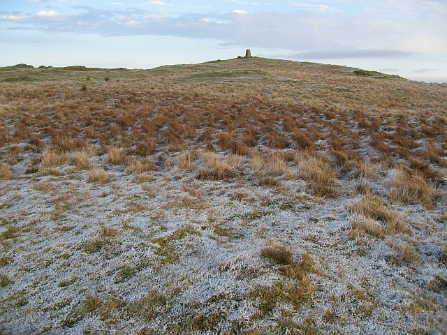
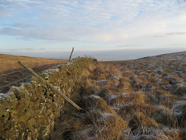
Collieston Moor is a picturesque moorland located in Dumfriesshire, Scotland. Situated in the southern part of the country, this vast expanse of land is known for its breathtaking natural beauty and rugged terrain. Covering an area of approximately 2,000 hectares, Collieston Moor is a haven for nature enthusiasts, hikers, and wildlife lovers.

The moorland is characterized by its undulating hills, heather-covered slopes, and panoramic views of the surrounding countryside. It is home to a diverse range of plant and animal species, including heather, grasses, and various types of moss. The rich flora and fauna make Collieston Moor an important ecological site within Dumfriesshire.

Visitors to the moorland can explore the network of trails and paths that crisscross the area, providing opportunities for walking, hiking, and birdwatching. The open landscape of Collieston Moor offers stunning vistas, particularly during the summer months when the heather is in full bloom, creating a vibrant carpet of purple hues.

The moorland also holds historical significance, with remnants of ancient settlements and archaeological sites scattered throughout the area. These remnants serve as a reminder of the human presence in Collieston Moor throughout the centuries.

Overall, Collieston Moor in Dumfriesshire is a natural treasure, offering visitors a chance to immerse themselves in the beauty of the Scottish countryside. Its diverse ecosystem, stunning vistas, and rich history make it a must-visit destination for those seeking an authentic Scottish moorland experience.

If you have any feedback on the listing, please let us know in the comments section below.

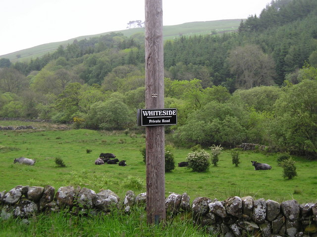
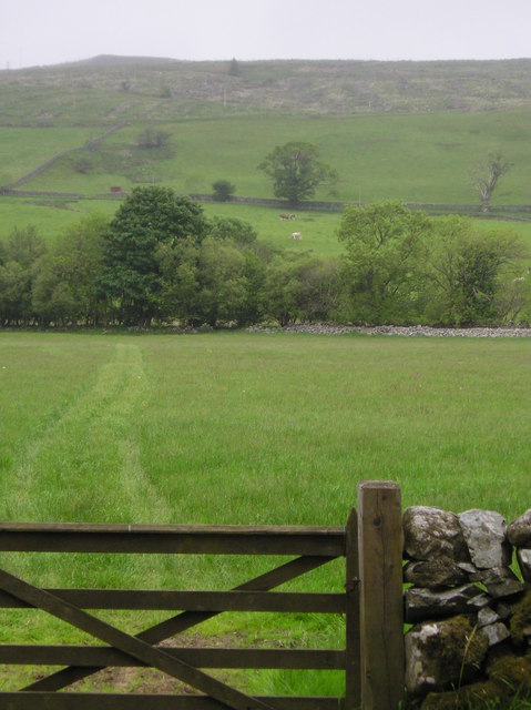
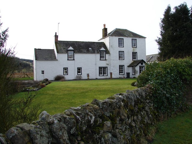
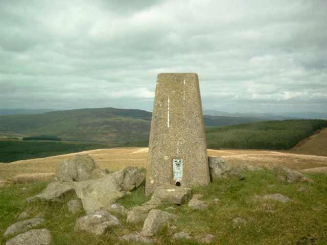
Collieston Moor Images

Images are sourced within 2km of 55.12317/-3.8626673 or Grid Reference NX8182. Thanks to Geograph Open Source API. All images are credited.

Sitka forestry A plantation between Craigdasher Hill and Whiteside Hill, viewed from a rough grazing area to the southwest of Darngarroch Hill.
Sitka forestry
A plantation between Craigdasher Hill and Whiteside Hill, viewed from a rough grazing area to the southwest of Darngarroch Hill.
Darngarroch Hill Lovely sunny October day for this plod over dampish upland sheep pasture. Climbed over Muil Hill on way out and back. Met the farmer on his quad, wondering if I was the idiot who left his car in the wide entrance at Marglolly Bridge. Were you expecting a delivery I asked? Then stated that I could drive most lorries passed my car without any problems.
Name: Darngarroch Hill
Hill number: 1791
Height: 373m / 1224ft
Area: 27C: The Glenkens to Annandale
Class: Hu,sMa
Grid ref: NX 80350 81585
Summit feature: trig point
Drop: 142m
Col: 231m  NX808799
Darngarroch Hill
Lovely sunny October day for this plod over dampish upland sheep pasture. Climbed over Muil Hill on way out and back. Met the farmer on his quad, wondering if I was the idiot who left his car in the wide entrance at Marglolly Bridge. Were you expecting a delivery I asked? Then stated that I could drive most lorries passed my car without any problems. Name: Darngarroch Hill Hill number: 1791 Height: 373m / 1224ft Area: 27C: The Glenkens to Annandale Class: Hu,sMa Grid ref: NX 80350 81585 Summit feature: trig point Drop: 142m Col: 231m NX808799
Moorland and forest on Stroquhan Moor
Moorland and forest north of Muil Hill
ATV tracks on Muil Hill Rough moorland makes for rough walking so the ATVs are essential for the farmers
ATV tracks on Muil Hill
Rough moorland makes for rough walking so the ATVs are essential for the farmers
Road to Whiteside Looking southward.
Road to Whiteside
Looking southward.
Road at the entrance to Sundaywell Looking eastward.
Road at the entrance to Sundaywell
Looking eastward.
Replanted woodland A lot of conifers, in small woods have been recently removed in Glenesslin.
Replanted woodland
A lot of conifers, in small woods have been recently removed in Glenesslin.
Road, Sundaywell
Road, Sundaywell
Cairn, Glenesslin Probably a clearance cairn, but marked as an antiquity by the Ordnance Survey. The area has many cairns and evidence of field systems - if this is the result of agricultural improvement, when was it done?
Cairn, Glenesslin
Probably a clearance cairn, but marked as an antiquity by the Ordnance Survey. The area has many cairns and evidence of field systems - if this is the result of agricultural improvement, when was it done?
Darngarroch Hill trig point The Ordnance Survey trig point on the summit of Darngarroch Hill.
Darngarroch Hill trig point
The Ordnance Survey trig point on the summit of Darngarroch Hill.
Drystane Dyke on Darngarroch Hill A drystane dyke on the low point between Darngarroch Hill and Muil Hill.
Drystane Dyke on Darngarroch Hill
A drystane dyke on the low point between Darngarroch Hill and Muil Hill.
At the road to Whiteside
Fields opposite Fraserford
Sundaywell Sundaywell Tower dates from 1651, it was converted to form part of farmhouse in late C18. There are a number of archaeological sites in the surrounding area.
Sundaywell
Sundaywell Tower dates from 1651, it was converted to form part of farmhouse in late C18. There are a number of archaeological sites in the surrounding area.
Trig Pillar S7980, Darngarroch. The pillar is in reasonable condition but with surface cracks. The flush bracket faces 171° south. The pillar was completed on 18th March 1954 costing £27.5s.0d. In 1954 this marker was computed for triangulation as tertiary station NX99/T12 in the Dumfries secondary block. The flush bracket was levelled for height also in 1954. The trig point was last maintained by the OS in June 1988. Panoramic views to neighbouring hills.
Trig Pillar S7980, Darngarroch.
The pillar is in reasonable condition but with surface cracks. The flush bracket faces 171° south. The pillar was completed on 18th March 1954 costing £27.5s.0d. In 1954 this marker was computed for triangulation as tertiary station NX99/T12 in the Dumfries secondary block. The flush bracket was levelled for height also in 1954. The trig point was last maintained by the OS in June 1988. Panoramic views to neighbouring hills.
Summit of Darngarroch Hill The trig pillar on the top of Darngarroch Hill
Summit of Darngarroch Hill
The trig pillar on the top of Darngarroch Hill
Dyke This dyke crosses the lowest saddle between Darngarroch Hill and Muil Hill
Dyke
This dyke crosses the lowest saddle between Darngarroch Hill and Muil Hill
Show me another place!

Collieston Moor is located at Grid Ref: NX8182 (Lat: 55.12317, Lng: -3.8626673)

Unitary Authority: Dumfries and Galloway

Police Authority: Dumfries and Galloway

What 3 Words

///seats.finalists.deposits. Near Thornhill, Dumfries & Galloway

Related Wikis

Dumfries and Galloway

Dumfries and Galloway (Scots: Dumfries an Gallowa; Scottish Gaelic: Dùn Phrìs is Gall-Ghaidhealaibh) is one of the 32 unitary council areas of Scotland...

Craigenputtock

Craigenputtock (usually spelled by the Carlyles as Craigenputtoch) is an estate in Scotland where Thomas Carlyle lived from 1828 to 1834. He wrote several...

Dunscore railway station

Dunscore (NX858840) was one of the four principal stations on the Cairn Valley Light Railway (CVR) branch, from Dumfries. It served the rural area of...

Glenkiln Sculpture Park

Glenkiln Sculpture Park was a sculpture landscape in the historic county of Kirkcudbrightshire in Dumfries and Galloway, south-west Scotland. After one...

Stepford railway station

Stepford (NX864815) was one of the minor request stop stations on the Cairn Valley Light Railway branch from Dumfries. It served a very rural area in...

Dunscore

Dunscore (['dʌnskər] / 'DUN-skur', less commonly ['dunskɔ:r] / 'DUN-score') is a small village which lies 9 miles (14 km) northwest of Dumfries on the...

Crossford railway station

Crossford is a closed station of the Cairn Valley Light Railway branch, from Dumfries. It served the rural area of Crossford in Dumfries and Galloway...

Newtonairds railway station

Newtonairds (NX877801) was one of the principal stations on the now closed Cairn Valley Light Railway branch from Dumfries. It served a very rural area...

Nearby Amenities

Located within 500m of 55.12317,-3.8626673
Collieston Hill
Natural: peak
Lat/Long: 55.1215811/-3.8637459
The data included in this document is from www.openstreetmap.org. The data is made available under ODbL.

Have you been to Collieston Moor?

Leave your review of Collieston Moor below (or comments, questions and feedback).