Bad an t-Sluichd

Downs, Moorland in Perthshire

Scotland

Bad an t-Sluichd

Road between the south shore of Loch Tummel and Frenich Wood Looking north-eastward.
Road between the south shore of Loch Tummel and Frenich Wood Credit: Peter Wood

Bad an t-Sluichd is a picturesque area located in Perthshire, Scotland, known for its captivating downs and moorland landscapes. Situated amidst the stunning Scottish Highlands, this region offers visitors a unique and immersive experience in nature.

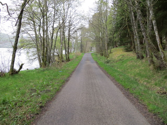
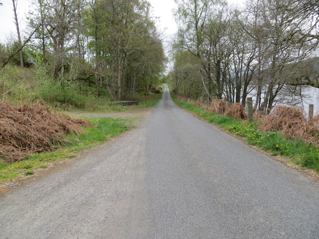
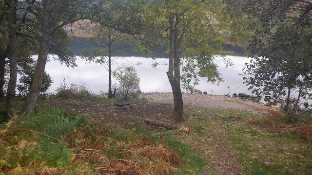
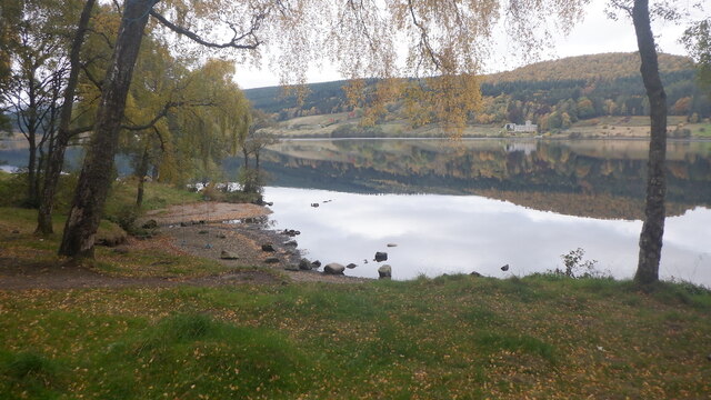
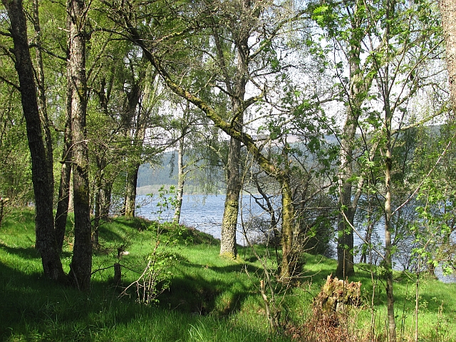
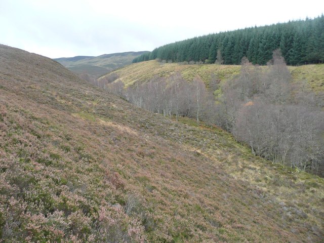
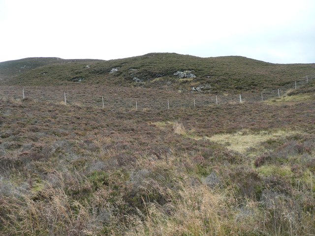
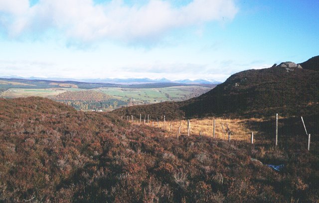
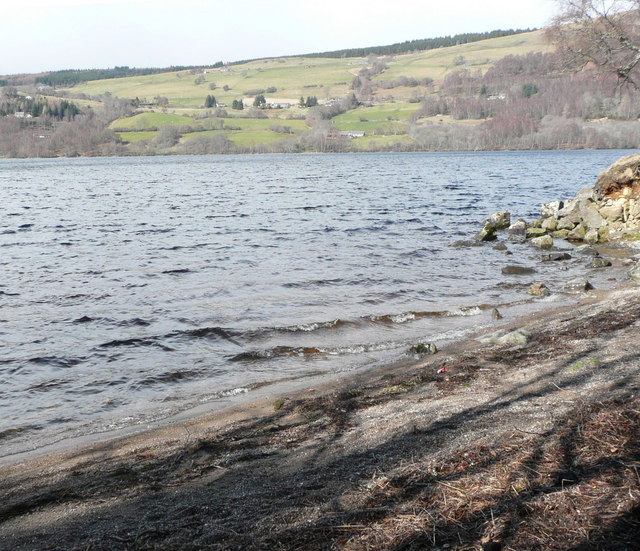
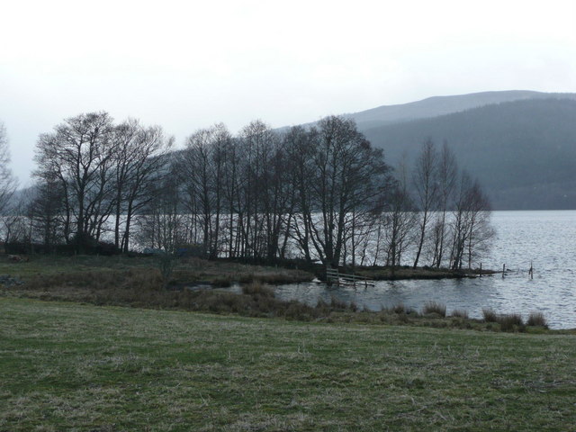
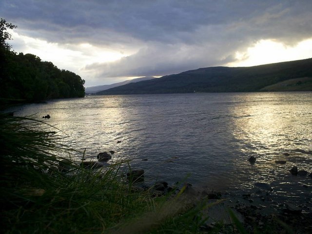
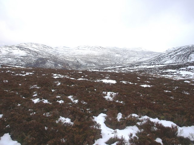
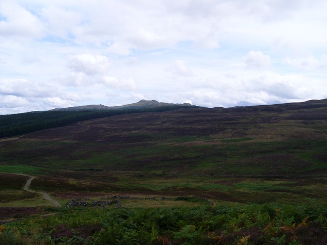
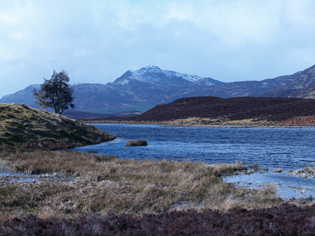
The downs of Bad an t-Sluichd are characterized by their rolling hills and gentle slopes, covered in lush green grass and dotted with wildflowers. The undulating terrain provides breathtaking panoramic views of the surrounding countryside, making it a popular destination for hikers and nature enthusiasts. The tranquility of the downs creates a serene atmosphere, perfect for those seeking solace in the beauty of the Scottish wilderness.

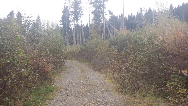
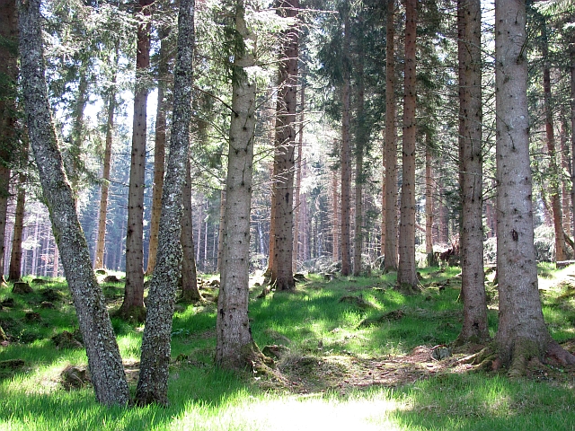
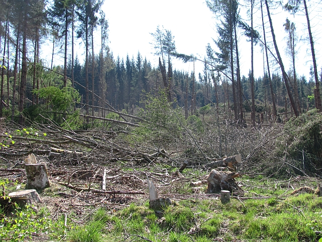
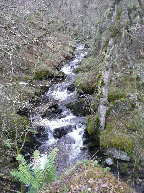
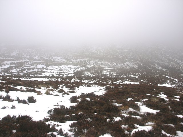
The moorland in Bad an t-Sluichd presents a different scenery, with its expansive stretches of heather-covered plains and scattered patches of birch and pine trees. This rugged terrain is home to various species of wildlife, including red deer and grouse, making it a haven for nature lovers and wildlife photographers. The moorland also offers opportunities for adventurous activities like birdwatching, mountain biking, and horse riding.

Bad an t-Sluichd is an ideal destination for those looking to escape the hustle and bustle of city life and immerse themselves in the tranquility of nature. The downs and moorland in this region offer a unique combination of scenic beauty, diverse wildlife, and outdoor recreational activities, making it a must-visit location in Perthshire.

If you have any feedback on the listing, please let us know in the comments section below.

Bad an t-Sluichd Images

Images are sourced within 2km of 56.691676/-3.9393546 or Grid Reference NN8157. Thanks to Geograph Open Source API. All images are credited.

Road between the south shore of Loch Tummel and Frenich Wood Looking north-eastward.
Road between the south shore of Loch Tummel and Frenich Wood
Looking north-eastward.
Road beside the south shore of Loch Tummel near to Ceann na Coille Looking westward.
Road beside the south shore of Loch Tummel near to Ceann na Coille
Looking westward.
Road, Ceann na Coille New generation of growth after the windthrow. <a href="https://www.geograph.org.uk/photo/2966416">NN8058 : Ceann na Coille</a>
Road, Ceann na Coille
New generation of growth after the windthrow. NN8058 : Ceann na Coille
Loch Tummel Overzealous parking restrictions in the war on the campervan/low quality camper has meant that this loch now requires a long portage to get on to it.
Loch Tummel
Overzealous parking restrictions in the war on the campervan/low quality camper has meant that this loch now requires a long portage to get on to it.
South side of Loch Tummel after the parking ban There is now an 8k clearway here which means a long portage or a drop off if you want to get on the water.  The upside is that there will now be some great camping spots for the non motorised.
South side of Loch Tummel after the parking ban
There is now an 8k clearway here which means a long portage or a drop off if you want to get on the water. The upside is that there will now be some great camping spots for the non motorised.
Frenich Wood Mature conifer woodland near Loch Tummel, some trees were lost to windthrow nearby.
Frenich Wood
Mature conifer woodland near Loch Tummel, some trees were lost to windthrow nearby.
Ceann na Coille Some of the 5,000,000 trees lost by the Forestry Commission to windthrow around New Year 2012.
Ceann na Coille
Some of the 5,000,000 trees lost by the Forestry Commission to windthrow around New Year 2012.
Frenich Wood Birches beside Loch Tummel.
Frenich Wood
Birches beside Loch Tummel.
Allt Tarruinchon In its gorge defended by the impenetrable Tay Forest Park.
Allt Tarruinchon
In its gorge defended by the impenetrable Tay Forest Park.
Birch trees mark the gorge of Allt Tarruinchon Tay Forest Park - an impenetrable barrier - on the right.
Devilish heather underfoot!
Birch trees mark the gorge of Allt Tarruinchon
Tay Forest Park - an impenetrable barrier - on the right. Devilish heather underfoot!
Heather slopes up to Dubh Chnocan With deer fence to encourage tree regeneration.
Heather slopes up to Dubh Chnocan
With deer fence to encourage tree regeneration.
Bad an t-Sluichd Hollow in the grouse moors south of Loch Tummel.
Bad an t-Sluichd
Hollow in the grouse moors south of Loch Tummel.
Beach on shore of Loch Tummel The storms blowing down the loch build up lines of debris.  Strathtummel is the community on the other side of Loch Tummel.
Beach on shore of Loch Tummel
The storms blowing down the loch build up lines of debris. Strathtummel is the community on the other side of Loch Tummel.
Marshy shoreline of Loch Tummel Geese are often found feeding here.  Canoes wait for warmer days.
Marshy shoreline of Loch Tummel
Geese are often found feeding here. Canoes wait for warmer days.
Electricity poles in Frenich Wood This substantial electricity pole marks an angle in the direction of the power lines along the south side of Loch Tummel.
Electricity poles in Frenich Wood
This substantial electricity pole marks an angle in the direction of the power lines along the south side of Loch Tummel.
Sunset over Loch Tummel
Upper Glen Frenich. The upper Frenich burn. Heather, tussock grass and snow.
Upper Glen Frenich.
The upper Frenich burn. Heather, tussock grass and snow.
View East across Glen Frenich. The view across the Frenich burn from the saddle north of Doire Leathan.
View East across Glen Frenich.
The view across the Frenich burn from the saddle north of Doire Leathan.
Show me another place!

Bad an t-Sluichd is located at Grid Ref: NN8157 (Lat: 56.691676, Lng: -3.9393546)

Unitary Authority: Perth and Kinross

Police Authority: Tayside

What 3 Words

///emulating.tracks.grumbles. Near Aberfeldy, Perth & Kinross

Related Wikis

Loch Tummel

Loch Tummel (Scottish Gaelic: Loch Teimheil) is a long, narrow loch, seven kilometres (4+1⁄2 miles) northwest of Pitlochry in the council area of Perth...

Tummel hydro-electric power scheme

The Tummel hydro-electric power scheme is an interconnected network of dams, power stations, aqueducts and electric power transmission in the Grampian...

Meall Tàirneachan

Meall Tairneachan (787 m) is a mountain in the Grampian Mountains of Scotland, located northwest of Aberfeldy in Perthshire. The peak lies in an area of...

Farragon Hill

Farragon Hill (782 m) is a peak in the foothills of the Grampian Mountains of Scotland. It lies above the town of Aberfeldy in Perthshire. The hill is...

Loch Bhac

Loch Bhac (Bhaic or Vach) is a fine freshwater trout loch, located in the west part of the Allean Forest, and east part of Tay Forest park, and slightly...

Tummel Bridge

Tummel Bridge is a double arched hump-backed former military bridge crossing the River Tummel at Tummel Bridge, Perth & Kinross, Scotland. A Category A...

Loch Derculich

Loch Derculich is a freshwater loch in central highlands of Scotland, in Perth and Kinross. Loch Tummel is located three miles to the north. == Habitation... ==

Creag Odhar

Creag Odhar is a rocky mountain peak in the southern Highlands of Scotland, in Perthshire north of Aberfeldy. The name is Gaelic, from creag, meaning...

Nearby Amenities

Located within 500m of 56.691676,-3.9393546
Cragan Dubh
Ele: 442
Natural: peak
Lat/Long: 56.69329/-3.9417741
The data included in this document is from www.openstreetmap.org. The data is made available under ODbL.

Have you been to Bad an t-Sluichd?

Leave your review of Bad an t-Sluichd below (or comments, questions and feedback).