Ramshorn Down

Downs, Moorland in Devon Teignbridge

England

Ramshorn Down

Layby on the Devon Expressway near Bickington The A38 is a major A-class trunk route. When first designated in 1922, it ran from Derby to Plymouth but it was later extended at both ends so that it now runs for 292 miles from Mansfield in Nottinghamshire to Bodmin in Cornwall.

Prior to the opening of the M5 motorway in the 1960s and 1970s, the A38 formed the main "holiday route" from the Midlands to Somerset, Devon and Cornwall and the south-western section was notorious at holiday times for the congestion. Nowadays, for most of the southern section, the A38 is a fairly quiet road shadowing the M5 extremely closely; often running alongside the motorway as a single carriageway road. The section between Exeter and Plymouth is, however, a busy dual carriageway which serves as the southern extension of the M5 and is known as “the Devon Expressway”.

More information at <span class="nowrap"><a title="http://en.wikipedia.org/wiki/A38_road" rel="nofollow ugc noopener" href="http://en.wikipedia.org/wiki/A38_road">Link</a><img style="margin-left:2px;" alt="External link" title="External link - shift click to open in new window" src="https://s1.geograph.org.uk/img/external.png" width="10" height="10"/></span>  (Wikipedia) and <span class="nowrap"><a title="http://www.sabre-roads.org.uk/wiki/index.php?title=A38" rel="nofollow ugc noopener" href="http://www.sabre-roads.org.uk/wiki/index.php?title=A38">Link</a><img style="margin-left:2px;" alt="External link" title="External link - shift click to open in new window" src="https://s1.geograph.org.uk/img/external.png" width="10" height="10"/></span>  (SABRE).
Layby on the Devon Expressway near Bickington Credit: David Dixon

Ramshorn Down is a picturesque area located in the county of Devon, England. Situated in the heart of Dartmoor National Park, it is part of the larger expanse known as the Dartmoor Downs and Moorland. This captivating landscape covers an area of approximately 10 square kilometers.

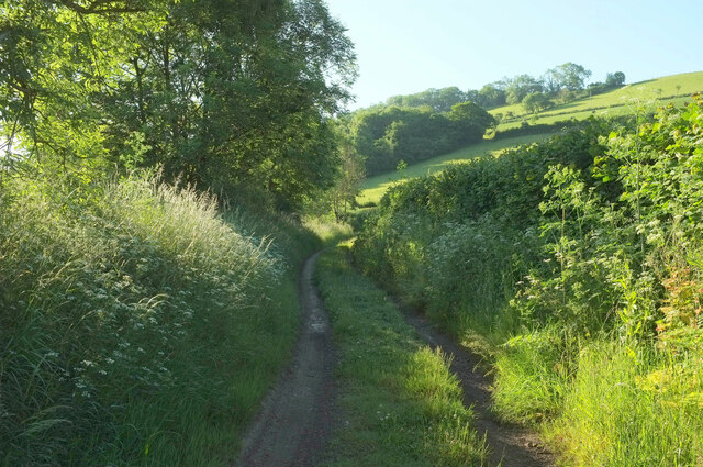
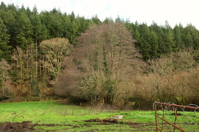
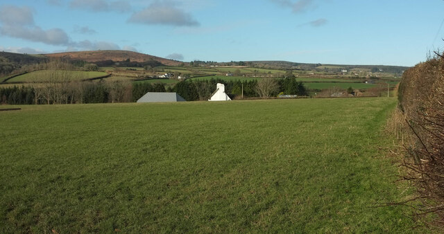
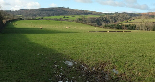
Ramshorn Down boasts stunning panoramic views, with rolling hills and vast stretches of open moorland. The area is characterized by its rugged terrain, dotted with granite tors that rise majestically from the ground. These tors, formed millions of years ago through the process of weathering and erosion, add a unique and fascinating element to the landscape.

The downs and moorland of Ramshorn Down are home to a diverse range of flora and fauna. The open grasslands provide ideal habitats for a variety of bird species, including skylarks and meadow pipits. Visitors may also catch a glimpse of Dartmoor ponies, which roam freely in the area and contribute to the preservation of the landscape.

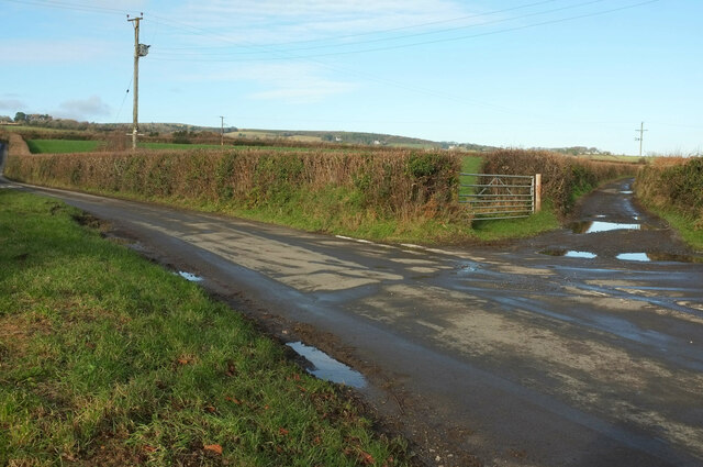
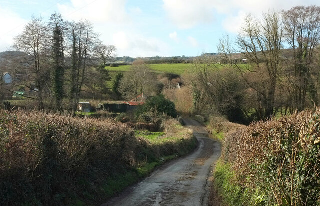
Ramshorn Down offers numerous opportunities for outdoor activities, such as hiking, walking, and nature exploration. There are several well-maintained footpaths and trails that wind through the area, allowing visitors to immerse themselves in the natural beauty and tranquility of the surroundings.

In conclusion, Ramshorn Down in Devon is a captivating destination within Dartmoor National Park. With its breathtaking views, unique geological features, and abundant wildlife, it offers a memorable experience for those seeking to explore the natural wonders of the region.

If you have any feedback on the listing, please let us know in the comments section below.

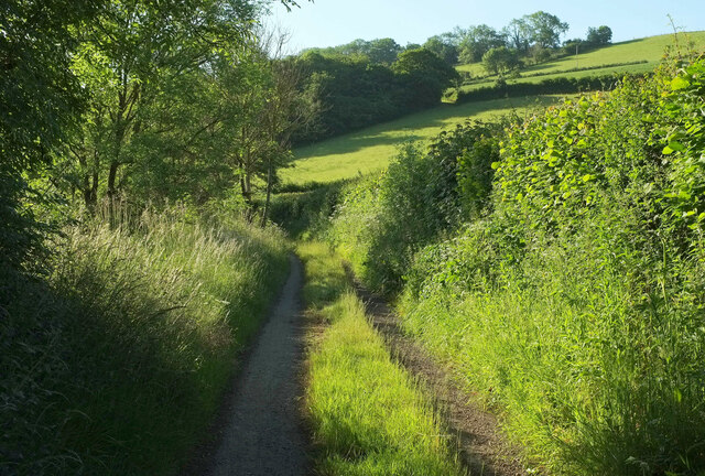
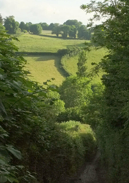
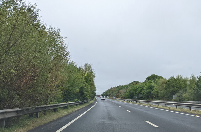
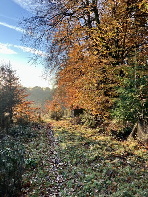
Ramshorn Down Images

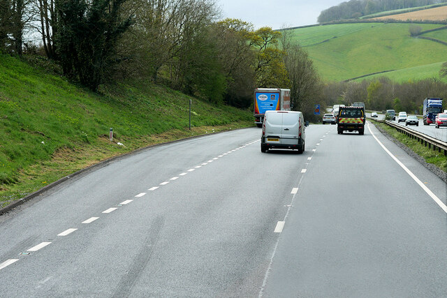
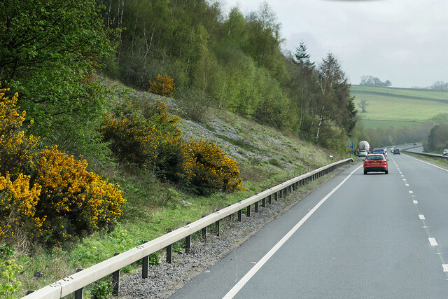
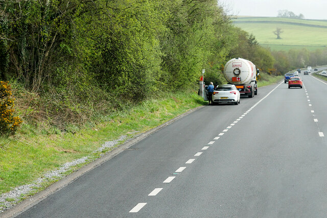
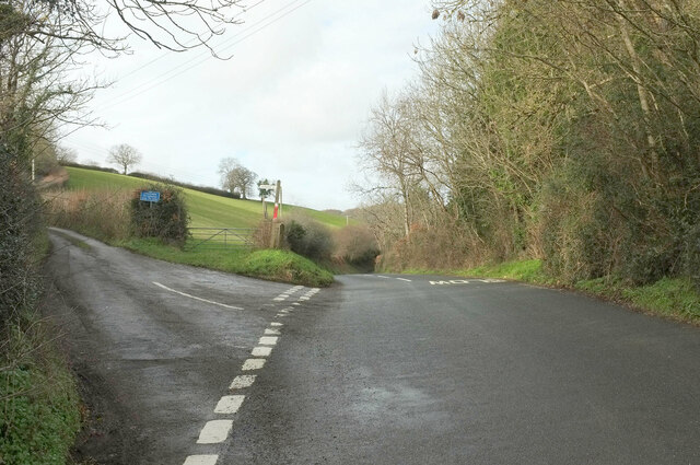
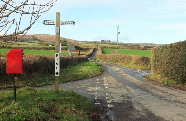
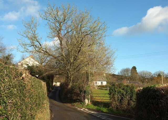
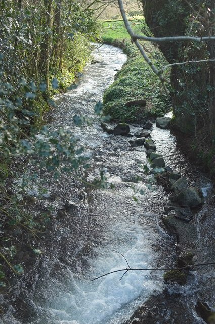
Images are sourced within 2km of 50.551849/-3.7051999 or Grid Reference SX7973. Thanks to Geograph Open Source API. All images are credited.

Layby on the Devon Expressway near Bickington The A38 is a major A-class trunk route. When first designated in 1922, it ran from Derby to Plymouth but it was later extended at both ends so that it now runs for 292 miles from Mansfield in Nottinghamshire to Bodmin in Cornwall.

Prior to the opening of the M5 motorway in the 1960s and 1970s, the A38 formed the main "holiday route" from the Midlands to Somerset, Devon and Cornwall and the south-western section was notorious at holiday times for the congestion. Nowadays, for most of the southern section, the A38 is a fairly quiet road shadowing the M5 extremely closely; often running alongside the motorway as a single carriageway road. The section between Exeter and Plymouth is, however, a busy dual carriageway which serves as the southern extension of the M5 and is known as “the Devon Expressway”.

More information at <span class="nowrap"><a title="http://en.wikipedia.org/wiki/A38_road" rel="nofollow ugc noopener" href="http://en.wikipedia.org/wiki/A38_road">Link</a><img style="margin-left:2px;" alt="External link" title="External link - shift click to open in new window" src="https://s1.geograph.org.uk/img/external.png" width="10" height="10"/></span>  (Wikipedia) and <span class="nowrap"><a title="http://www.sabre-roads.org.uk/wiki/index.php?title=A38" rel="nofollow ugc noopener" href="http://www.sabre-roads.org.uk/wiki/index.php?title=A38">Link</a><img style="margin-left:2px;" alt="External link" title="External link - shift click to open in new window" src="https://s1.geograph.org.uk/img/external.png" width="10" height="10"/></span>  (SABRE).
Layby on the Devon Expressway near Bickington
The A38 is a major A-class trunk route. When first designated in 1922, it ran from Derby to Plymouth but it was later extended at both ends so that it now runs for 292 miles from Mansfield in Nottinghamshire to Bodmin in Cornwall. Prior to the opening of the M5 motorway in the 1960s and 1970s, the A38 formed the main "holiday route" from the Midlands to Somerset, Devon and Cornwall and the south-western section was notorious at holiday times for the congestion. Nowadays, for most of the southern section, the A38 is a fairly quiet road shadowing the M5 extremely closely; often running alongside the motorway as a single carriageway road. The section between Exeter and Plymouth is, however, a busy dual carriageway which serves as the southern extension of the M5 and is known as “the Devon Expressway”. More information at LinkExternal link (Wikipedia) and LinkExternal link (SABRE).
Eastbound A38 between Goodstone and Bickington The A38 is a major A-class trunk route. When first designated in 1922, it ran from Derby to Plymouth but it was later extended at both ends so that it now runs for 292 miles from Mansfield in Nottinghamshire to Bodmin in Cornwall.

Prior to the opening of the M5 motorway in the 1960s and 1970s, the A38 formed the main "holiday route" from the Midlands to Somerset, Devon and Cornwall and the south-western section was notorious at holiday times for the congestion. Nowadays, for most of the southern section, the A38 is a fairly quiet road shadowing the M5 extremely closely; often running alongside the motorway as a single carriageway road. The section between Exeter and Plymouth is, however, a busy dual carriageway which serves as the southern extension of the M5 and is known as “the Devon Expressway”.

More information at <span class="nowrap"><a title="http://en.wikipedia.org/wiki/A38_road" rel="nofollow ugc noopener" href="http://en.wikipedia.org/wiki/A38_road">Link</a><img style="margin-left:2px;" alt="External link" title="External link - shift click to open in new window" src="https://s1.geograph.org.uk/img/external.png" width="10" height="10"/></span>  (Wikipedia) and <span class="nowrap"><a title="http://www.sabre-roads.org.uk/wiki/index.php?title=A38" rel="nofollow ugc noopener" href="http://www.sabre-roads.org.uk/wiki/index.php?title=A38">Link</a><img style="margin-left:2px;" alt="External link" title="External link - shift click to open in new window" src="https://s1.geograph.org.uk/img/external.png" width="10" height="10"/></span>  (SABRE).
Eastbound A38 between Goodstone and Bickington
The A38 is a major A-class trunk route. When first designated in 1922, it ran from Derby to Plymouth but it was later extended at both ends so that it now runs for 292 miles from Mansfield in Nottinghamshire to Bodmin in Cornwall. Prior to the opening of the M5 motorway in the 1960s and 1970s, the A38 formed the main "holiday route" from the Midlands to Somerset, Devon and Cornwall and the south-western section was notorious at holiday times for the congestion. Nowadays, for most of the southern section, the A38 is a fairly quiet road shadowing the M5 extremely closely; often running alongside the motorway as a single carriageway road. The section between Exeter and Plymouth is, however, a busy dual carriageway which serves as the southern extension of the M5 and is known as “the Devon Expressway”. More information at LinkExternal link (Wikipedia) and LinkExternal link (SABRE).
Layby on the A38 between Goodstone and Bickington The A38 is a major A-class trunk route. When first designated in 1922, it ran from Derby to Plymouth but it was later extended at both ends so that it now runs for 292 miles from Mansfield in Nottinghamshire to Bodmin in Cornwall.

Prior to the opening of the M5 motorway in the 1960s and 1970s, the A38 formed the main "holiday route" from the Midlands to Somerset, Devon and Cornwall and the south-western section was notorious at holiday times for the congestion. Nowadays, for most of the southern section, the A38 is a fairly quiet road shadowing the M5 extremely closely; often running alongside the motorway as a single carriageway road. The section between Exeter and Plymouth is, however, a busy dual carriageway which serves as the southern extension of the M5 and is known as “the Devon Expressway”.

More information at <span class="nowrap"><a title="http://en.wikipedia.org/wiki/A38_road" rel="nofollow ugc noopener" href="http://en.wikipedia.org/wiki/A38_road">Link</a><img style="margin-left:2px;" alt="External link" title="External link - shift click to open in new window" src="https://s1.geograph.org.uk/img/external.png" width="10" height="10"/></span>  (Wikipedia) and <span class="nowrap"><a title="http://www.sabre-roads.org.uk/wiki/index.php?title=A38" rel="nofollow ugc noopener" href="http://www.sabre-roads.org.uk/wiki/index.php?title=A38">Link</a><img style="margin-left:2px;" alt="External link" title="External link - shift click to open in new window" src="https://s1.geograph.org.uk/img/external.png" width="10" height="10"/></span>  (SABRE).
Layby on the A38 between Goodstone and Bickington
The A38 is a major A-class trunk route. When first designated in 1922, it ran from Derby to Plymouth but it was later extended at both ends so that it now runs for 292 miles from Mansfield in Nottinghamshire to Bodmin in Cornwall. Prior to the opening of the M5 motorway in the 1960s and 1970s, the A38 formed the main "holiday route" from the Midlands to Somerset, Devon and Cornwall and the south-western section was notorious at holiday times for the congestion. Nowadays, for most of the southern section, the A38 is a fairly quiet road shadowing the M5 extremely closely; often running alongside the motorway as a single carriageway road. The section between Exeter and Plymouth is, however, a busy dual carriageway which serves as the southern extension of the M5 and is known as “the Devon Expressway”. More information at LinkExternal link (Wikipedia) and LinkExternal link (SABRE).
Green lane by the A383 This is the course of the main road in past times. It now runs mere feet away to the left.
Green lane by the A383
This is the course of the main road in past times. It now runs mere feet away to the left.
Green lane by the A383 A little further along the lane shown in <a href="https://www.geograph.org.uk/photo/7198971">SX7971 : Green lane by the A383</a>. The hillside wood ahead is Mill Copse.
Green lane by the A383
A little further along the lane shown in SX7971 : Green lane by the A383. The hillside wood ahead is Mill Copse.
Valley side above the Lemon From one valley side to another. This is taken from the steep green lane that descends from the junction shown in <a href="https://www.geograph.org.uk/photo/7199305">SX7971 : Green lane junction</a> to Lemonford Mills.
Valley side above the Lemon
From one valley side to another. This is taken from the steep green lane that descends from the junction shown in SX7971 : Green lane junction to Lemonford Mills.
On the A38, westbound
Late Autumn colours Even though it’s early December, there are still plenty of green leaves in the area. Not including the obvious evergreen Sitka Spruce. But these large Southern Beech provide a lovely colourful scene.
Late Autumn colours
Even though it’s early December, there are still plenty of green leaves in the area. Not including the obvious evergreen Sitka Spruce. But these large Southern Beech provide a lovely colourful scene.
Willis's Cross The junction is also shown at <a title="https://www.geograph.org.uk/search.php?i=173337416" href="https://www.geograph.org.uk/search.php?i=173337416">Link</a> .
Willis's Cross
The junction is also shown at Link .
Five Cross A different angle on the junction where <a href="https://www.geograph.org.uk/photo/3727319">SX7874 : Five Cross</a> was taken. The diminutive signpost has been made a respectable size and a hydrant marker has attached itself to the Elizabeth II postbox. The eggs have sold out. In the background, the slightly wiggly lane heads to Haytor Vale and Ilsington.
Five Cross
A different angle on the junction where SX7874 : Five Cross was taken. The diminutive signpost has been made a respectable size and a hydrant marker has attached itself to the Elizabeth II postbox. The eggs have sold out. In the background, the slightly wiggly lane heads to Haytor Vale and Ilsington.
Sigford The junction is shown a little closer in <a href="https://www.geograph.org.uk/photo/5567247">SX7773 : Lane at Sigford</a>, nearly sixteen years earlier.  Little Grey House, the central of the three houses, is listed <span class="nowrap"><a title="https://historicengland.org.uk/listing/the-list/list-entry/1240944?section=official-list-entry" rel="nofollow ugc noopener" href="https://historicengland.org.uk/listing/the-list/list-entry/1240944?section=official-list-entry">Link</a><img style="margin-left:2px;" alt="External link" title="External link - shift click to open in new window" src="https://s1.geograph.org.uk/img/external.png" width="10" height="10"/></span> .
Sigford
The junction is shown a little closer in SX7773 : Lane at Sigford, nearly sixteen years earlier. Little Grey House, the central of the three houses, is listed LinkExternal link .
River Lemon Looking downstream from Cocksland Bridge. Immediately below the camera is a small weir.
River Lemon
Looking downstream from Cocksland Bridge. Immediately below the camera is a small weir.
Trees near Pool Down Wood A view from the road up the Liverton Brook valley. Pool Down Wood is in the background. The central tree with a purplish hue can only be an alder.
Trees near Pool Down Wood
A view from the road up the Liverton Brook valley. Pool Down Wood is in the background. The central tree with a purplish hue can only be an alder.
Five Cross Showing just two of the five ways. The "main road" is bound for either Haytor Vale or Ilsington. On the right is a public access route to Ilsington which involves a precipitous descent.
Five Cross
Showing just two of the five ways. The "main road" is bound for either Haytor Vale or Ilsington. On the right is a public access route to Ilsington which involves a precipitous descent.
Direction post, Five Cross Also shown at <a href="https://www.geograph.org.uk/photo/6072732">SX7874 : Old Guide Stone at Five Cross, Ilsington parish</a> and <a href="https://www.geograph.org.uk/photo/3727319">SX7874 : Five Cross</a>, and described at <span class="nowrap"><a title="https://historicengland.org.uk/listing/the-list/list-entry/1260938?section=official-list-entry" rel="nofollow ugc noopener" href="https://historicengland.org.uk/listing/the-list/list-entry/1260938?section=official-list-entry">Link</a><img style="margin-left:2px;" alt="External link" title="External link - shift click to open in new window" src="https://s1.geograph.org.uk/img/external.png" width="10" height="10"/></span> . This shows the southwest and southeast sides: " on south-west side TO ASHBURTON ... and on south-east side TO NEWTON."
Direction post, Five Cross
Also shown at SX7874 : Old Guide Stone at Five Cross, Ilsington parish and SX7874 : Five Cross, and described at LinkExternal link . This shows the southwest and southeast sides: " on south-west side TO ASHBURTON ... and on south-east side TO NEWTON."
Towards Higher Sigford From Bethel Cross. Haytor Down rises beyond.
Towards Higher Sigford
From Bethel Cross. Haytor Down rises beyond.
Towards Rippon Tor Looking left from <a href="https://www.geograph.org.uk/photo/7388713">SX7874 : Towards Higher Sigford</a>. That looks a huge spread of animal feed. Beyond it, on the right, is the wooded Lemon valley.
Towards Rippon Tor
Looking left from SX7874 : Towards Higher Sigford. That looks a huge spread of animal feed. Beyond it, on the right, is the wooded Lemon valley.
Sigford Bridge Over the River Lemon. The lane has come from Bethel Cross.
Sigford Bridge
Over the River Lemon. The lane has come from Bethel Cross.
Show me another place!

Ramshorn Down is located at Grid Ref: SX7973 (Lat: 50.551849, Lng: -3.7051999)

Administrative County: Devon

District: Teignbridge

Police Authority: Devon and Cornwall

What 3 Words

///builds.comically.bloodshot. Near Bovey Tracey, Devon

Related Wikis

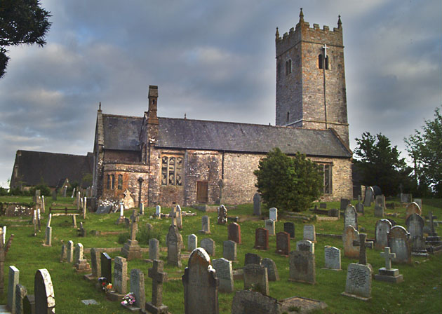
Church of St Mary the Virgin, Bickington

The Church of St Mary the Virgin, in Bickington, Devon, England, dates from the fifteenth century. The church is part of the Ashburton benefice, of the...

River Sig

The River Sig is a 2.4 mile long river on Dartmoor in the county of Devon, England. It is a tributary to the River Lemon which it meets at Sigford. �...

Church of St Peter, Shaldon

The Church of St Peter is the Church of England parish church of the village of Shaldon, Devon. Designed by Edmund Harold Sedding, and with later additions...

Sigford

Sigford is a small hamlet in the Parish of Ilsington, on the eastern edge of Dartmoor, Devon, England. It is situated at the confluence of three rivers...

Nearby Amenities

Located within 500m of 50.551849,-3.7051999
Parking
Capacity: 2
Lat/Long: 50.5508118/-3.7065378
Parking
Capacity: 15
Lat/Long: 50.5533545/-3.7091235
Tourism: viewpoint
Lat/Long: 50.5529506/-3.7039522
The data included in this document is from www.openstreetmap.org. The data is made available under ODbL.

Have you been to Ramshorn Down?

Leave your review of Ramshorn Down below (or comments, questions and feedback).