Bickington

Civil Parish in Devon Teignbridge

England

Bickington

Layby on the Devon Expressway near Bickington The A38 is a major A-class trunk route. When first designated in 1922, it ran from Derby to Plymouth but it was later extended at both ends so that it now runs for 292 miles from Mansfield in Nottinghamshire to Bodmin in Cornwall.

Prior to the opening of the M5 motorway in the 1960s and 1970s, the A38 formed the main "holiday route" from the Midlands to Somerset, Devon and Cornwall and the south-western section was notorious at holiday times for the congestion. Nowadays, for most of the southern section, the A38 is a fairly quiet road shadowing the M5 extremely closely; often running alongside the motorway as a single carriageway road. The section between Exeter and Plymouth is, however, a busy dual carriageway which serves as the southern extension of the M5 and is known as “the Devon Expressway”.

More information at <span class="nowrap"><a title="http://en.wikipedia.org/wiki/A38_road" rel="nofollow ugc noopener" href="http://en.wikipedia.org/wiki/A38_road">Link</a><img style="margin-left:2px;" alt="External link" title="External link - shift click to open in new window" src="https://s1.geograph.org.uk/img/external.png" width="10" height="10"/></span>  (Wikipedia) and <span class="nowrap"><a title="http://www.sabre-roads.org.uk/wiki/index.php?title=A38" rel="nofollow ugc noopener" href="http://www.sabre-roads.org.uk/wiki/index.php?title=A38">Link</a><img style="margin-left:2px;" alt="External link" title="External link - shift click to open in new window" src="https://s1.geograph.org.uk/img/external.png" width="10" height="10"/></span>  (SABRE).
Layby on the Devon Expressway near Bickington Credit: David Dixon

Bickington is a civil parish located in the county of Devon, England. Situated about 5 miles southwest of the market town of Barnstaple, Bickington is a small rural community with a population of around 1,200 people. The parish encompasses an area of approximately 2 square miles.

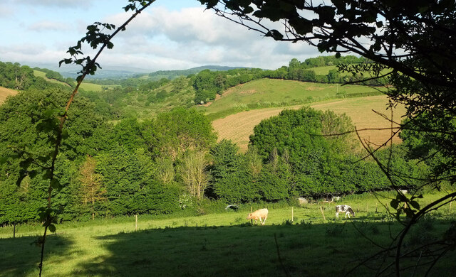
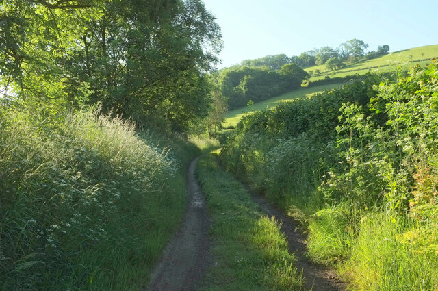
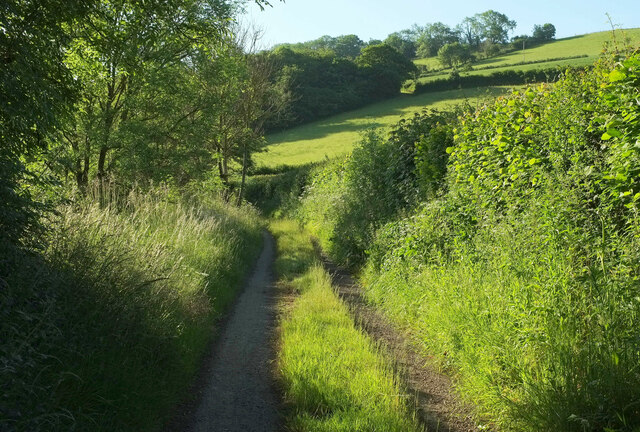
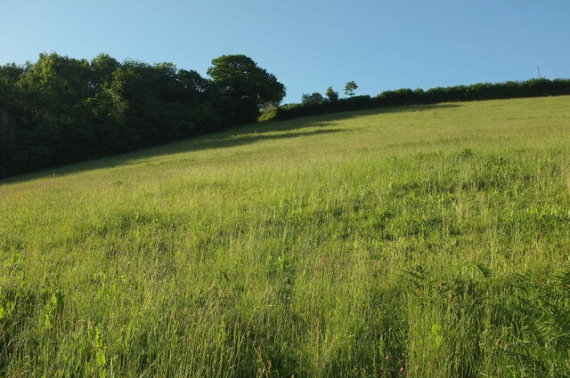
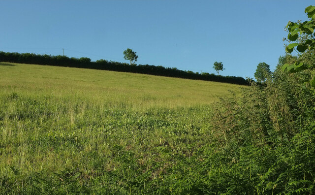
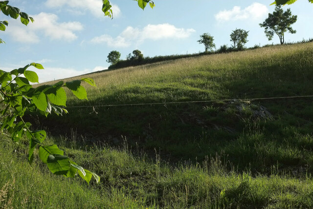
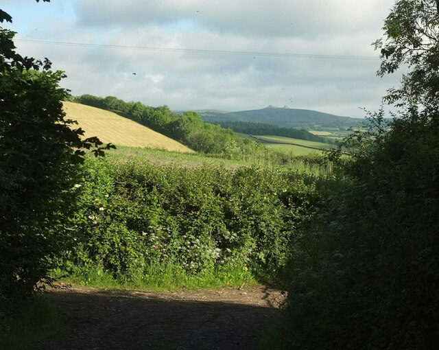
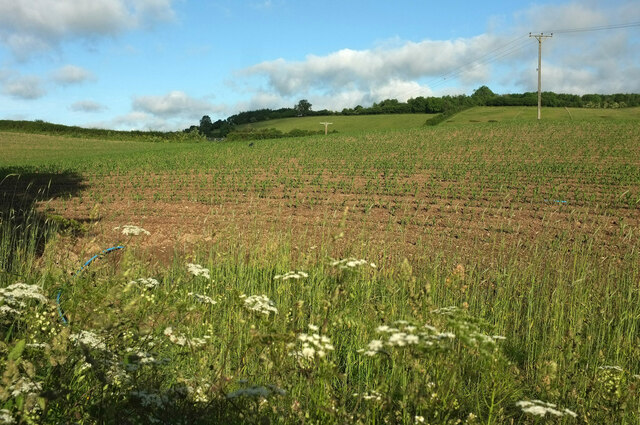
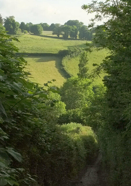
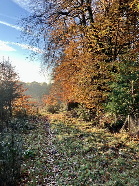
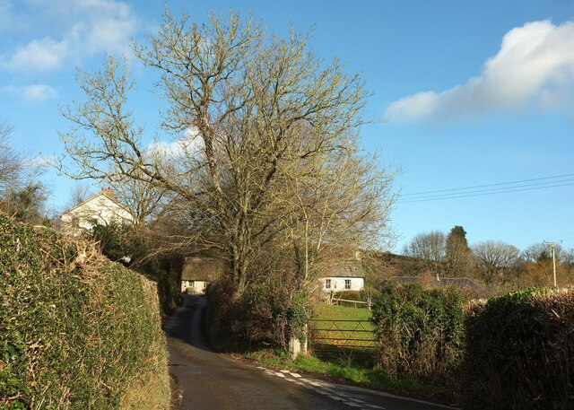
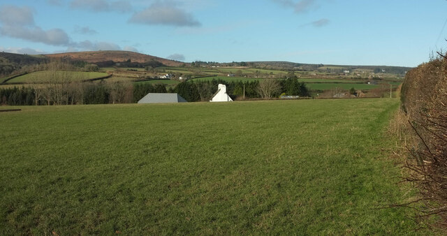
The village is nestled in the picturesque countryside of North Devon and offers stunning views of the surrounding rolling hills and farmland. Bickington is characterized by its charming thatched-roof cottages and traditional stone houses, which contribute to its quaint and idyllic atmosphere.

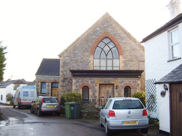
The village is home to a number of amenities and facilities, including a primary school, a village hall, and a local pub. The Bickington Community Centre serves as a hub for various community activities and events, offering a range of clubs and classes for residents of all ages.

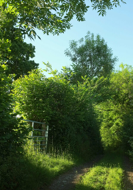
For outdoor enthusiasts, there are several scenic walking and cycling routes that crisscross the parish, allowing visitors to explore the beautiful countryside. The Tarka Trail, a popular long-distance footpath that follows the route of a former railway line, passes through Bickington, offering opportunities for leisurely strolls and bike rides.

Bickington's proximity to Barnstaple provides residents with easy access to a wider range of amenities, including supermarkets, shops, restaurants, and leisure facilities. The village also benefits from good transportation links, with regular bus services connecting it to surrounding towns and villages.

Overall, Bickington offers a peaceful and picturesque setting for residents seeking a rural lifestyle, while still providing convenient access to nearby amenities.

If you have any feedback on the listing, please let us know in the comments section below.

Bickington Images

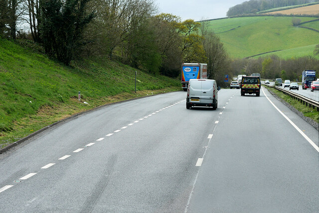
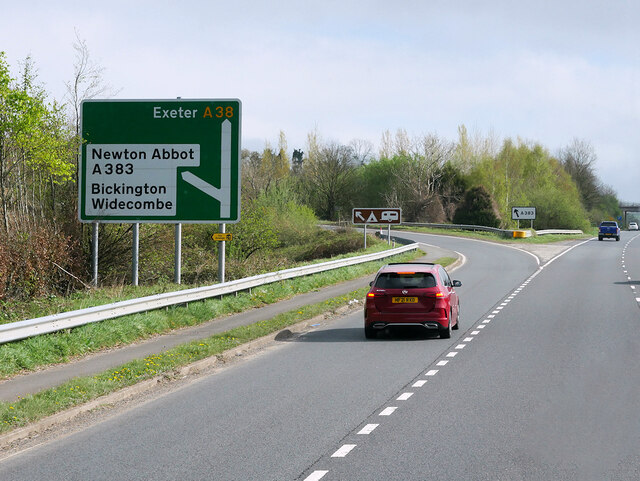
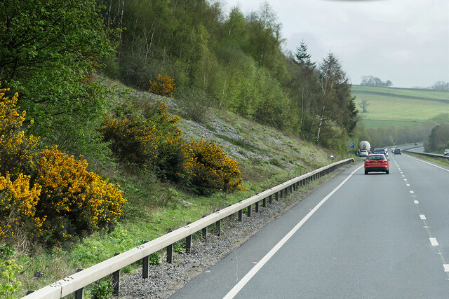
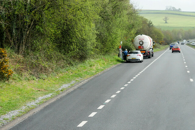
Images are sourced within 2km of 50.547318/-3.701833 or Grid Reference SX7973. Thanks to Geograph Open Source API. All images are credited.

Layby on the Devon Expressway near Bickington The A38 is a major A-class trunk route. When first designated in 1922, it ran from Derby to Plymouth but it was later extended at both ends so that it now runs for 292 miles from Mansfield in Nottinghamshire to Bodmin in Cornwall.

Prior to the opening of the M5 motorway in the 1960s and 1970s, the A38 formed the main "holiday route" from the Midlands to Somerset, Devon and Cornwall and the south-western section was notorious at holiday times for the congestion. Nowadays, for most of the southern section, the A38 is a fairly quiet road shadowing the M5 extremely closely; often running alongside the motorway as a single carriageway road. The section between Exeter and Plymouth is, however, a busy dual carriageway which serves as the southern extension of the M5 and is known as “the Devon Expressway”.

More information at <span class="nowrap"><a title="http://en.wikipedia.org/wiki/A38_road" rel="nofollow ugc noopener" href="http://en.wikipedia.org/wiki/A38_road">Link</a><img style="margin-left:2px;" alt="External link" title="External link - shift click to open in new window" src="https://s1.geograph.org.uk/img/external.png" width="10" height="10"/></span>  (Wikipedia) and <span class="nowrap"><a title="http://www.sabre-roads.org.uk/wiki/index.php?title=A38" rel="nofollow ugc noopener" href="http://www.sabre-roads.org.uk/wiki/index.php?title=A38">Link</a><img style="margin-left:2px;" alt="External link" title="External link - shift click to open in new window" src="https://s1.geograph.org.uk/img/external.png" width="10" height="10"/></span>  (SABRE).
Layby on the Devon Expressway near Bickington
The A38 is a major A-class trunk route. When first designated in 1922, it ran from Derby to Plymouth but it was later extended at both ends so that it now runs for 292 miles from Mansfield in Nottinghamshire to Bodmin in Cornwall. Prior to the opening of the M5 motorway in the 1960s and 1970s, the A38 formed the main "holiday route" from the Midlands to Somerset, Devon and Cornwall and the south-western section was notorious at holiday times for the congestion. Nowadays, for most of the southern section, the A38 is a fairly quiet road shadowing the M5 extremely closely; often running alongside the motorway as a single carriageway road. The section between Exeter and Plymouth is, however, a busy dual carriageway which serves as the southern extension of the M5 and is known as “the Devon Expressway”. More information at LinkExternal link (Wikipedia) and LinkExternal link (SABRE).
Goodstone Junction, Devon Expressway The A38 is a major A-class trunk route. When first designated in 1922, it ran from Derby to Plymouth but it was later extended at both ends so that it now runs for 292 miles from Mansfield in Nottinghamshire to Bodmin in Cornwall.

Prior to the opening of the M5 motorway in the 1960s and 1970s, the A38 formed the main "holiday route" from the Midlands to Somerset, Devon and Cornwall and the south-western section was notorious at holiday times for the congestion. Nowadays, for most of the southern section, the A38 is a fairly quiet road shadowing the M5 extremely closely; often running alongside the motorway as a single carriageway road. The section between Exeter and Plymouth is, however, a busy dual carriageway which serves as the southern extension of the M5 and is known as “the Devon Expressway”.

More information at <span class="nowrap"><a title="http://en.wikipedia.org/wiki/A38_road" rel="nofollow ugc noopener" href="http://en.wikipedia.org/wiki/A38_road">Link</a><img style="margin-left:2px;" alt="External link" title="External link - shift click to open in new window" src="https://s1.geograph.org.uk/img/external.png" width="10" height="10"/></span>  (Wikipedia) and <span class="nowrap"><a title="http://www.sabre-roads.org.uk/wiki/index.php?title=A38" rel="nofollow ugc noopener" href="http://www.sabre-roads.org.uk/wiki/index.php?title=A38">Link</a><img style="margin-left:2px;" alt="External link" title="External link - shift click to open in new window" src="https://s1.geograph.org.uk/img/external.png" width="10" height="10"/></span>  (SABRE).
Goodstone Junction, Devon Expressway
The A38 is a major A-class trunk route. When first designated in 1922, it ran from Derby to Plymouth but it was later extended at both ends so that it now runs for 292 miles from Mansfield in Nottinghamshire to Bodmin in Cornwall. Prior to the opening of the M5 motorway in the 1960s and 1970s, the A38 formed the main "holiday route" from the Midlands to Somerset, Devon and Cornwall and the south-western section was notorious at holiday times for the congestion. Nowadays, for most of the southern section, the A38 is a fairly quiet road shadowing the M5 extremely closely; often running alongside the motorway as a single carriageway road. The section between Exeter and Plymouth is, however, a busy dual carriageway which serves as the southern extension of the M5 and is known as “the Devon Expressway”. More information at LinkExternal link (Wikipedia) and LinkExternal link (SABRE).
Eastbound A38 between Goodstone and Bickington The A38 is a major A-class trunk route. When first designated in 1922, it ran from Derby to Plymouth but it was later extended at both ends so that it now runs for 292 miles from Mansfield in Nottinghamshire to Bodmin in Cornwall.

Prior to the opening of the M5 motorway in the 1960s and 1970s, the A38 formed the main "holiday route" from the Midlands to Somerset, Devon and Cornwall and the south-western section was notorious at holiday times for the congestion. Nowadays, for most of the southern section, the A38 is a fairly quiet road shadowing the M5 extremely closely; often running alongside the motorway as a single carriageway road. The section between Exeter and Plymouth is, however, a busy dual carriageway which serves as the southern extension of the M5 and is known as “the Devon Expressway”.

More information at <span class="nowrap"><a title="http://en.wikipedia.org/wiki/A38_road" rel="nofollow ugc noopener" href="http://en.wikipedia.org/wiki/A38_road">Link</a><img style="margin-left:2px;" alt="External link" title="External link - shift click to open in new window" src="https://s1.geograph.org.uk/img/external.png" width="10" height="10"/></span>  (Wikipedia) and <span class="nowrap"><a title="http://www.sabre-roads.org.uk/wiki/index.php?title=A38" rel="nofollow ugc noopener" href="http://www.sabre-roads.org.uk/wiki/index.php?title=A38">Link</a><img style="margin-left:2px;" alt="External link" title="External link - shift click to open in new window" src="https://s1.geograph.org.uk/img/external.png" width="10" height="10"/></span>  (SABRE).
Eastbound A38 between Goodstone and Bickington
The A38 is a major A-class trunk route. When first designated in 1922, it ran from Derby to Plymouth but it was later extended at both ends so that it now runs for 292 miles from Mansfield in Nottinghamshire to Bodmin in Cornwall. Prior to the opening of the M5 motorway in the 1960s and 1970s, the A38 formed the main "holiday route" from the Midlands to Somerset, Devon and Cornwall and the south-western section was notorious at holiday times for the congestion. Nowadays, for most of the southern section, the A38 is a fairly quiet road shadowing the M5 extremely closely; often running alongside the motorway as a single carriageway road. The section between Exeter and Plymouth is, however, a busy dual carriageway which serves as the southern extension of the M5 and is known as “the Devon Expressway”. More information at LinkExternal link (Wikipedia) and LinkExternal link (SABRE).
Layby on the A38 between Goodstone and Bickington The A38 is a major A-class trunk route. When first designated in 1922, it ran from Derby to Plymouth but it was later extended at both ends so that it now runs for 292 miles from Mansfield in Nottinghamshire to Bodmin in Cornwall.

Prior to the opening of the M5 motorway in the 1960s and 1970s, the A38 formed the main "holiday route" from the Midlands to Somerset, Devon and Cornwall and the south-western section was notorious at holiday times for the congestion. Nowadays, for most of the southern section, the A38 is a fairly quiet road shadowing the M5 extremely closely; often running alongside the motorway as a single carriageway road. The section between Exeter and Plymouth is, however, a busy dual carriageway which serves as the southern extension of the M5 and is known as “the Devon Expressway”.

More information at <span class="nowrap"><a title="http://en.wikipedia.org/wiki/A38_road" rel="nofollow ugc noopener" href="http://en.wikipedia.org/wiki/A38_road">Link</a><img style="margin-left:2px;" alt="External link" title="External link - shift click to open in new window" src="https://s1.geograph.org.uk/img/external.png" width="10" height="10"/></span>  (Wikipedia) and <span class="nowrap"><a title="http://www.sabre-roads.org.uk/wiki/index.php?title=A38" rel="nofollow ugc noopener" href="http://www.sabre-roads.org.uk/wiki/index.php?title=A38">Link</a><img style="margin-left:2px;" alt="External link" title="External link - shift click to open in new window" src="https://s1.geograph.org.uk/img/external.png" width="10" height="10"/></span>  (SABRE).
Layby on the A38 between Goodstone and Bickington
The A38 is a major A-class trunk route. When first designated in 1922, it ran from Derby to Plymouth but it was later extended at both ends so that it now runs for 292 miles from Mansfield in Nottinghamshire to Bodmin in Cornwall. Prior to the opening of the M5 motorway in the 1960s and 1970s, the A38 formed the main "holiday route" from the Midlands to Somerset, Devon and Cornwall and the south-western section was notorious at holiday times for the congestion. Nowadays, for most of the southern section, the A38 is a fairly quiet road shadowing the M5 extremely closely; often running alongside the motorway as a single carriageway road. The section between Exeter and Plymouth is, however, a busy dual carriageway which serves as the southern extension of the M5 and is known as “the Devon Expressway”. More information at LinkExternal link (Wikipedia) and LinkExternal link (SABRE).
Cattle near Combe Park A view from a green lane between Combe Park and the A383. The valley of the Kester Brook winds away on the left.
Cattle near Combe Park
A view from a green lane between Combe Park and the A383. The valley of the Kester Brook winds away on the left.
Green lane by the A383 This is the course of the main road in past times. It now runs mere feet away to the left.
Green lane by the A383
This is the course of the main road in past times. It now runs mere feet away to the left.
Green lane by the A383 A little further along the lane shown in <a href="https://www.geograph.org.uk/photo/7198971">SX7971 : Green lane by the A383</a>. The hillside wood ahead is Mill Copse.
Green lane by the A383
A little further along the lane shown in SX7971 : Green lane by the A383. The hillside wood ahead is Mill Copse.
Field beside Mill Copse The copse is on the left, sharing the steep valley side above the Lemon with this grass field seen from the junction of the green lane shown in <a href="https://www.geograph.org.uk/photo/7198971">SX7971 : Green lane by the A383</a> with a steep green lane up across the hill to the Kester Brook valley.
Field beside Mill Copse
The copse is on the left, sharing the steep valley side above the Lemon with this grass field seen from the junction of the green lane shown in SX7971 : Green lane by the A383 with a steep green lane up across the hill to the Kester Brook valley.
Field beside Mill Copse Looking right from <a href="https://www.geograph.org.uk/photo/7199029">SX7971 : Field beside Mill Copse</a>, with the hedge on the right of the camera bordering the steep public access route to Longstone Bridge on the Kester Brook.
Field beside Mill Copse
Looking right from SX7971 : Field beside Mill Copse, with the hedge on the right of the camera bordering the steep public access route to Longstone Bridge on the Kester Brook.
Green lane to Combe Park High above the Kestor Brook valley.
Green lane to Combe Park
High above the Kestor Brook valley.
Field above Combe Park On the other side of the green lane from <a href="https://www.geograph.org.uk/photo/7193522">SX7971 : Cattle near Combe Park</a> and from the gate shown in <a href="https://www.geograph.org.uk/photo/7199292">SX7971 : Green lane to Combe Park</a>.
Field above Combe Park
On the other side of the green lane from SX7971 : Cattle near Combe Park and from the gate shown in SX7971 : Green lane to Combe Park.
Green lane junction From a green lane from Combe Park, meeting a green lane from Longstone Bridge, which then leads to the right down to the Lemon valley.
Green lane junction
From a green lane from Combe Park, meeting a green lane from Longstone Bridge, which then leads to the right down to the Lemon valley.
Field above Gale An arable field seen from a gateway a few metres left of the junction shown in <a href="https://www.geograph.org.uk/photo/7199305">SX7971 : Green lane junction</a>.
Field above Gale
An arable field seen from a gateway a few metres left of the junction shown in SX7971 : Green lane junction.
Valley side above the Lemon From one valley side to another. This is taken from the steep green lane that descends from the junction shown in <a href="https://www.geograph.org.uk/photo/7199305">SX7971 : Green lane junction</a> to Lemonford Mills.
Valley side above the Lemon
From one valley side to another. This is taken from the steep green lane that descends from the junction shown in SX7971 : Green lane junction to Lemonford Mills.
On the A38, westbound
Late Autumn colours Even though it’s early December, there are still plenty of green leaves in the area. Not including the obvious evergreen Sitka Spruce. But these large Southern Beech provide a lovely colourful scene.
Late Autumn colours
Even though it’s early December, there are still plenty of green leaves in the area. Not including the obvious evergreen Sitka Spruce. But these large Southern Beech provide a lovely colourful scene.
Sigford The junction is shown a little closer in <a href="https://www.geograph.org.uk/photo/5567247">SX7773 : Lane at Sigford</a>, nearly sixteen years earlier.  Little Grey House, the central of the three houses, is listed <span class="nowrap"><a title="https://historicengland.org.uk/listing/the-list/list-entry/1240944?section=official-list-entry" rel="nofollow ugc noopener" href="https://historicengland.org.uk/listing/the-list/list-entry/1240944?section=official-list-entry">Link</a><img style="margin-left:2px;" alt="External link" title="External link - shift click to open in new window" src="https://s1.geograph.org.uk/img/external.png" width="10" height="10"/></span> .
Sigford
The junction is shown a little closer in SX7773 : Lane at Sigford, nearly sixteen years earlier. Little Grey House, the central of the three houses, is listed LinkExternal link .
Towards Higher Sigford From Bethel Cross. Haytor Down rises beyond.
Towards Higher Sigford
From Bethel Cross. Haytor Down rises beyond.
Show me another place!

Bickington is located at Grid Ref: SX7973 (Lat: 50.547318, Lng: -3.701833)

Administrative County: Devon

District: Teignbridge

Police Authority: Devon & Cornwall

What 3 Words

///buggy.shuffle.evoke. Near Ashburton, Devon

Related Wikis

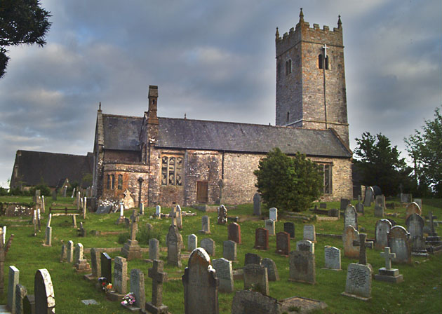
Church of St Mary the Virgin, Bickington

The Church of St Mary the Virgin, in Bickington, Devon, England, dates from the fifteenth century. The church is part of the Ashburton benefice, of the...

Church of St Peter, Shaldon

The Church of St Peter is the Church of England parish church of the village of Shaldon, Devon. Designed by Edmund Harold Sedding, and with later additions...

Bickington

Bickington is a village and civil parish in the Teignbridge district of Devon, England, on the east edge of the Dartmoor National Park. At the 2001 census...

River Sig

The River Sig is a 2.4 mile long river on Dartmoor in the county of Devon, England. It is a tributary to the River Lemon which it meets at Sigford. �...

Nearby Amenities

Located within 500m of 50.547318,-3.701833
Ford: yes
Lat/Long: 50.5454557/-3.7078616
Bench
Lat/Long: 50.5437688/-3.697575
The data included in this document is from www.openstreetmap.org. The data is made available under ODbL.

Have you been to Bickington?

Leave your review of Bickington below (or comments, questions and feedback).