Bickerton

Civil Parish in Cheshire

England

Bickerton

Larkton Hill
Larkton Hill Credit: Peter McDermott

Bickerton is a civil parish located in the county of Cheshire, England. It is situated in the south-eastern part of the county, near the border with Shropshire. The parish covers an area of approximately 9 square kilometers and has a population of around 200.

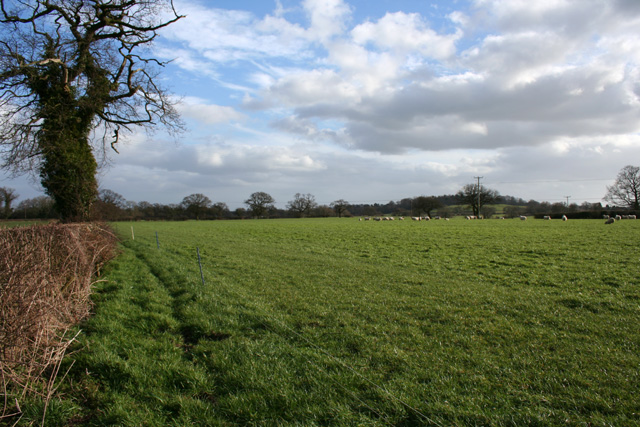
The village of Bickerton lies at the heart of the civil parish. It is a small and picturesque settlement, characterized by its charming cottages and traditional English countryside atmosphere. The village is surrounded by rolling hills and farmland, offering stunning views of the Cheshire Plain.

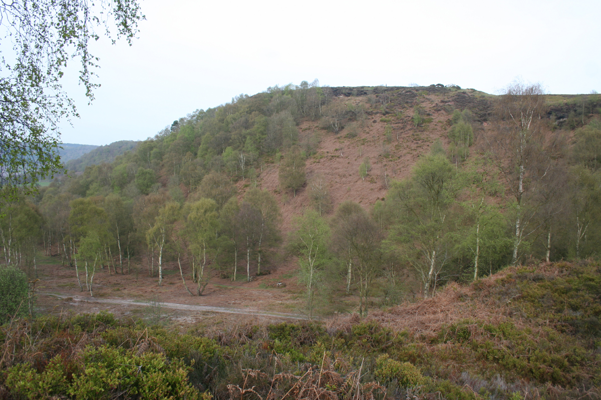
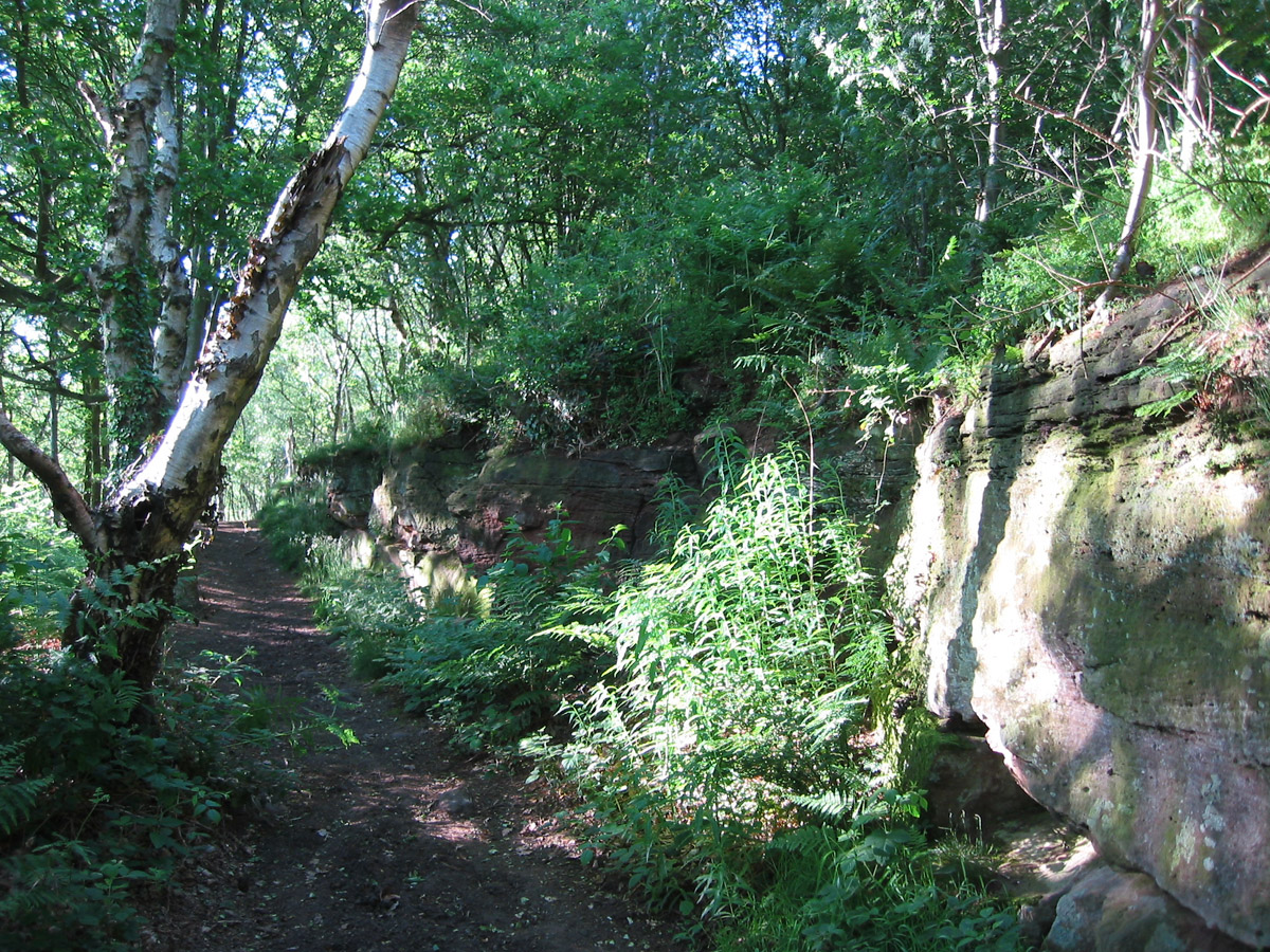
Bickerton is well-known for its natural beauty and is a popular destination for outdoor enthusiasts. The area is crisscrossed with footpaths and bridleways, making it ideal for walking, hiking, and horse riding. One of the highlights of the parish is Bickerton Hill, a prominent landmark that rises to a height of 226 meters. From the top of the hill, visitors can enjoy panoramic views of the surrounding countryside.

In addition to its natural attractions, Bickerton also has a rich history. The village is home to several historic buildings, including St. Werburgh's Church, which dates back to the 12th century. The church is known for its beautiful stained glass windows and medieval architecture.

Overall, Bickerton, Cheshire, offers visitors a tranquil and picturesque setting, with its rolling hills, charming village, and rich history. It is a perfect destination for those seeking a peaceful retreat in the heart of the English countryside.

If you have any feedback on the listing, please let us know in the comments section below.

Bickerton Images

Images are sourced within 2km of 53.075843/-2.729717 or Grid Reference SJ5153. Thanks to Geograph Open Source API. All images are credited.

Larkton Hill
Larkton Hill
Fingerpost, A534 Junction with Harthill Lane. One missing finger, with "CCC" shield but no manufacturer's marking.


Milestone Society National ID: CH_SJ5053B
Fingerpost, A534
Junction with Harthill Lane. One missing finger, with "CCC" shield but no manufacturer's marking. Milestone Society National ID: CH_SJ5053B
Harthill Horses at pond near Harthill.
Harthill
Horses at pond near Harthill.
Hill View
Hill View
Holy Trinity Church
Holy Trinity Church
Pool Farm Pond at Pool Farm.
Pool Farm
Pond at Pool Farm.
Trig Point on Raw Head The trig point on the highest part of Bickerton Hill, Raw Head.

Wikipedia Bickerton Hill <span class="nowrap"><a title="https://en.wikipedia.org/wiki/Bickerton_Hill" rel="nofollow ugc noopener" href="https://en.wikipedia.org/wiki/Bickerton_Hill">Link</a><img style="margin-left:2px;" alt="External link" title="External link - shift click to open in new window" src="https://s1.geograph.org.uk/img/external.png" width="10" height="10"/></span>
Trig Point on Raw Head
The trig point on the highest part of Bickerton Hill, Raw Head. Wikipedia Bickerton Hill LinkExternal link
View from Bickerton Hill on a Murky Day Looking west from the Sandstone Trail near Raw Head on Bickerton Hill on a murky winter's day.

Wikipedia Bickerton Hill <span class="nowrap"><a title="https://en.wikipedia.org/wiki/Bickerton_Hill" rel="nofollow ugc noopener" href="https://en.wikipedia.org/wiki/Bickerton_Hill">Link</a><img style="margin-left:2px;" alt="External link" title="External link - shift click to open in new window" src="https://s1.geograph.org.uk/img/external.png" width="10" height="10"/></span>
View from Bickerton Hill on a Murky Day
Looking west from the Sandstone Trail near Raw Head on Bickerton Hill on a murky winter's day. Wikipedia Bickerton Hill LinkExternal link
The Sandstone Trail near Rawhead Farm The Sandstone Trail between Bickerton Hill and Bulkeley Hill.

Wikipedia Sandstone Trail <span class="nowrap"><a title="https://en.wikipedia.org/wiki/Sandstone_Trail" rel="nofollow ugc noopener" href="https://en.wikipedia.org/wiki/Sandstone_Trail">Link</a><img style="margin-left:2px;" alt="External link" title="External link - shift click to open in new window" src="https://s1.geograph.org.uk/img/external.png" width="10" height="10"/></span>
The Sandstone Trail near Rawhead Farm
The Sandstone Trail between Bickerton Hill and Bulkeley Hill. Wikipedia Sandstone Trail LinkExternal link
View west off the Sandstone Trail below Larkton Hill
Sandstone Trail below Larkton Hill
Junction of paths on the Sandstone Trail
Woods off the Sandstone Trail
Sandstone Trail below Maiden Castle
Sandstone Trail climbing up to Maiden Castle The Sandstone Trail is the path on the right, climbing to Maiden Castle up the steps seen at <a href="https://www.geograph.org.uk/photo/4995601">SJ4952 : Sandstone Trail below Maiden Castle</a>.
Sandstone Trail climbing up to Maiden Castle
The Sandstone Trail is the path on the right, climbing to Maiden Castle up the steps seen at SJ4952 : Sandstone Trail below Maiden Castle.
View off Maiden Castle towards Brown Knowl
Show me another place!

Bickerton is located at Grid Ref: SJ5153 (Lat: 53.075843, Lng: -2.729717)

Unitary Authority: Cheshire East

Police Authority: Cheshire

What 3 Words

///twee.rainfall.unzipped. Near Harthill, Cheshire

Nearby Locations

Bickerton Gallantry Bank

Related Wikis

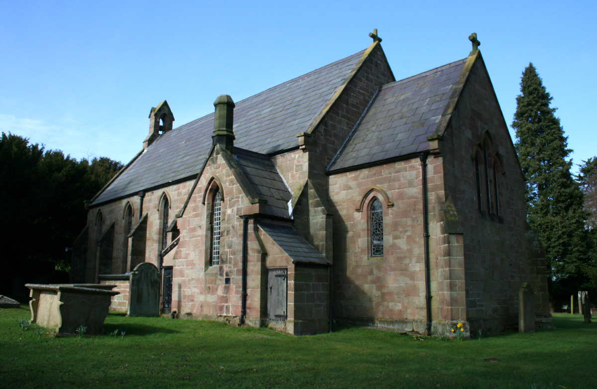
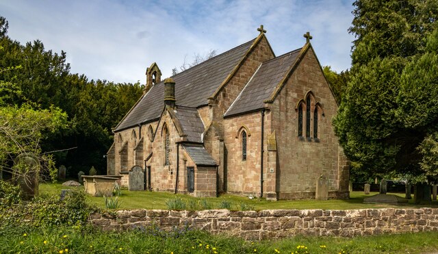
Holy Trinity Church, Bickerton

Holy Trinity Church stands to the north of the village of Bickerton, Cheshire, England. The church is recorded in the National Heritage List for England...

Bulkeley Hall

Bulkeley Hall is a country house to the southwest of the village of Bulkeley, Cheshire, England. It dates from the middle of the 18th century, and was...

Bickerton, Cheshire

Bickerton is a village and civil parish in the unitary authority of Cheshire East and the ceremonial county of Cheshire, England, about 8 miles (13 km...

Maiden Castle, Cheshire

Maiden Castle is an Iron Age hill fort, one of many fortified hill-top settlements constructed across Britain during the Iron Age, but one of only seven...

Bickerton Hill

Bickerton Hill refers to two low red sandstone hills that form the southern end of the Mid Cheshire Ridge in Cheshire, north-west England. The high point...

Brown Knowl Methodist Church

Brown Knowl Methodist Church is in Sherrington's Lane in the settlement of Brown Knowl in the civil parish of Broxton, Cheshire, England. The church,...

Larkton

Larkton is a former civil parish, now in the parish of No Man's Heath and District, in the Cheshire West and Chester district and ceremonial county of...

Egerton, Cheshire

Egerton is a civil parish in the unitary authority of Cheshire East and the ceremonial county of Cheshire, England. A largely rural area, the parish includes...

Nearby Amenities

Located within 500m of 53.075843,-2.729717
Bus Stop
Bickerton, Long Lane / Institute
Bus: yes
Naptan AtcoCode: 0600CR484
Naptan Bearing: SE
Naptan CommonName: Institute
Naptan Crossing: Reading Room Lane
Naptan Indicator: o/s
Naptan Landmark: Bickerton Institute
Naptan LocalityName: Bickerton
Naptan NaptanCode: chejwta
Naptan ShortCommonName: Institute
Naptan Street: Long Lane
Naptan Verified: yes
Network: Cheshire East Council
Operator: Ansa Transport
Public Transport: platform
Source: naptan_import
Lat/Long: 53.07895/-2.73433
Bus Stop
Bickerton, Brunty Bank / Holy Trinity Church
Bus: yes
Naptan AtcoCode: 0600CR487
Naptan Bearing: SW
Naptan CommonName: Holy Trinity Church
Naptan Indicator: adj
Naptan Landmark: War Memorial
Naptan LocalityName: Bickerton
Naptan NaptanCode: cheampg
Naptan ShortCommonName: Holy Trinity Church
Naptan Street: Brunty Bank
Naptan Verified: no
Network: Cheshire East Council
Operator: Ansa Transport
Public Transport: platform
Source: naptan_import
Lat/Long: 53.0774109/-2.7319168
Post Box
Brand: Royal Mail
Brand Wikidata: Q638098
Brand Wikipedia: en:Royal Mail
Collection Times: Mo-Fr 09:00; Sa 07:00; Su off
Drive Through: no
Old Ref: SY14 628
Operator: Royal Mail
Operator Wikidata: Q638098
Post Box Type: lamp
Ref: SY14 628D
Royal Cypher: EIIR
Lat/Long: 53.0786089/-2.7340167
Barrier: stile
Foot: yes
Source: GPS survey
Lat/Long: 53.0788475/-2.7342128
Historic: memorial
Memorial: war_memorial
Lat/Long: 53.0773181/-2.7326024
Give Way
Lat/Long: 53.0733376/-2.7322818
Give Way
Direction: forward
Lat/Long: 53.0772569/-2.7323851
Give Way
Direction: forward
Lat/Long: 53.0772263/-2.7325192
Give Way
Direction: forward
Lat/Long: 53.0786348/-2.7342211
Give Way
Lat/Long: 53.0795473/-2.7260145
Give Way
Lat/Long: 53.079602/-2.7263536
Post Box
Brand: Royal Mail
Brand Wikidata: Q638098
Brand Wikipedia: en:Royal Mail
Collection Times: Mo-Fr 17:00; Sa 10:00; Su off
Drive Through: no
Operator: Royal Mail
Operator Wikidata: Q638098
Post Box Type: lamp
Ref: SY14 672
Royal Cypher: EIIR
Royal Cypher Wikidata: Q33102113
Lat/Long: 53.078811/-2.7270759
Defibrillator
Emergency: defibrillator
Survey Date: 2021-07-19
Lat/Long: 53.0745191/-2.7365847
Entrance: yes
Lat/Long: 53.0786239/-2.7335442
Defibrillator
Access: yes
Defibrillator Location: outside Bickerton Village Hall (in entrance foyer)
Emergency: defibrillator
Lat/Long: 53.0786142/-2.7335401
Parking
Parking: layby
Lat/Long: 53.0745053/-2.7322955
The data included in this document is from www.openstreetmap.org. The data is made available under ODbL.

Have you been to Bickerton?

Leave your review of Bickerton below (or comments, questions and feedback).