Bryn Ceffyl

Downs, Moorland in Merionethshire

Wales

Bryn Ceffyl

Gravel track following route of disused railway line near Llyn Tryweryn
Gravel track following route of disused railway line near Llyn Tryweryn Credit: Steven Brown

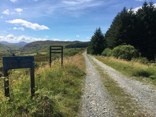
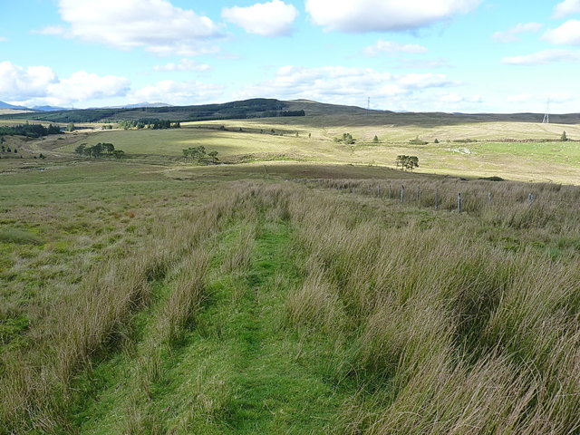
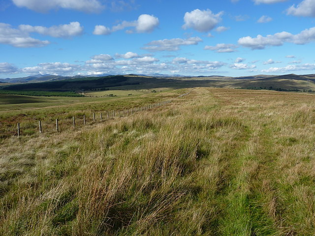
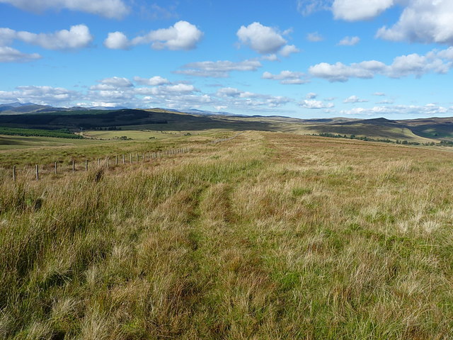
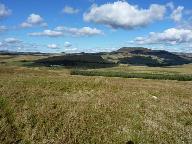
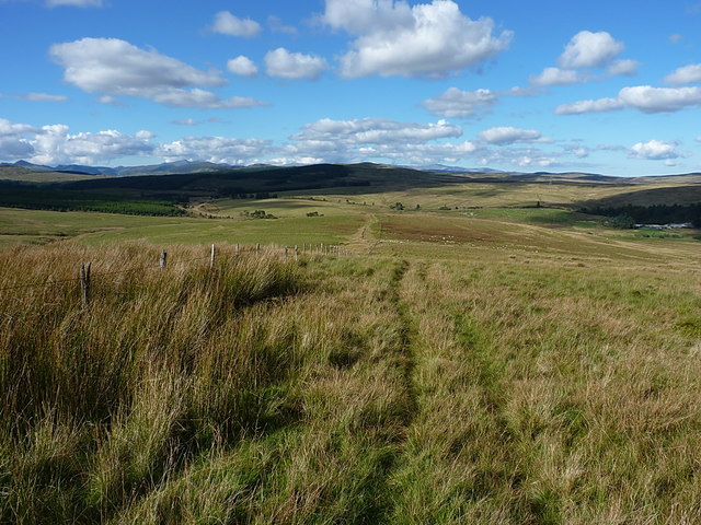
Bryn Ceffyl is a stunning region located in the county of Merionethshire, Wales. Known for its breathtaking scenery, it is characterized by its downs and moorlands, making it a haven for nature enthusiasts and outdoor adventurers alike.

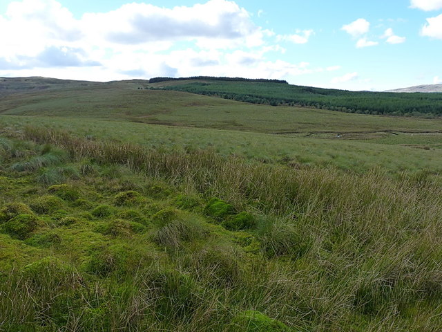
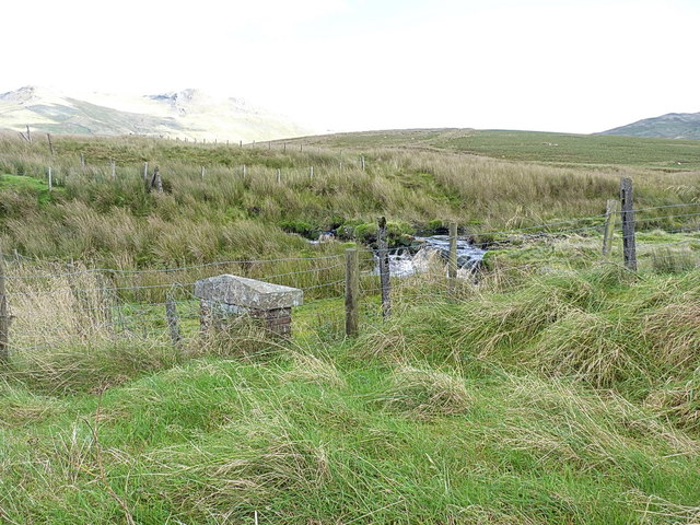
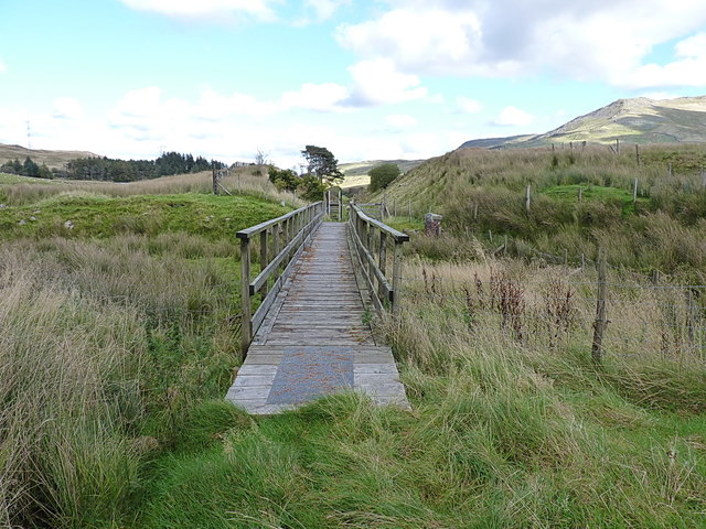
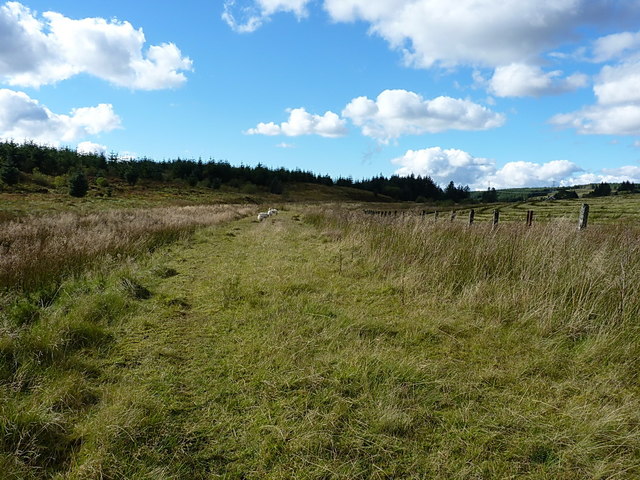
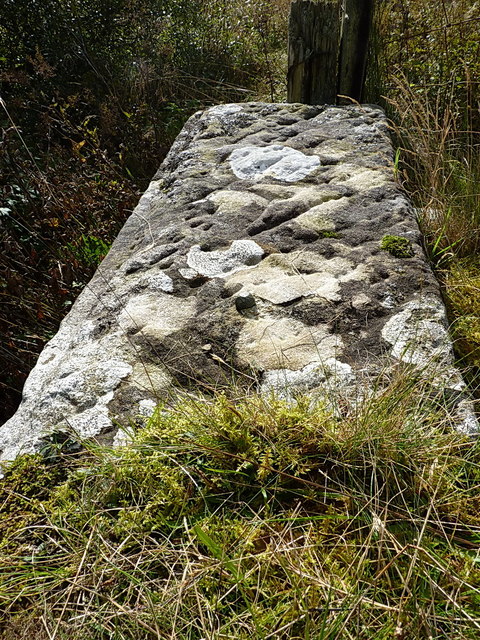
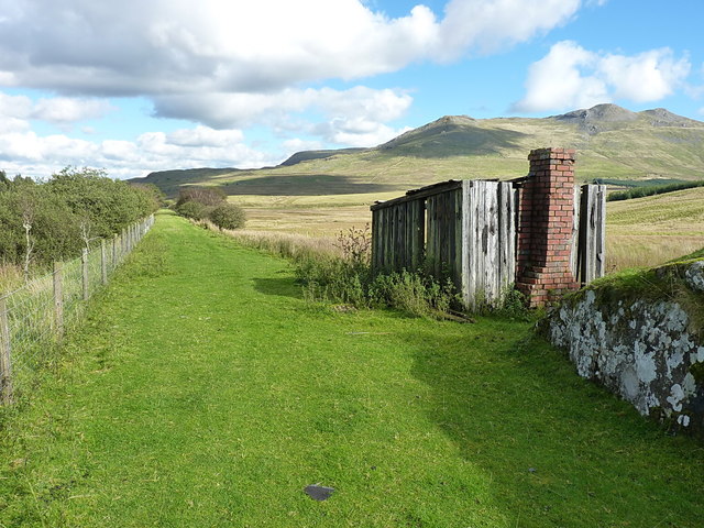
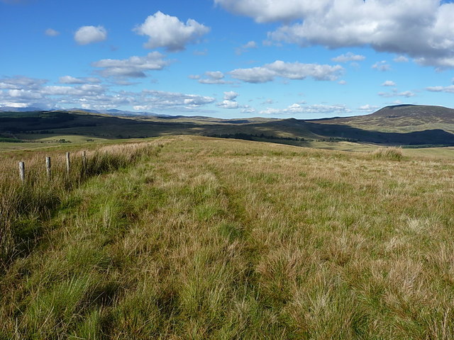
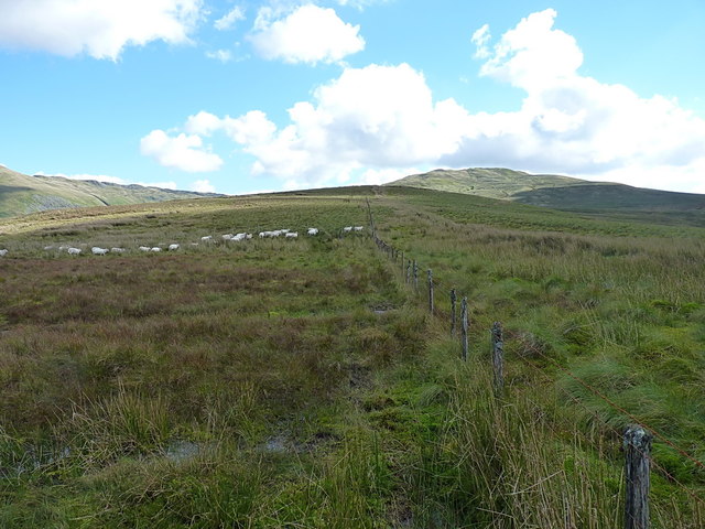
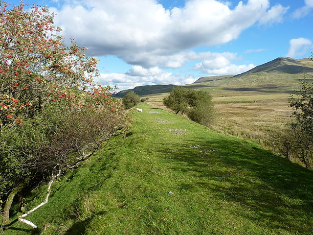
The area is primarily made up of gently rolling hills, offering panoramic views of the surrounding landscape. The downs of Bryn Ceffyl are covered in lush green grass, creating a picturesque backdrop that is often dotted with grazing sheep. The moorlands, on the other hand, are characterized by their wild beauty, with heather and gorse providing a colorful contrast to the rugged terrain.

Bryn Ceffyl is home to a diverse range of flora and fauna, making it an ideal destination for wildlife enthusiasts. The moorlands are particularly renowned for their birdlife, with species such as red grouse, golden plovers, and curlews thriving in the area. The downs are also home to many species of butterflies and wildflowers, adding to the region's natural beauty.

For those seeking outdoor adventures, Bryn Ceffyl offers a plethora of activities. The downs are perfect for hiking and walking, with numerous trails crisscrossing the landscape. Mountain biking is also popular, with many challenging routes available. The moorlands provide opportunities for birdwatching, as well as horseback riding and even camping for those seeking a more immersive experience.

In summary, Bryn Ceffyl in Merionethshire is a captivating region, boasting downs and moorlands that showcase the natural beauty of Wales. With its diverse wildlife, stunning vistas, and a range of outdoor activities, it is a must-visit destination for nature lovers and adventure seekers.

If you have any feedback on the listing, please let us know in the comments section below.

Bryn Ceffyl Images

Images are sourced within 2km of 52.918832/-3.807749 or Grid Reference SH7837. Thanks to Geograph Open Source API. All images are credited.

Gravel track following route of disused railway line near Llyn Tryweryn
Old field boundary and modern fence A little way above the Afon Treweryn and the disused railway line. The modern fence lies a few yards to the east of an older linear feature in the field, which I took to be a former (and long collapsed) boundary wall or fence-bottom.
Old field boundary and modern fence
A little way above the Afon Treweryn and the disused railway line. The modern fence lies a few yards to the east of an older linear feature in the field, which I took to be a former (and long collapsed) boundary wall or fence-bottom.
Over the Nant y Gist-Faen to the Penllyn Forest Rough grazing land in the valley of the Afon Treweryn.
Over the Nant y Gist-Faen to the Penllyn Forest
Rough grazing land in the valley of the Afon Treweryn.
OS pivot mark - Nant Ddu, railway bridge parapet wall An OS pivot mark on the coping stone of a now-disused railway bridge over the Afon Treweryn; originally levelled in 1942 at 384.636m above Ordnance Datum Newlyn.
OS pivot mark - Nant Ddu, railway bridge parapet wall
An OS pivot mark on the coping stone of a now-disused railway bridge over the Afon Treweryn; originally levelled in 1942 at 384.636m above Ordnance Datum Newlyn.
Former railway bridge parapet over the Afon Treweryn This is the location of the pivot mark in <a href="https://www.geograph.org.uk/photo/5179809">SH7938 : OS pivot mark - Nant Ddu, railway bridge parapet wall</a> with a view up the hill towards Arenig Fawr above.
Former railway bridge parapet over the Afon Treweryn
This is the location of the pivot mark in SH7938 : OS pivot mark - Nant Ddu, railway bridge parapet wall with a view up the hill towards Arenig Fawr above.
Footbridge over the Afon Treweryn Much of the disused GWR Bala to Blaenau Ffestiniog railway is open for walking or cycling, and many of the demolished bridges have been replaced by structures such as this one. It certainly does the job, and avoids paddling through the river.
Footbridge over the Afon Treweryn
Much of the disused GWR Bala to Blaenau Ffestiniog railway is open for walking or cycling, and many of the demolished bridges have been replaced by structures such as this one. It certainly does the job, and avoids paddling through the river.
West along the old railway line The ex-GWR Bala to Blaenau Ffestiniog railway, which was closed in the early 1960s. This section makes for a pleasant walk.
West along the old railway line
The ex-GWR Bala to Blaenau Ffestiniog railway, which was closed in the early 1960s. This section makes for a pleasant walk.
OS bolt - Cefn Llyn An OSBM copper or brass bolt set into the coping stone of a disused bridge at the SW side of the former railway line; it was levelled in 1942 at 388.398m above Ordnance Datum Newlyn.
OS bolt - Cefn Llyn
An OSBM copper or brass bolt set into the coping stone of a disused bridge at the SW side of the former railway line; it was levelled in 1942 at 388.398m above Ordnance Datum Newlyn.
Parapet wall of former bridge In mid-shot, this coping stone of the bridge contains the <a href="https://www.geograph.org.uk/photo/5179832">SH7938 : OS bolt - Cefn Llyn</a>
Parapet wall of former bridge
In mid-shot, this coping stone of the bridge contains the SH7938 : OS bolt - Cefn Llyn
Disused platers' hut beside the railway line Long fallen into both disuse and ruin, the only semi-permanent part of this construction is the brick chimney and fireplace, the rest being made of old sleepers.
Disused platers' hut beside the railway line
Long fallen into both disuse and ruin, the only semi-permanent part of this construction is the brick chimney and fireplace, the rest being made of old sleepers.
Probable accommodation bridge under the disused railway line A small bridge under the line, very boggy in the base; it's not clear whether it's taking drainage across the line, or is a genuine accommodation bridge for the hill farm.
Probable accommodation bridge under the disused railway line
A small bridge under the line, very boggy in the base; it's not clear whether it's taking drainage across the line, or is a genuine accommodation bridge for the hill farm.
Hill fence and a vague track above Amnodd-bwll
Down the fenceline A vague track from occasional use by a quad-bike runs along parallel to this fence, down the summit of the spur that runs north from Moel Llyfnant. It's all fairly boggy underfoot.
Down the fenceline
A vague track from occasional use by a quad-bike runs along parallel to this fence, down the summit of the spur that runs north from Moel Llyfnant. It's all fairly boggy underfoot.
Almost north along the fenceline The fence here runs more or less along the crest of a ridge that drops from Moel Llyfnant to the old railway line. There is no path as such, but a faint quadbike track parallels the fence for much of the way, easing the way for walking through deep grass.
Almost north along the fenceline
The fence here runs more or less along the crest of a ridge that drops from Moel Llyfnant to the old railway line. There is no path as such, but a faint quadbike track parallels the fence for much of the way, easing the way for walking through deep grass.
Grassy fields above Nant Ddu Grazings of the sheep-farm in the valley of the Afon Treweryn, with Arening Fach prominent in the distance.
Grassy fields above Nant Ddu
Grazings of the sheep-farm in the valley of the Afon Treweryn, with Arening Fach prominent in the distance.
West of Cefn Glas Fence and quadbike track on the hillside above the Afon Amnodd-bwll.
West of Cefn Glas
Fence and quadbike track on the hillside above the Afon Amnodd-bwll.
Some unknown attraction for the sheep This flock of sheep departed the corner of the field as I crossed the fence and walked through them; they then returned more or less as soon as I'd gone 50 yards through the bogs down the hill. Nope, I can't see what was so attractive about that particular corner of the field either.
Some unknown attraction for the sheep
This flock of sheep departed the corner of the field as I crossed the fence and walked through them; they then returned more or less as soon as I'd gone 50 yards through the bogs down the hill. Nope, I can't see what was so attractive about that particular corner of the field either.
Along the railway line south of Nant Ddu Eastwards (to Bala) along the route of the ex-GWR Bala to Blaenau Ffestiniog railway line, which closed in the early 1960s.
Along the railway line south of Nant Ddu
Eastwards (to Bala) along the route of the ex-GWR Bala to Blaenau Ffestiniog railway line, which closed in the early 1960s.
Show me another place!

Bryn Ceffyl is located at Grid Ref: SH7837 (Lat: 52.918832, Lng: -3.807749)

Unitary Authority: Gwynedd

Police Authority: North Wales

What 3 Words

///shelters.twinge.midfield. Near Trawsfynydd, Gwynedd

Nearby Locations

Bryn Ceffyl Y Trinant

Related Wikis

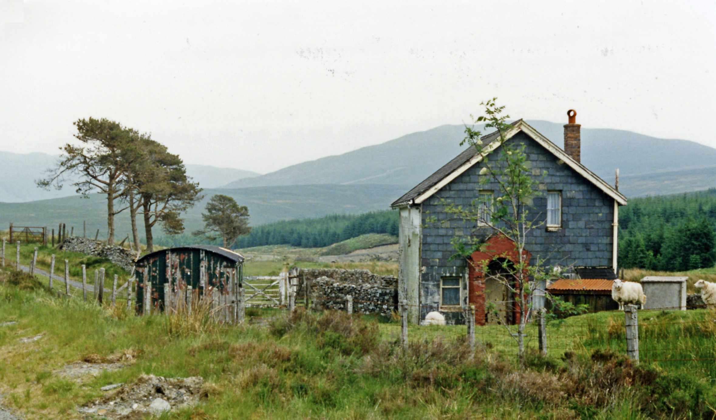
Cwm Prysor Halt railway station

Cwm Prysor Halt (named simply Cwm Prysor until 1953) was a railway station which served the remote rural area of Cwm Prysor, east of Trawsfynydd, Gwynedd...
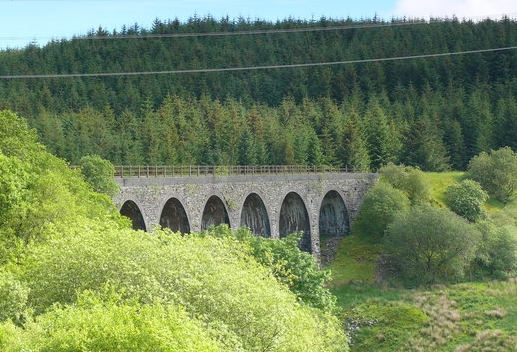
Cwm Prysor Viaduct

Cwm Prysor Viaduct, which is occasionally referred to as Blaen-y-Cwm Viaduct, is a railway viaduct which crosses the Afon Prysor in thinly populated uplands...

Moel Llyfnant

Moel Llyfnant is a mountain in the southern portion of the Snowdonia National Park in Gwynedd, Wales. It is a peak in the Arenig mountain range. It lies...

Snowdonia

Snowdonia, or Eryri (pronounced [ɛrəri] ), is a mountainous region and national park in northwestern Wales. It contains all 15 mountains in Wales over...

Bryn-Celynog Halt railway station

Bryn-Celynog Halt (sometimes written as Bryncelynog Halt) was an unstaffed solely passenger railway station which served the rural area of Bryn-Celynog...

Foel Boeth

Foel Boeth is the twin top of Gallt y Daren in the southern half of the Snowdonia National Park in Gwynedd, North Wales, and forms part of the Arenig mountain...

Gallt y Daren

Gallt y Daren is a peak in the southern half of the Snowdonia National Park in Gwynedd, North Wales, and forms part of the Arenig mountain range. It is...

Arenig Fawr South Top

Arenig Fawr South Top is the twin top of Arenig Fawr in southern Snowdonia, North Wales. It is the second highest member of the Arenig range, being 18...

Have you been to Bryn Ceffyl?

Leave your review of Bryn Ceffyl below (or comments, questions and feedback).