Badgworthy Lees

Downs, Moorland in Devon North Devon

England

Badgworthy Lees

Brendon: Badgworthy Wood Woodland on the walk south from Malmsmead to the 'Doone Country', beside Badgworthy Water
Brendon: Badgworthy Wood Credit: Martin Bodman

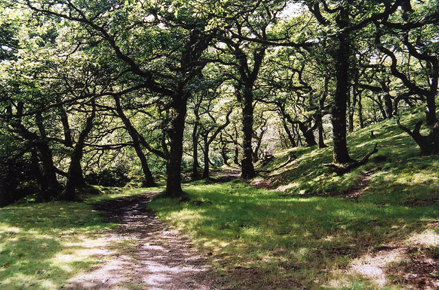
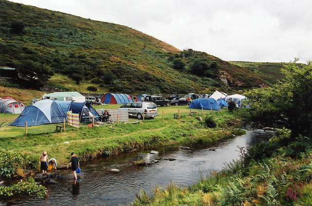
Badgworthy Lees is a picturesque area located in the county of Devon, England. Set in the heart of Exmoor National Park, it is renowned for its stunning natural beauty and diverse landscapes. Covering a vast expanse of downs and moorland, Badgworthy Lees offers visitors a unique and immersive experience in the great outdoors.

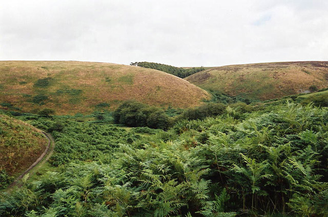
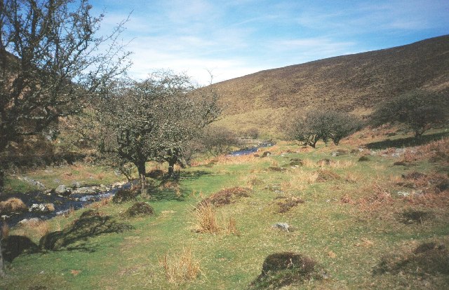
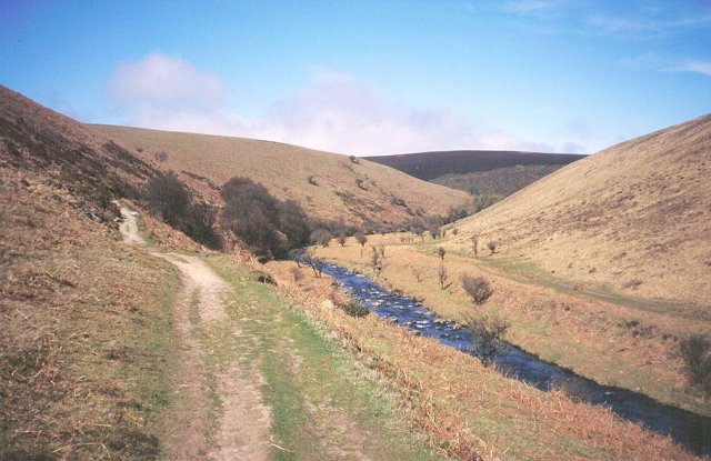
The downs of Badgworthy Lees are characterized by their gently rolling hills and lush green pastures. It is a haven for wildlife enthusiasts, as the area is home to a variety of bird species, including skylarks and meadow pipits. The tranquility of the downs makes it an ideal spot for leisurely walks, picnics, and enjoying the sweeping views of the surrounding countryside.

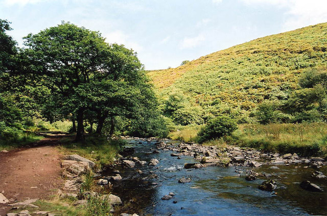
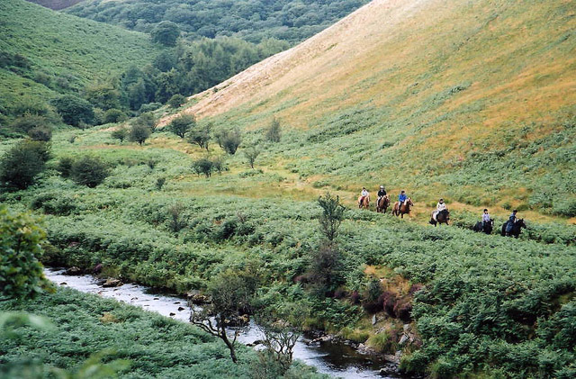
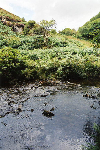
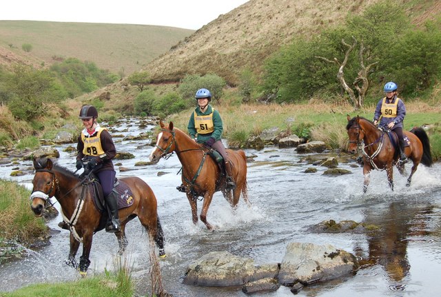
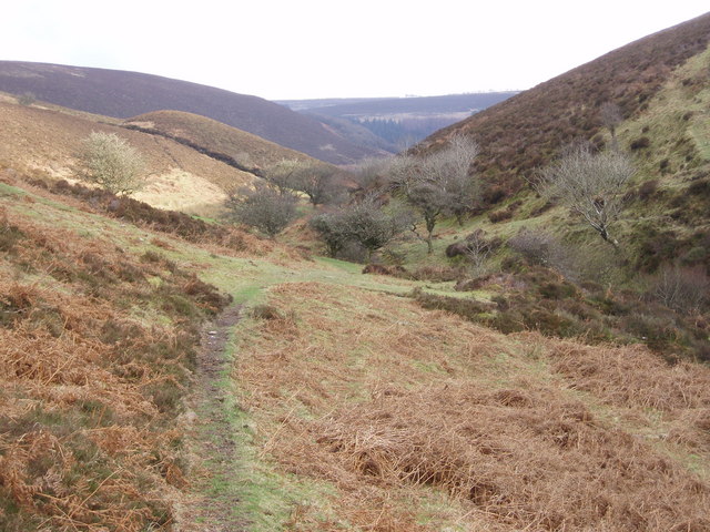
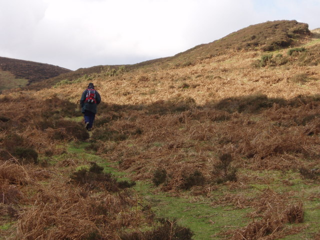
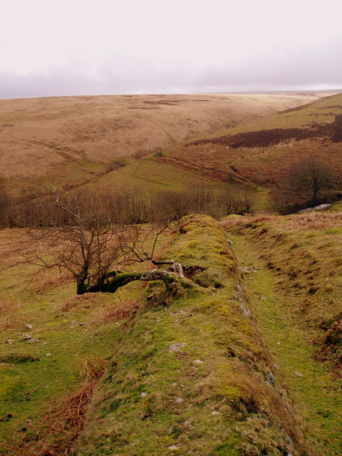
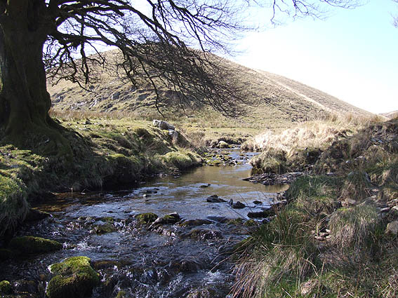
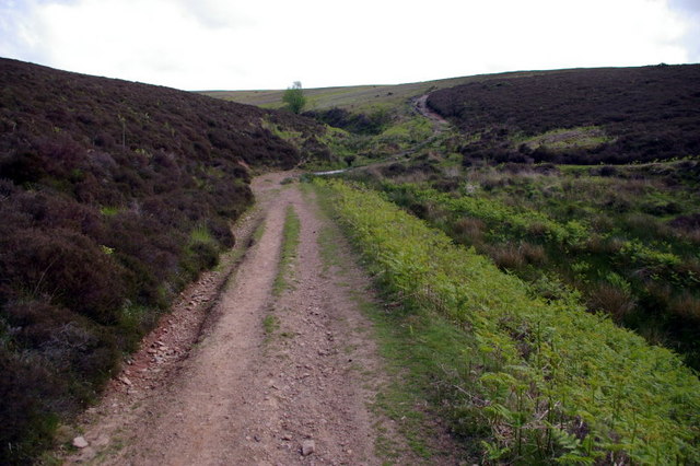
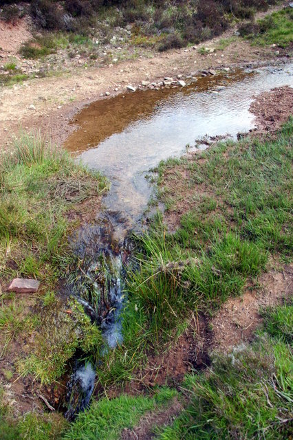
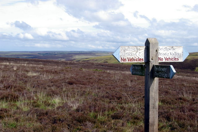
In contrast, the moorland of Badgworthy Lees presents a more rugged and wild landscape. Visitors will find themselves surrounded by heather-covered hills, rocky outcrops, and winding streams. The moorland is crisscrossed by a network of footpaths and trails, inviting hikers and nature lovers to explore its hidden corners. It is not uncommon to encounter wild ponies and deer grazing in this untamed terrain.

For those seeking a more adventurous experience, Badgworthy Lees offers opportunities for outdoor activities such as mountain biking, horseback riding, and even wild camping. With its remote location and minimal light pollution, it also attracts stargazers and astronomy enthusiasts, providing a clear and uninterrupted view of the night sky.

Overall, Badgworthy Lees is a captivating destination for nature enthusiasts and those looking to escape the hustle and bustle of everyday life. Its combination of downs and moorland creates a diverse and captivating landscape, offering something for everyone to enjoy.

If you have any feedback on the listing, please let us know in the comments section below.

Badgworthy Lees Images

Images are sourced within 2km of 51.190659/-3.7398984 or Grid Reference SS7844. Thanks to Geograph Open Source API. All images are credited.

Brendon: Badgworthy Wood Woodland on the walk south from Malmsmead to the 'Doone Country', beside Badgworthy Water
Brendon: Badgworthy Wood
Woodland on the walk south from Malmsmead to the 'Doone Country', beside Badgworthy Water
Brendon: Badgworthy Water With the Oare Water, Badgworthy Water combines to form the East Lyn, which meets the West Lyn at Lynmouth. By the path south from Malmsmead
Brendon: Badgworthy Water
With the Oare Water, Badgworthy Water combines to form the East Lyn, which meets the West Lyn at Lynmouth. By the path south from Malmsmead
Brendon: Badgworthy Water Badgworthy Water provides the border between west Somerset and north Devon. Riders on the Somerset bank in Oare parish
Brendon: Badgworthy Water
Badgworthy Water provides the border between west Somerset and north Devon. Riders on the Somerset bank in Oare parish
Brendon: site of medieval village Overlooking the site of a medieval village at the foot of Hoccombe Combe, in 'Doone Country', lost in the bracken
Brendon: site of medieval village
Overlooking the site of a medieval village at the foot of Hoccombe Combe, in 'Doone Country', lost in the bracken
Brendon: view to Cloud Farm camp site Cloud Farm is across the county boundary in Somerset. The river is Badgworthy Water and nearby, on the Devon bank, is the memorial stone to R D Blackmore, the creator of 'Lorna Doone'
Brendon: view to Cloud Farm camp site
Cloud Farm is across the county boundary in Somerset. The river is Badgworthy Water and nearby, on the Devon bank, is the memorial stone to R D Blackmore, the creator of 'Lorna Doone'
Brendon: Badgworthy Water Looking east to the Somerset bank
Brendon: Badgworthy Water
Looking east to the Somerset bank
Badgworthy Water River, deep in the moor.  Heads north to join the East Lyn.
Badgworthy Water
River, deep in the moor. Heads north to join the East Lyn.
Badgworthy Water The river downstream and north of the medieval village.
Badgworthy Water
The river downstream and north of the medieval village.
Crossing Badgworthy Water Riders crossing in a south west direction heading towards the remains of the medieval village.
Crossing Badgworthy Water
Riders crossing in a south west direction heading towards the remains of the medieval village.
Looking down Lankcombe The path leads down to the valley of Badgworthy Water, Little Black Hill on the left.
Looking down Lankcombe
The path leads down to the valley of Badgworthy Water, Little Black Hill on the left.
Upper Lank Combe Walking towards the ford.
Upper Lank Combe
Walking towards the ford.
Standing stone above Badgworthy Water Standing stone on Badgworthy Lees above Badgworthy Water which flows through the Doone Valley (made famous in RD Blackmore's "Lorna Doone"). There is also a deserted medieval village in the valley below this stone.
Standing stone above Badgworthy Water
Standing stone on Badgworthy Lees above Badgworthy Water which flows through the Doone Valley (made famous in RD Blackmore's "Lorna Doone"). There is also a deserted medieval village in the valley below this stone.
Field boundary looking South from Badgworthy Lees Field boundary looking South from Badgworthy Lees into Hoccombe Combe.
Field boundary looking South from Badgworthy Lees
Field boundary looking South from Badgworthy Lees into Hoccombe Combe.
Hoccombe Water, Exmoor Looking south west, at the confluence of the main water and (Lanacombe?) stream
Hoccombe Water, Exmoor
Looking south west, at the confluence of the main water and (Lanacombe?) stream
Ford Close up view of ford at location shown in previous picture.
Ford
Close up view of ford at location shown in previous picture.
Bridleway Crossroads View East towards Great Black Hill, not that it stands out as one!
Bridleway Crossroads
View East towards Great Black Hill, not that it stands out as one!
Fox's Den There are five foxes in this picture with possibly more below ground. Local to this den are a number of carcases that appear to have been scavenged by the foxes.
Fox's Den
There are five foxes in this picture with possibly more below ground. Local to this den are a number of carcases that appear to have been scavenged by the foxes.
Show me another place!

Badgworthy Lees is located at Grid Ref: SS7844 (Lat: 51.190659, Lng: -3.7398984)

Administrative County: Devon

District: North Devon

Police Authority: Devon and Cornwall

What 3 Words

///flopped.estimated.flashing. Near Lynton, Devon

Related Wikis

Lanacombe

Lanacombe is an area of Exmoor in Somerset, South West England. It is the site of several standing stones and cairns which have been scheduled as ancient...

Oare, Somerset

Oare is a village and civil parish on Oare Water on Exmoor in the Somerset West and Taunton district of Somerset, England. It is located 6 miles (10 km...

North Exmoor SSSI

North Exmoor (grid reference SS800430) is a 12,005.3-hectare (29,666-acre) biological Site of Special Scientific Interest (SSSI) in Devon and Somerset...

Malmsmead Bridge

Malmsmead Bridge is a 17th-century stone bridge which crosses Badgworthy Water in the hamlet of Malmsmead, on the road between Oare and Brendon. The Badgworthy...

Church of St Mary, Oare

The Anglican Church of St Mary in Oare, Somerset, England, was built in the 15th century. It is a Grade II* listed building. == History == The nave and...

Malmsmead

Malmsmead is a hamlet on the border between the English counties of Devon and Somerset. The nearest town is Lynton, which lies approximately 4.7 miles...

Oare Water

Oare Water passes through the village of Oare, on Exmoor in Somerset, England. It joins Badgworthy Water before flowing to Watersmeet and the Bristol Channel...

Badgworthy Water

Badgworthy Water is a small river which flows through Malmsmead on Exmoor, close to the border between Devon and Somerset, England. It merges with Oare...

Nearby Amenities

Located within 500m of 51.190659,-3.7398984
Doone Country
Place: locality
Lat/Long: 51.1909273/-3.7344485
The data included in this document is from www.openstreetmap.org. The data is made available under ODbL.

Have you been to Badgworthy Lees?

Leave your review of Badgworthy Lees below (or comments, questions and feedback).