Habberley

Settlement in Worcestershire Wyre Forest

England

Habberley

Humped zebra crossing ahead Nothing to do with the safari park - at least one hopes not.
Humped zebra crossing ahead Credit: Peter Whatley

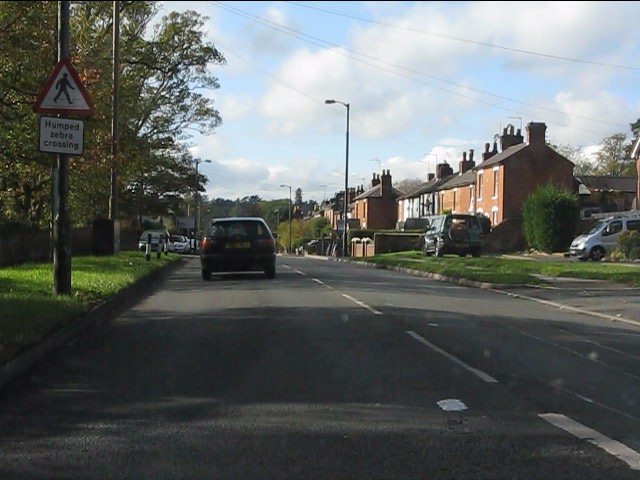
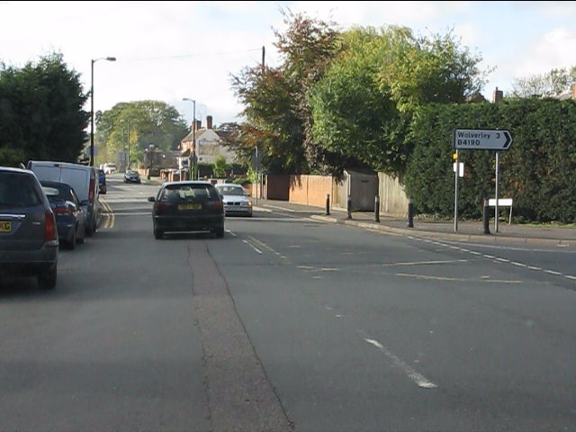
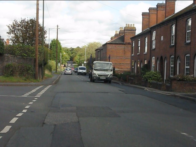
Habberley is a small village located in the county of Worcestershire, England. Situated approximately 3 miles northwest of Kidderminster, it is nestled in the beautiful countryside of the Wyre Forest District. With a population of around 600 residents, Habberley offers a tranquil and close-knit community atmosphere.

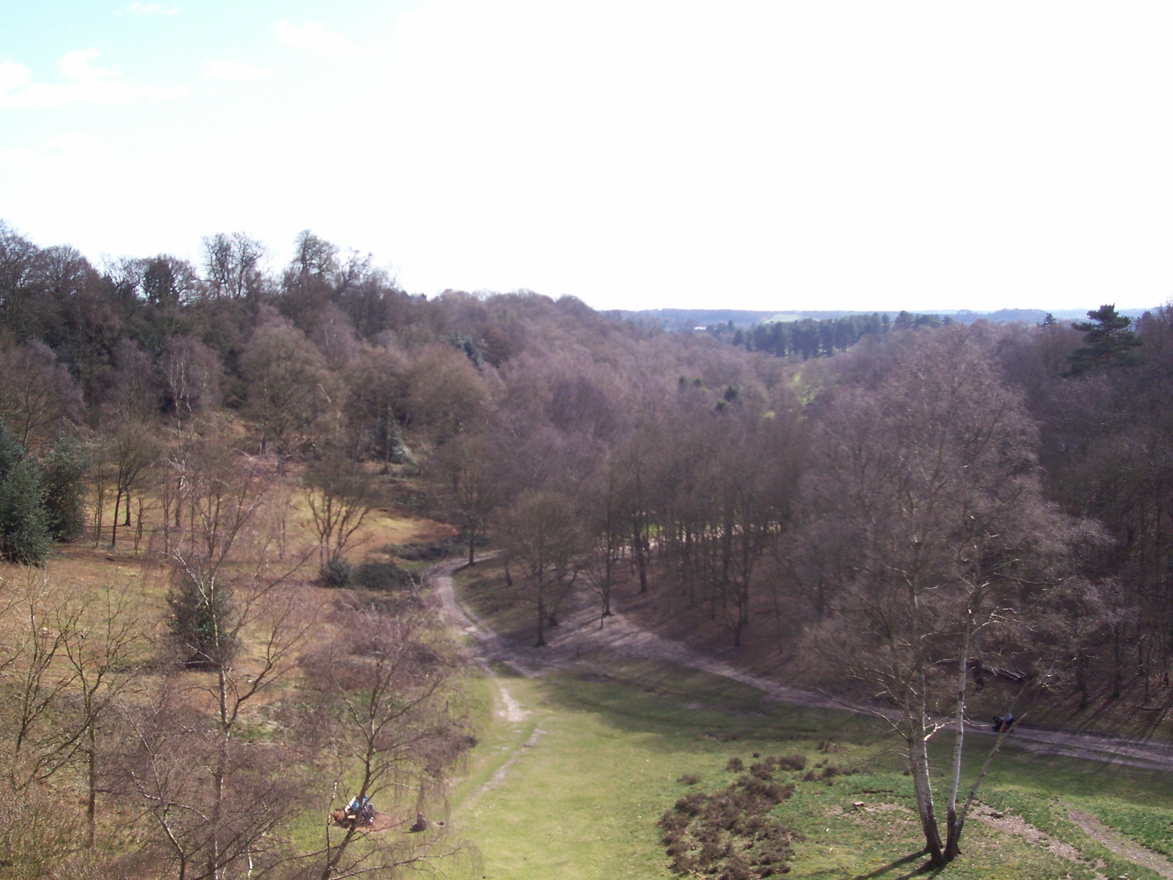
The village is renowned for its picturesque surroundings, with rolling hills, lush green meadows, and ancient woodlands. Habberley is situated on the edge of the expansive Wyre Forest, providing residents and visitors with ample opportunities for outdoor activities such as hiking, cycling, and wildlife spotting. The forest is also home to a diverse range of flora and fauna, making it a haven for nature enthusiasts.

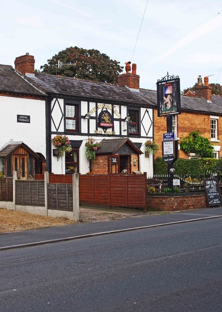
Habberley boasts a rich history, with evidence of settlement dating back to Roman times. The village is dotted with charming historic buildings, including the iconic St. John the Baptist Church, which dates back to the 12th century. The church's impressive architecture and tranquil setting make it a popular spot for visitors.

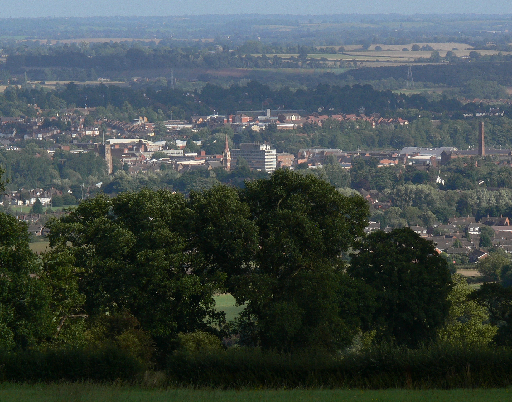
Despite its peaceful rural setting, Habberley benefits from its proximity to nearby towns and cities. Kidderminster, with its bustling town center, is just a short drive away, offering a range of amenities such as shopping centers, restaurants, and leisure facilities. The village is also well-connected to the wider region, with good transport links to Worcester, Birmingham, and beyond.

In summary, Habberley is a picturesque village in Worcestershire, characterized by its stunning natural surroundings, rich history, and close-knit community. It offers a peaceful and idyllic lifestyle while still providing access to nearby amenities and urban centers.

If you have any feedback on the listing, please let us know in the comments section below.

Habberley Images

Images are sourced within 2km of 52.391566/-2.2826959 or Grid Reference SO8077. Thanks to Geograph Open Source API. All images are credited.

Humped zebra crossing ahead Nothing to do with the safari park - at least one hopes not.
Humped zebra crossing ahead
Nothing to do with the safari park - at least one hopes not.
Kidderminster Road meets Habberley Road
Habberley Road
Habberley Road
Distorted silver birch Growing alongside a path through Pigstyehill Coppice, in Habberley Valley.
Distorted silver birch
Growing alongside a path through Pigstyehill Coppice, in Habberley Valley.
Trimpley Lane, Wribbenhall, Bewdley The start of Trimpley Lane photographed from its junction with Habberley Road. The part of Bewdley on the east side of the River Severn is usually known as Wribbenhall. This particular part is or was known as Catchems End, although that name seems to be falling into disuse. On the left is a warning sign against using Trimpley Lane as a route into Bewdley's town centre. However, anyone ignoring this would still have to rejoin the main road to cross the River Severn by Bewdley Bridge.
Trimpley Lane, Wribbenhall, Bewdley
The start of Trimpley Lane photographed from its junction with Habberley Road. The part of Bewdley on the east side of the River Severn is usually known as Wribbenhall. This particular part is or was known as Catchems End, although that name seems to be falling into disuse. On the left is a warning sign against using Trimpley Lane as a route into Bewdley's town centre. However, anyone ignoring this would still have to rejoin the main road to cross the River Severn by Bewdley Bridge.
New Road, Wribbenhall, Bewdley New Road is a mixture of old and new housing. It runs between Habberley Road and Kidderminster Road. There is no access for motor vehicles from Habberley Road, as bollards have been placed across New Road, just behind the camera position in this photograph.
New Road, Wribbenhall, Bewdley
New Road is a mixture of old and new housing. It runs between Habberley Road and Kidderminster Road. There is no access for motor vehicles from Habberley Road, as bollards have been placed across New Road, just behind the camera position in this photograph.
Habberley Road (B4190), Wribbenhall, Bewdley Habberley Road is part of the B4190 road which goes to the outskirts of Kidderminster, and then on to the village of Wolverley.
Habberley Road (B4190), Wribbenhall, Bewdley
Habberley Road is part of the B4190 road which goes to the outskirts of Kidderminster, and then on to the village of Wolverley.
Threlfall Drive, Wribbenhall, Bewdley Threlfall Drive is the entrance road, off Habberley Road, to a modern housing development.
Threlfall Drive, Wribbenhall, Bewdley
Threlfall Drive is the entrance road, off Habberley Road, to a modern housing development.
Catchems End Fish Bar, 134 Kidderminster Road, Wribbenhall, Bewdley A fish and chip shop whose name reflects the fact that this area used to be known as Catchems End, but except on maps this name seems to be rarely used these days.
Catchems End Fish Bar, 134 Kidderminster Road, Wribbenhall, Bewdley
A fish and chip shop whose name reflects the fact that this area used to be known as Catchems End, but except on maps this name seems to be rarely used these days.
Junction of Kidderminster Road and Habberley Road, Wribbenhall, Bewdley In the foreground is Kidderminster Road, which to the left goes to Bewdley via Bewdley Bridge, and to the right goes to Kidderminster. The road ahead is Habberley Road (part of the B4190), which goes through the outskirts of Kidderminster on its way to the village of Wolverley.
Junction of Kidderminster Road and Habberley Road, Wribbenhall, Bewdley
In the foreground is Kidderminster Road, which to the left goes to Bewdley via Bewdley Bridge, and to the right goes to Kidderminster. The road ahead is Habberley Road (part of the B4190), which goes through the outskirts of Kidderminster on its way to the village of Wolverley.
New Road, Wribbenhall, Bewdley The road contains a mix of housing and runs between Kidderminster Road and Habberley Road. At the latter end motor vehicles are blocked by bollards.
New Road, Wribbenhall, Bewdley
The road contains a mix of housing and runs between Kidderminster Road and Habberley Road. At the latter end motor vehicles are blocked by bollards.
Abi Lane, looking south, Wribbenhall, Bewdley The lane starts at a junction with Kidderminster Road, just behind the camera position. Eventually it leads to a grassy track, which is a public footpath and is fenced on both sides, and this comes out on the other side of the Severn Valley Railway line. See also:- <a href="https://www.geograph.org.uk/photo/3169224">SO7975 : Abi Lane - road name sign,  Wribbenhall, Bewdley</a>.
Abi Lane, looking south, Wribbenhall, Bewdley
The lane starts at a junction with Kidderminster Road, just behind the camera position. Eventually it leads to a grassy track, which is a public footpath and is fenced on both sides, and this comes out on the other side of the Severn Valley Railway line. See also:- SO7975 : Abi Lane - road name sign, Wribbenhall, Bewdley.
Abi Lane - road name sign,  Wribbenhall, Bewdley The lane off Kidderminster Road is named Abi Lane. The origin of the name is unknown to me. See:- <a href="https://www.geograph.org.uk/photo/3169156">SO7975 : Abi Lane, looking south, Wribbenhall, Bewdley</a>.
Abi Lane - road name sign, Wribbenhall, Bewdley
The lane off Kidderminster Road is named Abi Lane. The origin of the name is unknown to me. See:- SO7975 : Abi Lane, looking south, Wribbenhall, Bewdley.
Abi Lane, looking north, Wribbenhall, Bewdley The lane, over which there is a public footpath, comes out on Kidderminster Road.
Abi Lane, looking north, Wribbenhall, Bewdley
The lane, over which there is a public footpath, comes out on Kidderminster Road.
The Rising Sun (1), 139 Kidderminster Road, Wribbenhall, Bewdley A popular traditional pub on the edge of the Wribbenhall part of the town. Despite the Banks's branding it's not listed on the Marston's website, and appears to be a free house.

<a href="https://www.geograph.org.uk/photo/3223229">SO7975 : The Rising Sun (2) - sign, 139 Kidderminster Road, Wribbenhall, Bewdley</a>.
The Rising Sun (1), 139 Kidderminster Road, Wribbenhall, Bewdley
A popular traditional pub on the edge of the Wribbenhall part of the town. Despite the Banks's branding it's not listed on the Marston's website, and appears to be a free house. SO7975 : The Rising Sun (2) - sign, 139 Kidderminster Road, Wribbenhall, Bewdley.
The Rising Sun (2) - sign, 139 Kidderminster Road, Wribbenhall, Bewdley The Rising Sun is quite a common name for public houses and inns, and like so many others appears to be connected with heraldry. It is a symbol of the east and of optimism.

<a href="https://www.geograph.org.uk/photo/3223216">SO7975 : The Rising Sun (1), 139 Kidderminster Road, Wribbenhall, Bewdley</a>.
The Rising Sun (2) - sign, 139 Kidderminster Road, Wribbenhall, Bewdley
The Rising Sun is quite a common name for public houses and inns, and like so many others appears to be connected with heraldry. It is a symbol of the east and of optimism. SO7975 : The Rising Sun (1), 139 Kidderminster Road, Wribbenhall, Bewdley.
View east from Wassell Wood Looking through a gap in the trees on the eastern edge of a medieval earthworks.
View east from Wassell Wood
Looking through a gap in the trees on the eastern edge of a medieval earthworks.
The Rising Sun inn A pub set into a terrace of houses on the B4190 Kiddy Road, in the Catchems End or Wribbenhall side of Bewdley.
The Rising Sun inn
A pub set into a terrace of houses on the B4190 Kiddy Road, in the Catchems End or Wribbenhall side of Bewdley.
Show me another place!

Habberley is located at Grid Ref: SO8077 (Lat: 52.391566, Lng: -2.2826959)

Administrative County: Worcestershire

District: Wyre Forest

Police Authority: West Mercia

What 3 Words

///inner.major.jazz. Near Kidderminster, Worcestershire

Related Wikis

Habberley, Worcestershire

Habberley was one of the hamlets of the ancient parish of Kidderminster in the county of Worcestershire, England. It is now divided so that part of it...

Baxter College

Baxter College is a mixed secondary school with academy status located in Kidderminster, Worcestershire, England. Prior to September 2002 the school was...

Franche, Worcestershire

Franche is a village in Worcestershire, England, just outside Kidderminster. It is served by two main bus services. These are service 297 operated by...

St John's Church, Kidderminster

St John's Church, Kidderminster is a Church of England parish church in Kidderminster, Worcestershire, England. The church is a Grade II listed building...

Kidderminster Hospital

Kidderminster Hospital is an acute general hospital in Kidderminster in Worcestershire, England. It is managed by the Worcestershire Acute Hospitals NHS...

Kidderminster Register Office

Kidderminster Register Office is the former Register Office for the town of Kidderminster, Worcestershire, England. As such, it was a designated venue...

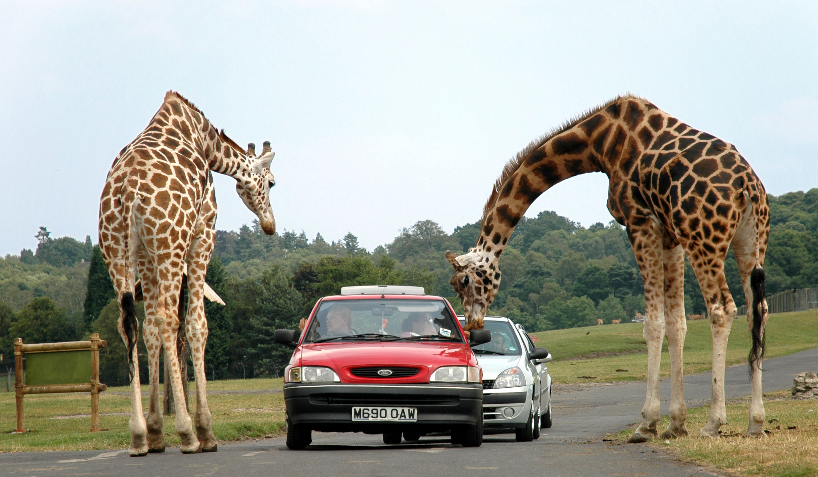
West Midland Safari Park

West Midland Safari and Leisure Park is a safari park located in Bewdley in Worcestershire, England. It was opened under the name of West Midland Safari...

Wyre Forest District

Wyre Forest is a local government district in Worcestershire, England. The district includes the towns of Kidderminster, Stourport-on-Severn and Bewdley...

Nearby Amenities

Located within 500m of 52.391566,-2.2826959
Coningsby Drive
Naptan AtcoCode: 2000G022367
Naptan Bearing: NW
Naptan BusStopType: CUS
Naptan CommonName: Coningsby Drive
Naptan Crossing: Coningsby Drive
Naptan NaptanCode: wocgpdta
Naptan PlusbusZoneRef: KDRMNST
Naptan ShortCommonName: end of Coningsby Drive
Naptan Street: Habberley Lane
Naptan Verified: no
Source: naptan_import
Lat/Long: 52.3939489/-2.2787954
Bus Stop
St. Davids Close
Bus: yes
Naptan AtcoCode: 2000G101100
Naptan Bearing: N
Naptan CommonName: St. Davids Close
Naptan Crossing: St. Davids Close
Naptan Indicator: opp
Naptan NaptanCode: wocgmjgt
Naptan PlusbusZoneRef: KDRMNST
Naptan Street: Canterbury Road
Naptan Verified: no
Public Transport: platform
Source: naptan_import
Lat/Long: 52.390952/-2.2814803
Bus Stop
St. Davids Close
Bus: yes
Naptan AtcoCode: 2000G101101
Naptan Bearing: NW
Naptan CommonName: St. Davids Close
Naptan Crossing: St. Davids Close
Naptan Indicator: Opp
Naptan NaptanCode: wocgpjdp
Naptan Street: Canterbury Road
Naptan Verified: yes
Public Transport: platform
Shelter: no
Source: naptan_import
Lat/Long: 52.3909101/-2.2816033
Bus Stop
Salisbury Drive
Bus: yes
Naptan AtcoCode: 2000G101103
Naptan Bearing: S
Naptan CommonName: Salisbury Drive
Naptan Crossing: Salisbury Drive
Naptan Indicator: Opp
Naptan NaptanCode: wocgmjma
Naptan PlusbusZoneRef: KDRMNST
Naptan Street: Canterbury Road
Naptan Verified: yes
Public Transport: platform
Shelter: no
Source: naptan_import
Lat/Long: 52.3895954/-2.280318
Bus Stop
Hillside Drive
Bus: yes
Naptan AtcoCode: 2000G101104
Naptan Bearing: SW
Naptan CommonName: Hillside Drive
Naptan Crossing: Hillside Drive
Naptan Indicator: adj
Naptan NaptanCode: wocgmjmd
Naptan PlusbusZoneRef: KDRMNST
Naptan Street: Habberley Road
Naptan Verified: no
Public Transport: platform
Source: naptan_import
Lat/Long: 52.3930134/-2.2789953
Bus Stop
Salisbury Drive
Bus: yes
Naptan AtcoCode: 2000G101106
Naptan Bearing: N
Naptan CommonName: Salisbury Drive
Naptan Crossing: Salisbury Drive
Naptan Indicator: Adj
Naptan NaptanCode: wocgpjmp
Naptan Street: Canterbury Road
Naptan Verified: yes
Public Transport: platform
Shelter: no
Source: naptan_import
Lat/Long: 52.389624/-2.2804787
Bus Stop
Coningsby Drive
Bus: yes
Naptan AtcoCode: 2000G106599
Naptan Bearing: N
Naptan CommonName: Coningsby Drive
Naptan Crossing: Habberley Lane
Naptan Indicator: Adj
Naptan NaptanCode: wocgmdja
Naptan PlusbusZoneRef: KDRMNST
Naptan Street: Coningsby Drive
Naptan Verified: yes
Public Transport: platform
Shelter: no
Source: naptan_import
Lat/Long: 52.3947723/-2.278328
Turning Circle
Lat/Long: 52.3896763/-2.2813598
High Habberley Farm
Man Made: survey_point
Ref: S3953
Tpuk Ref: TP3786
Lat/Long: 52.3913286/-2.2828102
Post Box
Postal Code: DY11
Ref: DY11 36
Source: GPS Survey
Lat/Long: 52.3926719/-2.2759633
Grit Bin
Source: observation
Lat/Long: 52.3924818/-2.280431
Post Box
Post Box Type: pillar
Postal Code: DY11
Ref: DY11 216
Source: GPS Survey
Lat/Long: 52.3895651/-2.2802771
Habberley
Place: suburb
Source: NPTG
Lat/Long: 52.3902605/-2.2792081
Generator Method: photovoltaic
Generator Output Electricity: yes
Generator Source: solar
Generator Type: solar_photovoltaic_panel
Location: roof
Power: generator
Lat/Long: 52.3912508/-2.2813365
Generator Method: photovoltaic
Generator Output Electricity: yes
Generator Source: solar
Generator Type: solar_photovoltaic_panel
Location: roof
Power: generator
Lat/Long: 52.3902236/-2.2796863
Generator Method: photovoltaic
Generator Output Electricity: yes
Generator Source: solar
Generator Type: solar_photovoltaic_panel
Location: roof
Power: generator
Lat/Long: 52.3899573/-2.2770886
Generator Method: photovoltaic
Generator Output Electricity: yes
Generator Source: solar
Generator Type: solar_photovoltaic_panel
Location: roof
Power: generator
Lat/Long: 52.3923442/-2.2800851
Generator Method: photovoltaic
Generator Output Electricity: yes
Generator Source: solar
Generator Type: solar_photovoltaic_panel
Location: roof
Power: generator
Lat/Long: 52.3950526/-2.2781758
Generator Method: photovoltaic
Generator Output Electricity: yes
Generator Source: solar
Generator Type: solar_photovoltaic_panel
Location: roof
Power: generator
Lat/Long: 52.3885732/-2.2803967
Generator Method: photovoltaic
Generator Output Electricity: yes
Generator Source: solar
Generator Type: solar_photovoltaic_panel
Location: roof
Power: generator
Lat/Long: 52.3912553/-2.2761521
Generator Method: photovoltaic
Generator Output Electricity: yes
Generator Source: solar
Generator Type: solar_photovoltaic_panel
Location: roof
Power: generator
Lat/Long: 52.3891952/-2.2766832
Generator Method: photovoltaic
Generator Output Electricity: yes
Generator Source: solar
Generator Type: solar_photovoltaic_panel
Location: roof
Power: generator
Lat/Long: 52.3928888/-2.276832
Generator Method: photovoltaic
Generator Output Electricity: yes
Generator Source: solar
Generator Type: solar_photovoltaic_panel
Location: roof
Power: generator
Lat/Long: 52.3925934/-2.2792755
Generator Method: photovoltaic
Generator Output Electricity: yes
Generator Source: solar
Generator Type: solar_photovoltaic_panel
Location: roof
Power: generator
Lat/Long: 52.3923298/-2.2800305
Generator Method: photovoltaic
Generator Output Electricity: yes
Generator Source: solar
Generator Type: solar_photovoltaic_panel
Location: roof
Power: generator
Lat/Long: 52.3922701/-2.2803953
Generator Method: photovoltaic
Generator Output Electricity: yes
Generator Source: solar
Generator Type: solar_photovoltaic_panel
Location: roof
Power: generator
Lat/Long: 52.392239/-2.280284
Generator Method: photovoltaic
Generator Output Electricity: yes
Generator Source: solar
Generator Type: solar_photovoltaic_panel
Location: roof
Power: generator
Lat/Long: 52.3905571/-2.279647
Generator Method: photovoltaic
Generator Output Electricity: yes
Generator Source: solar
Generator Type: solar_photovoltaic_panel
Location: roof
Power: generator
Lat/Long: 52.3906046/-2.2794673
Generator Method: photovoltaic
Generator Output Electricity: yes
Generator Source: solar
Generator Type: solar_photovoltaic_panel
Location: roof
Power: generator
Lat/Long: 52.3898901/-2.2841182
Generator Method: photovoltaic
Generator Output Electricity: yes
Generator Source: solar
Generator Type: solar_photovoltaic_panel
Location: roof
Power: generator
Lat/Long: 52.3899073/-2.2840565
Generator Method: photovoltaic
Generator Output Electricity: yes
Generator Source: solar
Generator Type: solar_photovoltaic_panel
Location: roof
Power: generator
Lat/Long: 52.391121/-2.2829327
Generator Method: photovoltaic
Generator Output Electricity: yes
Generator Source: solar
Generator Type: solar_photovoltaic_panel
Location: roof
Power: generator
Lat/Long: 52.3910678/-2.282867
Generator Method: photovoltaic
Generator Output Electricity: yes
Generator Source: solar
Generator Type: solar_photovoltaic_panel
Location: roof
Power: generator
Lat/Long: 52.3919918/-2.2755379
Marker: pedestal
Operator: CLH
Operator Old: GPSS
Ref: CP 1702
Utility: oil
Lat/Long: 52.3914861/-2.2826631
Marker: pedestal
Operator: CLH
Operator Old: GPSS
Ref: MP 2407
Utility: oil
Lat/Long: 52.3895639/-2.2838768
Marker: aerial
Operator: CLH
Operator Old: GPSS
Ref: MP 4070
Ref GPSS: 15362
Utility: oil
Lat/Long: 52.3918399/-2.2824478
Marker: pedestal
Operator: CLH
Operator Old: GPSS
Ref: CP 1702
Utility: oil
Lat/Long: 52.3916006/-2.2824887
Marker: aerial
Operator: CLH
Operator Old: GPSS
Ref GPSS: 19903; 15379
Utility: oil
Lat/Long: 52.3878311/-2.28297
Marker: pedestal
Operator: CLH
Operator Old: GPSS
Ref: CP 1716
Utility: oil
Lat/Long: 52.387825/-2.2829718
Marker: pedestal
Operator: CLH
Operator Old: GPSS
Ref: CP 1698
Ref GPSS: 15362
Utility: oil
Lat/Long: 52.3949802/-2.2819113
Marker: aerial
Operator: CLH
Operator Old: GPSS
Ref GPSS: 18473; 18474
Utility: oil
Lat/Long: 52.3949862/-2.2819103
Marker: post
Operator: CLH
Operator Old: GPSS
Ref GPSS: 18470
Utility: oil
Lat/Long: 52.3948953/-2.2819258
Marker: aerial
Operator: CLH
Operator Old: GPSS
Ref GPSS: 18483
Utility: oil
Lat/Long: 52.3933401/-2.2821772
Location: outdoor
Power: transformer
Lat/Long: 52.3925163/-2.2756472
Bench
Lat/Long: 52.3894971/-2.2803118
The data included in this document is from www.openstreetmap.org. The data is made available under ODbL.

Have you been to Habberley?

Leave your review of Habberley below (or comments, questions and feedback).