Low Habberley

Settlement in Worcestershire Wyre Forest

England

Low Habberley

Habberley Road
Habberley Road Credit: Peter Whatley

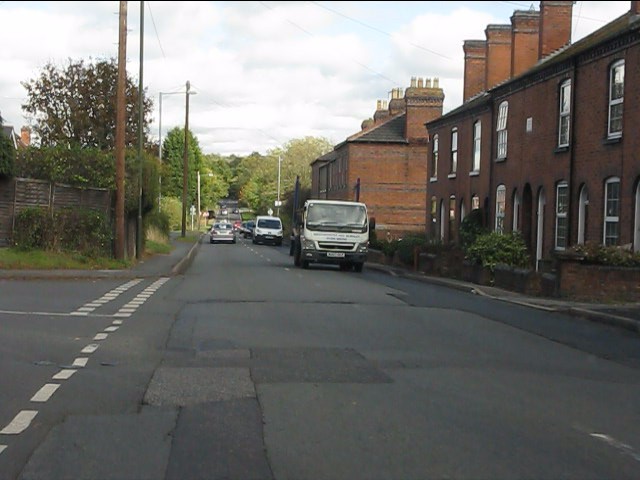
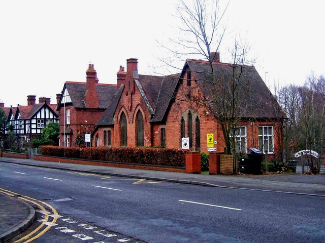
Low Habberley is a small village located in the county of Worcestershire, England. Situated approximately 3 miles northwest of the town of Kidderminster, it is nestled in the picturesque countryside of the Severn Valley. The village is part of the Wyre Forest district and falls within the Habberley and Blakebrook ward.

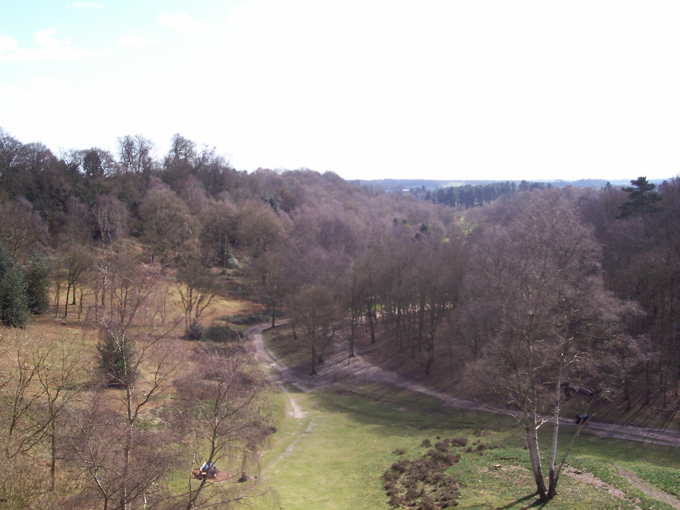
Low Habberley is known for its rural charm and tranquil atmosphere. Surrounded by rolling hills and lush green fields, it offers residents and visitors a peaceful retreat from the hustle and bustle of city life. The village is predominantly residential, with a small number of houses scattered throughout its landscape. The architecture of Low Habberley is typically traditional, featuring quaint cottages and farmhouses that add to its idyllic character.

Despite its small size, Low Habberley benefits from its proximity to nearby amenities and attractions. The neighboring town of Kidderminster provides residents with access to a range of shops, supermarkets, and services, as well as leisure and recreational facilities. The village is also surrounded by beautiful countryside, offering opportunities for outdoor activities such as walking, hiking, and cycling.

Low Habberley boasts a strong sense of community, with various social and recreational activities organized by local groups and organizations. The village has a primary school, ensuring that families have access to education within their immediate vicinity.

In conclusion, Low Habberley is a charming village in Worcestershire, offering a peaceful and picturesque setting for its residents. With its rural charm, proximity to amenities, and strong community spirit, it is an ideal place for those seeking a quiet and close-knit community.

If you have any feedback on the listing, please let us know in the comments section below.

Low Habberley Images

Images are sourced within 2km of 52.396407/-2.283465 or Grid Reference SO8077. Thanks to Geograph Open Source API. All images are credited.

Habberley Road
Habberley Road
Distorted silver birch Growing alongside a path through Pigstyehill Coppice, in Habberley Valley.
Distorted silver birch
Growing alongside a path through Pigstyehill Coppice, in Habberley Valley.
Trimpley Lane, Wribbenhall, Bewdley The start of Trimpley Lane photographed from its junction with Habberley Road. The part of Bewdley on the east side of the River Severn is usually known as Wribbenhall. This particular part is or was known as Catchems End, although that name seems to be falling into disuse. On the left is a warning sign against using Trimpley Lane as a route into Bewdley's town centre. However, anyone ignoring this would still have to rejoin the main road to cross the River Severn by Bewdley Bridge.
Trimpley Lane, Wribbenhall, Bewdley
The start of Trimpley Lane photographed from its junction with Habberley Road. The part of Bewdley on the east side of the River Severn is usually known as Wribbenhall. This particular part is or was known as Catchems End, although that name seems to be falling into disuse. On the left is a warning sign against using Trimpley Lane as a route into Bewdley's town centre. However, anyone ignoring this would still have to rejoin the main road to cross the River Severn by Bewdley Bridge.
New Road, Wribbenhall, Bewdley New Road is a mixture of old and new housing. It runs between Habberley Road and Kidderminster Road. There is no access for motor vehicles from Habberley Road, as bollards have been placed across New Road, just behind the camera position in this photograph.
New Road, Wribbenhall, Bewdley
New Road is a mixture of old and new housing. It runs between Habberley Road and Kidderminster Road. There is no access for motor vehicles from Habberley Road, as bollards have been placed across New Road, just behind the camera position in this photograph.
Habberley Road (B4190), Wribbenhall, Bewdley Habberley Road is part of the B4190 road which goes to the outskirts of Kidderminster, and then on to the village of Wolverley.
Habberley Road (B4190), Wribbenhall, Bewdley
Habberley Road is part of the B4190 road which goes to the outskirts of Kidderminster, and then on to the village of Wolverley.
Threlfall Drive, Wribbenhall, Bewdley Threlfall Drive is the entrance road, off Habberley Road, to a modern housing development.
Threlfall Drive, Wribbenhall, Bewdley
Threlfall Drive is the entrance road, off Habberley Road, to a modern housing development.
New Road, Wribbenhall, Bewdley The road contains a mix of housing and runs between Kidderminster Road and Habberley Road. At the latter end motor vehicles are blocked by bollards.
New Road, Wribbenhall, Bewdley
The road contains a mix of housing and runs between Kidderminster Road and Habberley Road. At the latter end motor vehicles are blocked by bollards.
View east from Wassell Wood Looking through a gap in the trees on the eastern edge of a medieval earthworks.
View east from Wassell Wood
Looking through a gap in the trees on the eastern edge of a medieval earthworks.
Jacob's Ladder - middle part Recently rebuilt with the assistance of the local Ramblers' Association, Jacob's Ladder footpath climbs steeply out of the Habberley Valley towards Trimpley.
Jacob's Ladder - middle part
Recently rebuilt with the assistance of the local Ramblers' Association, Jacob's Ladder footpath climbs steeply out of the Habberley Valley towards Trimpley.
Top of Jacob's Ladder A steepening footpath down into the Habberley Valley.
Top of Jacob's Ladder
A steepening footpath down into the Habberley Valley.
Lost Footpath Somewhere in this field a footpath runs to Catchems End.
Lost Footpath
Somewhere in this field a footpath runs to Catchems End.
Wassell Wood This woodland has existed for over 400 years.  It is home to a mediaeval earthwork on the northern fringe of the wood.
Wassell Wood
This woodland has existed for over 400 years. It is home to a mediaeval earthwork on the northern fringe of the wood.
Wassell Wood This is inside a medieval earthwork at the top of the woods. Henry IV is thought to have used this spot as an over winter post in 1405 and 1406 when he occupied Worcester to hold up forces of the legendary Welsh hero Owen Glyn Dwr.
Wassell Wood
This is inside a medieval earthwork at the top of the woods. Henry IV is thought to have used this spot as an over winter post in 1405 and 1406 when he occupied Worcester to hold up forces of the legendary Welsh hero Owen Glyn Dwr.
Habberley Valley Circular Walk This is a public footpath that forms part of the Habberley Valley Circular Walk.
<span class="nowrap"><a title="http://worcestershire.whub.org.uk/home/wccindex/wcc-countryside/wcc-countryside-exploring/wcc-countryside-exploring-offcircular/wcc-countryside-service-habberley.htm" rel="nofollow ugc noopener" href="http://worcestershire.whub.org.uk/home/wccindex/wcc-countryside/wcc-countryside-exploring/wcc-countryside-exploring-offcircular/wcc-countryside-service-habberley.htm">Link</a><img style="margin-left:2px;" alt="External link" title="External link - shift click to open in new window" src="https://s1.geograph.org.uk/img/external.png" width="10" height="10"/></span>
Habberley Valley Circular Walk
This is a public footpath that forms part of the Habberley Valley Circular Walk. LinkExternal link
North Worcestershire countryside Photographed from the public footpath that forms part of the Habberley Valley Circular Walk.
<span class="nowrap"><a title="http://worcestershire.whub.org.uk/home/wccindex/wcc-countryside/wcc-countryside-exploring/wcc-countryside-exploring-offcircular/wcc-countryside-service-habberley.htm" rel="nofollow ugc noopener" href="http://worcestershire.whub.org.uk/home/wccindex/wcc-countryside/wcc-countryside-exploring/wcc-countryside-exploring-offcircular/wcc-countryside-service-habberley.htm">Link</a><img style="margin-left:2px;" alt="External link" title="External link - shift click to open in new window" src="https://s1.geograph.org.uk/img/external.png" width="10" height="10"/></span>
North Worcestershire countryside
Photographed from the public footpath that forms part of the Habberley Valley Circular Walk. LinkExternal link
Buttercups at Easthams Coppice The public footpath known as the Habberley Valley Circular Walk descends this steep hill.
Buttercups at Easthams Coppice
The public footpath known as the Habberley Valley Circular Walk descends this steep hill.
View towards Kidderminster The public footpath known as the Habberley Valley Circular Walk descends this steep hill.
View towards Kidderminster
The public footpath known as the Habberley Valley Circular Walk descends this steep hill.
Farmland near Trimpley, Worcestershire
Show me another place!

Low Habberley is located at Grid Ref: SO8077 (Lat: 52.396407, Lng: -2.283465)

Administrative County: Worcestershire

District: Wyre Forest

Police Authority: West Mercia

What 3 Words

///year.noted.noises. Near Kidderminster, Worcestershire

Related Wikis

Habberley, Worcestershire

Habberley was one of the hamlets of the ancient parish of Kidderminster in the county of Worcestershire, England. It is now divided so that part of it...

Baxter College

Baxter College is a mixed secondary school with academy status located in Kidderminster, Worcestershire, England. Prior to September 2002 the school was...

Franche, Worcestershire

Franche is a village in Worcestershire, England, just outside Kidderminster. It is served by two main bus services. These are service 297 operated by...

Trimpley

Trimpley (grid reference SO793784) is a hamlet in the parish of Kidderminster Foreign. It lies on the ridge of Shatterford Hill, north of Wribbenhall...

Nearby Amenities

Located within 500m of 52.396407,-2.283465
Coningsby Drive
Naptan AtcoCode: 2000G022367
Naptan Bearing: NW
Naptan BusStopType: CUS
Naptan CommonName: Coningsby Drive
Naptan Crossing: Coningsby Drive
Naptan NaptanCode: wocgpdta
Naptan PlusbusZoneRef: KDRMNST
Naptan ShortCommonName: end of Coningsby Drive
Naptan Street: Habberley Lane
Naptan Verified: no
Source: naptan_import
Lat/Long: 52.3939489/-2.2787954
Bus Stop
Hillside Drive
Bus: yes
Naptan AtcoCode: 2000G101104
Naptan Bearing: SW
Naptan CommonName: Hillside Drive
Naptan Crossing: Hillside Drive
Naptan Indicator: adj
Naptan NaptanCode: wocgmjmd
Naptan PlusbusZoneRef: KDRMNST
Naptan Street: Habberley Road
Naptan Verified: no
Public Transport: platform
Source: naptan_import
Lat/Long: 52.3930134/-2.2789953
Bus Stop
Ferndale
Bus: yes
Naptan AtcoCode: 2000G101301
Naptan NaptanCode: wocdjdgd
Public Transport: platform
Source: GPS Survey
Lat/Long: 52.3971925/-2.2767537
Bus Stop
Coningsby Drive
Bus: yes
Naptan AtcoCode: 2000G106599
Naptan Bearing: N
Naptan CommonName: Coningsby Drive
Naptan Crossing: Habberley Lane
Naptan Indicator: Adj
Naptan NaptanCode: wocgmdja
Naptan PlusbusZoneRef: KDRMNST
Naptan Street: Coningsby Drive
Naptan Verified: yes
Public Transport: platform
Shelter: no
Source: naptan_import
Lat/Long: 52.3947723/-2.278328
Low Habberley Farm
Naptan AtcoCode: 2000G500145
Naptan Bearing: N
Naptan BusStopType: CUS
Naptan CommonName: Low Habberley Farm
Naptan Crossing: Valley Close
Naptan Indicator: Opp
Naptan Landmark: Low Habberley Farm
Naptan NaptanCode: wocdpadg
Naptan PlusbusZoneRef: KDRMNST
Naptan Street: Habberley Lane
Naptan Verified: no
Source: naptan_import
Lat/Long: 52.3988352/-2.2881298
Bus Stop
Fountain Inn
Bus: yes
Naptan AtcoCode: 2000G500146
Naptan Bearing: SE
Naptan CommonName: Fountain Inn
Naptan Indicator: Adj
Naptan Landmark: Public House
Naptan NaptanCode: wocdpadj
Naptan PlusbusZoneRef: KDRMNST
Naptan Street: Habberley Lane
Naptan Verified: no
Public Transport: platform
Source: naptan_import
Lat/Long: 52.3966562/-2.2858082
Low Habberley Farm
Naptan AtcoCode: 2000G581588
Naptan Bearing: S
Naptan BusStopType: CUS
Naptan CommonName: Low Habberley Farm
Naptan Crossing: Valley Close
Naptan Indicator: Adj
Naptan Landmark: Low Habberley Farm
Naptan NaptanCode: wocgagwd
Naptan PlusbusZoneRef: KDRMNST
Naptan Street: Habberley Lane
Naptan Verified: no
Source: naptan_import
Lat/Long: 52.3984849/-2.2880099
Grit Bin
Source: observation
Lat/Long: 52.3924818/-2.280431
Eagles Nest
Demolished Amenity: pub
Source: GPS Survey
Lat/Long: 52.3967429/-2.2771017
Bench
Lat/Long: 52.3963042/-2.2907441
Bench
Lat/Long: 52.3991752/-2.2878913
Addr Housename: Fountain Court
Old Amenity: pub
Old Name: Fountain Inn
Source: OS OpenData StreetView
Source Old: NaPTAN
Lat/Long: 52.3967553/-2.2855917
Low Habberley
Place: hamlet
Source: OS OpenData StreetView
Lat/Long: 52.3971811/-2.2878872
Generator Method: photovoltaic
Generator Output Electricity: yes
Generator Source: solar
Generator Type: solar_photovoltaic_panel
Location: roof
Power: generator
Lat/Long: 52.3963341/-2.2763479
Generator Method: photovoltaic
Generator Output Electricity: yes
Generator Source: solar
Generator Type: solar_photovoltaic_panel
Location: roof
Power: generator
Lat/Long: 52.3963276/-2.2762647
Generator Method: photovoltaic
Generator Output Electricity: yes
Generator Source: solar
Generator Type: solar_photovoltaic_panel
Location: roof
Power: generator
Lat/Long: 52.3962883/-2.2781932
Generator Method: photovoltaic
Generator Output Electricity: yes
Generator Source: solar
Generator Type: solar_photovoltaic_panel
Location: roof
Power: generator
Lat/Long: 52.3959855/-2.277799
Generator Method: photovoltaic
Generator Output Electricity: yes
Generator Source: solar
Generator Type: solar_photovoltaic_panel
Location: roof
Power: generator
Lat/Long: 52.3950526/-2.2781758
Post Box
Collection Times: Mo-Fr 12:00; Sa 09:00
Post Box Type: wall
Ref: DY11 26
Royal Cypher: VR
Royal Cypher Wikidata: Q33102356
Lat/Long: 52.3971958/-2.2867481
Marker: pedestal
Operator: CLH
Operator Old: GPSS
Ref: CP 1698
Ref GPSS: 15362
Utility: oil
Lat/Long: 52.3949802/-2.2819113
Marker: aerial
Operator: CLH
Operator Old: GPSS
Ref GPSS: 18473; 18474
Utility: oil
Lat/Long: 52.3949862/-2.2819103
Marker: post
Operator: CLH
Operator Old: GPSS
Ref GPSS: 18470
Utility: oil
Lat/Long: 52.3948953/-2.2819258
Marker: aerial
Operator: CLH
Operator Old: GPSS
Ref GPSS: 18483
Utility: oil
Lat/Long: 52.3933401/-2.2821772
The data included in this document is from www.openstreetmap.org. The data is made available under ODbL.

Have you been to Low Habberley?

Leave your review of Low Habberley below (or comments, questions and feedback).