Brae Moor

Downs, Moorland in Wigtownshire

Scotland

Brae Moor

View to cairn on Mochrum Fell From Culshabbin.
View to cairn on Mochrum Fell Credit: Russel Wills

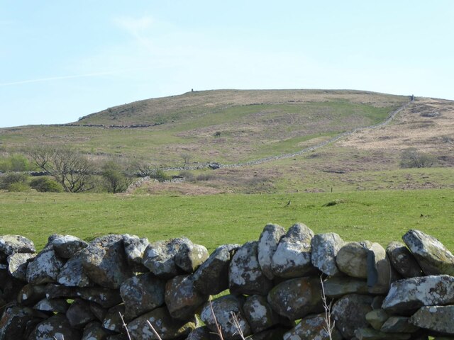
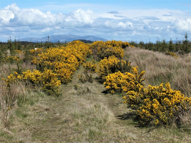
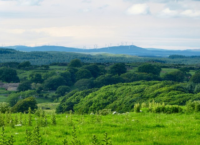
Brae Moor, located in Wigtownshire, is a picturesque and expansive expanse of downs and moorland. Stretching over a vast area, it offers breathtaking views and a serene atmosphere. The moor is situated in the southern part of Scotland, near the village of Brae, and is characterized by its undulating terrain, heather-covered hills, and numerous small lochs.

This natural landscape is home to a variety of flora and fauna, making it a haven for nature enthusiasts and wildlife lovers. The heather that blankets the moorland provides a burst of purple hues during the summer months, creating a stunning sight for visitors. Many species of birds can be spotted here, including the elusive golden eagle, peregrine falcon, and red grouse.

Brae Moor also possesses a rich historical and cultural heritage. The moor is dotted with ancient archaeological sites, such as burial mounds and standing stones, dating back thousands of years. These remnants offer a glimpse into the region's past and provide insight into the lives of its early inhabitants.

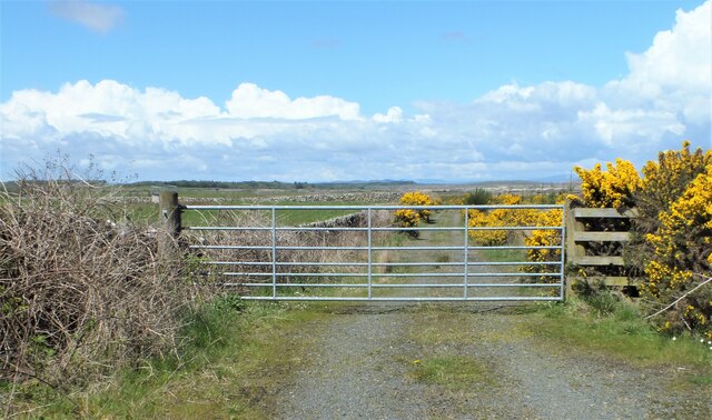
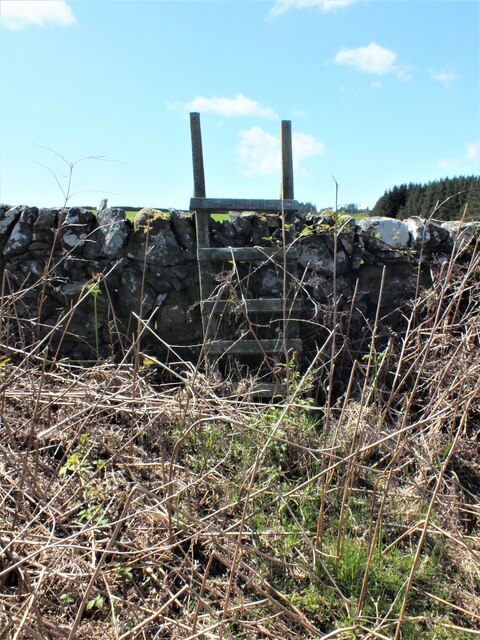
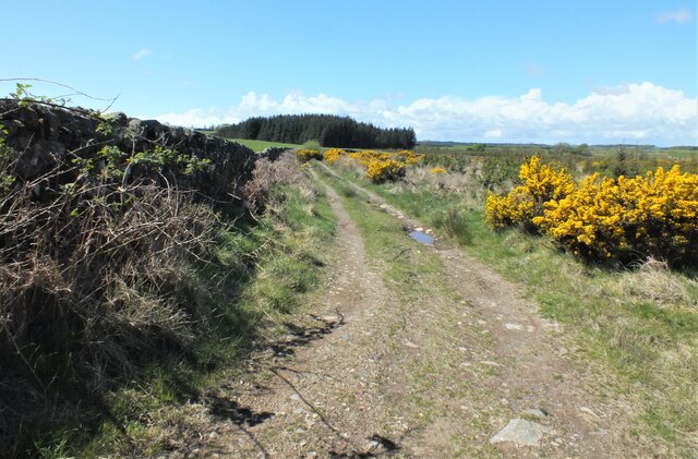
For outdoor enthusiasts, Brae Moor offers ample opportunities for activities such as hiking, birdwatching, and photography. Several well-marked trails traverse the moor, allowing visitors to explore its beauty at their own pace. The peaceful and tranquil ambiance of this remote location makes it an ideal destination for those seeking a break from the hustle and bustle of city life.

Overall, Brae Moor in Wigtownshire is a captivating natural landscape, offering a unique blend of stunning scenery, abundant wildlife, and historical significance.

If you have any feedback on the listing, please let us know in the comments section below.

Brae Moor Images

Images are sourced within 2km of 54.818687/-4.6472157 or Grid Reference NX3050. Thanks to Geograph Open Source API. All images are credited.

View to cairn on Mochrum Fell From Culshabbin.
View to cairn on Mochrum Fell
From Culshabbin.
Gate to the Forestry Off the road between Culshabbin and High Glenling.
Gate to the Forestry
Off the road between Culshabbin and High Glenling.
Ladder Stile This is part of Mochrum Estate, very much a sporting estate.
Ladder Stile
This is part of Mochrum Estate, very much a sporting estate.
Track on the Machar Following the wall.
Track on the Machar
Following the wall.
Not Going to get Very Far Down There! Although the track seen in <a href="https://www.geograph.org.uk/photo/7485841">NX3051 : Track on the Machar</a> carries on following the wall, according to the map it goes to the right here. But it appears to have been taken over by Gorse.
Not Going to get Very Far Down There!
Although the track seen in NX3051 : Track on the Machar carries on following the wall, according to the map it goes to the right here. But it appears to have been taken over by Gorse.
Corwall Farm View of the farm on Low Moor above Luce Bay.
Corwall Farm
View of the farm on Low Moor above Luce Bay.
Track to Chapel Finian This grass track runs from Corwall Farm through Low Moor to Chapel Finian on the A747 coast road. I decided though to turn around and head back the way I came rather than have a fight with a ferocious lamb that was blocking my route.
Track to Chapel Finian
This grass track runs from Corwall Farm through Low Moor to Chapel Finian on the A747 coast road. I decided though to turn around and head back the way I came rather than have a fight with a ferocious lamb that was blocking my route.
Low Moor View across the moor towards the Mull of Sinniness and Luce Bay.
Low Moor
View across the moor towards the Mull of Sinniness and Luce Bay.
Low Moor Looking across the moors to Mains of Alticry.
Low Moor
Looking across the moors to Mains of Alticry.
View across Low Moor Looking towards Alticry with the Artfield Fell Wind Farm on the horizon.
View across Low Moor
Looking towards Alticry with the Artfield Fell Wind Farm on the horizon.
Corwall View south east over Low Moor.
Corwall
View south east over Low Moor.
Corwall View to the east over Low Moor.
Corwall
View to the east over Low Moor.
Mid Moor Wood View across the moor to the woodland with Knock Fell left of picture on the horizon.
Mid Moor Wood
View across the moor to the woodland with Knock Fell left of picture on the horizon.
Boundary Walls The stane walls on Low Moor around Corwall Farm appear mostly in good condition, no easy task in an isolated area of the Machars.
Boundary Walls
The stane walls on Low Moor around Corwall Farm appear mostly in good condition, no easy task in an isolated area of the Machars.
Road to Corwall This road leads from the B7005 to Corwall Farm behind the camera. Originally tarmac the 2km farm track has been rebuilt over the last 5 years with 125 lorry loads of concrete to create a single track road that can be easily driven to the farm in comfort. It rates as one of the best farm roads I've ever driven in the Machars and gets my 2012 'Best Farm Road' Award. A well deserved award when you consider that the lorry laying the road over the five years always had to reverse in to lay the concrete!
Road to Corwall
This road leads from the B7005 to Corwall Farm behind the camera. Originally tarmac the 2km farm track has been rebuilt over the last 5 years with 125 lorry loads of concrete to create a single track road that can be easily driven to the farm in comfort. It rates as one of the best farm roads I've ever driven in the Machars and gets my 2012 'Best Farm Road' Award. A well deserved award when you consider that the lorry laying the road over the five years always had to reverse in to lay the concrete!
Road to Corwall End of the concrete road to the farm which was a delight to use. Luce Bay is right of picture. <a title="https://www.geograph.org.uk/photo/3027386" href="https://www.geograph.org.uk/photo/3027386">Link</a>
Road to Corwall
End of the concrete road to the farm which was a delight to use. Luce Bay is right of picture. Link
North of Corwall View across the moors to Alticry.
North of Corwall
View across the moors to Alticry.
Mid Moor Wood Looking across the moorland to the wood.
Mid Moor Wood
Looking across the moorland to the wood.
Show me another place!

Brae Moor is located at Grid Ref: NX3050 (Lat: 54.818687, Lng: -4.6472157)

Unitary Authority: Dumfries and Galloway

Police Authority: Dumfries and Galloway

What 3 Words

///resting.unopposed.shrubbery. Near Whithorn, Dumfries & Galloway

Related Wikis

Machars

The Machars (Scottish Gaelic: Machair Ghallghaidhealaibh) is a peninsula in the historical county of Wigtownshire in Galloway in the south-west of Scotland...

Doon of May

The Doon of May is a conifer plantation associated with an Iron Age hill fort in Dumfries and Galloway, south-west Scotland. Located around 14 kilometres...

Mochrum Loch

Mochrum Loch is a large, irregular shaped, shallow, freshwater loch in Dumfries and Galloway, in the Southern Uplands of south-west Scotland. It lies approximately...

Elrig

Elrig (Scottish Gaelic: An Eileirg, meaning "the deer run") is a clachan or hamlet in the historical county of Wigtownshire in Dumfries and Galloway...

Have you been to Brae Moor?

Leave your review of Brae Moor below (or comments, questions and feedback).