Brae

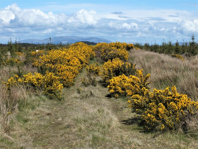
Downs, Moorland in Wigtownshire

Scotland

Brae

View to cairn on Mochrum Fell From Culshabbin.
View to cairn on Mochrum Fell Credit: Russel Wills

Brae, located in Wigtownshire, is a picturesque rural area known for its stunning downs and moorland landscapes. Situated in the southwestern part of Scotland, Brae offers a tranquil and serene environment for visitors and residents alike.

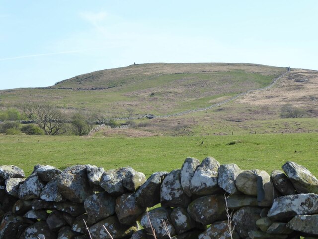
The downs of Brae are characterized by rolling hills covered in lush green grass, providing a perfect setting for outdoor activities such as hiking, picnicking, and birdwatching. The undulating terrain offers breathtaking views of the surrounding countryside, making it a popular spot for nature enthusiasts and photographers. The downs are home to a variety of flora and fauna, including wildflowers, heather, and numerous bird species.

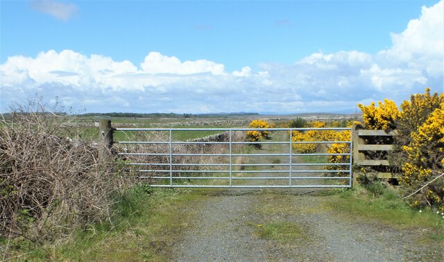
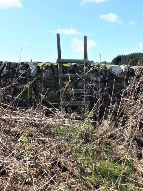
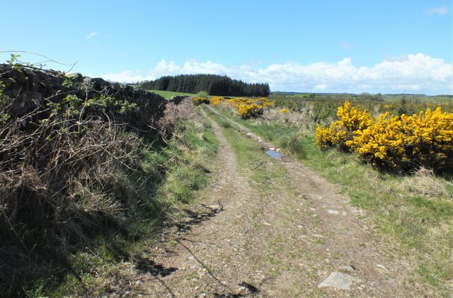
Adjacent to the downs, Brae boasts vast moorland expanses that stretch as far as the eye can see. These moorlands are characterized by open spaces, heath, and peat bogs, creating a unique and diverse ecosystem. Visitors can explore the moorlands on foot or by following designated trails, where they can observe the local wildlife, including birds of prey, deer, and rabbits.

Brae is also known for its rich history and heritage, with several ancient sites and ruins scattered throughout the area. These sites provide glimpses into the region's past, including its agricultural and industrial roots.

In terms of amenities, Brae offers a range of accommodation options, including bed and breakfasts and self-catering cottages, allowing visitors to fully immerse themselves in the natural beauty of the area. Additionally, there are a few local shops and eateries where visitors can enjoy traditional Scottish cuisine and purchase locally produced goods.

Overall, Brae, Wigtownshire, with its downs and moorland, offers a peaceful and idyllic retreat for those seeking to connect with nature and experience the tranquility of the Scottish countryside.

If you have any feedback on the listing, please let us know in the comments section below.

Brae Images

Images are sourced within 2km of 54.822649/-4.6464941 or Grid Reference NX3050. Thanks to Geograph Open Source API. All images are credited.

View to cairn on Mochrum Fell From Culshabbin.
View to cairn on Mochrum Fell
From Culshabbin.
Gate to the Forestry Off the road between Culshabbin and High Glenling.
Gate to the Forestry
Off the road between Culshabbin and High Glenling.
Ladder Stile This is part of Mochrum Estate, very much a sporting estate.
Ladder Stile
This is part of Mochrum Estate, very much a sporting estate.
Track on the Machar Following the wall.
Track on the Machar
Following the wall.
Not Going to get Very Far Down There! Although the track seen in <a href="https://www.geograph.org.uk/photo/7485841">NX3051 : Track on the Machar</a> carries on following the wall, according to the map it goes to the right here. But it appears to have been taken over by Gorse.
Not Going to get Very Far Down There!
Although the track seen in NX3051 : Track on the Machar carries on following the wall, according to the map it goes to the right here. But it appears to have been taken over by Gorse.
Corwall Farm View of the farm on Low Moor above Luce Bay.
Corwall Farm
View of the farm on Low Moor above Luce Bay.
Track to Chapel Finian This grass track runs from Corwall Farm through Low Moor to Chapel Finian on the A747 coast road. I decided though to turn around and head back the way I came rather than have a fight with a ferocious lamb that was blocking my route.
Track to Chapel Finian
This grass track runs from Corwall Farm through Low Moor to Chapel Finian on the A747 coast road. I decided though to turn around and head back the way I came rather than have a fight with a ferocious lamb that was blocking my route.
Low Moor Looking across the moors to Mains of Alticry.
Low Moor
Looking across the moors to Mains of Alticry.
Corwall View south east over Low Moor.
Corwall
View south east over Low Moor.
Corwall View to the east over Low Moor.
Corwall
View to the east over Low Moor.
Mid Moor Wood View across the moor to the woodland with Knock Fell left of picture on the horizon.
Mid Moor Wood
View across the moor to the woodland with Knock Fell left of picture on the horizon.
Boundary Walls The stane walls on Low Moor around Corwall Farm appear mostly in good condition, no easy task in an isolated area of the Machars.
Boundary Walls
The stane walls on Low Moor around Corwall Farm appear mostly in good condition, no easy task in an isolated area of the Machars.
Road to Corwall This road leads from the B7005 to Corwall Farm behind the camera. Originally tarmac the 2km farm track has been rebuilt over the last 5 years with 125 lorry loads of concrete to create a single track road that can be easily driven to the farm in comfort. It rates as one of the best farm roads I've ever driven in the Machars and gets my 2012 'Best Farm Road' Award. A well deserved award when you consider that the lorry laying the road over the five years always had to reverse in to lay the concrete!
Road to Corwall
This road leads from the B7005 to Corwall Farm behind the camera. Originally tarmac the 2km farm track has been rebuilt over the last 5 years with 125 lorry loads of concrete to create a single track road that can be easily driven to the farm in comfort. It rates as one of the best farm roads I've ever driven in the Machars and gets my 2012 'Best Farm Road' Award. A well deserved award when you consider that the lorry laying the road over the five years always had to reverse in to lay the concrete!
Road to Corwall End of the concrete road to the farm which was a delight to use. Luce Bay is right of picture. <a title="https://www.geograph.org.uk/photo/3027386" href="https://www.geograph.org.uk/photo/3027386">Link</a>
Road to Corwall
End of the concrete road to the farm which was a delight to use. Luce Bay is right of picture. Link
North of Corwall View across the moors to Alticry.
North of Corwall
View across the moors to Alticry.
Mid Moor Wood Looking across the moorland to the wood.
Mid Moor Wood
Looking across the moorland to the wood.
Stone work Plenty of boundary walls in good repair and a derelict cottage by the road to Corwall Farm.
Stone work
Plenty of boundary walls in good repair and a derelict cottage by the road to Corwall Farm.
Road to the B7005 This farm road leads from Corwall Farm across Low Moor and High Moor to the B7005.
Road to the B7005
This farm road leads from Corwall Farm across Low Moor and High Moor to the B7005.
Show me another place!

Brae is located at Grid Ref: NX3050 (Lat: 54.822649, Lng: -4.6464941)

Unitary Authority: Dumfries and Galloway

Police Authority: Dumfries and Galloway

What 3 Words

///contracting.improving.lifeguard. Near Whithorn, Dumfries & Galloway

Related Wikis

Machars

The Machars (Scottish Gaelic: Machair Ghallghaidhealaibh) is a peninsula in the historical county of Wigtownshire in Galloway in the south-west of Scotland...

Doon of May

The Doon of May is a conifer plantation associated with an Iron Age hill fort in Dumfries and Galloway, south-west Scotland. Located around 14 kilometres...

Mochrum Loch

Mochrum Loch is a large, irregular shaped, shallow, freshwater loch in Dumfries and Galloway, in the Southern Uplands of south-west Scotland. It lies approximately...

Castle Loch, Dumfries and Galloway

Castle Loch is a large, shallow, freshwater loch in Dumfries and Galloway, in the Southern Uplands of south-west Scotland. It lies to the west of Mochrum...

Related Videos

Oh god, it’s me. On video πŸ€¦πŸΌβ€β™€οΈπŸ€¦πŸΌβ€β™€οΈπŸ€¦πŸΌβ€β™€οΈπŸ€¦πŸΌβ€β™€οΈ

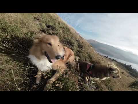
You probably can't hear a word I'm saying - I'm explaining why I'm too chicken to climb to the top of the Wee Hill of Craigmulloch!

The Loch Doon Aerial Gunnery School and Railway, East Ayrshire

Between 1916 and 1918 an Aerial Gunnery School with associated airfields and a standard gauge railway were constructed at ...

Nearby Amenities

Located within 500m of 54.822649,-4.6464941
Barrier: cattle_grid
Lat/Long: 54.8250871/-4.6503228
Power: pole
Lat/Long: 54.8233505/-4.653239
Power: pole
Lat/Long: 54.8235537/-4.652644
Power: pole
Lat/Long: 54.8239087/-4.6515316
Power: pole
Lat/Long: 54.8243124/-4.6502499
Power: pole
Lat/Long: 54.8248218/-4.6484273
Power: pole
Lat/Long: 54.8247311/-4.6470045
Power: pole
Lat/Long: 54.8246579/-4.6458192
Power: pole
Lat/Long: 54.8245658/-4.6443964
Power: pole
Lat/Long: 54.8244804/-4.642983
Power: pole
Lat/Long: 54.8244086/-4.6418025
Power: pole
Lat/Long: 54.8243233/-4.6405655
Power: pole
Lat/Long: 54.824582/-4.6395754
Power: pole
Lat/Long: 54.8240103/-4.6468187
Power: pole
Lat/Long: 54.8233356/-4.6466329
Power: pole
Lat/Long: 54.8249035/-4.6498419
Power: pole
Lat/Long: 54.8255853/-4.6493411
Power: pole
Lat/Long: 54.8263437/-4.6487874
Power: pole
Lat/Long: 54.8269658/-4.6483541
The data included in this document is from www.openstreetmap.org. The data is made available under ODbL.

Have you been to Brae?

Leave your review of Brae below (or comments, questions and feedback).