West Plantation

Wood, Forest in Wigtownshire

Scotland

West Plantation

View to cairn on Mochrum Fell From Culshabbin.
View to cairn on Mochrum Fell Credit: Russel Wills

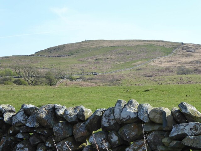
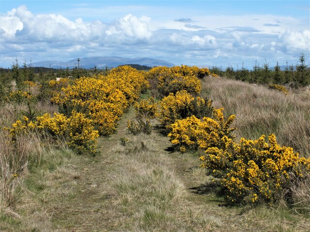
West Plantation is a scenic woodland area located in the county of Wigtownshire, Scotland. Situated within close proximity to the charming village of Wood, this sprawling forest covers an area of approximately 300 acres and offers a haven of natural beauty for visitors and wildlife alike.

The plantation is predominantly composed of a mix of deciduous and coniferous trees, creating a diverse and stunning landscape. Towering oak, beech, and birch trees provide a picturesque canopy overhead, while the scent of pine fills the air. The varying tree species also support a rich ecosystem, attracting a wide range of bird species, including woodpeckers, owls, and various songbirds. Nature enthusiasts will be delighted to spot deer, foxes, and squirrels roaming freely in their natural habitat.

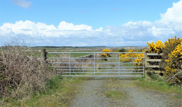
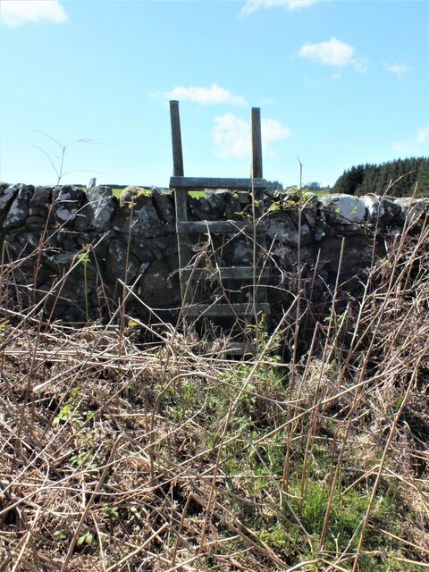
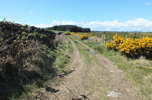
The forest offers several walking trails that wind through its enchanting beauty, providing visitors with the opportunity to immerse themselves in nature. These trails are well-maintained, making them easily accessible for all levels of fitness. Along the way, visitors can enjoy the breathtaking views, tranquil streams, and vibrant wildflowers that dot the forest floor.

West Plantation also boasts a picnic area, where visitors can relax and enjoy a meal amidst the serenity of the woodland. Additionally, the plantation offers educational programs and guided tours, providing visitors with the chance to learn about the local flora and fauna.

Overall, West Plantation in Wigtownshire is a captivating destination for nature lovers, offering a peaceful retreat and a chance to appreciate the breathtaking beauty of Scotland's woodlands.

If you have any feedback on the listing, please let us know in the comments section below.

West Plantation Images

Images are sourced within 2km of 54.820989/-4.6389437 or Grid Reference NX3050. Thanks to Geograph Open Source API. All images are credited.

View to cairn on Mochrum Fell From Culshabbin.
View to cairn on Mochrum Fell
From Culshabbin.
Gate to the Forestry Off the road between Culshabbin and High Glenling.
Gate to the Forestry
Off the road between Culshabbin and High Glenling.
Ladder Stile This is part of Mochrum Estate, very much a sporting estate.
Ladder Stile
This is part of Mochrum Estate, very much a sporting estate.
Track on the Machar Following the wall.
Track on the Machar
Following the wall.
Not Going to get Very Far Down There! Although the track seen in <a href="https://www.geograph.org.uk/photo/7485841">NX3051 : Track on the Machar</a> carries on following the wall, according to the map it goes to the right here. But it appears to have been taken over by Gorse.
Not Going to get Very Far Down There!
Although the track seen in NX3051 : Track on the Machar carries on following the wall, according to the map it goes to the right here. But it appears to have been taken over by Gorse.
Boundary Walls The stane walls on Low Moor around Corwall Farm appear mostly in good condition, no easy task in an isolated area of the Machars.
Boundary Walls
The stane walls on Low Moor around Corwall Farm appear mostly in good condition, no easy task in an isolated area of the Machars.
North of Corwall View across the moors to Alticry.
North of Corwall
View across the moors to Alticry.
Mid Moor Wood Looking across the moorland to the wood.
Mid Moor Wood
Looking across the moorland to the wood.
Stone work Plenty of boundary walls in good repair and a derelict cottage by the road to Corwall Farm.
Stone work
Plenty of boundary walls in good repair and a derelict cottage by the road to Corwall Farm.
Road to the B7005 This farm road leads from Corwall Farm across Low Moor and High Moor to the B7005.
Road to the B7005
This farm road leads from Corwall Farm across Low Moor and High Moor to the B7005.
Derelict Cottage on High Moor At the side of the road to Corwall Farm.
Derelict Cottage on High Moor
At the side of the road to Corwall Farm.
Abandoned Dwelling Sits at the side of the road to Corwall Farm on High Moor.
Abandoned Dwelling
Sits at the side of the road to Corwall Farm on High Moor.
Road through High Moor In this direction leads off the moor and down to the B7005.
Road through High Moor
In this direction leads off the moor and down to the B7005.
Derelict Dwelling Long abandoned cottage on High Moor.
Derelict Dwelling
Long abandoned cottage on High Moor.
Wooly Jumper This sheep was hopping about all over the place by the road to the B7005 on High Moor when I stopped to take some pictures.
Wooly Jumper
This sheep was hopping about all over the place by the road to the B7005 on High Moor when I stopped to take some pictures.
Road to Corwall Concrete track that leads down from the B7005 to the farm on the moors above Luce Bay. Surprisingly accessible for such an isolated farm.
Road to Corwall
Concrete track that leads down from the B7005 to the farm on the moors above Luce Bay. Surprisingly accessible for such an isolated farm.
Moors above Luce Bay Looking from High Moor across Low Moor to the bay.
Moors above Luce Bay
Looking from High Moor across Low Moor to the bay.
High Moor View across the moors towards Mid Moor Wood.
High Moor
View across the moors towards Mid Moor Wood.
Show me another place!

West Plantation is located at Grid Ref: NX3050 (Lat: 54.820989, Lng: -4.6389437)

Unitary Authority: Dumfries and Galloway

Police Authority: Dumfries and Galloway

What 3 Words

///memory.firelight.guideline. Near Whithorn, Dumfries & Galloway

Related Wikis

Machars

The Machars (Scottish Gaelic: Machair Ghallghaidhealaibh) is a peninsula in the historical county of Wigtownshire in Galloway in the south-west of Scotland...

Doon of May

The Doon of May is a conifer plantation associated with an Iron Age hill fort in Dumfries and Galloway, south-west Scotland. Located around 14 kilometres...

Mochrum Loch

Mochrum Loch is a large, irregular shaped, shallow, freshwater loch in Dumfries and Galloway, in the Southern Uplands of south-west Scotland. It lies approximately...

Elrig

Elrig (Scottish Gaelic: An Eileirg, meaning "the deer run") is a clachan or hamlet in the historical county of Wigtownshire in Dumfries and Galloway...

Castle Loch, Dumfries and Galloway

Castle Loch is a large, shallow, freshwater loch in Dumfries and Galloway, in the Southern Uplands of south-west Scotland. It lies to the west of Mochrum...

Castle Loch

Castle Loch is a shallow eutrophic loch covering an area of around 100 hectares in the town of Lochmaben in Dumfries and Galloway, Scotland. It lies to...

Mochrum

Mochrum () is a coastal civil and Church of Scotland parish situated to the east of Luce Bay on the Machars peninsula and 8 miles (13 km) southwest of...

Wigtown Area

Wigtown is a lieutenancy area in south-west Scotland and a committee area of Dumfries and Galloway Council. From 1975 until 1996 it was also a local government...

Nearby Amenities

Located within 500m of 54.820989,-4.6389437
Power: pole
Lat/Long: 54.8244804/-4.642983
Power: pole
Lat/Long: 54.8244086/-4.6418025
Power: pole
Lat/Long: 54.8243233/-4.6405655
Power: pole
Lat/Long: 54.824582/-4.6395754
Power: pole
Lat/Long: 54.82483/-4.6385806
Power: pole
Lat/Long: 54.8250806/-4.6375882
Power: pole
Lat/Long: 54.8252323/-4.6363488
The data included in this document is from www.openstreetmap.org. The data is made available under ODbL.

Have you been to West Plantation?

Leave your review of West Plantation below (or comments, questions and feedback).