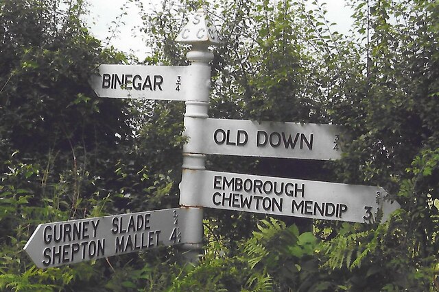
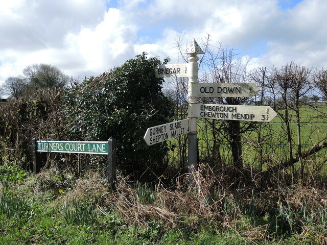
Gurney Slade

Settlement in Somerset Mendip

England

Gurney Slade

Direction Sign – Signpost on Turner's Court Lane, Emborough Located west of Turner's Court Lane and west of Portway Bridge in Emborough parish. 4 arms and pyramid finial. Google Earth shows that the Emborough / Chewton Mendip arm and the finial were missing in 2011.

Milestone Society National ID: SO_ST6250
Direction Sign – Signpost on Turner's Court Lane, Emborough Credit: R Raynsford

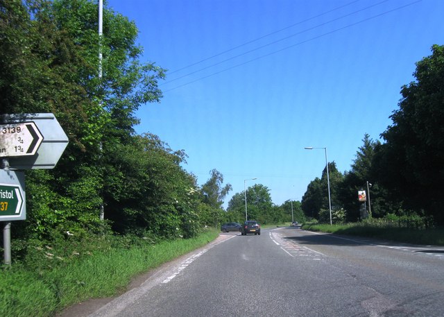
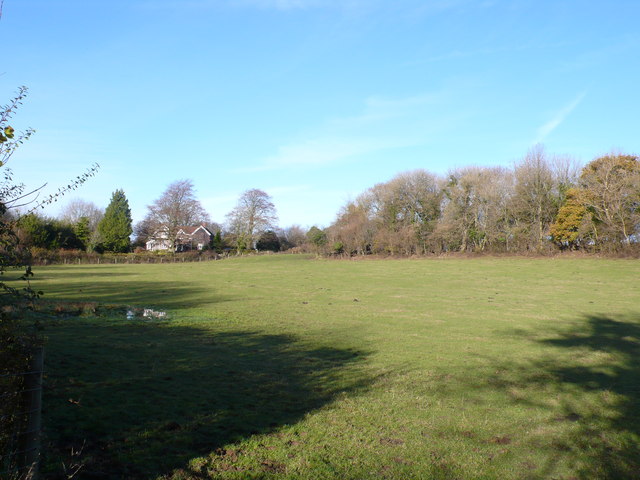
Gurney Slade is a small village located in the Mendip Hills, Somerset, England. Situated approximately 20 miles southwest of Bath, it is part of the Mendip district. The village is surrounded by picturesque countryside, with rolling hills and charming rural landscapes.

With a population of around 600 residents, Gurney Slade has a close-knit community feel. The village is known for its peaceful and tranquil atmosphere, making it an ideal place for those seeking a quieter way of life. The local economy is mainly based on agriculture, with farming activities playing a significant role in the area.

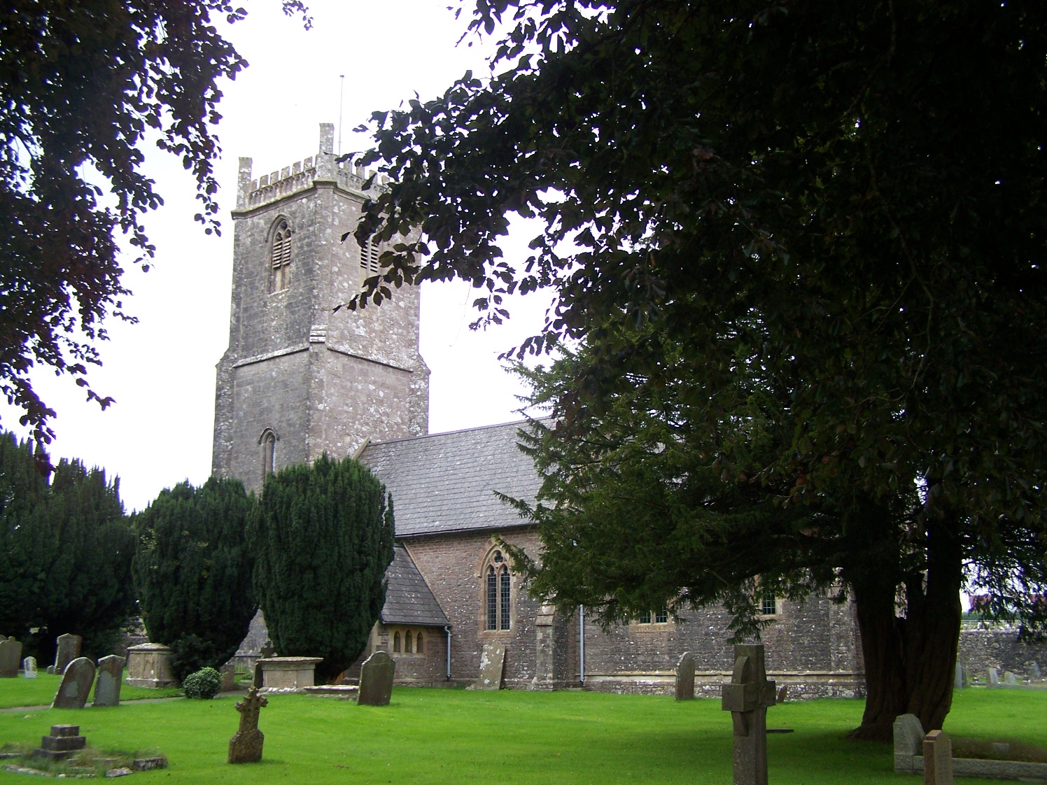
One of the notable features of Gurney Slade is its beautiful church, St John the Baptist. Dating back to the 12th century, this historic church is a prominent landmark in the village. It serves as a place of worship, as well as a cultural and historical attraction.

The village also offers a range of amenities to its residents. These include a primary school, a village hall, a local shop, and a pub. The pub, named The George Inn, is a popular gathering spot for locals and visitors alike, offering traditional pub fare and a warm and friendly atmosphere.

Gurney Slade is a gateway to the Mendip Hills, providing access to various outdoor activities and attractions. The surrounding area offers opportunities for hiking, cycling, and exploring the stunning limestone landscapes. Cheddar Gorge, a renowned natural landmark, is located just a few miles away, attracting tourists from far and wide.

In summary, Gurney Slade is a charming village nestled in the scenic Mendip Hills. With its peaceful ambiance, historic church, and beautiful countryside, it offers a delightful place to live or visit for those seeking a tranquil and picturesque setting.

If you have any feedback on the listing, please let us know in the comments section below.
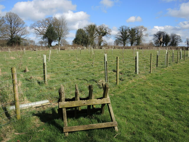
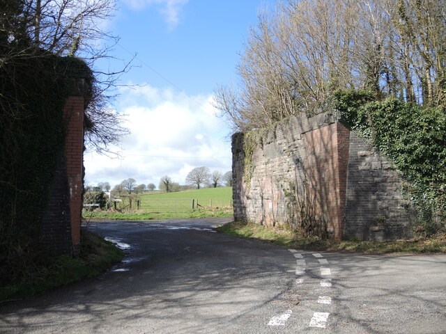
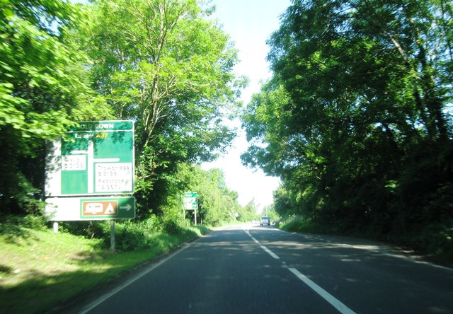
Gurney Slade Images

Images are sourced within 2km of 51.242113/-2.540481 or Grid Reference ST6249. Thanks to Geograph Open Source API. All images are credited.

Direction Sign – Signpost on Turner's Court Lane, Emborough Located west of Turner's Court Lane and west of Portway Bridge in Emborough parish. 4 arms and pyramid finial. Google Earth shows that the Emborough / Chewton Mendip arm and the finial were missing in 2011.

Milestone Society National ID: SO_ST6250
Direction Sign – Signpost on Turner's Court Lane, Emborough
Located west of Turner's Court Lane and west of Portway Bridge in Emborough parish. 4 arms and pyramid finial. Google Earth shows that the Emborough / Chewton Mendip arm and the finial were missing in 2011. Milestone Society National ID: SO_ST6250
Patterns on Portway Bridge The blocks, shadows and a little graffiti on Portway Bridge.
Patterns on Portway Bridge
The blocks, shadows and a little graffiti on Portway Bridge.
Signpost on Turner's Court Lane Cast arms and embossed lettering on a traditional Somerset post.
Signpost on Turner's Court Lane
Cast arms and embossed lettering on a traditional Somerset post.
Lechmere Water A private fishing lake near Emborough, with the old boat house on the far shore. Its size has been reduced slightly from the nineteenth century.
Lechmere Water
A private fishing lake near Emborough, with the old boat house on the far shore. Its size has been reduced slightly from the nineteenth century.
Not enough hop An amphibian road kill near Lechmere Water.
Not enough hop
An amphibian road kill near Lechmere Water.
Growing by the drain It looks like the water is a continuous suppy and has allowed some brightly-coloured growth on the road surface.
Growing by the drain
It looks like the water is a continuous suppy and has allowed some brightly-coloured growth on the road surface.
Lechmere Water track Access to the lake is a muddy track.
Lechmere Water track
Access to the lake is a muddy track.
Emborough signpost At the junction of the B3139 and B3114 is a particularly rusty signpost, save the Emborough arm.
Emborough signpost
At the junction of the B3139 and B3114 is a particularly rusty signpost, save the Emborough arm.
Trees on a tumulus One of a number in the area, this bowl barrow is close to Emborough and is possibly believed to date back to the Bronze Age. It is about 32m in diameter and 2.5m high, with evidence of a berm surrounding it. The trees have shielded the outline somewhat. See <a href="https://www.geograph.org.uk/photo/7146021">ST6050 : An old barrow in the field</a> for another barrow north of this one.
Trees on a tumulus
One of a number in the area, this bowl barrow is close to Emborough and is possibly believed to date back to the Bronze Age. It is about 32m in diameter and 2.5m high, with evidence of a berm surrounding it. The trees have shielded the outline somewhat. See ST6050 : An old barrow in the field for another barrow north of this one.
A small plantation on the farm The path between Coldharbour and Weaver's Farms has some land set aside for the future.
A small plantation on the farm
The path between Coldharbour and Weaver's Farms has some land set aside for the future.
Portway Bridge, open to the sky The old Somerset and Dorset Joint Railway used to span it, but the tracks were ripped up after the line closed in 1965. See <a href="https://www.geograph.org.uk/photo/7146829">ST6250 : Portway Bridge benchmark</a> for a benchmark on the corner.
Portway Bridge, open to the sky
The old Somerset and Dorset Joint Railway used to span it, but the tracks were ripped up after the line closed in 1965. See ST6250 : Portway Bridge benchmark for a benchmark on the corner.
Portway Bridge benchmark A post-war cutmark, as listed in the Benchmark Database: <span class="nowrap"><a title="https://www.bench-marks.org.uk/bm161728" rel="nofollow ugc noopener" href="https://www.bench-marks.org.uk/bm161728">Link</a><img style="margin-left:2px;" alt="External link" title="External link - shift click to open in new window" src="https://s1.geograph.org.uk/img/external.png" width="10" height="10"/></span> . The old railway bridge is now minus the tracks - see <a href="https://www.geograph.org.uk/photo/7146828">ST6250 : Portway Bridge, open to the sky</a>.
Portway Bridge benchmark
A post-war cutmark, as listed in the Benchmark Database: LinkExternal link . The old railway bridge is now minus the tracks - see ST6250 : Portway Bridge, open to the sky.
A37 northbound
A37 northbound
A37 northbound
A37 northbound
Fields at Portway Bridge The bridge refers to an old bridge over the now dismantled railway that use to run through Binegar which was part of the Somerset and Dorset Joint Railway. Portway Lane, Turners  Court Lane and Kings lane all meet at the bridge. Portway lane is just in front of the house in the middle of the image.
Fields at Portway Bridge
The bridge refers to an old bridge over the now dismantled railway that use to run through Binegar which was part of the Somerset and Dorset Joint Railway. Portway Lane, Turners Court Lane and Kings lane all meet at the bridge. Portway lane is just in front of the house in the middle of the image.
Houses at Emborough Farm This row of terraced cottages is close to the crossroads near Old Down on the B3139
Houses at Emborough Farm
This row of terraced cottages is close to the crossroads near Old Down on the B3139
A bus stop casualty The post has come down. Well, it had been leaning for a while.
A bus stop casualty
The post has come down. Well, it had been leaning for a while.
A mixture of masonry The old railway bridge in Binegar has been dismantled but the strange mixture of construction shows.
A mixture of masonry
The old railway bridge in Binegar has been dismantled but the strange mixture of construction shows.
Show me another place!

Gurney Slade is located at Grid Ref: ST6249 (Lat: 51.242113, Lng: -2.540481)

Administrative County: Somerset

District: Mendip

Police Authority: Avon and Somerset

What 3 Words

///longer.dummy.sensitive. Near Chilcompton, Somerset

Related Wikis

Gurney Slade quarry

Gurney Slade quarry, grid reference ST626497 is a limestone quarry near Gurney Slade between Binegar and Holcombe, on the Mendip Hills, Somerset, England...

Binegar

Binegar is a small village and civil parish in Somerset, England. It is located on the A37, 4 miles (6.4 km) east of Wells, between Shepton Mallet and...

Binegar railway station

Binegar railway station was a station on the Somerset and Dorset Joint Railway in the county of Somerset in England. Opened on 20 July 1874, the station...

Church of the Holy Trinity, Binegar

The Anglican Church of the Holy Trinity, Binegar, Somerset, England is Norman but has been rebuilt and restored several times since. It is a Grade II*...

Emborough Quarries

Emborough Quarries (grid reference ST623505) is a 1 hectare (2.5 acre) geological Site of Special Scientific Interest at Emborough in the Mendip Hills...

Blacker's Hill

Blacker's Hill is an Iron Age hill fort at Chilcompton, 4.5 kilometres (3 mi) south west of Radstock, Somerset, England. It has been designated as a Scheduled...

Ashwick Court

Ashwick Court is Grade II listed house on Heckley Lane northwest of Ashwick, in Mendip district, eastern Somerset, England, adjacent to the Church of St...

Ashwick

Ashwick is a village in Somerset, England, about three miles north of Shepton Mallet and seven miles east from Wells. It has also been a civil parish since...

Nearby Amenities

Located within 500m of 51.242113,-2.540481
Gurney Slade
Place: village
Postal Code: BA3 4
Source: npe
Lat/Long: 51.2425109/-2.5411003
Bus Stop
Bus: yes
Naptan AtcoCode: 3600SOB21645
Naptan NaptanCode: sotdgtpg
Public Transport: platform
Lat/Long: 51.2420102/-2.5427029
Post Office
Binigar and Gurney Slade Stores
Lat/Long: 51.2409428/-2.5414218
Barrier: stile
Foot: yes
Lat/Long: 51.240566/-2.5369961
Barrier: stile
Foot: yes
Lat/Long: 51.241011/-2.5358734
Speed Camera
Lat/Long: 51.2390502/-2.5415156
Kindergarten
Binegar and Gurney Slade Store
Lat/Long: 51.2410042/-2.5413968
Pub
George Inn
Lat/Long: 51.2419578/-2.5421949
Post Box
Mapillary: 1444814666024899
Operator: Royal Mail
Operator Wikidata: Q638098
Post Box Mounting: pier
Post Box Type: lamp
Ref: BA3 206D
Royal Cypher: EIIR
Lat/Long: 51.2456117/-2.5427507
Post Box
Mapillary: 481656220448317
Operator: Royal Mail
Operator Wikidata: Q638098
Post Box Mounting: building
Post Box Type: wall
Lat/Long: 51.2409795/-2.5413801
The data included in this document is from www.openstreetmap.org. The data is made available under ODbL.

Have you been to Gurney Slade?

Leave your review of Gurney Slade below (or comments, questions and feedback).