Breney Common

Downs, Moorland in Cornwall

England

Breney Common

Old Wayside Cross in Fenton Pits, Lanivet Fenton Pits Cross, a wayside cross with an old head and shaft. Set on the east side of the road in Fenton Pits in Lanivet parish. Langdon Mid Cornwall number 51. A Scheduled Monument <span class="nowrap"><a title="https://historicengland.org.uk/listing/the-list/list-entry/1012507" rel="nofollow ugc noopener" href="https://historicengland.org.uk/listing/the-list/list-entry/1012507">Link</a><img style="margin-left:2px;" alt="External link" title="External link - shift click to open in new window" src="https://s1.geograph.org.uk/img/external.png" width="10" height="10"/></span>. See also <span class="nowrap"><a title="http://www.flickr.com/photos/ocifant/1656598946" rel="nofollow ugc noopener" href="http://www.flickr.com/photos/ocifant/1656598946">Link</a><img style="margin-left:2px;" alt="External link" title="External link - shift click to open in new window" src="https://s1.geograph.org.uk/img/external.png" width="10" height="10"/></span> and <a title="https://www.geograph.org.uk/photo/155223" href="https://www.geograph.org.uk/photo/155223">Link</a>.

Milestone Society National ID: CWNC_LIV04
Old Wayside Cross in Fenton Pits, Lanivet Credit: L Nott

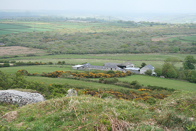
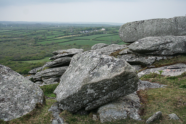
Breney Common is a vast expanse of land located in Cornwall, England. It is characterized by its diverse landscape, encompassing downs, moorland, and other unique natural features. Covering an area of approximately 2,500 acres, Breney Common is a designated Site of Special Scientific Interest (SSSI) due to its rich biodiversity and historical significance.

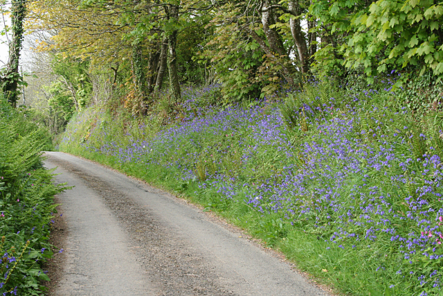
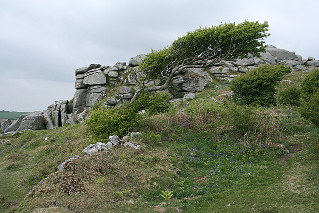
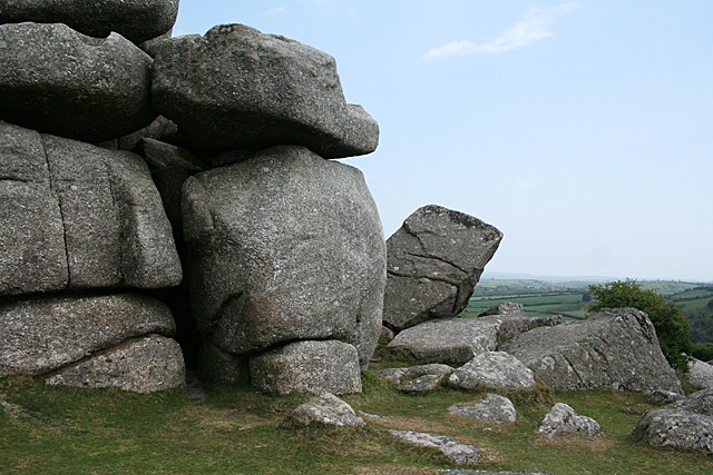
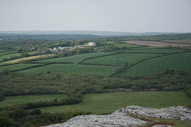
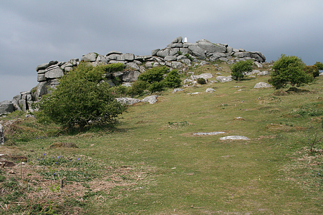
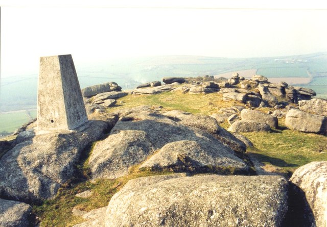
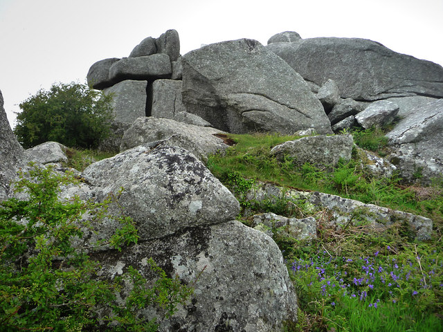
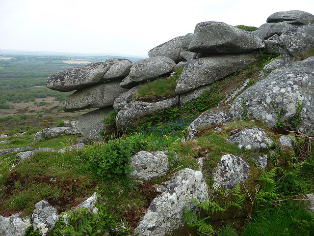
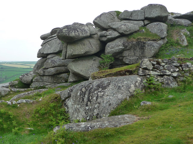
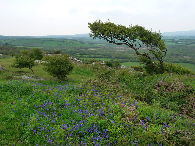
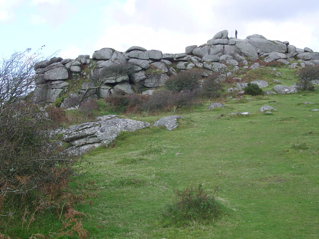
The downs of Breney Common are extensive grassy areas that stretch across the landscape, providing a habitat for a variety of plant and animal species. These downs are interspersed with patches of heathland and scrub, creating an interesting mosaic of different habitats. The moorland, on the other hand, consists of wetter areas with peat bogs and heather, supporting a distinct range of flora and fauna.

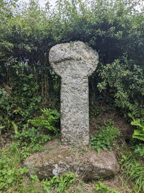
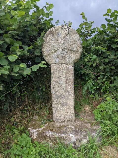
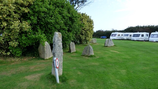
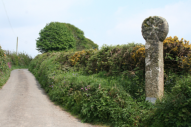
The common is home to several rare and protected species, including the nightjar, Dartford warbler, and adder snake. It is also a breeding ground for various bird species, making it a popular destination for birdwatchers. Additionally, the area is dotted with ancient monuments and archaeological sites, such as Bronze Age burial mounds and stone circles, highlighting its historical significance.

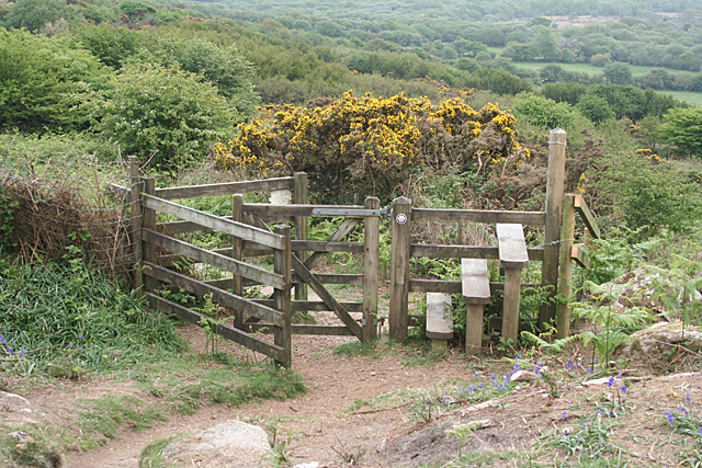
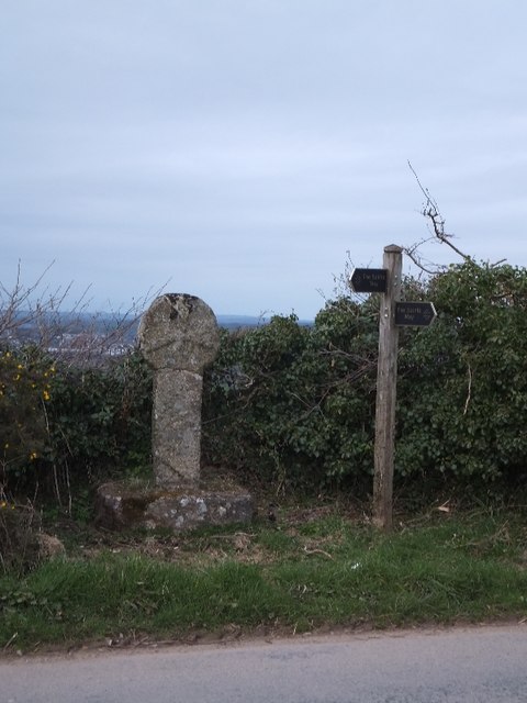
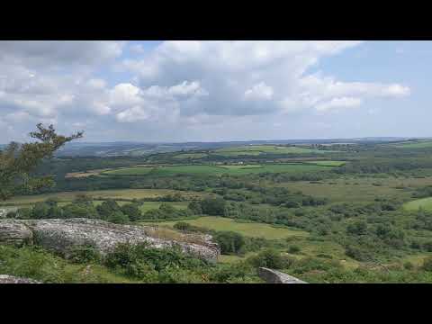
Breney Common offers a range of recreational activities for visitors, including walking, hiking, and nature photography. There are well-maintained footpaths and trails that allow visitors to explore the diverse landscape and enjoy the breathtaking views. The common is managed by local authorities and conservation organizations to preserve its natural beauty and protect its wildlife.

In conclusion, Breney Common in Cornwall is a remarkable natural area that showcases the beauty and diversity of downs, moorland, and other unique habitats. With its rich biodiversity, historical sites, and recreational opportunities, it offers visitors an unforgettable experience in the heart of Cornwall's countryside.

If you have any feedback on the listing, please let us know in the comments section below.

Breney Common Images

Images are sourced within 2km of 50.420127/-4.737257 or Grid Reference SX0561. Thanks to Geograph Open Source API. All images are credited.

Old Wayside Cross in Fenton Pits, Lanivet Fenton Pits Cross, a wayside cross with an old head and shaft. Set on the east side of the road in Fenton Pits in Lanivet parish. Langdon Mid Cornwall number 51. A Scheduled Monument <span class="nowrap"><a title="https://historicengland.org.uk/listing/the-list/list-entry/1012507" rel="nofollow ugc noopener" href="https://historicengland.org.uk/listing/the-list/list-entry/1012507">Link</a><img style="margin-left:2px;" alt="External link" title="External link - shift click to open in new window" src="https://s1.geograph.org.uk/img/external.png" width="10" height="10"/></span>. See also <span class="nowrap"><a title="http://www.flickr.com/photos/ocifant/1656598946" rel="nofollow ugc noopener" href="http://www.flickr.com/photos/ocifant/1656598946">Link</a><img style="margin-left:2px;" alt="External link" title="External link - shift click to open in new window" src="https://s1.geograph.org.uk/img/external.png" width="10" height="10"/></span> and <a title="https://www.geograph.org.uk/photo/155223" href="https://www.geograph.org.uk/photo/155223">Link</a>.

Milestone Society National ID: CWNC_LIV04
Old Wayside Cross in Fenton Pits, Lanivet
Fenton Pits Cross, a wayside cross with an old head and shaft. Set on the east side of the road in Fenton Pits in Lanivet parish. Langdon Mid Cornwall number 51. A Scheduled Monument LinkExternal link. See also LinkExternal link and Link. Milestone Society National ID: CWNC_LIV04
Old Wayside Cross at St Ingunger, Lanivet St Ingunger Cross, a wayside cross with an old head and shaft. Set on the north side of a T junction, opposite a lane to Fenton Pits, in Lanivet parish. Langdon Mid Cornwall number 50. A Scheduled Monument <span class="nowrap"><a title="https://historicengland.org.uk/listing/the-list/list-entry/" rel="nofollow ugc noopener" href="https://historicengland.org.uk/listing/the-list/list-entry/">Link</a><img style="margin-left:2px;" alt="External link" title="External link - shift click to open in new window" src="https://s1.geograph.org.uk/img/external.png" width="10" height="10"/></span> 1007951. See also <span class="nowrap"><a title="http://www.flickr.com/photos/ocifant/1656595894," rel="nofollow ugc noopener" href="http://www.flickr.com/photos/ocifant/1656595894,">Link</a><img style="margin-left:2px;" alt="External link" title="External link - shift click to open in new window" src="https://s1.geograph.org.uk/img/external.png" width="10" height="10"/></span> <a title="https://www.geograph.org.uk/photo/1685630" href="https://www.geograph.org.uk/photo/1685630">Link</a> and <a title="https://www.geograph.org.uk/photo/2278867" href="https://www.geograph.org.uk/photo/2278867">Link</a>.

Milestone Society National ID: CWNC_LIV08
Old Wayside Cross at St Ingunger, Lanivet
St Ingunger Cross, a wayside cross with an old head and shaft. Set on the north side of a T junction, opposite a lane to Fenton Pits, in Lanivet parish. Langdon Mid Cornwall number 50. A Scheduled Monument LinkExternal link 1007951. See also LinkExternal link Link and Link. Milestone Society National ID: CWNC_LIV08
Granite stones at Mena Farm Camp Site
Lanivet: ancient cross by Lesquite By the entrance to Lesquite farm
Lanivet: ancient cross by Lesquite
By the entrance to Lesquite farm
Lanivet: bluebell bank By the entrance to Fenton Farm. In the lane linking Tredinnick and Fenton Pits
Lanivet: bluebell bank
By the entrance to Fenton Farm. In the lane linking Tredinnick and Fenton Pits
Lanlivery: tree and tor On Helman Tor
Lanlivery: tree and tor
On Helman Tor
Lanlivery: Higher Trevilmick Farm seen from Helman Tor. On the edge of Red Moor Nature Reserve. In Lanlivery parish
Lanlivery: Higher Trevilmick
Farm seen from Helman Tor. On the edge of Red Moor Nature Reserve. In Lanlivery parish
Lanlivery: on Helman Tor Looking north west towards Bokiddick and Bokiddick Downs
Lanlivery: on Helman Tor
Looking north west towards Bokiddick and Bokiddick Downs
Lanlivery: Logan Stone On Helman Tor. The Logan Stone is top, centre. In Lanlivery parish
Lanlivery: Logan Stone
On Helman Tor. The Logan Stone is top, centre. In Lanlivery parish
Lanlivery: Bokiddick Seen from Helman Tor
Lanlivery: Bokiddick
Seen from Helman Tor
Lanlivery: Helman Tor The approach from the south; from the car park. The trig point on top of the tor has been painted white
Lanlivery: Helman Tor
The approach from the south; from the car park. The trig point on top of the tor has been painted white
Lanlivery: gate and stile These provide access to Helman Tor. The tor's small car park lies beyond, to the left
Lanlivery: gate and stile
These provide access to Helman Tor. The tor's small car park lies beyond, to the left
Helman Tor triangulation pillar The trig point has an Ordnance Survey flush bracket bench mark with serial number S7862. Some youngsters on the same climb thought the 7862 referred to height above sea level. More details of the pillar at <span class="nowrap"><a title="http://www.trigpointinguk.com/trigs/trig-details.php?t=3722" rel="nofollow ugc noopener" href="http://www.trigpointinguk.com/trigs/trig-details.php?t=3722">Link</a><img style="margin-left:2px;" alt="External link" title="External link - shift click to open in new window" src="https://s1.geograph.org.uk/img/external.png" width="10" height="10"/></span>
Helman Tor triangulation pillar
The trig point has an Ordnance Survey flush bracket bench mark with serial number S7862. Some youngsters on the same climb thought the 7862 referred to height above sea level. More details of the pillar at LinkExternal link
Cross and signpost at St Ingunger The signpost is at a junction where the Saints Way turns through a right angle.
Cross and signpost at St Ingunger
The signpost is at a junction where the Saints Way turns through a right angle.
Helman Tor
Helman Tor
Helman Tor
Helman Tor
Helman Tor
Helman Tor
View from Helman Tor
Show me another place!

Breney Common is located at Grid Ref: SX0561 (Lat: 50.420127, Lng: -4.737257)

Unitary Authority: Cornwall

Police Authority: Devon and Cornwall

What 3 Words

///narrowest.free.incur. Near Bugle, Cornwall

Related Wikis

Breney Common

Breney Common is a nature reserve and Site of Special Scientific Interest, noted for its biological characteristics, in mid Cornwall, England, UK. It is...

Lowertown, Luxulyan

Lowertown is a hamlet in the civil parish of Luxulyan, where the population in the 2011 census was included, in Cornwall, England. Lowertown is approximately...

Helman Tor

Helman Tor (Cornish: Torr Helman) is a granite hill in mid Cornwall, UK with several separated tors, and is designated as a (non-statutory) County Geology...

Bokiddick

Bokiddick is a hamlet in Cornwall, England, United Kingdom. It is approximately one mile south of Lanivet at grid reference SX 051 622 and is centred on...

Related Videos

Helman Tor, Cornwall

Exploring Helman Tor, a 686 ft high granite tor standing in the parish of Lanlivery in Mid Cornwall, around three miles north west ...

trig point Tuesday #trigs&torschallenge #cornwall #HelmanTor

Music: King Of The Roads Musician: Philip E Morris.

FLYING OVER CORNWALL : #3 HELMAN TOR

just a short walk over on helman tor , wasnt sure if to post this one or not .

Mena Farm

Mena Farm Campsite.

Nearby Amenities

Located within 500m of 50.420127,-4.737257
Post Box
Collection Times: Mo-Fr 09:00; Sa 07:00
Ref: PL30 152
Royal Cypher: EIIR
Lat/Long: 50.41885/-4.74283
Parking
Lat/Long: 50.4188312/-4.7425636
Lowertown
Place: hamlet
Wikidata: Q6693980
Lat/Long: 50.4186888/-4.7427774
The data included in this document is from www.openstreetmap.org. The data is made available under ODbL.

Have you been to Breney Common?

Leave your review of Breney Common below (or comments, questions and feedback).