Bokiddick Downs

Downs, Moorland in Cornwall

England

Bokiddick Downs

Old Wayside Cross in Fenton Pits, Lanivet Fenton Pits Cross, a wayside cross with an old head and shaft. Set on the east side of the road in Fenton Pits in Lanivet parish. Langdon Mid Cornwall number 51. A Scheduled Monument <span class="nowrap"><a title="https://historicengland.org.uk/listing/the-list/list-entry/1012507" rel="nofollow ugc noopener" href="https://historicengland.org.uk/listing/the-list/list-entry/1012507">Link</a><img style="margin-left:2px;" alt="External link" title="External link - shift click to open in new window" src="https://s1.geograph.org.uk/img/external.png" width="10" height="10"/></span>. See also <span class="nowrap"><a title="http://www.flickr.com/photos/ocifant/1656598946" rel="nofollow ugc noopener" href="http://www.flickr.com/photos/ocifant/1656598946">Link</a><img style="margin-left:2px;" alt="External link" title="External link - shift click to open in new window" src="https://s1.geograph.org.uk/img/external.png" width="10" height="10"/></span> and <a title="https://www.geograph.org.uk/photo/155223" href="https://www.geograph.org.uk/photo/155223">Link</a>.

Milestone Society National ID: CWNC_LIV04
Old Wayside Cross in Fenton Pits, Lanivet Credit: L Nott

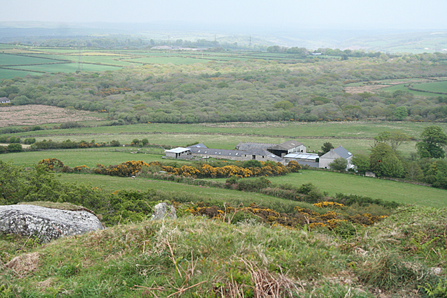
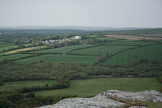
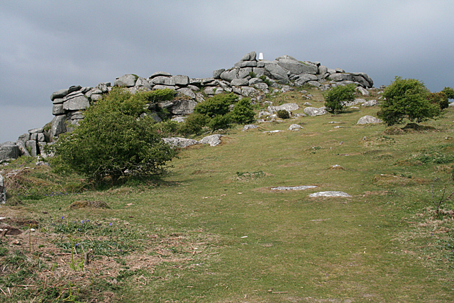
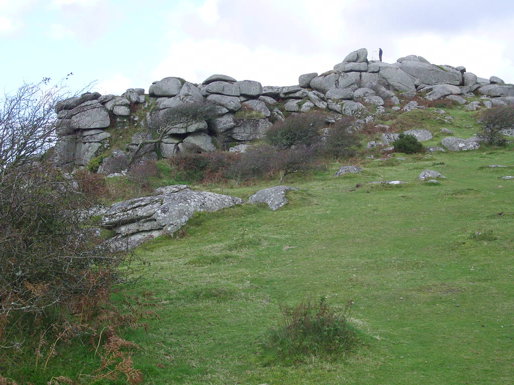
Bokiddick Downs is a picturesque area located in Cornwall, England. Situated in the southwestern part of the county, it is a part of the larger Bodmin Moorland region. The downs are characterized by rolling hills, heather-covered moorland, and breathtaking panoramic views.

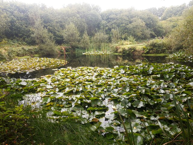
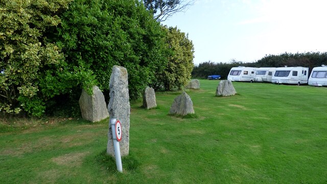
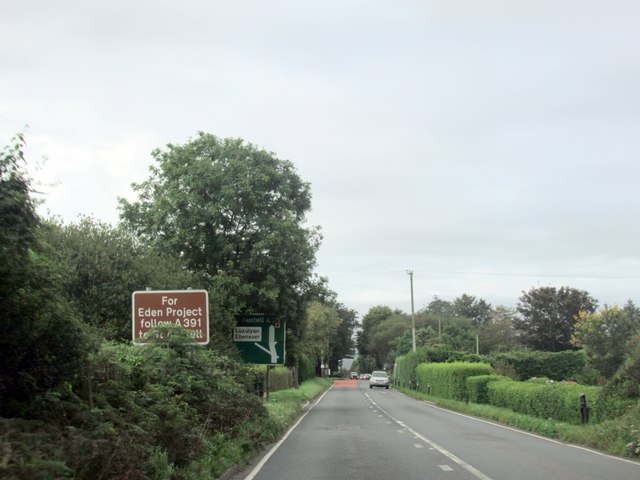
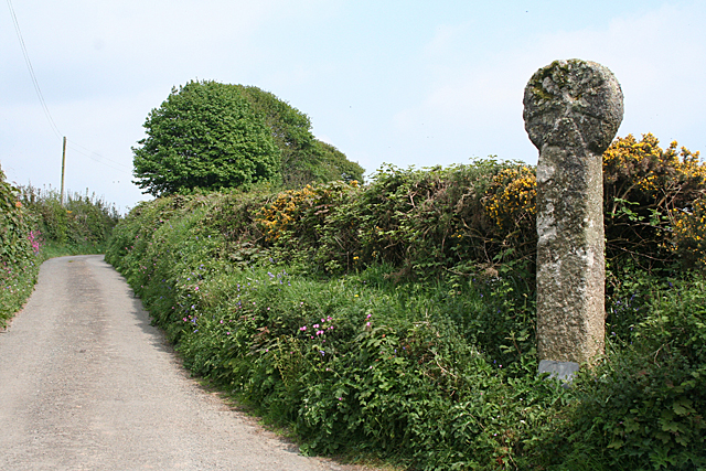
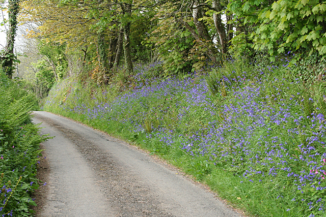
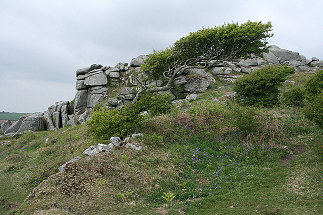
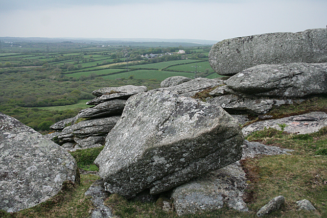
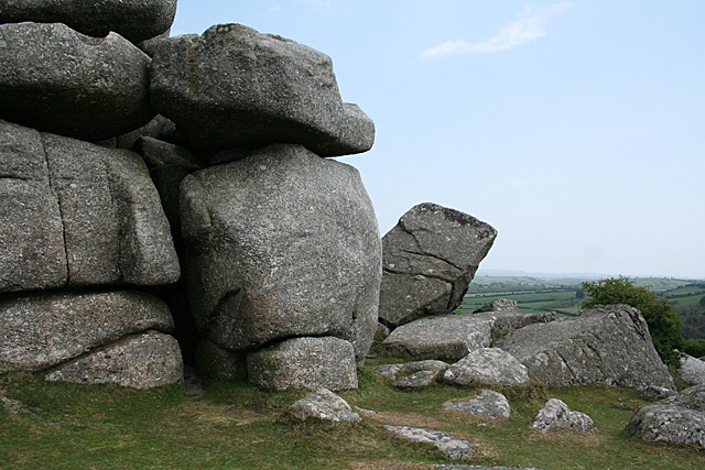
Covering an area of approximately 2,000 acres, Bokiddick Downs offers a tranquil and serene escape for nature lovers and outdoor enthusiasts. The landscape is dotted with granite outcrops and ancient stone circles, adding to the area's mystical appeal. Visitors can explore the area on foot, taking advantage of the numerous walking trails that crisscross the downs.

Wildlife thrives in this untouched habitat, with native species such as the Dartmoor pony, Red Deer, and various bird species making their home here. Birdwatchers will be delighted to spot species like the curlew, skylark, and peregrine falcon.

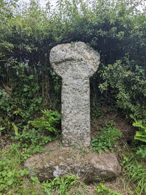
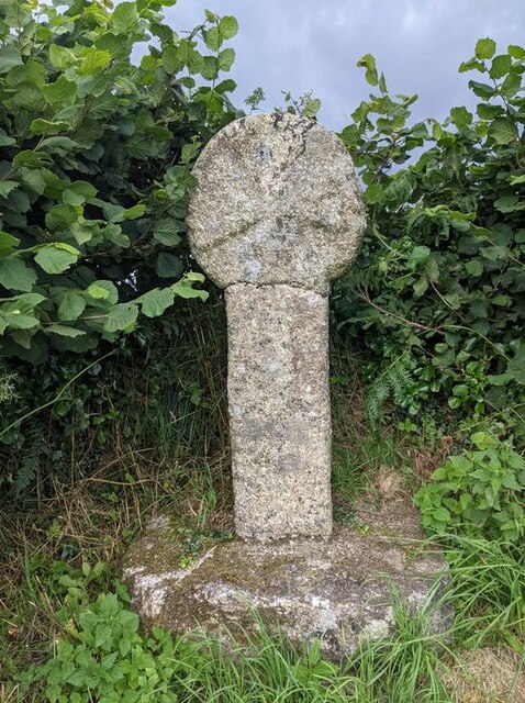
Bokiddick Downs also holds historical significance, with evidence of human settlement dating back to the Bronze Age. The area is home to several ancient burial sites and Celtic crosses, offering a glimpse into Cornwall's rich heritage.

Due to its remote location, Bokiddick Downs provides a haven for stargazers, away from the light pollution of urban areas. On clear nights, the sky comes alive with a dazzling display of stars, making it an ideal spot for astronomy enthusiasts.

Overall, Bokiddick Downs is a natural gem in Cornwall, offering visitors a chance to immerse themselves in the beauty of the moorland landscape, connect with nature, and explore the area's rich cultural and historical heritage.

If you have any feedback on the listing, please let us know in the comments section below.

Bokiddick Downs Images

Images are sourced within 2km of 50.422816/-4.7460572 or Grid Reference SX0561. Thanks to Geograph Open Source API. All images are credited.

Old Wayside Cross in Fenton Pits, Lanivet Fenton Pits Cross, a wayside cross with an old head and shaft. Set on the east side of the road in Fenton Pits in Lanivet parish. Langdon Mid Cornwall number 51. A Scheduled Monument <span class="nowrap"><a title="https://historicengland.org.uk/listing/the-list/list-entry/1012507" rel="nofollow ugc noopener" href="https://historicengland.org.uk/listing/the-list/list-entry/1012507">Link</a><img style="margin-left:2px;" alt="External link" title="External link - shift click to open in new window" src="https://s1.geograph.org.uk/img/external.png" width="10" height="10"/></span>. See also <span class="nowrap"><a title="http://www.flickr.com/photos/ocifant/1656598946" rel="nofollow ugc noopener" href="http://www.flickr.com/photos/ocifant/1656598946">Link</a><img style="margin-left:2px;" alt="External link" title="External link - shift click to open in new window" src="https://s1.geograph.org.uk/img/external.png" width="10" height="10"/></span> and <a title="https://www.geograph.org.uk/photo/155223" href="https://www.geograph.org.uk/photo/155223">Link</a>.

Milestone Society National ID: CWNC_LIV04
Old Wayside Cross in Fenton Pits, Lanivet
Fenton Pits Cross, a wayside cross with an old head and shaft. Set on the east side of the road in Fenton Pits in Lanivet parish. Langdon Mid Cornwall number 51. A Scheduled Monument LinkExternal link. See also LinkExternal link and Link. Milestone Society National ID: CWNC_LIV04
Old Wayside Cross at St Ingunger, Lanivet St Ingunger Cross, a wayside cross with an old head and shaft. Set on the north side of a T junction, opposite a lane to Fenton Pits, in Lanivet parish. Langdon Mid Cornwall number 50. A Scheduled Monument <span class="nowrap"><a title="https://historicengland.org.uk/listing/the-list/list-entry/" rel="nofollow ugc noopener" href="https://historicengland.org.uk/listing/the-list/list-entry/">Link</a><img style="margin-left:2px;" alt="External link" title="External link - shift click to open in new window" src="https://s1.geograph.org.uk/img/external.png" width="10" height="10"/></span> 1007951. See also <span class="nowrap"><a title="http://www.flickr.com/photos/ocifant/1656595894," rel="nofollow ugc noopener" href="http://www.flickr.com/photos/ocifant/1656595894,">Link</a><img style="margin-left:2px;" alt="External link" title="External link - shift click to open in new window" src="https://s1.geograph.org.uk/img/external.png" width="10" height="10"/></span> <a title="https://www.geograph.org.uk/photo/1685630" href="https://www.geograph.org.uk/photo/1685630">Link</a> and <a title="https://www.geograph.org.uk/photo/2278867" href="https://www.geograph.org.uk/photo/2278867">Link</a>.

Milestone Society National ID: CWNC_LIV08
Old Wayside Cross at St Ingunger, Lanivet
St Ingunger Cross, a wayside cross with an old head and shaft. Set on the north side of a T junction, opposite a lane to Fenton Pits, in Lanivet parish. Langdon Mid Cornwall number 50. A Scheduled Monument LinkExternal link 1007951. See also LinkExternal link Link and Link. Milestone Society National ID: CWNC_LIV08
Bus shelter, Lockengate
Lily Pond at Mena Farm Campsite
Granite stones at Mena Farm Camp Site
The A30 west at Innis Downs
Lockengate Mission Church Now a private dwelling.
Lockengate Mission Church
Now a private dwelling.
The A391 heading south from A30, Bodmin
The A391 at Lockengate village sign
The A391 at Lockengate
Lanivet: ancient cross by Lesquite By the entrance to Lesquite farm
Lanivet: ancient cross by Lesquite
By the entrance to Lesquite farm
Lanivet: bluebell bank By the entrance to Fenton Farm. In the lane linking Tredinnick and Fenton Pits
Lanivet: bluebell bank
By the entrance to Fenton Farm. In the lane linking Tredinnick and Fenton Pits
Lanlivery: tree and tor On Helman Tor
Lanlivery: tree and tor
On Helman Tor
Lanlivery: Higher Trevilmick Farm seen from Helman Tor. On the edge of Red Moor Nature Reserve. In Lanlivery parish
Lanlivery: Higher Trevilmick
Farm seen from Helman Tor. On the edge of Red Moor Nature Reserve. In Lanlivery parish
Lanlivery: on Helman Tor Looking north west towards Bokiddick and Bokiddick Downs
Lanlivery: on Helman Tor
Looking north west towards Bokiddick and Bokiddick Downs
Lanlivery: Logan Stone On Helman Tor. The Logan Stone is top, centre. In Lanlivery parish
Lanlivery: Logan Stone
On Helman Tor. The Logan Stone is top, centre. In Lanlivery parish
Lanlivery: Bokiddick Seen from Helman Tor
Lanlivery: Bokiddick
Seen from Helman Tor
Lanlivery: Helman Tor The approach from the south; from the car park. The trig point on top of the tor has been painted white
Lanlivery: Helman Tor
The approach from the south; from the car park. The trig point on top of the tor has been painted white
Show me another place!

Bokiddick Downs is located at Grid Ref: SX0561 (Lat: 50.422816, Lng: -4.7460572)

Unitary Authority: Cornwall

Police Authority: Devon and Cornwall

What 3 Words

///luxury.lottery.configure. Near Bugle, Cornwall

Related Wikis

Bokiddick

Bokiddick is a hamlet in Cornwall, England, United Kingdom. It is approximately one mile south of Lanivet at grid reference SX 051 622 and is centred on...

Lowertown, Luxulyan

Lowertown is a hamlet in the civil parish of Luxulyan, where the population in the 2011 census was included, in Cornwall, England. Lowertown is approximately...

Breney Common

Breney Common is a nature reserve and Site of Special Scientific Interest, noted for its biological characteristics, in mid Cornwall, England, UK. It is...

Helman Tor

Helman Tor (Cornish: Torr Helman) is a granite hill in mid Cornwall, UK with several separated tors, and is designated as a (non-statutory) County Geology...

Nearby Amenities

Located within 500m of 50.422816,-4.7460572
Post Box
Collection Times: Mo-Fr 09:00; Sa 07:00
Ref: PL30 152
Royal Cypher: EIIR
Lat/Long: 50.41885/-4.74283
Design: three-level
Power: tower
Lat/Long: 50.4243643/-4.750139
Design: three-level
Power: tower
Lat/Long: 50.4247881/-4.7450857
Bokiddick
Name Kw: Boskasek
Place: hamlet
Source: OS_OpenData_StreetView
Wikidata: Q4938777
Lat/Long: 50.4268514/-4.7450229
The data included in this document is from www.openstreetmap.org. The data is made available under ODbL.

Have you been to Bokiddick Downs?

Leave your review of Bokiddick Downs below (or comments, questions and feedback).