Tongue

Downs, Moorland in Ayrshire

Scotland

Tongue

Penderry Hill (309 metres) North of Finnarts Bay and Glenapp.
Penderry Hill (309 metres) North of Finnarts Bay and Glenapp. Credit: Colin McDonald

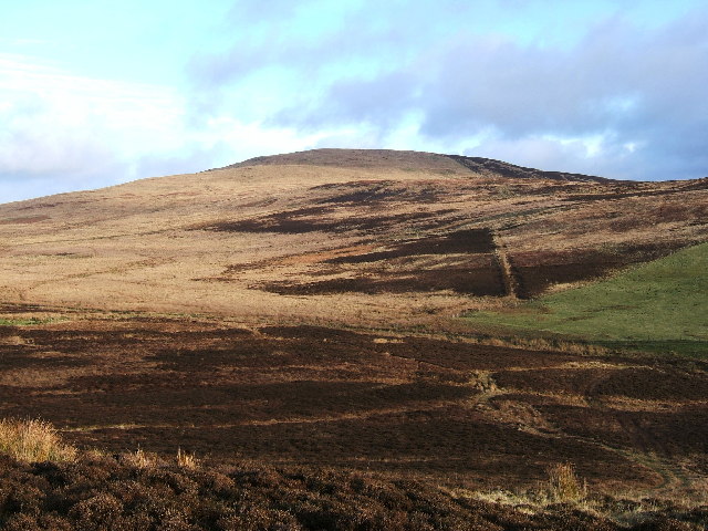
Tongue is a small village located in the county of Ayrshire in Scotland. Situated on the edge of the Galloway Forest Park, Tongue is surrounded by stunning natural landscapes including downs and moorland. The village is known for its picturesque setting, with rolling hills and open countryside providing a peaceful and tranquil environment for residents and visitors alike.

The downs in Tongue offer sweeping views of the surrounding countryside, while the moorland provides opportunities for hiking, birdwatching, and wildlife spotting. The area is rich in biodiversity, with a variety of plant and animal species calling the moorland home.

Tongue is also home to a number of historical sites, including ancient stone circles and burial mounds, which offer a glimpse into the village's past. The village itself has a small but vibrant community, with local shops, pubs, and restaurants providing amenities for residents and tourists.

Overall, Tongue in Ayrshire offers a peaceful retreat for those looking to escape the hustle and bustle of city life and immerse themselves in the beauty of the Scottish countryside.

If you have any feedback on the listing, please let us know in the comments section below.
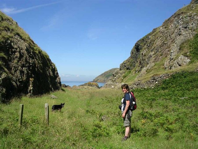
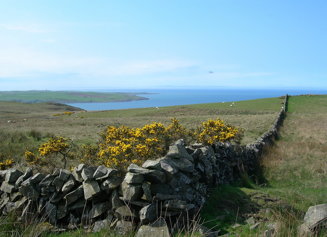
Tongue Images

Images are sourced within 2km of 55.04576/-5.0485434 or Grid Reference NX0576. Thanks to Geograph Open Source API. All images are credited.

Penderry Hill (309 metres) North of Finnarts Bay and Glenapp.
Portandea Looking North from Portandea. A strange sheltered but remote part of the coast with an abandoned house on it and a sandy beach on the South side.
Portandea
Looking North from Portandea. A strange sheltered but remote part of the coast with an abandoned house on it and a sandy beach on the South side.
North End of Currarie Port
South Side of Currarie Bay
Towards Corsewall Point Looking across the Firth of Clyde at the entrance to Loch Ryan.  Corsewall Point is the second promontory from the left.  Northern Ireland is just visible on the horizon.
Towards Corsewall Point
Looking across the Firth of Clyde at the entrance to Loch Ryan. Corsewall Point is the second promontory from the left. Northern Ireland is just visible on the horizon.
The March Burn The burn tumbles down the steep cliff to reach the Firth of Clyde.  Viewed on a fine late-April morning.
The March Burn
The burn tumbles down the steep cliff to reach the Firth of Clyde. Viewed on a fine late-April morning.
Portandea Looking down into the bay from the top of the cliffs.
Portandea
Looking down into the bay from the top of the cliffs.
Portandea Track Looking down the track to Portandea, with Ailsa Craig in the distance, on a fine late-April morning.
Portandea Track
Looking down the track to Portandea, with Ailsa Craig in the distance, on a fine late-April morning.
Clyde View Looking across the Firth of Clyde towards Ailsa Craig.
Clyde View
Looking across the Firth of Clyde towards Ailsa Craig.
Sheep and Lambs Sheep and lambs on the lower slopes of Penderry Hill.
Sheep and Lambs
Sheep and lambs on the lower slopes of Penderry Hill.
Down The Dyke Looking down a dry-stane dyke towards the Firth of Clyde on a beautiful late-April afternoon.
Down The Dyke
Looking down a dry-stane dyke towards the Firth of Clyde on a beautiful late-April afternoon.
Wood Anemone (Anemone nemorosa) Photographed in late April, the Wood Anemone flowers were quite common and very attractive on the moorland.
Wood Anemone (Anemone nemorosa)
Photographed in late April, the Wood Anemone flowers were quite common and very attractive on the moorland.
Coastline seen from the Belfast-Stranraer Ferry Coastline, most likely near Brackness Hole, as seen from the Belfast-Stranraer Ferry a few minutes before entering the port of Stranraer. I hope the coordinates and coastal features are assigned correctly, but I like the image.
Coastline seen from the Belfast-Stranraer Ferry
Coastline, most likely near Brackness Hole, as seen from the Belfast-Stranraer Ferry a few minutes before entering the port of Stranraer. I hope the coordinates and coastal features are assigned correctly, but I like the image.
By Shallochwreck Burn Looking down the farm track towards the Firth of Clyde, with the Mull of Kintyre visible on the skyline.
By Shallochwreck Burn
Looking down the farm track towards the Firth of Clyde, with the Mull of Kintyre visible on the skyline.
Rough Grazing With A View Looking across the rough grazing land towards the Firth of Clyde, with the Mull of Kintyre visible on the skyline.
Rough Grazing With A View
Looking across the rough grazing land towards the Firth of Clyde, with the Mull of Kintyre visible on the skyline.
Looking Up The Hill Looking up the western slopes of Green Bennan.
Looking Up The Hill
Looking up the western slopes of Green Bennan.
Hill Country Looking up Shallochwreck Burn and the hill grazing land.
Hill Country
Looking up Shallochwreck Burn and the hill grazing land.
North From Donald Bowie Looking north along the dyke from the edge of the small hill called Donald Bowie.  Bennane Head is shown on the skyline.
North From Donald Bowie
Looking north along the dyke from the edge of the small hill called Donald Bowie. Bennane Head is shown on the skyline.
Show me another place!

Tongue is located at Grid Ref: NX0576 (Lat: 55.04576, Lng: -5.0485434)

Unitary Authority: South Ayrshire

Police Authority: Ayrshire

What 3 Words

///rooting.line.hurtles. Near Cairnryan, Dumfries & Galloway

Related Wikis

Glenapp Castle

Glenapp Castle, formerly the family seat of the Earl of Inchcape, is now a luxury hotel and restaurant located about 1+1⁄2 miles (2.5 kilometres) southeast...

Ballantrae

Ballantrae is a community in Carrick, South Ayrshire, Scotland. The name probably comes from the Scottish Gaelic Baile na Tràgha, meaning the "town by...

River Stinchar

The River Stinchar ( STIN-shər) is a river in South Ayrshire, Scotland. It flows south west from the Galloway Forest Park to enter the Firth of Clyde at...

Ballantrae Windmill

The Ballantrae Windmill, on Mill Hill was a late 17th or early 18th century vaulted tower windmill, the ruins of which are located above the old raised...

Nearby Amenities

Located within 500m of 55.04576,-5.0485434
Created By: dmgroom_coastlines
Source: PGS
Lat/Long: 55.049587/-5.052511
Created By: dmgroom_coastlines
Source: PGS
Lat/Long: 55.049331/-5.052498
Created By: dmgroom_coastlines
Source: PGS
Lat/Long: 55.048299/-5.052891
Created By: dmgroom_coastlines
Source: PGS
Lat/Long: 55.047788/-5.052865
Created By: dmgroom_coastlines
Source: PGS
Lat/Long: 55.047276/-5.052839
Created By: dmgroom_coastlines
Source: PGS
Lat/Long: 55.046252/-5.052786
Created By: dmgroom_coastlines
Source: PGS
Lat/Long: 55.045747/-5.052314
Created By: dmgroom_coastlines
Source: PGS
Lat/Long: 55.045492/-5.052301
Created By: dmgroom_coastlines
Source: PGS
Lat/Long: 55.044464/-5.052471
Created By: dmgroom_coastlines
Source: PGS
Lat/Long: 55.044479/-5.05158
Created By: dmgroom_coastlines
Source: PGS
Lat/Long: 55.043963/-5.051777
Created By: dmgroom_coastlines
Source: PGS
Lat/Long: 55.0437/-5.052209
Created By: dmgroom_coastlines
Source: PGS
Lat/Long: 55.043444/-5.052196
Created By: dmgroom_coastlines
Source: PGS
Lat/Long: 55.042932/-5.05217
Created By: dmgroom_coastlines
Source: PGS
Lat/Long: 55.042676/-5.052157
Created By: dmgroom_coastlines
Source: PGS
Lat/Long: 55.041908/-5.052118
The data included in this document is from www.openstreetmap.org. The data is made available under ODbL.

Have you been to Tongue?

Leave your review of Tongue below (or comments, questions and feedback).