Black Glen

Valley in Ayrshire

Scotland

Black Glen

Penderry Hill (309 metres) North of Finnarts Bay and Glenapp.
Penderry Hill (309 metres) North of Finnarts Bay and Glenapp. Credit: Colin McDonald

Black Glen is a picturesque valley located in the region of Ayrshire, Scotland. Situated in the southern part of the country, it is known for its stunning natural beauty and rich history. The glen is named after the dense population of blackthorn bushes that grow in the area, creating a unique and distinct atmosphere.

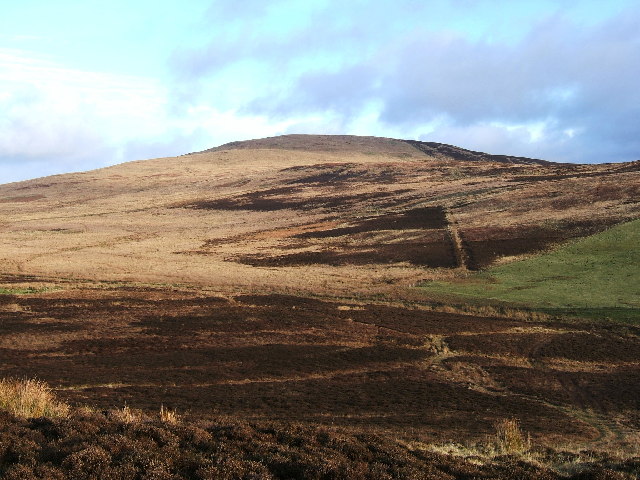
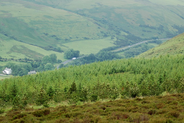
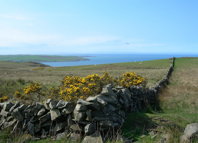
The landscape of Black Glen is characterized by rolling hills, lush green meadows, and a meandering river that flows through the valley. The glen is surrounded by dense forests, providing a haven for various species of flora and fauna. This pristine environment makes it a popular destination for nature lovers and outdoor enthusiasts.

The history of Black Glen dates back centuries, with evidence of human settlement in the area since ancient times. Ruins of old cottages and stone walls can still be found, serving as a reminder of the glen's past. The valley was once a thriving farming community, and remnants of traditional agricultural practices can still be observed.

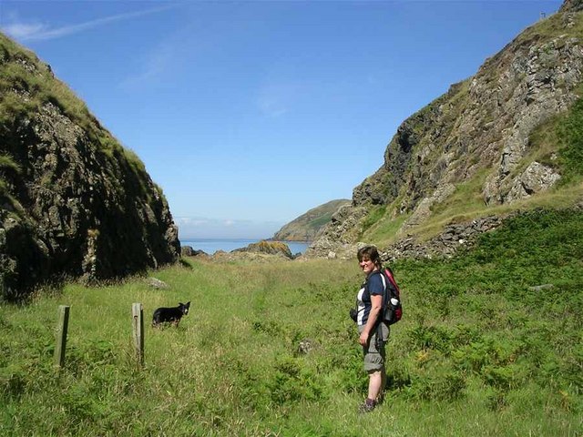
Today, Black Glen attracts visitors from near and far who come to explore its natural wonders and immerse themselves in its tranquil ambiance. Hiking trails offer breathtaking views of the surrounding countryside, while the river provides opportunities for fishing and canoeing. The glen is also home to a wide range of wildlife, including deer, birds, and small mammals, making it a haven for wildlife enthusiasts.

In conclusion, Black Glen in Ayrshire is a picturesque valley that offers a blend of natural beauty and historical significance. Its diverse landscape, rich history, and abundant wildlife make it a must-visit destination for those seeking a peaceful and scenic retreat in Scotland.

If you have any feedback on the listing, please let us know in the comments section below.

Black Glen Images

Images are sourced within 2km of 55.045636/-5.0387637 or Grid Reference NX0576. Thanks to Geograph Open Source API. All images are credited.

Penderry Hill (309 metres) North of Finnarts Bay and Glenapp.
Lower Glen App Looking from Shallochwreck Hill towards lower Glen App and A77
Lower Glen App
Looking from Shallochwreck Hill towards lower Glen App and A77
Portandea Looking North from Portandea. A strange sheltered but remote part of the coast with an abandoned house on it and a sandy beach on the South side.
Portandea
Looking North from Portandea. A strange sheltered but remote part of the coast with an abandoned house on it and a sandy beach on the South side.
North End of Currarie Port
South Side of Currarie Bay
Towards Corsewall Point Looking across the Firth of Clyde at the entrance to Loch Ryan.  Corsewall Point is the second promontory from the left.  Northern Ireland is just visible on the horizon.
Towards Corsewall Point
Looking across the Firth of Clyde at the entrance to Loch Ryan. Corsewall Point is the second promontory from the left. Northern Ireland is just visible on the horizon.
Portandea Looking down into the bay from the top of the cliffs.
Portandea
Looking down into the bay from the top of the cliffs.
Portandea Track Looking down the track to Portandea, with Ailsa Craig in the distance, on a fine late-April morning.
Portandea Track
Looking down the track to Portandea, with Ailsa Craig in the distance, on a fine late-April morning.
Clyde View Looking across the Firth of Clyde towards Ailsa Craig.
Clyde View
Looking across the Firth of Clyde towards Ailsa Craig.
Sheep and Lambs Sheep and lambs on the lower slopes of Penderry Hill.
Sheep and Lambs
Sheep and lambs on the lower slopes of Penderry Hill.
Wood Anemone (Anemone nemorosa) Photographed in late April, the Wood Anemone flowers were quite common and very attractive on the moorland.
Wood Anemone (Anemone nemorosa)
Photographed in late April, the Wood Anemone flowers were quite common and very attractive on the moorland.
Coastline seen from the Belfast-Stranraer Ferry Coastline, most likely near Brackness Hole, as seen from the Belfast-Stranraer Ferry a few minutes before entering the port of Stranraer. I hope the coordinates and coastal features are assigned correctly, but I like the image.
Coastline seen from the Belfast-Stranraer Ferry
Coastline, most likely near Brackness Hole, as seen from the Belfast-Stranraer Ferry a few minutes before entering the port of Stranraer. I hope the coordinates and coastal features are assigned correctly, but I like the image.
By Shallochwreck Burn Looking down the farm track towards the Firth of Clyde, with the Mull of Kintyre visible on the skyline.
By Shallochwreck Burn
Looking down the farm track towards the Firth of Clyde, with the Mull of Kintyre visible on the skyline.
Rough Grazing With A View Looking across the rough grazing land towards the Firth of Clyde, with the Mull of Kintyre visible on the skyline.
Rough Grazing With A View
Looking across the rough grazing land towards the Firth of Clyde, with the Mull of Kintyre visible on the skyline.
Looking Up The Hill Looking up the western slopes of Green Bennan.
Looking Up The Hill
Looking up the western slopes of Green Bennan.
Hill Country Looking up Shallochwreck Burn and the hill grazing land.
Hill Country
Looking up Shallochwreck Burn and the hill grazing land.
Clyde View Looking from the High Ballochdowan road, with Currarie Farm in the background on the far right. Ailsa Craig is visible on the left, with Arran on the skyline.
Clyde View
Looking from the High Ballochdowan road, with Currarie Farm in the background on the far right. Ailsa Craig is visible on the left, with Arran on the skyline.
North From Donald Bowie Looking north along the dyke from the edge of the small hill called Donald Bowie.  Bennane Head is shown on the skyline.
North From Donald Bowie
Looking north along the dyke from the edge of the small hill called Donald Bowie. Bennane Head is shown on the skyline.
Show me another place!

Black Glen is located at Grid Ref: NX0576 (Lat: 55.045636, Lng: -5.0387637)

Unitary Authority: South Ayrshire

Police Authority: Ayrshire

What 3 Words

///motive.rafters.darkens. Near Cairnryan, Dumfries & Galloway

Related Wikis

Glenapp Castle

Glenapp Castle, formerly the family seat of the Earl of Inchcape, is now a luxury hotel and restaurant located about 1+1⁄2 miles (2.5 kilometres) southeast...

Ballantrae

Ballantrae is a community in Carrick, South Ayrshire, Scotland. The name probably comes from the Scottish Gaelic Baile na Tràgha, meaning the "town by...

River Stinchar

The River Stinchar ( STIN-shər) is a river in South Ayrshire, Scotland. It flows south west from the Galloway Forest Park to enter the Firth of Clyde at...

Ballantrae Windmill

The Ballantrae Windmill, on Mill Hill was a late 17th or early 18th century vaulted tower windmill, the ruins of which are located above the old raised...

Have you been to Black Glen?

Leave your review of Black Glen below (or comments, questions and feedback).