Croft Common

Downs, Moorland in Cornwall

England

Croft Common

Wheal Grenville Fortesque's shaft and whim The impressive engine house at Fortesque's shaft with the drawing whim beyond. See
<a title="https://www.geograph.org.uk/photo/4131867" href="https://www.geograph.org.uk/photo/4131867">Link</a> for more details.
Wheal Grenville Fortesque's shaft and whim Credit: Richard Bird

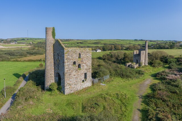
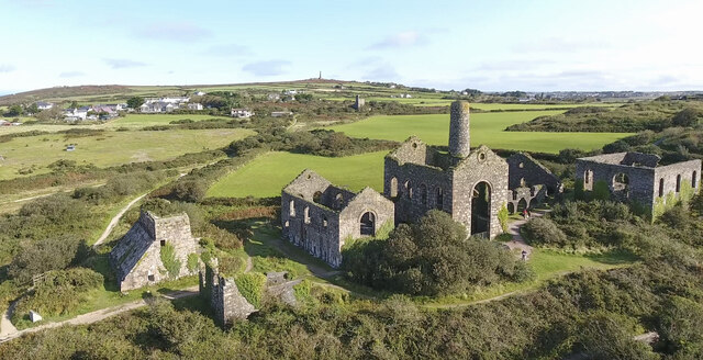
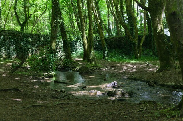
Croft Common is a stunning area located in Cornwall, England, known for its picturesque downs and moorland. Covering a vast expanse of land, it is a haven for nature enthusiasts and offers breathtaking views of the surrounding countryside.

The common is characterized by its undulating downs, which are gently sloping hills covered in lush green grass and scattered with vibrant wildflowers. These downs create a serene and peaceful atmosphere, perfect for long walks or picnics. The area is also home to a variety of wildlife, including rabbits, birds, and occasional deer, making it a popular spot for birdwatching and nature photography.

As you explore Croft Common, you will come across areas of moorland, characterized by its open spaces and rugged terrain. The moors are covered in heather and gorse, creating a vibrant and colorful landscape. This diverse habitat provides a home for many rare plants and animals, including the iconic Dartford warbler and the Cornwall moth.

Visitors to Croft Common can enjoy a network of walking trails that wind through the area, allowing them to fully immerse themselves in the natural beauty of the surroundings. These trails offer stunning views of the rolling hills, vast expanses of moorland, and, on clear days, even glimpses of the nearby coastline.

Overall, Croft Common in Cornwall is a true gem for those seeking a tranquil escape into nature. With its downs, moorland, and abundance of wildlife, it is a must-visit destination for anyone looking to experience the unique beauty of the Cornish countryside.

If you have any feedback on the listing, please let us know in the comments section below.

Croft Common Images

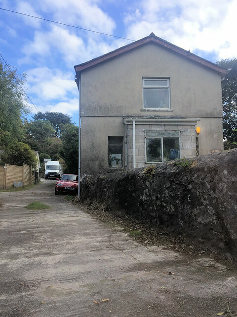
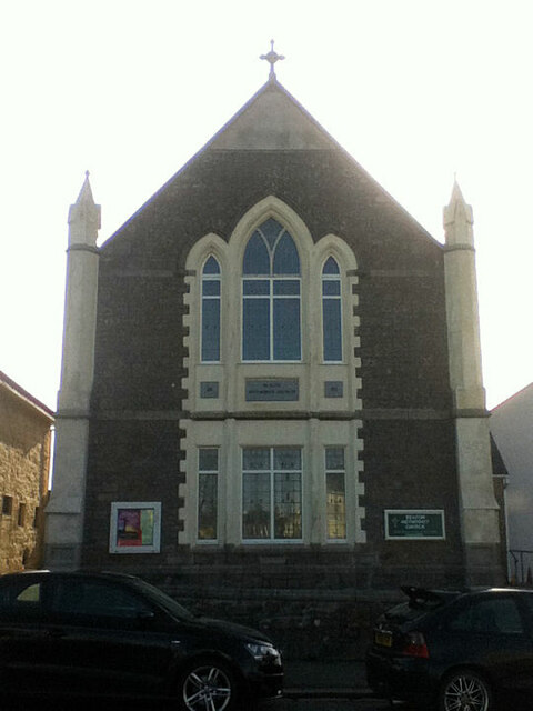
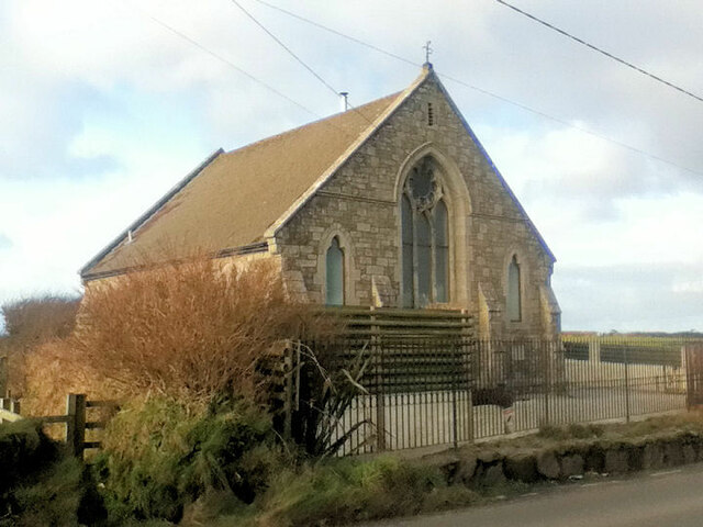
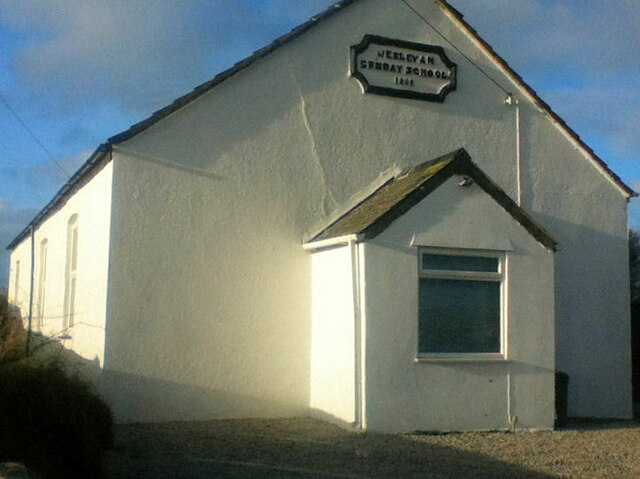
Images are sourced within 2km of 50.197638/-5.2702226 or Grid Reference SW6638. Thanks to Geograph Open Source API. All images are credited.

Wheal Grenville Fortesque's shaft and whim The impressive engine house at Fortesque's shaft with the drawing whim beyond. See
<a title="https://www.geograph.org.uk/photo/4131867" href="https://www.geograph.org.uk/photo/4131867">Link</a> for more details.
Wheal Grenville Fortesque's shaft and whim
The impressive engine house at Fortesque's shaft with the drawing whim beyond. See Link for more details.
South Frances Mine ruins Widely regarded as the finest group of mining remains in Cornwall, South Frances is located on the Great Flat Lode. Working into the 1900s this site was the scene of the last-ditch attempt to mine this lode in depth, with an up-to-date new steam pump installed in the cathedral-like ruins. It was intended to eventually sink the shaft to 500 fathoms (3000 feet, 914 metres) but ingress of water from other nearby closed mines caused the mission to be eventually abandoned. The collar of the shaft has been safely covered by a grille which allows a view into the massive brick-lined shaft.  A large ore bin, miners' dry, boiler house and other sundry buildings complete with fine site.
South Frances Mine ruins
Widely regarded as the finest group of mining remains in Cornwall, South Frances is located on the Great Flat Lode. Working into the 1900s this site was the scene of the last-ditch attempt to mine this lode in depth, with an up-to-date new steam pump installed in the cathedral-like ruins. It was intended to eventually sink the shaft to 500 fathoms (3000 feet, 914 metres) but ingress of water from other nearby closed mines caused the mission to be eventually abandoned. The collar of the shaft has been safely covered by a grille which allows a view into the massive brick-lined shaft. A large ore bin, miners' dry, boiler house and other sundry buildings complete with fine site.
Beacon Methodist Church
Former Free United Church
Former Wesleyan Methodist Chapel
Beacon Methodist Church
Former Wesleyan Methodist Chapel
Former Wesleyan Sunday School
Plantation Chapel
Plantation Chapel
Former chapel
Former chapel
St. John's Church
St. John's Church
Former Mission Church with adjoining Sunday School at left
Troon Methodist Church
Chapel Square leading to Chapel Farm
Troon Cemetery
Troon Cemetery
South Wheal Frances
South Wheal Frances
Stream flows under the road The stream flows through woodland and under the road.
Stream flows under the road
The stream flows through woodland and under the road.
Woodland track Track through woodland.
Woodland track
Track through woodland.
Show me another place!

Croft Common is located at Grid Ref: SW6638 (Lat: 50.197638, Lng: -5.2702226)

Unitary Authority: Cornwall

Police Authority: Devon and Cornwall

What 3 Words

///hammer.teardrop.went. Near Four Lanes, Cornwall

Nearby Locations

Troon Croft Common

Related Wikis

Bolenowe

Bolenowe (Cornish: Boslenow, meaning dwelling of strip-fields) is a village in west Cornwall, England, United Kingdom. It is approximately one-and-a-half...

King Edward Mine

The King Edward Mine at Camborne, Cornwall, in the United Kingdom is a mine wholly owned by Cornwall Council. At the end of the 19th century students at...

Troon, Cornwall

Troon (Cornish: Trewoon) is a village in Cornwall, UK, 1+1⁄2 miles (2.5 kilometres) southeast of Camborne. The village lies at around 560 feet (170 m)...

Higher Condurrow

Higher Condurrow is a hamlet in the parish of Camborne, Cornwall, England. == Cornish wrestling == Cornish wrestling tournaments, have been held at Lower...

Nearby Amenities

Located within 500m of 50.197638,-5.2702226
Bus Stop
The Square
Bus: yes
Naptan AtcoCode: 0800COD40947
Naptan Bearing: NW
Naptan CommonName: The Square
Naptan Crossing: New Road
Naptan NaptanCode: corajwaw
Naptan Street: Troon Moor
Naptan Verified: no
Public Transport: platform
Source: naptan_import
Lat/Long: 50.1955877/-5.276376
Bus Stop
Grenville Gardens Stop 2
Bus: yes
Description: no signage, markings on the ground
Naptan AtcoCode: 0800COA15380
Naptan Bearing: NE
Naptan CommonName: Grenville Gardens Stop 2
Naptan Indicator: NE-bound
Naptan NaptanCode: corgdpma
Naptan NptgLocalityCode: E0003469
Naptan PlusbusZoneRef: CBORNE
Naptan Verified: no
Public Transport: platform
Source: naptan_import;survey
Survey Date: 2020-10-28
Lat/Long: 50.2002556/-5.275797
Bus Stop
Polgine Lane
Bus: yes
Description: Signage on pole with timetable board, markings on the ground
Naptan AtcoCode: 0800COA15381
Naptan Bearing: SW
Naptan CommonName: Polgine Lane
Naptan Crossing: Polgine Close
Naptan Indicator: SW-bound
Naptan NaptanCode: corgdpmd
Naptan NptgLocalityCode: E0003469
Naptan PlusbusZoneRef: CBORNE
Naptan Street: Polgine Lane
Public Transport: platform
Source: naptan_import;survey
Survey Date: 2020-10-28
Lat/Long: 50.1989123/-5.27643
Barrier: cattle_grid
Lat/Long: 50.1964941/-5.2748819
Barrier: stile
Lat/Long: 50.1984251/-5.271584
Barrier: stile
Lat/Long: 50.1972467/-5.2714266
Historic: yes
Man Made: chimney
Ruins: yes
Lat/Long: 50.2010945/-5.2712632
Power: pole
Source: approximate
Lat/Long: 50.1932338/-5.270375
Power: pole
Source: approximate
Lat/Long: 50.1940546/-5.2703777
Power: pole
Source: approximate
Lat/Long: 50.1952685/-5.2703697
Power: pole
Source: approximate
Lat/Long: 50.1959674/-5.2703858
Power: pole
Source: approximate
Lat/Long: 50.1967937/-5.2704031
Power: pole
Source: approximate
Lat/Long: 50.1978016/-5.2703966
Power: pole
Source: approximate
Lat/Long: 50.1987864/-5.2703882
Power: pole
Source: approximate
Lat/Long: 50.1997749/-5.2703877
Power: pole
Source: approximate
Lat/Long: 50.2005869/-5.270382
Power: pole
Source: approximate
Lat/Long: 50.2014801/-5.2703824
Barrier: stile
Lat/Long: 50.1954649/-5.2682575
Power: pole
Source: approximate
Lat/Long: 50.1984083/-5.2755201
Power: pole
Source: approximate
Lat/Long: 50.1980024/-5.2761497
Power: pole
Source: approximate
Lat/Long: 50.1978428/-5.2759915
Power: pole
Source: approximate
Lat/Long: 50.1975758/-5.2754859
Power: pole
Source: approximate
Lat/Long: 50.1971894/-5.2748797
Power: pole
Source: approximate
Lat/Long: 50.1965155/-5.274822
Power: pole
Source: approximate
Lat/Long: 50.1968931/-5.2732168
Power: pole
Source: approximate
Lat/Long: 50.1967193/-5.2739876
Barrier: stile
Lat/Long: 50.1963209/-5.2691661
Information: guidepost
Tourism: information
Lat/Long: 50.1944302/-5.2656711
Barrier: stile
Lat/Long: 50.1944396/-5.2656652
Barrier: cattle_grid
Lat/Long: 50.1960017/-5.2736387
Barrier: entrance
Lat/Long: 50.1977194/-5.2751917
Barrier: entrance
Lat/Long: 50.2004322/-5.2706239
Barrier: entrance
Lat/Long: 50.1979701/-5.2734831
Barrier: entrance
Lat/Long: 50.2001356/-5.2694973
Barrier: entrance
Lat/Long: 50.1965004/-5.2738237
Barrier: entrance
Lat/Long: 50.1972473/-5.2749664
Barrier: entrance
Lat/Long: 50.1967408/-5.2706936
Barrier: entrance
Lat/Long: 50.1987943/-5.2680543
Barrier: entrance
Lat/Long: 50.1973486/-5.273298
Barrier: entrance
Lat/Long: 50.1986226/-5.267082
Barrier: entrance
Lat/Long: 50.1993145/-5.2708478
Barrier: entrance
Lat/Long: 50.1987694/-5.2725135
Barrier: entrance
Lat/Long: 50.1979401/-5.2752399
Barrier: entrance
Lat/Long: 50.1994853/-5.271446
Barrier: entrance
Lat/Long: 50.2004022/-5.2679376
Noexit: yes
Lat/Long: 50.1998071/-5.2762593
Generator Method: photovoltaic
Generator Output Electricity: small_installation
Generator Source: solar
Generator Type: solar_photovoltaic_panel
Location: roof
Power: generator
Source: bing
Lat/Long: 50.1989256/-5.2754706
Generator Method: photovoltaic
Generator Output Electricity: small_installation
Generator Source: solar
Generator Type: solar_photovoltaic_panel
Location: roof
Power: generator
Source: bing
Lat/Long: 50.1990243/-5.2751327
Generator Method: photovoltaic
Generator Output Electricity: small_installation
Generator Source: solar
Generator Type: solar_photovoltaic_panel
Location: roof
Power: generator
Source: bing
Lat/Long: 50.1993317/-5.2745305
Generator Method: photovoltaic
Generator Output Electricity: small_installation
Generator Source: solar
Generator Type: solar_photovoltaic_panel
Location: roof
Power: generator
Source: bing
Lat/Long: 50.1990492/-5.2736561
Generator Method: photovoltaic
Generator Output Electricity: small_installation
Generator Source: solar
Generator Type: solar_photovoltaic_panel
Location: roof
Power: generator
Source: bing
Lat/Long: 50.1988943/-5.2736038
Generator Method: photovoltaic
Generator Output Electricity: small_installation
Generator Source: solar
Generator Type: solar_photovoltaic_panel
Location: roof
Power: generator
Source: bing
Lat/Long: 50.1984852/-5.2739873
Generator Method: photovoltaic
Generator Output Electricity: small_installation
Generator Source: solar
Generator Type: solar_photovoltaic_panel
Location: roof
Power: generator
Source: bing
Lat/Long: 50.1984466/-5.2744849
Generator Method: photovoltaic
Generator Output Electricity: small_installation
Generator Source: solar
Generator Type: solar_photovoltaic_panel
Location: roof
Power: generator
Source: bing
Lat/Long: 50.1986535/-5.2753177
Generator Method: photovoltaic
Generator Output Electricity: small_installation
Generator Source: solar
Generator Type: solar_photovoltaic_panel
Location: roof
Power: generator
Source: bing
Lat/Long: 50.1987187/-5.2753646
Generator Method: photovoltaic
Generator Output Electricity: small_installation
Generator Source: solar
Generator Type: solar_photovoltaic_panel
Location: roof
Power: generator
Source: bing
Lat/Long: 50.1984972/-5.2757469
Generator Method: photovoltaic
Generator Output Electricity: small_installation
Generator Source: solar
Generator Type: solar_photovoltaic_panel
Location: roof
Power: generator
Source: bing
Lat/Long: 50.1987153/-5.2762806
Generator Method: photovoltaic
Generator Output Electricity: small_installation
Generator Source: solar
Generator Type: solar_photovoltaic_panel
Location: roof
Power: generator
Source: bing
Lat/Long: 50.1980131/-5.2768144
Generator Method: photovoltaic
Generator Output Electricity: small_installation
Generator Source: solar
Generator Type: solar_photovoltaic_panel
Location: roof
Power: generator
Source: bing
Lat/Long: 50.1958809/-5.2759152
Generator Method: photovoltaic
Generator Output Electricity: small_installation
Generator Source: solar
Generator Type: solar_photovoltaic_panel
Location: roof
Power: generator
Source: bing
Lat/Long: 50.1985831/-5.266282
Information: guidepost
Tourism: information
Lat/Long: 50.1965261/-5.2749526
Information: guidepost
Tourism: information
Lat/Long: 50.1959874/-5.27364
Source: bing
Traffic Calming: bump
Lat/Long: 50.1992236/-5.2757061
Power: pole
Source: bing;wpd_open_data
Lat/Long: 50.1988104/-5.2668267
Power: pole
Source: bing;wpd_open_data
Lat/Long: 50.1989805/-5.2681072
Power: pole
Source: bing;wpd_open_data
Lat/Long: 50.1991034/-5.2690138
Power: pole
Source: bing;wpd_open_data
Lat/Long: 50.1987996/-5.2703079
Power: pole
Source: bing;wpd_open_data
Lat/Long: 50.1963309/-5.2731135
Power: pole
Source: bing;wpd_open_data
Lat/Long: 50.1967764/-5.2704723
The data included in this document is from www.openstreetmap.org. The data is made available under ODbL.

Have you been to Croft Common?

Leave your review of Croft Common below (or comments, questions and feedback).