Troon

Settlement in Cornwall

England

Troon

Wheal Grenville Fortesque's shaft and whim The impressive engine house at Fortesque's shaft with the drawing whim beyond. See
<a title="https://www.geograph.org.uk/photo/4131867" href="https://www.geograph.org.uk/photo/4131867">Link</a> for more details.
Wheal Grenville Fortesque's shaft and whim Credit: Richard Bird

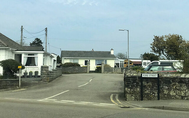
Troon is a small coastal village located in the southwestern region of Cornwall, England. Situated approximately two miles north of Camborne, Troon is neighbored by other villages such as Baripper, Beacon, and North Roskear. The village is conveniently positioned just off the A30 road, providing easy access to nearby towns and attractions.

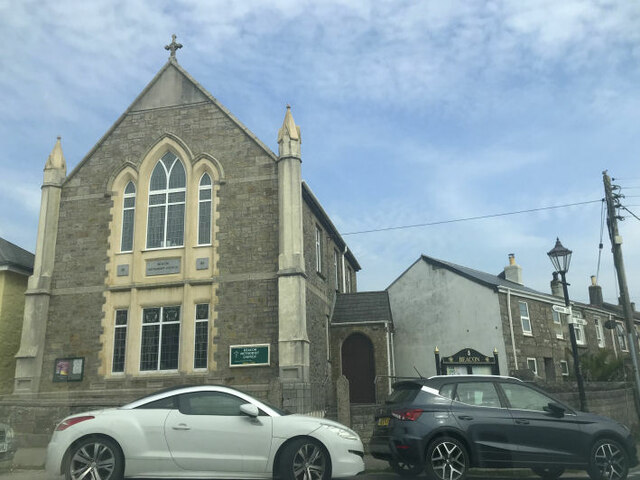
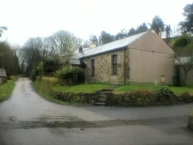
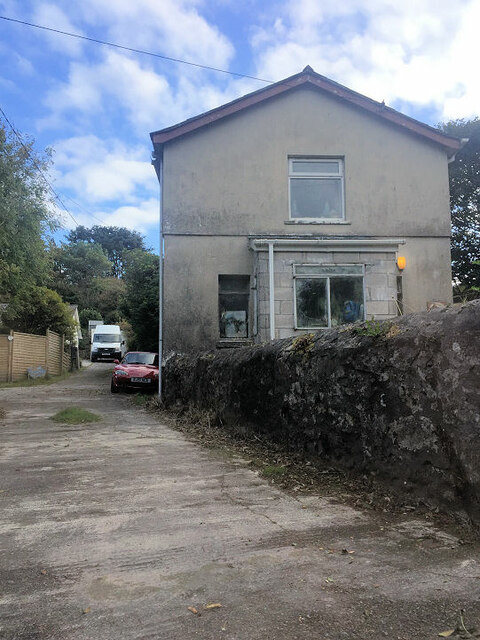
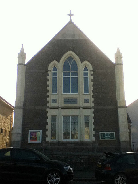
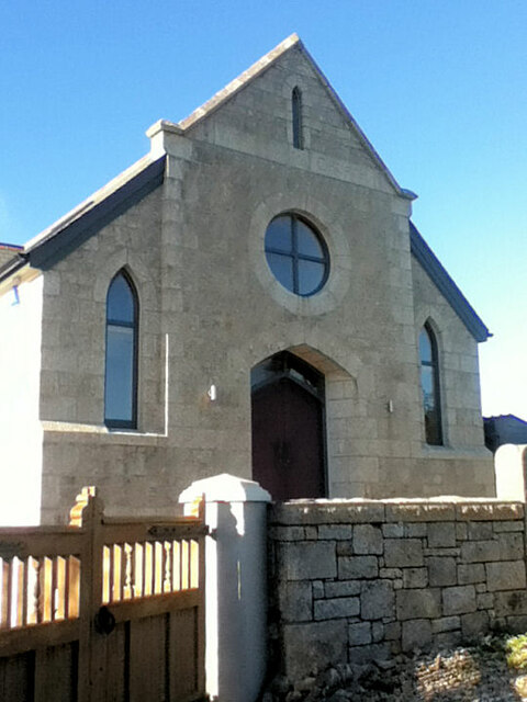
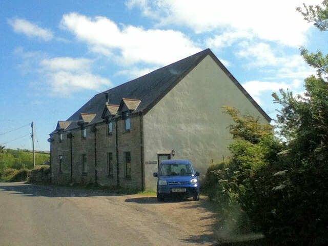
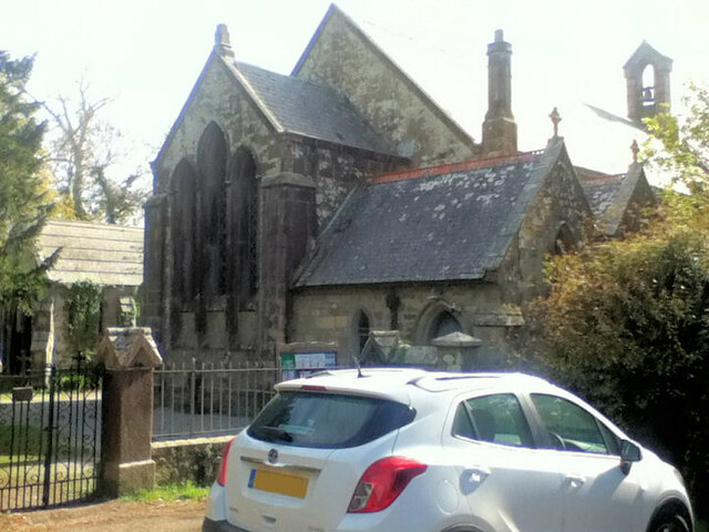
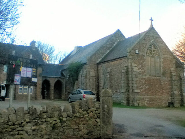
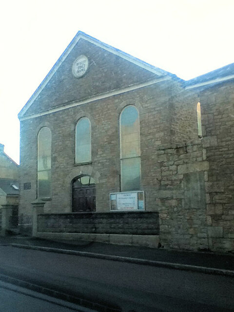
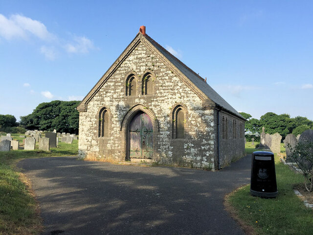
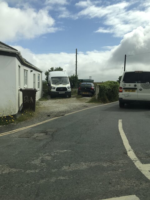
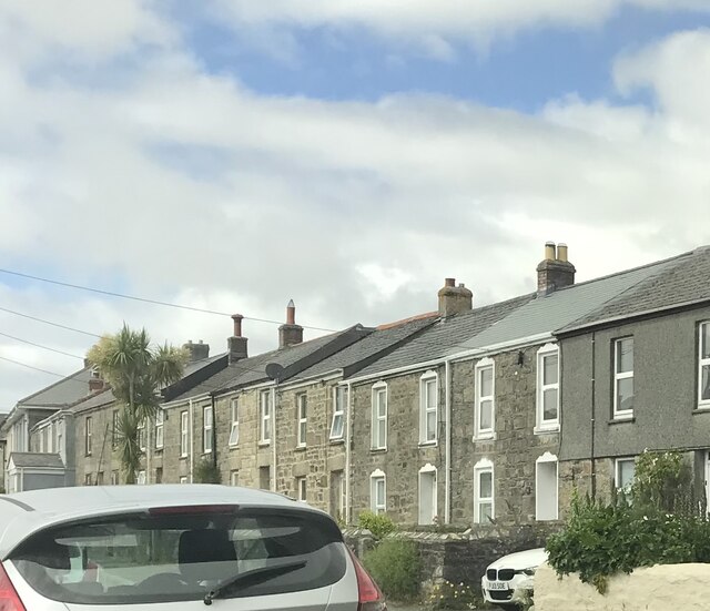
Troon is nestled in a picturesque setting, surrounded by rolling hills, lush countryside, and the stunning coastline of the Celtic Sea. The village itself is characterized by charming traditional Cornish architecture, with stone cottages and narrow winding streets, creating an idyllic atmosphere for residents and visitors alike.

Despite its small size, Troon offers a range of amenities to cater to the needs of its community. The village boasts a primary school, a post office, a local convenience store, and a few small businesses. Additionally, Troon is well-connected to public transport networks, with regular bus services passing through the village.

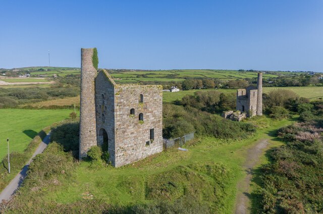
The village is also known for its rich mining heritage, with remnants of old mine shafts and engine houses visible in the surrounding areas. The mining industry played a significant role in the development of Troon, and today, it serves as a reminder of the village's historical roots.

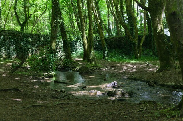
For outdoor enthusiasts, Troon offers easy access to beautiful coastal walks, where visitors can enjoy breathtaking views of the sea and take in the fresh sea air. The nearby Godrevy Heritage Coastline is a popular spot for nature lovers and birdwatchers, boasting a diverse range of flora and fauna.

Overall, Troon is a charming and tranquil village that provides a peaceful and picturesque retreat for residents and visitors seeking a slice of Cornwall's natural beauty and heritage.

If you have any feedback on the listing, please let us know in the comments section below.

Troon Images

Images are sourced within 2km of 50.197159/-5.275845 or Grid Reference SW6638. Thanks to Geograph Open Source API. All images are credited.

Wheal Grenville Fortesque's shaft and whim The impressive engine house at Fortesque's shaft with the drawing whim beyond. See
<a title="https://www.geograph.org.uk/photo/4131867" href="https://www.geograph.org.uk/photo/4131867">Link</a> for more details.
Wheal Grenville Fortesque's shaft and whim
The impressive engine house at Fortesque's shaft with the drawing whim beyond. See Link for more details.
Beacon Methodist Church
Former Free United Church
Former Wesleyan Methodist Chapel
Beacon Methodist Church
Plantation Chapel
Plantation Chapel
Former chapel
Former chapel
St. John's Church
St. John's Church
Former Mission Church with adjoining Sunday School at left
Troon Methodist Church
Chapel Square leading to Chapel Farm
Troon Cemetery
Troon Cemetery
Stream flows under the road The stream flows through woodland and under the road.
Stream flows under the road
The stream flows through woodland and under the road.
Woodland track Track through woodland.
Woodland track
Track through woodland.
Roadside woodland Woodland beside the road.
Roadside woodland
Woodland beside the road.
Footpath to Knave-Go-By The footpath runs alongside a field where a horse was grazing.
Footpath to Knave-Go-By
The footpath runs alongside a field where a horse was grazing.
Corner of Fore Street and Cadogan Road
Terraced houses
Terraced houses
Show me another place!

Troon is located at Grid Ref: SW6638 (Lat: 50.197159, Lng: -5.275845)

Unitary Authority: Cornwall

Police Authority: Devon and Cornwall

What 3 Words

///inefficient.drummers.sushi. Near Camborne, Cornwall

Nearby Locations

Croft Common Troon

Related Wikis

Troon, Cornwall

Troon (Cornish: Trewoon) is a village in Cornwall, UK, 1+1⁄2 miles (2.5 kilometres) southeast of Camborne. The village lies at around 560 feet (170 m)...

King Edward Mine

The King Edward Mine at Camborne, Cornwall, in the United Kingdom is a mine wholly owned by Cornwall Council. At the end of the 19th century students at...

Bolenowe

Bolenowe (Cornish: Boslenow, meaning dwelling of strip-fields) is a village in west Cornwall, England, United Kingdom. It is approximately one-and-a-half...

Higher Condurrow

Higher Condurrow is a hamlet in the parish of Camborne, Cornwall, England. == Cornish wrestling == Cornish wrestling tournaments, have been held at Lower...

Nearby Amenities

Located within 500m of 50.197159,-5.275845
Troon
Is In: Cornwall, England, UK
Is In Country: England
Is In Country Code: GB
Is In County: Cornwall
Name Kw: Trewoon
Place: village
Source: npe
Wikidata: Q7845529
Lat/Long: 50.195401/-5.276347
Bus Stop
Newton Road
Bench: no
Bin: no
Bus: yes
Description: Lay-by opposite S bound
Naptan AtcoCode: 0800COD40944
Naptan Bearing: N
Naptan BusStopType: CUS
Naptan CommonName: Newton Road
Naptan NaptanCode: corajtpd
Naptan PlusbusZoneRef: CBORNE
Naptan Street: Newton Road
Naptan Verified: no
Passenger Information Display: no
Public Transport: platform
Shelter: no
Source: naptan_import;survey
Survey Date: 2020-10-28
Lat/Long: 50.2007402/-5.279218
Bus Stop
Chapel Square
Bench: no
Bin: yes
Bus: yes
Naptan AtcoCode: 0800COD40945
Naptan Bearing: N
Naptan CommonName: Chapel Square
Naptan Crossing: Chapel Square
Naptan NaptanCode: corajtwm
Naptan NptgLocalityCode: E0003469
Naptan PlusbusZoneRef: CBORNE
Naptan Street: Newton Road
Passenger Information Display: no
Public Transport: platform
Shelter: no
Source: naptan_import;survey
Survey Date: 2020-10-28
Lat/Long: 50.1971666/-5.2782011
Bus Stop
The Square
Bus: yes
Naptan AtcoCode: 0800COD40947
Naptan Bearing: NW
Naptan CommonName: The Square
Naptan Crossing: New Road
Naptan NaptanCode: corajwaw
Naptan Street: Troon Moor
Naptan Verified: no
Public Transport: platform
Source: naptan_import
Lat/Long: 50.1955877/-5.276376
Bus Stop
Grenville Gardens Stop 1
Bench: no
Bin: no
Bus: yes
Description: signage on pole, markings on the ground
Naptan AtcoCode: 0800COA15379
Naptan Bearing: NE
Naptan CommonName: Grenville Gardens Stop 1
Naptan Indicator: NE-bound
Naptan NaptanCode: corgdpjw
Naptan NptgLocalityCode: E0003469
Naptan PlusbusZoneRef: CBORNE
Passenger Information Display: no
Public Transport: platform
Shelter: no
Source: naptan_import;survey
Survey Date: 2020-10-28
Lat/Long: 50.1999855/-5.2778235
Bus Stop
Grenville Gardens Stop 2
Bus: yes
Description: no signage, markings on the ground
Naptan AtcoCode: 0800COA15380
Naptan Bearing: NE
Naptan CommonName: Grenville Gardens Stop 2
Naptan Indicator: NE-bound
Naptan NaptanCode: corgdpma
Naptan NptgLocalityCode: E0003469
Naptan PlusbusZoneRef: CBORNE
Naptan Verified: no
Public Transport: platform
Source: naptan_import;survey
Survey Date: 2020-10-28
Lat/Long: 50.2002556/-5.275797
Bus Stop
Polgine Lane
Bus: yes
Description: Signage on pole with timetable board, markings on the ground
Naptan AtcoCode: 0800COA15381
Naptan Bearing: SW
Naptan CommonName: Polgine Lane
Naptan Crossing: Polgine Close
Naptan Indicator: SW-bound
Naptan NaptanCode: corgdpmd
Naptan NptgLocalityCode: E0003469
Naptan PlusbusZoneRef: CBORNE
Naptan Street: Polgine Lane
Public Transport: platform
Source: naptan_import;survey
Survey Date: 2020-10-28
Lat/Long: 50.1989123/-5.27643
Bus Stop
Bottom of Polgine Lane
Bus: yes
Fixme: Need to confirm location, No signage or markings on the ground
Naptan AtcoCode: 0800COD40974
Naptan Bearing: S
Naptan CommonName: Bottom of Polgine Lane
Naptan Crossing: Polgine Lane
Naptan NaptanCode: corajtwt
Naptan PlusbusZoneRef: CBORNE
Naptan Street: Newton Road
Naptan Verified: no
Public Transport: platform
Source: naptan_import
Lat/Long: 50.198287/-5.2781209
Bus Stop
Spar Shop
Bus: yes
Fixme: confirm location, no signage or markings on the ground
Naptan AtcoCode: 0800FWX38518
Naptan Bearing: NW
Naptan CommonName: Spar Shop
Naptan NaptanCode: corajwat
Naptan Street: Troon Moor
Naptan Verified: no
Public Transport: platform
Source: naptan_import
Lat/Long: 50.1956445/-5.2770216
Bus Stop
Newton Road
Bench: no
Bin: no
Bus: yes
Description: Signage on pole no markings on the ground
Naptan AtcoCode: 0800FWZ38552
Naptan Bearing: S
Naptan CommonName: Newton Road
Naptan Indicator: S-bound
Naptan NaptanCode: corajtpm
Naptan NptgLocalityCode: E0003469
Naptan PlusbusZoneRef: CBORNE
Naptan Street: Newton Road
Passenger Information Display: no
Public Transport: platform
Shelter: no
Source: naptan_import;survey
Survey Date: 2020-10-28
Lat/Long: 50.2007855/-5.2791175
Bus Stop
Grenville Estate
Bench: yes
Bus: yes
Description: Signage on pole with timetable board, no markings on the ground, shelter set back from the road
Naptan AtcoCode: 0800FWX38501
Naptan Bearing: N
Naptan CommonName: Grenville Estate
Naptan Crossing: Polgine Lane
Naptan Indicator: Opp
Naptan NaptanCode: corajtwd
Naptan NptgLocalityCode: E0003469
Naptan PlusbusZoneRef: CBORNE
Naptan Street: Newton Road
Naptan Verified: no
Public Transport: platform
Shelter: yes
Source: naptan_import;survey
Survey Date: 2020-10-28
Lat/Long: 50.1997923/-5.2789228
Noexit: yes
Lat/Long: 50.1987859/-5.2779647
Source: bing
Traffic Calming: cushion
Lat/Long: 50.1987207/-5.2771698
Barrier: cattle_grid
Lat/Long: 50.1964941/-5.2748819
Barrier: stile
Lat/Long: 50.1984251/-5.271584
Source: bing
Traffic Calming: cushion
Lat/Long: 50.1984775/-5.2777796
Barrier: stile
Lat/Long: 50.1972467/-5.2714266
Chimney
Historic: ruins
Lat/Long: 50.2001099/-5.2796955
Chimney
Historic: ruins
Lat/Long: 50.1997996/-5.2804009
Power: pole
Source: approximate
Lat/Long: 50.1952685/-5.2703697
Power: pole
Source: approximate
Lat/Long: 50.1959674/-5.2703858
Power: pole
Source: approximate
Lat/Long: 50.1967937/-5.2704031
Power: pole
Source: approximate
Lat/Long: 50.1978016/-5.2703966
Power: pole
Source: approximate
Lat/Long: 50.1987864/-5.2703882
Power: pole
Source: approximate
Lat/Long: 50.1997749/-5.2703877
Power: pole
Source: approximate
Lat/Long: 50.1984083/-5.2755201
Power: pole
Source: approximate
Lat/Long: 50.1980024/-5.2761497
Power: pole
Source: approximate
Lat/Long: 50.1978428/-5.2759915
Power: pole
Source: approximate
Lat/Long: 50.1975758/-5.2754859
Power: pole
Source: approximate
Lat/Long: 50.1971894/-5.2748797
Power: pole
Source: approximate
Lat/Long: 50.1965155/-5.274822
Power: pole
Source: approximate
Lat/Long: 50.1968931/-5.2732168
Power: pole
Source: approximate
Lat/Long: 50.1967193/-5.2739876
Community Centre
Troon Church Hall
Addr City: Camborne
Addr Hamlet: Troon
Addr Postcode: TR14 9EJ
Addr Street: Treslothan Road
Fhrs Id: 534530
Lat/Long: 50.1949663/-5.2803889
Barrier: cycle_barrier
Lat/Long: 50.2006824/-5.279402
Barrier: stile
Lat/Long: 50.1963209/-5.2691661
Barrier: cattle_grid
Lat/Long: 50.1960017/-5.2736387
Barrier: entrance
Lat/Long: 50.1977194/-5.2751917
Barrier: entrance
Lat/Long: 50.1979701/-5.2734831
Barrier: entrance
Lat/Long: 50.1965004/-5.2738237
Barrier: entrance
Lat/Long: 50.1972473/-5.2749664
Barrier: entrance
Lat/Long: 50.1967408/-5.2706936
Barrier: entrance
Lat/Long: 50.1973486/-5.273298
Barrier: entrance
Lat/Long: 50.1993145/-5.2708478
Barrier: entrance
Lat/Long: 50.1987694/-5.2725135
Barrier: entrance
Lat/Long: 50.1979401/-5.2752399
Barrier: entrance
Lat/Long: 50.1994853/-5.271446
Disused Man Made: mineshaft
Headframe: no
Historic: mine_shaft
Man Made: mineshaft
Lat/Long: 50.1964094/-5.2816736
Ford: stepping_stones
Lat/Long: 50.1963433/-5.2818784
Ford: stepping_stones
Lat/Long: 50.196155/-5.2816799
Noexit: yes
Lat/Long: 50.1998071/-5.2762593
Waste Basket
Source: survey
Lat/Long: 50.2000991/-5.2775199
Waste Basket
Source: survey
Lat/Long: 50.1996699/-5.2787013
Waste Basket
Description: At bus stop
Source: survey
Survey Date: 2020-06-30
Lat/Long: 50.1971396/-5.2782044
Post Box
Collection Times: Mo-Fr 16:30; Sa 10:30
Description: Outside Mc Colls
Operator: Royal Mail
Operator Wikidata: Q638098
Post Box Type: pillar
Ref: TR14 126
Source: survey
Survey Date: 2020-06-30
Lat/Long: 50.1957999/-5.2771658
Waste Basket
Description: On school sign
Source: survey
Lat/Long: 50.1956483/-5.2770511
Waste Basket
Description: Outside the shop
Source: survey
Lat/Long: 50.1958355/-5.2771846
Generator Method: photovoltaic
Generator Output Electricity: small_installation
Generator Source: solar
Generator Type: solar_photovoltaic_panel
Location: roof
Power: generator
Source: bing
Lat/Long: 50.1984647/-5.2785585
Generator Method: photovoltaic
Generator Output Electricity: small_installation
Generator Source: solar
Generator Type: solar_photovoltaic_panel
Location: roof
Power: generator
Source: bing
Lat/Long: 50.1989256/-5.2754706
Generator Method: photovoltaic
Generator Output Electricity: small_installation
Generator Source: solar
Generator Type: solar_photovoltaic_panel
Location: roof
Power: generator
Source: bing
Lat/Long: 50.1990243/-5.2751327
Generator Method: photovoltaic
Generator Output Electricity: small_installation
Generator Source: solar
Generator Type: solar_photovoltaic_panel
Location: roof
Power: generator
Source: bing
Lat/Long: 50.1993317/-5.2745305
Generator Method: photovoltaic
Generator Output Electricity: small_installation
Generator Source: solar
Generator Type: solar_photovoltaic_panel
Location: roof
Power: generator
Source: bing
Lat/Long: 50.1990492/-5.2736561
Generator Method: photovoltaic
Generator Output Electricity: small_installation
Generator Source: solar
Generator Type: solar_photovoltaic_panel
Location: roof
Power: generator
Source: bing
Lat/Long: 50.1988943/-5.2736038
Generator Method: photovoltaic
Generator Output Electricity: small_installation
Generator Source: solar
Generator Type: solar_photovoltaic_panel
Location: roof
Power: generator
Source: bing
Lat/Long: 50.1984852/-5.2739873
Generator Method: photovoltaic
Generator Output Electricity: small_installation
Generator Source: solar
Generator Type: solar_photovoltaic_panel
Location: roof
Power: generator
Source: bing
Lat/Long: 50.1984466/-5.2744849
Generator Method: photovoltaic
Generator Output Electricity: small_installation
Generator Source: solar
Generator Type: solar_photovoltaic_panel
Location: roof
Power: generator
Source: bing
Lat/Long: 50.1986535/-5.2753177
Generator Method: photovoltaic
Generator Output Electricity: small_installation
Generator Source: solar
Generator Type: solar_photovoltaic_panel
Location: roof
Power: generator
Source: bing
Lat/Long: 50.1987187/-5.2753646
Generator Method: photovoltaic
Generator Output Electricity: small_installation
Generator Source: solar
Generator Type: solar_photovoltaic_panel
Location: roof
Power: generator
Source: bing
Lat/Long: 50.1984972/-5.2757469
Generator Method: photovoltaic
Generator Output Electricity: small_installation
Generator Source: solar
Generator Type: solar_photovoltaic_panel
Location: roof
Power: generator
Source: bing
Lat/Long: 50.1987153/-5.2762806
Generator Method: photovoltaic
Generator Output Electricity: small_installation
Generator Source: solar
Generator Type: solar_photovoltaic_panel
Location: roof
Power: generator
Source: bing
Lat/Long: 50.1980131/-5.2768144
Generator Method: photovoltaic
Generator Output Electricity: small_installation
Generator Source: solar
Generator Type: solar_photovoltaic_panel
Location: roof
Power: generator
Source: bing
Lat/Long: 50.1970962/-5.2784318
Generator Method: photovoltaic
Generator Output Electricity: small_installation
Generator Source: solar
Generator Type: solar_photovoltaic_panel
Location: roof
Power: generator
Source: bing
Lat/Long: 50.1958809/-5.2759152
Generator Method: photovoltaic
Generator Output Electricity: small_installation
Generator Source: solar
Generator Type: solar_photovoltaic_panel
Location: roof
Power: generator
Source: bing
Lat/Long: 50.1941411/-5.281004
Generator Method: photovoltaic
Generator Output Electricity: small_installation
Generator Source: solar
Generator Type: solar_photovoltaic_panel
Location: roof
Power: generator
Source: bing
Lat/Long: 50.1942785/-5.2805614
Generator Method: photovoltaic
Generator Output Electricity: small_installation
Generator Source: solar
Generator Type: solar_photovoltaic_panel
Location: roof
Power: generator
Source: bing
Lat/Long: 50.1947902/-5.2790916
Generator Method: photovoltaic
Generator Output Electricity: small_installation
Generator Source: solar
Generator Type: solar_photovoltaic_panel
Location: roof
Power: generator
Source: bing
Lat/Long: 50.1945077/-5.278523
Generator Method: photovoltaic
Generator Output Electricity: small_installation
Generator Source: solar
Generator Type: solar_photovoltaic_panel
Location: roof
Power: generator
Source: bing
Lat/Long: 50.1943995/-5.2775587
Generator Method: photovoltaic
Generator Output Electricity: small_installation
Generator Source: solar
Generator Type: solar_photovoltaic_panel
Location: roof
Power: generator
Source: bing
Lat/Long: 50.1942064/-5.2774072
Generator Method: photovoltaic
Generator Output Electricity: small_installation
Generator Source: solar
Generator Type: solar_photovoltaic_panel
Location: roof
Power: generator
Source: bing
Lat/Long: 50.1941772/-5.2778095
Generator Method: photovoltaic
Generator Output Electricity: small_installation
Generator Source: solar
Generator Type: solar_photovoltaic_panel
Location: roof
Power: generator
Source: bing
Lat/Long: 50.1939144/-5.2787831
Generator Method: photovoltaic
Generator Output Electricity: small_installation
Generator Source: solar
Generator Type: solar_photovoltaic_panel
Location: roof
Power: generator
Source: bing
Lat/Long: 50.1936015/-5.2782829
Bus Stop
Chapel Square
Bench: no
Bin: no
Bus: yes
Description: No signage, markings on the ground
Naptan AtcoCode: 0800COD40946
Naptan Bearing: S
Naptan CommonName: Chapel Square
Naptan Indicator: S-bound
Naptan NaptanCode: corajwap
Naptan NptgLocalityCode: E0003469
Naptan PlusbusZoneRef: CBORNE
Passenger Information Display: no
Public Transport: platform
Shelter: no
Source: naptan_import;survey
Survey Date: 2020-10-28
Lat/Long: 50.1974705/-5.2780603
Information: guidepost
Tourism: information
Lat/Long: 50.1965261/-5.2749526
Information: guidepost
Tourism: information
Lat/Long: 50.1959874/-5.27364
Playground: climbingframe
Source: survey
Source Geometry: Bing
Lat/Long: 50.2005325/-5.2774587
Playground: structure
Playground Theme: ship
Source: survey
Source Geometry: Bing
Lat/Long: 50.2005868/-5.2772885
Bench
Backrest: no
Direction: SW
Material: wood
Source: survey
Source Geometry: Bing
Lat/Long: 50.2005941/-5.2771689
Bench
Backrest: no
Direction: SW
Material: wood
Source: survey
Source Geometry: Bing
Lat/Long: 50.2005626/-5.2770698
Baby: yes
Playground: swing
Source: survey
Source Geometry: Bing
Lat/Long: 50.2004571/-5.2769415
Baby: yes
Playground: swing
Source: survey
Source Geometry: Bing
Lat/Long: 50.2004435/-5.2769543
Playground: spinnerbowl
Source: survey
Source Geometry: Bing
Lat/Long: 50.2005045/-5.2771771
Hoops: 1
Leisure: pitch
Source: survey
Source Geometry: Bing
Sport: basketball
Lat/Long: 50.200431/-5.2773319
Material: metal
Playground: teenshelter
Source: survey
Source Geometry: Bing;estimated
Lat/Long: 50.2009873/-5.2780335
Power: pole
Source: bing;wpd_open_data
Lat/Long: 50.2008645/-5.2793836
Power: pole
Source: bing;wpd_open_data
Lat/Long: 50.199637/-5.2798283
Power: pole
Source: bing;wpd_open_data
Lat/Long: 50.1996822/-5.2806419
Source: bing
Traffic Calming: cushion
Lat/Long: 50.2001318/-5.2773304
Source: bing
Traffic Calming: cushion
Lat/Long: 50.199667/-5.2785529
Source: bing
Traffic Calming: bump
Lat/Long: 50.1992236/-5.2757061
Power: pole
Source: bing;wpd_open_data
Lat/Long: 50.1931384/-5.2771919
Power: pole
Source: bing;wpd_open_data
Lat/Long: 50.1987996/-5.2703079
Power: pole
Source: bing;wpd_open_data
Lat/Long: 50.1963309/-5.2731135
Power: pole
Source: bing;wpd_open_data
Lat/Long: 50.1967764/-5.2704723
Post Office
Troon Post Office
Addr City: Camborne
Addr Housenumber: 1-5
Addr Postcode: TR14 9EP
Addr Street: New Road
Addr Village: Troon
Brand: Post Office
Brand Wikidata: Q1783168
Opening Hours: Mo-Su 07:00-22:00
Operator: Morrisons Daily
Ref Pol Id: 13364
Source: pol_branch_list_2022‑05‑27
Website: https://www.postoffice.co.uk/branch-finder/342555x/troon
Lat/Long: 50.1957807/-5.2770806
The data included in this document is from www.openstreetmap.org. The data is made available under ODbL.

Have you been to Troon?

Leave your review of Troon below (or comments, questions and feedback).