Trannack Downs

Downs, Moorland in Cornwall

England

Trannack Downs

Helston : Helston Heritage Railway - Truthall Halt A latecomer to the passenger facilities on the Helston branch, Truthall Halt was opened on 3 July 1905, at a location about one and three-quarters miles (2.8 km) north of Helston.
Helston : Helston Heritage Railway - Truthall Halt Credit: Lewis Clarke

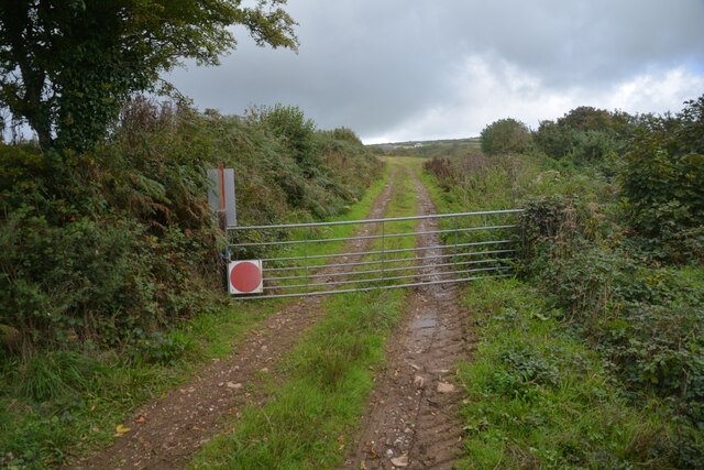
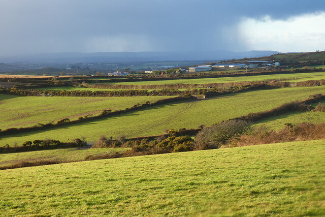
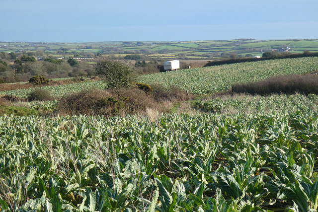
Trannack Downs, located in Cornwall, England, is a stunning area of moorland known for its rugged beauty and panoramic views. Situated near the village of Helston, this vast expanse of open land covers approximately 200 acres and is a popular destination for nature enthusiasts and outdoor activities.

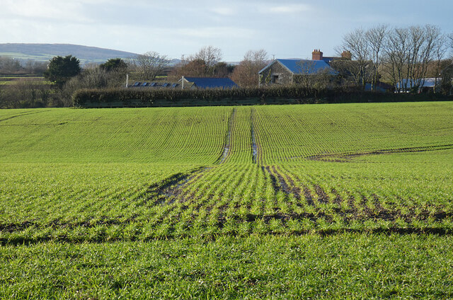
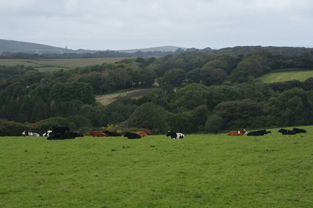
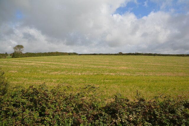
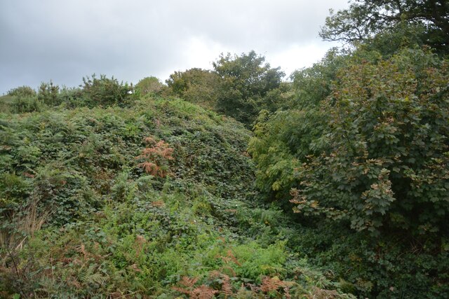
Trannack Downs is characterized by its undulating terrain, featuring a combination of rocky outcrops, heathland, and grassy slopes. The area boasts a rich biodiversity, with a variety of plant and animal species thriving in its unique ecosystem. Visitors can observe a range of wildlife, including birds such as skylarks, kestrels, and buzzards, as well as adders and common lizards.

The downs offer numerous walking trails and paths, allowing visitors to explore the area at their own pace. The breathtaking views from the higher points provide a picturesque backdrop of the surrounding countryside, including the nearby Atlantic Ocean.

Trannack Downs also holds historical significance, with evidence of prehistoric settlements scattered throughout the area. Archaeological remains, including stone circles and burial mounds, offer a glimpse into the past and attract those interested in ancient history.

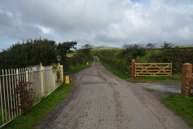
The downs are easily accessible, with ample parking and well-maintained footpaths. Picnic areas and benches are available, allowing visitors to relax and enjoy the peaceful surroundings. Whether it's hiking, birdwatching, or simply immersing oneself in nature, Trannack Downs offers a tranquil and captivating experience for all who visit.

If you have any feedback on the listing, please let us know in the comments section below.

Trannack Downs Images

Images are sourced within 2km of 50.132971/-5.2690271 or Grid Reference SW6630. Thanks to Geograph Open Source API. All images are credited.
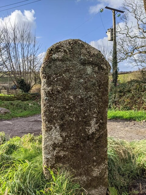
Helston : Helston Heritage Railway - Truthall Halt A latecomer to the passenger facilities on the Helston branch, Truthall Halt was opened on 3 July 1905, at a location about one and three-quarters miles (2.8 km) north of Helston.
Helston : Helston Heritage Railway - Truthall Halt
A latecomer to the passenger facilities on the Helston branch, Truthall Halt was opened on 3 July 1905, at a location about one and three-quarters miles (2.8 km) north of Helston.
Farmland, Wendron Roselidden Farm is seen across an arable field from Rowe's Lane.
Farmland, Wendron
Roselidden Farm is seen across an arable field from Rowe's Lane.
Sithney : Road Looking along a road.
Sithney : Road
Looking along a road.
Sithney : Grassy Field & Cattle Cows in a field.
Sithney : Grassy Field & Cattle
Cows in a field.
Sithney : Truthall Halt A latecomer to the passenger facilities on the Helston branch, Truthall Halt was opened on 3 July 1905, at a location about one and three-quarters miles (2.8 km) north of Helston.
Sithney : Truthall Halt
A latecomer to the passenger facilities on the Helston branch, Truthall Halt was opened on 3 July 1905, at a location about one and three-quarters miles (2.8 km) north of Helston.
Sithney : Truthall Halt Truthall Halt was opened by the Great Western Railway in July 1905 after the line had been opened for a number of years.

Truthall Halt opened as such but changed its name to Truthall Platform in July 1906 and closed with this name on 5 November 1962. The station has held three different names – Truthall Platform, Truthall Halt and Truthall Bridge Halt – although the last one was only referred to in ticketing
Sithney : Truthall Halt
Truthall Halt was opened by the Great Western Railway in July 1905 after the line had been opened for a number of years. Truthall Halt opened as such but changed its name to Truthall Platform in July 1906 and closed with this name on 5 November 1962. The station has held three different names – Truthall Platform, Truthall Halt and Truthall Bridge Halt – although the last one was only referred to in ticketing
Sithney : Grassy Field Looking out towards a field.
Sithney : Grassy Field
Looking out towards a field.
Old Boundary Marker at Lower Prospidnick, Sithney parish Estate Boundary Marker on the north side of the road at Lower Prospidnick beside stone steps to a converted barn. Sithney parish. Inscribed LP (Lower Prospidnick) and HP (Higher Prospidnick) on adjacent faces. Assumed to have been moved as Higher Prospidnick is at [SW6387731897].

Milestone Society National ID: CW_SITH02em
Old Boundary Marker at Lower Prospidnick, Sithney parish
Estate Boundary Marker on the north side of the road at Lower Prospidnick beside stone steps to a converted barn. Sithney parish. Inscribed LP (Lower Prospidnick) and HP (Higher Prospidnick) on adjacent faces. Assumed to have been moved as Higher Prospidnick is at [SW6387731897]. Milestone Society National ID: CW_SITH02em
Old Wayside Cross in Bodilly Veor, Wendron Bodilly Cross, incised in a stone on the west side of the road in Bodilly Veor, Wendron parish. A Scheduled Monument <span class="nowrap"><a title="https://historicengland.org.uk/listing/the-list/list-entry/1010851" rel="nofollow ugc noopener" href="https://historicengland.org.uk/listing/the-list/list-entry/1010851">Link</a><img style="margin-left:2px;" alt="External link" title="External link - shift click to open in new window" src="https://s1.geograph.org.uk/img/external.png" width="10" height="10"/></span>. See also <a title="https://www.geograph.org.uk/photo/3379823" href="https://www.geograph.org.uk/photo/3379823">Link</a>.

Milestone Society National ID: CWKE_WEN09
Old Wayside Cross in Bodilly Veor, Wendron
Bodilly Cross, incised in a stone on the west side of the road in Bodilly Veor, Wendron parish. A Scheduled Monument LinkExternal link. See also Link. Milestone Society National ID: CWKE_WEN09
Crowntown : Track A track seen beyond the gate.
Crowntown : Track
A track seen beyond the gate.
Crowntown : Bushes Bushes seen from the Helston Heritage Railway.
Crowntown : Bushes
Bushes seen from the Helston Heritage Railway.
Crowntown : Helston Heritage Railway On the train heading under the bridge.
Crowntown : Helston Heritage Railway
On the train heading under the bridge.
Crowntown : Helston Heritage Railway One of the steam engines which runs up and down the railway.
Crowntown : Helston Heritage Railway
One of the steam engines which runs up and down the railway.
Crowntown : Helston Heritage Railway The train driver is ready to depart.
Crowntown : Helston Heritage Railway
The train driver is ready to depart.
Pasture and farm buildings, Sithney Cattle in a field to the south of Wheal Mount Farm.
Pasture and farm buildings, Sithney
Cattle in a field to the south of Wheal Mount Farm.
Pasture, Sithney High Park Farm is seen in the middle distance with a showery skyline and the higher ground near St Ives beyond.
Pasture, Sithney
High Park Farm is seen in the middle distance with a showery skyline and the higher ground near St Ives beyond.
Farmland, Sithney The cauliflowers here look like they are approaching being large enough for harvesting. One of the grower's wagons is seen ahead. It belongs to a Lincolnshire-based company that also operates down here.
Farmland, Sithney
The cauliflowers here look like they are approaching being large enough for harvesting. One of the grower's wagons is seen ahead. It belongs to a Lincolnshire-based company that also operates down here.
Sithney : Track Alongside the railway is a small track.
Sithney : Track
Alongside the railway is a small track.
Show me another place!

Trannack Downs is located at Grid Ref: SW6630 (Lat: 50.132971, Lng: -5.2690271)

Unitary Authority: Cornwall

Police Authority: Devon and Cornwall

What 3 Words

///home.excusing.retrain. Near Wendron, Cornwall

Related Wikis

Boscadjack

Boscadjack is an area of high ground in west Cornwall, England, United Kingdom, which gives its name to two farming settlements. The area lies to the west...

Coverack Bridges

Coverack Bridges (Cornish: Ponskovrek) is a hamlet in southwest Cornwall, England. It is situated southwest of Wendron in the valley of the River Cober...

Bodilly

Bodilly is a hamlet in south Cornwall, England, United Kingdom, that lends its name to neighbouring farms and settlements. It is situated in the civil...

Wendron

Wendron (Cornish: Egloswendron (village), Pluw Wendron (parish); historically St. Wendron) is a village and civil parish in Cornwall, England, United Kingdom...

Nearby Amenities

Located within 500m of 50.132971,-5.2690271
Place: farm
Lat/Long: 50.1315473/-5.270073
The data included in this document is from www.openstreetmap.org. The data is made available under ODbL.

Have you been to Trannack Downs?

Leave your review of Trannack Downs below (or comments, questions and feedback).