Salakee Down

Downs, Moorland in Cornwall

England

Salakee Down

Church Point
Church Point Credit: David Lally

The requested URL returned error: 429 Too Many Requests

If you have any feedback on the listing, please let us know in the comments section below.
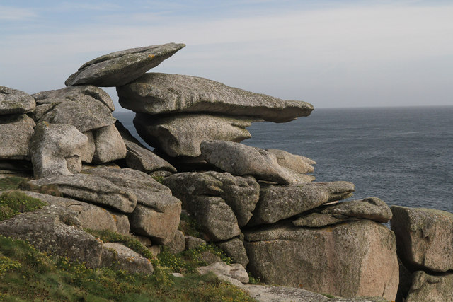
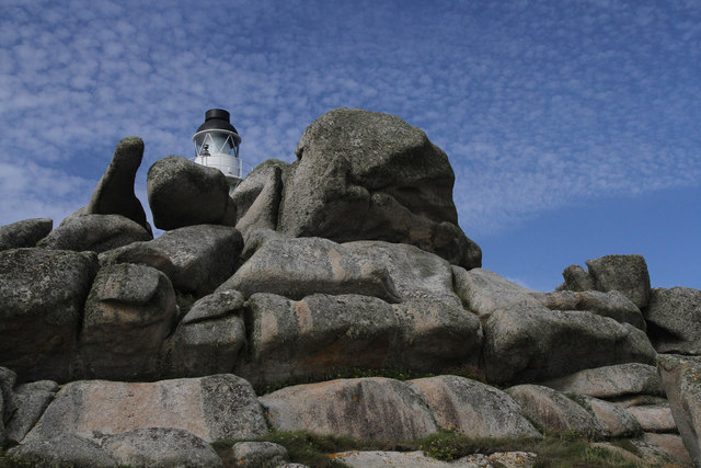
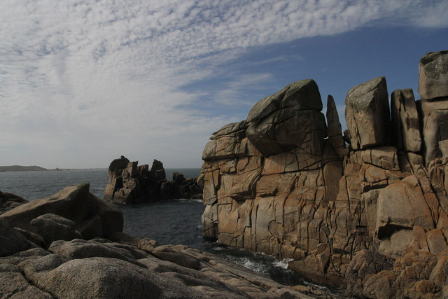
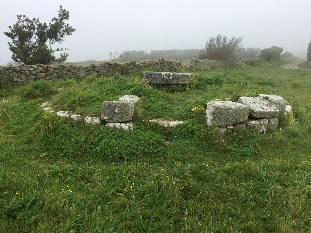
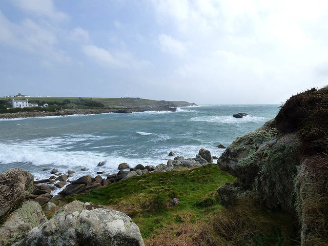
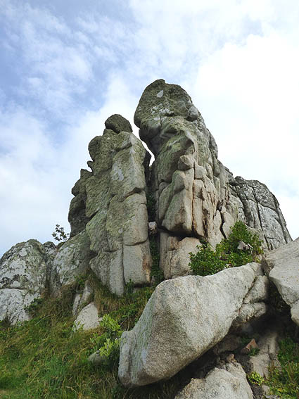
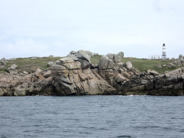
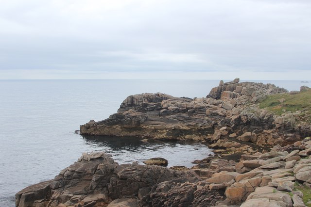
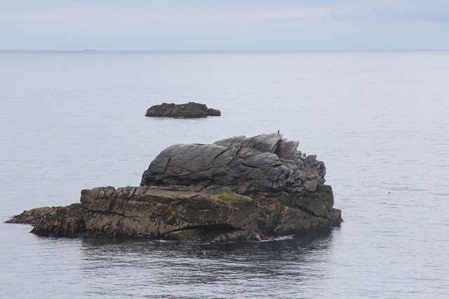
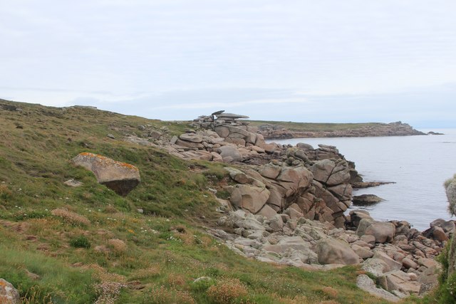
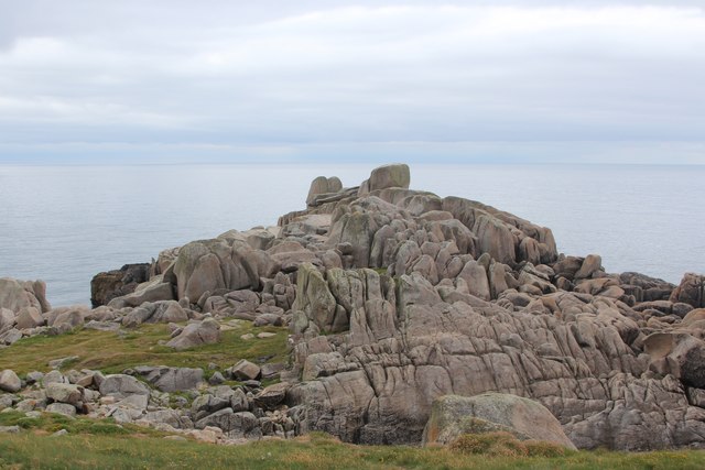
Salakee Down Images

Images are sourced within 2km of 49.912048/-6.2876423 or Grid Reference SV9210. Thanks to Geograph Open Source API. All images are credited.

Church Point
Church Point
Pillbox entrance On Tolman Point.
Pillbox entrance
On Tolman Point.
Footpath Passing End of Scilly Isles Runway Wikipedia : <span class="nowrap"><a title="https://en.wikipedia.org/wiki/St_Mary%27s_Airport_(Isles_of_Scilly)" rel="nofollow ugc noopener" href="https://en.wikipedia.org/wiki/St_Mary%27s_Airport_(Isles_of_Scilly)">Link</a><img style="margin-left:2px;" alt="External link" title="External link - shift click to open in new window" src="https://s1.geograph.org.uk/img/external.png" width="10" height="10"/></span>
Footpath Passing End of Scilly Isles Runway
Wikipedia : LinkExternal link
Old Town Bay
Old Town Bay
The turning circle At the end of the runway at Church Point on St Mary's, Isles of Scilly
The turning circle
At the end of the runway at Church Point on St Mary's, Isles of Scilly
Pill box on Tolman Point Near Old Town, St Mary's.
Pill box on Tolman Point
Near Old Town, St Mary's.
Pulpit Rock These seemingly precariously balanced rocks are really very stable.
Pulpit Rock
These seemingly precariously balanced rocks are really very stable.
Peninnis Head Lighthouse An unusual view of Peninnis Head Lighthouse from the rocks immediately to the south of the building.
Peninnis Head Lighthouse
An unusual view of Peninnis Head Lighthouse from the rocks immediately to the south of the building.
Outer Head The granite rocks of Outer Head, which is the most southerly part of Peninnis Head.
Outer Head
The granite rocks of Outer Head, which is the most southerly part of Peninnis Head.
Peninnis Mill Now disused
Peninnis Mill
Now disused
Entrance to Old Town Bay in strong easterly gale with heavy seas
Carn Leh Believed to be the site of an old battery to defend Old Town, St. Marys
Carn Leh
Believed to be the site of an old battery to defend Old Town, St. Marys
Outer Head Peninnis Head Lighthouse Grade II listed <span class="nowrap"><a title="https://www.historicengland.org.uk/listing/the-list/list-entry/1328857" rel="nofollow ugc noopener" href="https://www.historicengland.org.uk/listing/the-list/list-entry/1328857">Link</a><img style="margin-left:2px;" alt="External link" title="External link - shift click to open in new window" src="https://s1.geograph.org.uk/img/external.png" width="10" height="10"/></span>
Outer Head
Peninnis Head Lighthouse Grade II listed LinkExternal link
Stacked pebbles at Old Town Bay
Pulpit Rock
Pulpit Rock
Carrickstarne
Carrickstarne
Piper's Hole
Piper's Hole
Show me another place!

Salakee Down is located at Grid Ref: SV9210 (Lat: 49.912048, Lng: -6.2876423)

Division: Isles of Scilly

Unitary Authority: Isles of Scilly

Police Authority: Devon and Cornwall

What 3 Words

///theory.whisker.deferring. Near St Mary's, Isles of Scilly

Related Wikis

Giant's Castle, Isles of Scilly

The Giant's Castle is a promontory fort of the Iron Age, on St Mary's, Isles of Scilly, England. It is a scheduled monument. == Description == The fort...

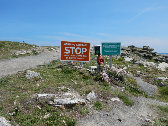
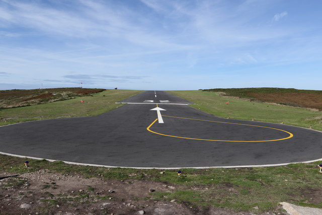
St Mary's Airport, Isles of Scilly

St Mary's Airport or Isles of Scilly Airport (IATA: ISC, ICAO: EGHE) is an airport located 1 nautical mile (1.9 km; 1.2 mi) east of Hugh Town on St Mary...
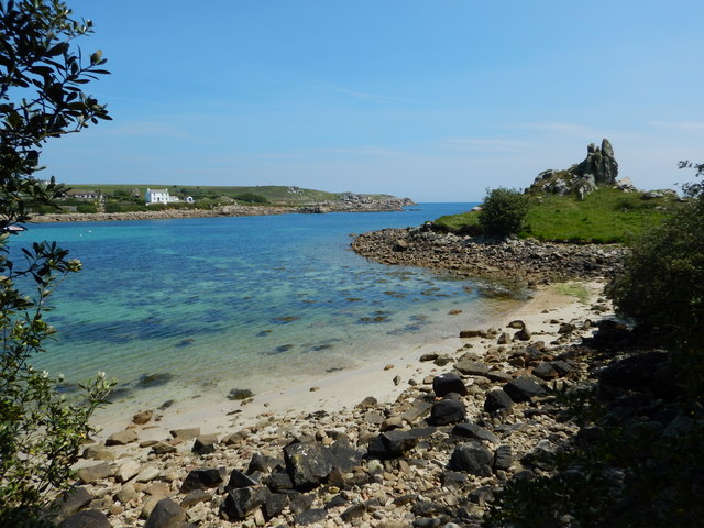
Porth Hellick

Porth Hellick (Cornish: Porth Helyk, meaning Willow Cove) is a tidal inlet on the south coast of St Mary’s, the largest island in the Isles of Scilly....
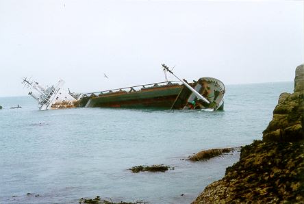
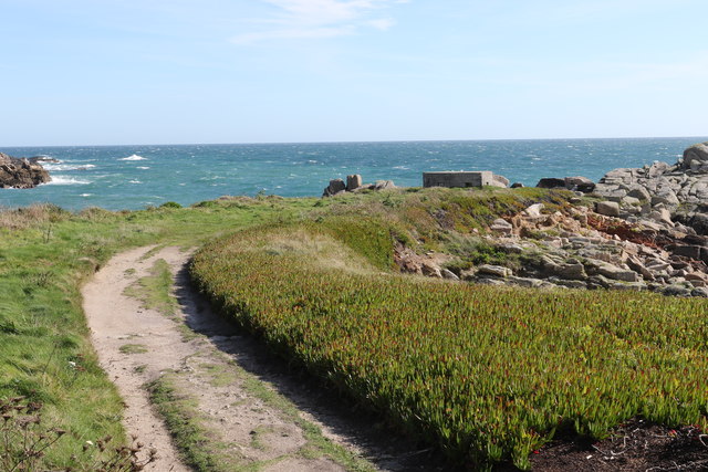
MV Cita

On 26 March 1997, the 300-ft merchant vessel MV Cita pierced its hull when running aground on rocks off the south coast of the Isles of Scilly in gale...

Nearby Amenities

Located within 500m of 49.912048,-6.2876423
Salakee Down
Place: locality
Lat/Long: 49.9126221/-6.2870477
Ward Hill
Natural: peak
Lat/Long: 49.912515/-6.2889735
Mainmark Rock
Place: islet
Lat/Long: 49.9104734/-6.2935923
Turning Circle
Lat/Long: 49.9137011/-6.2912165
Aeroway: gate
Ref: 1
Lat/Long: 49.9138422/-6.2938978
Church Porth
Natural: bay
Source: OS Open Names
Lat/Long: 49.9099893/-6.2872327
Porth Loggos
Natural: bay
Source: OS Open Names
Lat/Long: 49.9133442/-6.2826535
Seamark Landmark Category: mast
Seamark Light Colour: red
Seamark Type: landmark
Lat/Long: 49.9121829/-6.2918749
The data included in this document is from www.openstreetmap.org. The data is made available under ODbL.

Have you been to Salakee Down?

Leave your review of Salakee Down below (or comments, questions and feedback).