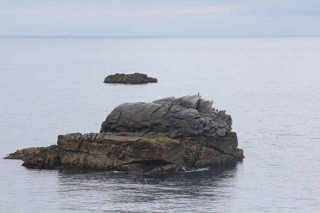
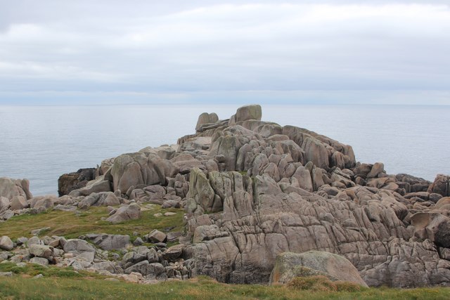
Pig Rock

Coastal Feature, Headland, Point in Cornwall

England

Pig Rock

Church Point
Church Point Credit: David Lally

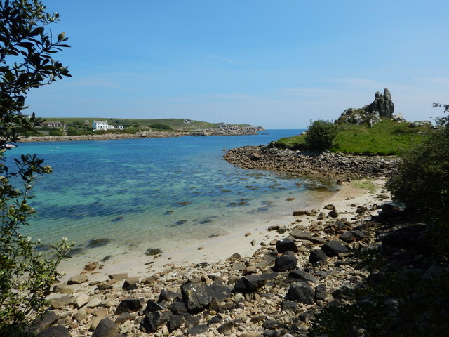
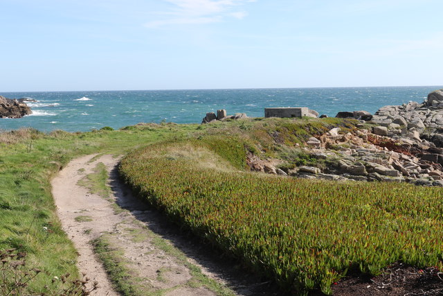
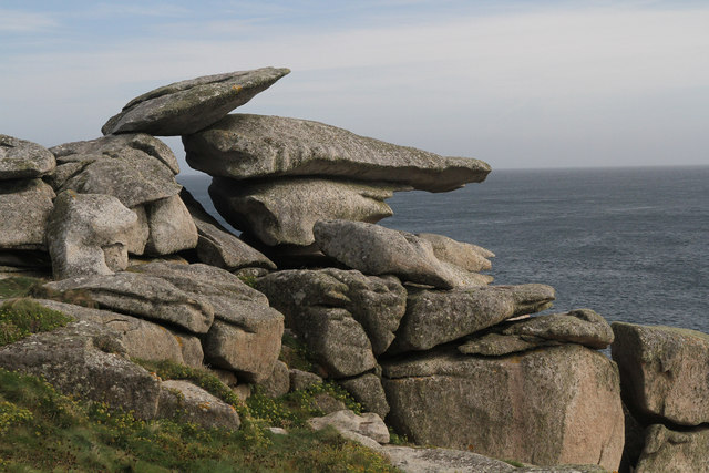
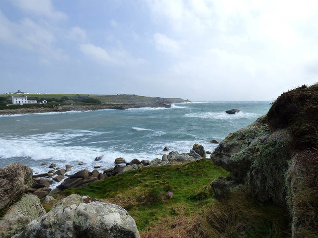
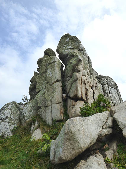
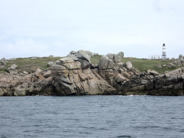
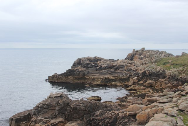
Pig Rock is a notable coastal feature located in Cornwall, England. Situated on the southern coast of the county, it is a prominent headland that juts out into the Atlantic Ocean. The rock gets its name from its distinctive shape, resembling the silhouette of a pig when seen from certain angles.

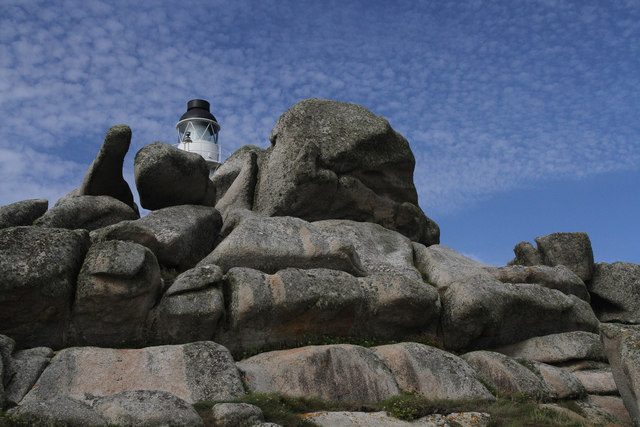
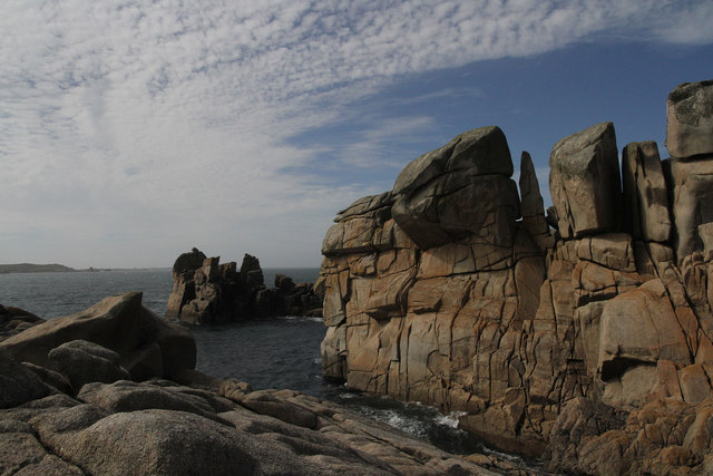
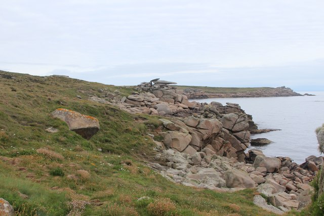
As a point of interest, Pig Rock is a popular destination for tourists and locals alike. Its unique formation provides stunning panoramic views of the surrounding coastline, making it a picturesque spot for photography and sightseeing. The rugged cliffs and crashing waves add to its allure, creating a dramatic backdrop against the blue waters.

The headland is also known for its rich biodiversity. The coastal area surrounding Pig Rock is home to a variety of marine life, including seals, dolphins, and various species of seabirds. Thus, it has become a haven for wildlife enthusiasts and birdwatchers, who often visit the area to observe and appreciate the natural beauty it offers.

Access to Pig Rock is relatively easy, with a well-maintained footpath leading to the headland. Additionally, there are several vantage points and benches strategically placed along the route, allowing visitors to pause and take in the breathtaking scenery.

In conclusion, Pig Rock is a remarkable coastal feature in Cornwall, boasting stunning views, diverse wildlife, and easy accessibility. Whether one is seeking a peaceful stroll along the cliffs or an opportunity to witness nature in its raw beauty, Pig Rock offers an experience that is sure to leave a lasting impression.

If you have any feedback on the listing, please let us know in the comments section below.

Pig Rock Images

Images are sourced within 2km of 49.913732/-6.2846983 or Grid Reference SV9210. Thanks to Geograph Open Source API. All images are credited.

Church Point
Church Point
Pillbox entrance On Tolman Point.
Pillbox entrance
On Tolman Point.
Footpath Passing End of Scilly Isles Runway Wikipedia : <span class="nowrap"><a title="https://en.wikipedia.org/wiki/St_Mary%27s_Airport_(Isles_of_Scilly)" rel="nofollow ugc noopener" href="https://en.wikipedia.org/wiki/St_Mary%27s_Airport_(Isles_of_Scilly)">Link</a><img style="margin-left:2px;" alt="External link" title="External link - shift click to open in new window" src="https://s1.geograph.org.uk/img/external.png" width="10" height="10"/></span>
Footpath Passing End of Scilly Isles Runway
Wikipedia : LinkExternal link
Old Town Bay
Old Town Bay
The turning circle At the end of the runway at Church Point on St Mary's, Isles of Scilly
The turning circle
At the end of the runway at Church Point on St Mary's, Isles of Scilly
Pill box on Tolman Point Near Old Town, St Mary's.
Pill box on Tolman Point
Near Old Town, St Mary's.
Pulpit Rock These seemingly precariously balanced rocks are really very stable.
Pulpit Rock
These seemingly precariously balanced rocks are really very stable.
Peninnis Head Lighthouse An unusual view of Peninnis Head Lighthouse from the rocks immediately to the south of the building.
Peninnis Head Lighthouse
An unusual view of Peninnis Head Lighthouse from the rocks immediately to the south of the building.
Outer Head The granite rocks of Outer Head, which is the most southerly part of Peninnis Head.
Outer Head
The granite rocks of Outer Head, which is the most southerly part of Peninnis Head.
Peninnis Mill Now disused
Peninnis Mill
Now disused
Entrance to Old Town Bay in strong easterly gale with heavy seas
Carn Leh Believed to be the site of an old battery to defend Old Town, St. Marys
Carn Leh
Believed to be the site of an old battery to defend Old Town, St. Marys
Outer Head Peninnis Head Lighthouse Grade II listed <span class="nowrap"><a title="https://www.historicengland.org.uk/listing/the-list/list-entry/1328857" rel="nofollow ugc noopener" href="https://www.historicengland.org.uk/listing/the-list/list-entry/1328857">Link</a><img style="margin-left:2px;" alt="External link" title="External link - shift click to open in new window" src="https://s1.geograph.org.uk/img/external.png" width="10" height="10"/></span>
Outer Head
Peninnis Head Lighthouse Grade II listed LinkExternal link
Stacked pebbles at Old Town Bay
Pulpit Rock
Pulpit Rock
Carrickstarne
Carrickstarne
Piper's Hole
Piper's Hole
Show me another place!

Pig Rock is located at Grid Ref: SV9210 (Lat: 49.913732, Lng: -6.2846983)

Division: Isles of Scilly

Unitary Authority: Isles of Scilly

Police Authority: Devon and Cornwall

What 3 Words

///meatballs.twisty.inviting. Near St Mary's, Isles of Scilly

Related Wikis

Giant's Castle, Isles of Scilly

The Giant's Castle is a promontory fort of the Iron Age, on St Mary's, Isles of Scilly, England. It is a scheduled monument. == Description == The fort...

Porth Hellick

Porth Hellick (Cornish: Porth Helyk, meaning Willow Cove) is a tidal inlet on the south coast of St Mary’s, the largest island in the Isles of Scilly....

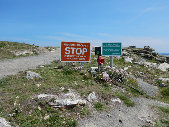
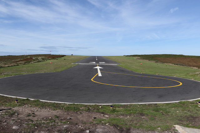
St Mary's Airport, Isles of Scilly

St Mary's Airport or Isles of Scilly Airport (IATA: ISC, ICAO: EGHE) is an airport located 1 nautical mile (1.9 km; 1.2 mi) east of Hugh Town on St Mary...
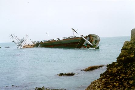
MV Cita

On 26 March 1997, the 300-ft merchant vessel MV Cita pierced its hull when running aground on rocks off the south coast of the Isles of Scilly in gale...

Nearby Amenities

Located within 500m of 49.913732,-6.2846983
Source: PGS
Lat/Long: 49.9162423/-6.2829784
Source: PGS
Lat/Long: 49.9159144/-6.2821365
Source: PGS
Lat/Long: 49.9169328/-6.2834201
Source: PGS
Lat/Long: 49.9166181/-6.2836098
Source: PGS
Lat/Long: 49.9164524/-6.2835598
MV Cita
Historic: wreck
Seamark Type: wreck
Wikidata: Q6719379
Wikipedia: en:MV Cita
Wreck Visible At Low Tide: no
Lat/Long: 49.912676/-6.279583
Porth Hellick
Natural: bay
Wikidata: Q7231737
Wikipedia: en:Porth Hellick
Lat/Long: 49.9161679/-6.2847408
Salakee Down
Place: locality
Lat/Long: 49.9126221/-6.2870477
Ward Hill
Natural: peak
Lat/Long: 49.912515/-6.2889735
Porth Hellick Point
Place: locality
Lat/Long: 49.9151447/-6.2794176
Turning Circle
Lat/Long: 49.9137011/-6.2912165
Church Porth
Natural: bay
Source: OS Open Names
Lat/Long: 49.9099893/-6.2872327
Porth Loggos
Natural: bay
Source: OS Open Names
Lat/Long: 49.9133442/-6.2826535
The data included in this document is from www.openstreetmap.org. The data is made available under ODbL.

Have you been to Pig Rock?

Leave your review of Pig Rock below (or comments, questions and feedback).